이 페이지는 앱이나 개발자의 공식 페이지가 아니며, 정보 제공 및 논평을 목적으로 작성된 독립 편집 간행물입니다. 명시적으로 달리 언급되지 않는 한, 해당 앱이나 개발자는 MWM, Apple, Google Play, 앱 퍼블리셔 또는 앱 개발자와 제휴, 보증, 후원, 승인 또는 공식적으로 연결되어 있지 않으며, 이 페이지의 어떤 내용도 해당 앱이 MWM의 서비스를 사용하여 개발되었음을 의미하지 않습니다. 모든 상표, 로고, 스크린샷 및 기타 콘텐츠는 해당 소유자의 자산입니다.

My Altitude and Elevation GPS
UTM, MGRS 및 Apple Watch 통합 기능을 사용하여 전문적인 정확도로 고도 및 좌표를 추적합니다. 셀룰러 서비스가 끊기는 곳에서도 신뢰할 수 있는 데이터가 필요한 등산객, 전문가 및 탐험가에게 완벽합니다.
다운로드
267K+사용자 평점
총 평가 수
2K+개발사
카테고리
Navigation지원 언어
14최신 버전
6.50크기
72.8 MB출시일
2018년 2월 15일현대 탐험가를 위한 정밀 내비게이션
전문적인 지형 측량부터 백컨트리 하이킹까지, 고정밀 고도 데이터와 험난한 아웃도어를 위해 설계된 특수 GPS 도구로 모든 지형을 마스터하세요.
초정밀 고도 추적
UTM 및 MGRS와 같은 전문 좌표 형식을 사용하여 최대 정밀도로 고도를 모니터링하여 어떤 지형도에서도 정확한 위치를 항상 파악할 수 있습니다.
스마트 지오태그 문서화
GPX 및 KML 데이터 내보내기를 완벽하게 지원하며, 완벽한 캠핑장을 정찰하거나 전문 현장 사이트를 문서화하기 위해 내장 위치 데이터가 포함된 사진을 캡처하세요.
다음 스크린샷과 설명은 앱의 공식 스토어 목록에서 직접 가져온 것이며 앱 개발자의 자산입니다.
앱 스토어
스크린샷
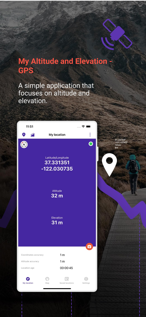
산악 풍경 위에서 위도, 경도 및 고도 데이터를 표시하는 My Altitude and Elevation GPS 앱 인터페이스
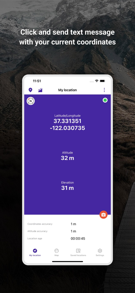
위도, 경도 및 고도 좌표를 표시하는 My Altitude and Elevation GPS 앱 인터페이스
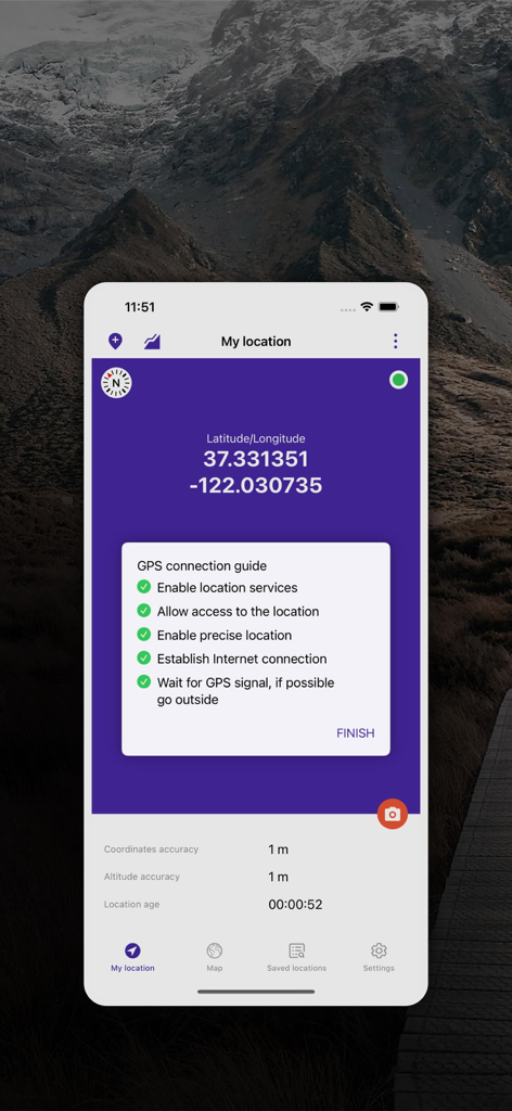
위치 정확도 데이터와 함께 위도 및 경도를 보여주는 My Altitude and Elevation GPS 앱 화면
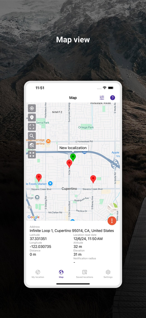
핀과 상세 위치 좌표를 보여주는 My Altitude and Elevation GPS 앱의 지도 보기
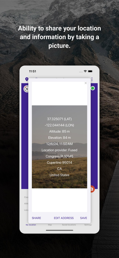
공유를 위해 GPS 좌표와 고도 데이터가 겹쳐진 사진을 보여주는 My Altitude 앱 스크린샷
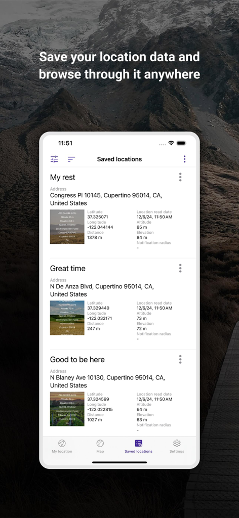
좌표와 고도 데이터를 보여주는 My Altitude and Elevation GPS 앱의 저장된 위치 목록
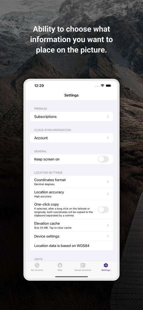
좌표 형식 및 위치 정확도 옵션을 보여주는 My Altitude and Elevation GPS 앱의 설정 화면
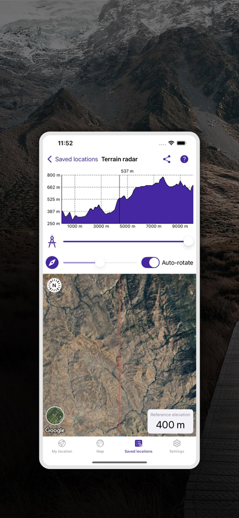
고도 프로필 그래프와 위성 지도 보기를 보여주는 지형 레이더 기능
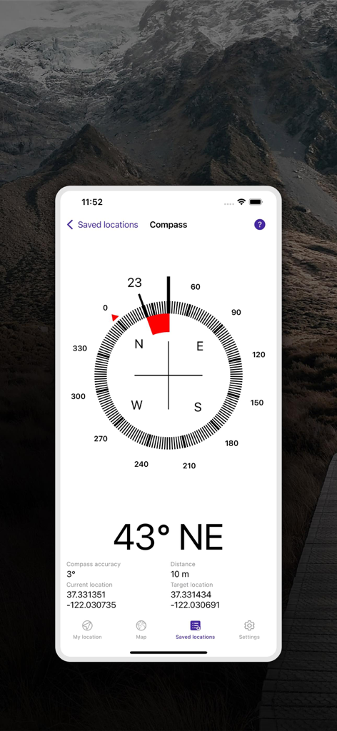
내비게이션을 위한 방위각 및 GPS 좌표를 표시하는 디지털 나침반 인터페이스
설명
Download
비슷한 앱
같은 카테고리의 상위 앱

Google Maps
Google LLC

Waze Navigation & Live Traffic
waze

AMap Global
AutoNavi Information Technology Co. Ltd.

百度地图-路线规划,出行必备
Beijing Baidu Netcom Science & Technology Co.,Ltd

Moovit: Bus & Transit Tracker
Moovit App Global LTD

Transit • Subway & Bus Times
9280-0366 Quebec inc.

ParkMobile: Park. Pay. Go.
Parkmobile USA, Inc

腾讯地图-路线规划,导航地铁打车出行
Shenzhen Tencent Computer Systems Company Limited

Île-de-France Mobilités
Ile de France Mobilites
이 페이지는 앱이나 개발자의 공식 페이지가 아니며, 정보 제공 및 논평을 목적으로 작성된 독립 편집 간행물입니다. 명시적으로 달리 언급되지 않는 한, 해당 앱이나 개발자는 MWM, Apple, Google Play, 앱 퍼블리셔 또는 앱 개발자와 제휴, 보증, 후원, 승인 또는 공식적으로 연결되어 있지 않으며, 이 페이지의 어떤 내용도 해당 앱이 MWM의 서비스를 사용하여 개발되었음을 의미하지 않습니다. 모든 상표, 로고, 스크린샷 및 기타 콘텐츠는 해당 소유자의 자산입니다.