이 페이지는 앱이나 개발자의 공식 페이지가 아니며, 정보 제공 및 논평을 목적으로 작성된 독립 편집 간행물입니다. 명시적으로 달리 언급되지 않는 한, 해당 앱이나 개발자는 MWM, Apple, Google Play, 앱 퍼블리셔 또는 앱 개발자와 제휴, 보증, 후원, 승인 또는 공식적으로 연결되어 있지 않으며, 이 페이지의 어떤 내용도 해당 앱이 MWM의 서비스를 사용하여 개발되었음을 의미하지 않습니다. 모든 상표, 로고, 스크린샷 및 기타 콘텐츠는 해당 소유자의 자산입니다.

Northumberland Maps Offline
하드리아누스의 장벽과 국립공원을 트레킹하기 위한 필수 동반자입니다. 전문 등급의 Ordnance Survey 지도로 야생을 탐색하세요. 셀룰러 신호나 로밍 데이터가 필요 없습니다.
다운로드
8K+사용자 평점
총 평가 수
0개발사
카테고리
Navigation지원 언어
1최신 버전
2.1.1크기
612.2 MB출시일
2015년 5월 9일현지 전문가처럼 탐색하세요
하이킹을 즐기는 탐험가를 위한 맞춤형 전문 Ordnance Survey 매핑. 세계에서 가장 상세한 오프라인 지도 제작으로 하드리아누스의 장벽과 노섬벌랜드 황야를 발견하세요.
신호 없음? 문제없습니다.
국제 로밍 요금을 없애고 외딴 '통신 불가지역'에서 안전을 유지하세요. 고해상도 지도는 완벽한 오프라인 독립성을 위해 장치에 완전히 저장됩니다.
Ordnance Survey 정확성
영국 지도 제작의 골드 스탠다드를 경험하세요. 전문 1:25,000 Explorer 스케일로 복잡한 등고선, 특정 길, 역사적인 랜드마크를 확인하세요.
다음 스크린샷과 설명은 앱의 공식 스토어 목록에서 직접 가져온 것이며 앱 개발자의 자산입니다.
앱 스토어
스크린샷
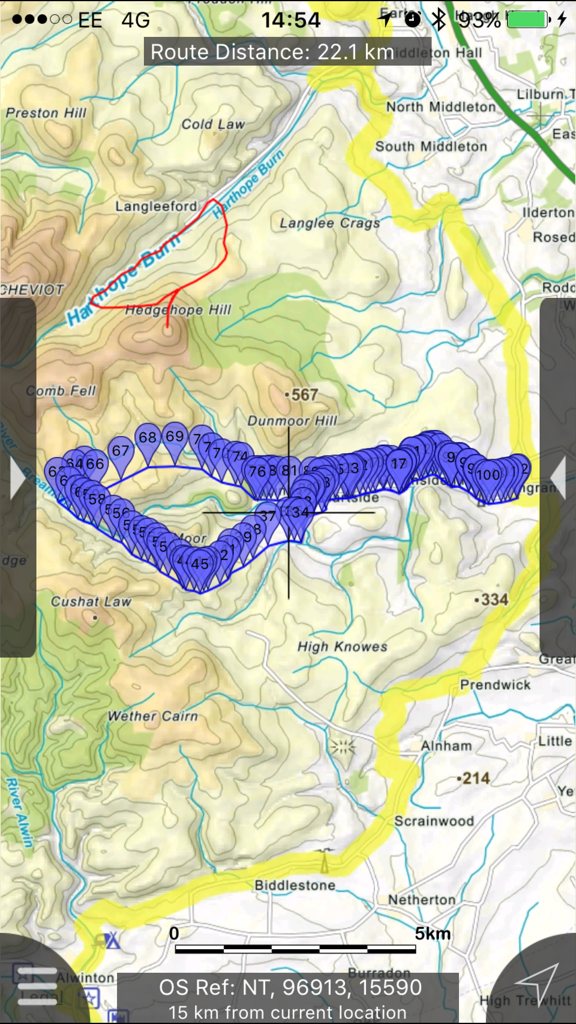
노섬벌랜드의 추적된 경로와 경유지가 있는 상세한 지형 등산 지도
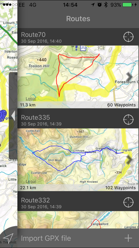
거리와 지형도를 보여주는 노섬벌랜드 지도 오프라인 앱의 저장된 등산 경로 목록
노섬벌랜드 지도 앱 내 지형 지도에서 상세한 등산 경로
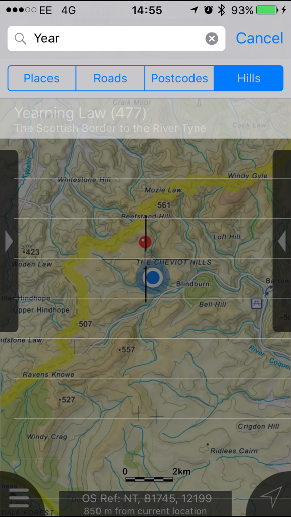
노섬벌랜드 언덕에 대한 오프라인 지형 지도 검색 인터페이스
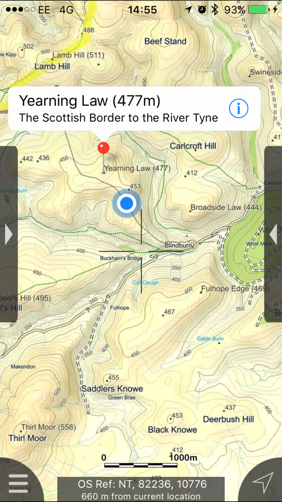
고도 등고선과 등산로가 있는 Yearning Law를 보여주는 노섬벌랜드의 지형 지도
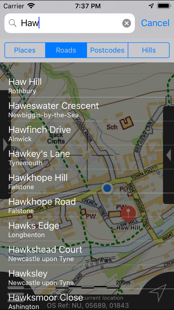
노섬벌랜드 지도 앱에서 도로 및 언덕에 대한 오프라인 검색 결과
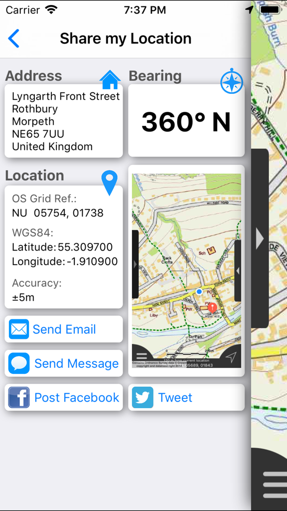
주소 GPS 좌표 및 지도 보기를 보여주는 내 위치 공유 인터페이스.
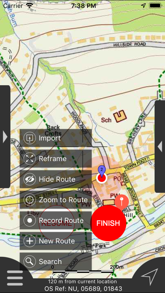
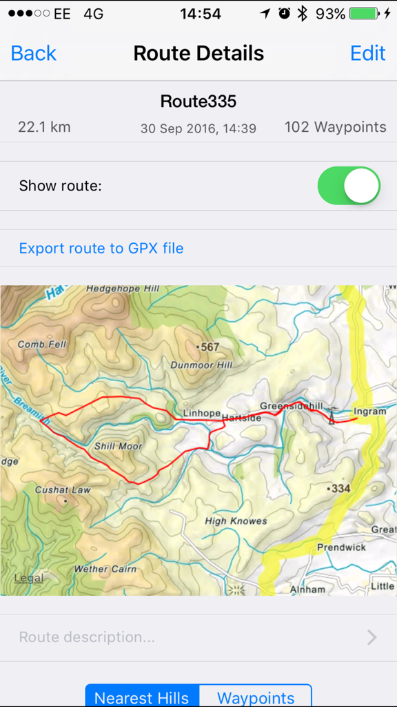
상세 지도와 경로 관리 메뉴를 보여주는 노섬벌랜드 지도 오프라인 앱 인터페이스
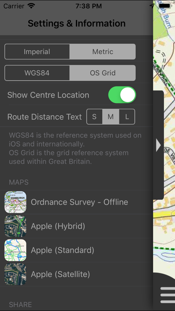
단위 및 좌표계 옵션을 표시하는 노섬벌랜드 지도 오프라인 앱의 설정 및 정보 화면.
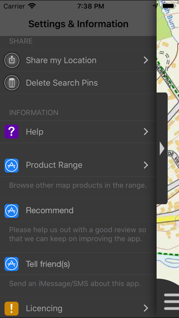
다양한 탐색 및 공유 옵션을 보여주는 노섬벌랜드 지도 오프라인 앱의 설정 및 정보 메뉴 화면.
설명
Download
비슷한 앱
같은 카테고리의 상위 앱

Google Maps
Google LLC

Waze Navigation & Live Traffic
waze

AMap Global
AutoNavi Information Technology Co. Ltd.

百度地图-路线规划,出行必备
Beijing Baidu Netcom Science & Technology Co.,Ltd

Moovit: Bus & Transit Tracker
Moovit App Global LTD

Transit • Subway & Bus Times
9280-0366 Quebec inc.

ParkMobile: Park. Pay. Go.
Parkmobile USA, Inc

腾讯地图-路线规划,导航地铁打车出行
Shenzhen Tencent Computer Systems Company Limited

Île-de-France Mobilités
Ile de France Mobilites
이 페이지는 앱이나 개발자의 공식 페이지가 아니며, 정보 제공 및 논평을 목적으로 작성된 독립 편집 간행물입니다. 명시적으로 달리 언급되지 않는 한, 해당 앱이나 개발자는 MWM, Apple, Google Play, 앱 퍼블리셔 또는 앱 개발자와 제휴, 보증, 후원, 승인 또는 공식적으로 연결되어 있지 않으며, 이 페이지의 어떤 내용도 해당 앱이 MWM의 서비스를 사용하여 개발되었음을 의미하지 않습니다. 모든 상표, 로고, 스크린샷 및 기타 콘텐츠는 해당 소유자의 자산입니다.