이 페이지는 앱이나 개발자의 공식 페이지가 아니며, 정보 제공 및 논평을 목적으로 작성된 독립 편집 간행물입니다. 명시적으로 달리 언급되지 않는 한, 해당 앱이나 개발자는 MWM, Apple, Google Play, 앱 퍼블리셔 또는 앱 개발자와 제휴, 보증, 후원, 승인 또는 공식적으로 연결되어 있지 않으며, 이 페이지의 어떤 내용도 해당 앱이 MWM의 서비스를 사용하여 개발되었음을 의미하지 않습니다. 모든 상표, 로고, 스크린샷 및 기타 콘텐츠는 해당 소유자의 자산입니다.

Offline Maps: GPS Tracker GPX
무제한 오프라인 지도와 정확한 GPX 추적으로 백컨트리를 마스터하세요. 기술적 신뢰성, 광고 없음, 모든 트레일에서 완벽한 개인 정보 보호를 요구하는 진정한 탐험가를 위해 설계되었습니다.
다운로드
64K+사용자 평점
총 평가 수
200개발사
카테고리
Navigation지원 언어
16최신 버전
3.4.0크기
24.8 MB출시일
2021년 1월 24일오프그리드 탐험가를 위한 엔지니어링
무제한 오프라인 지도, 전문가 수준의 GPX 추적, 고급 기술 데이터 — 구독이나 숨겨진 비용 없이 야생에서 진정한 자율성을 경험하세요.
무제한 오프라인 신뢰성
지역 전체를 무제한으로 오프라인에서 사용할 수 있도록 다운로드하세요. 셀룰러 서비스와 데이터가 없는 백컨트리 '데드 존'에서도 자신 있게 길을 찾으세요.
구독 없는 자유
구독 피로에서 벗어나세요. 백그라운드 추적, 웨이포인트 및 내보내기에 대한 전체 액세스를 광고, 인앱 구매 또는 월별 요금 없이 이용하세요.
다음 스크린샷과 설명은 앱의 공식 스토어 목록에서 직접 가져온 것이며 앱 개발자의 자산입니다.
앱 스토어
스크린샷
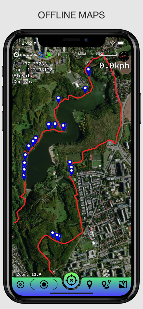
오프라인 지도 GPS 추적기 앱에서 기록된 GPX 트랙과 웨이포인트를 보여주는 위성 지도 보기
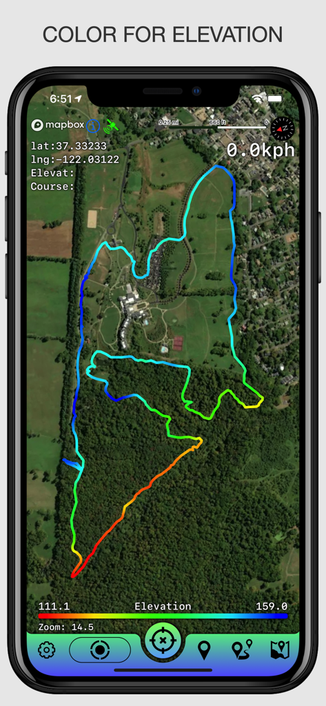
GPS 추적기 앱이 위성 지도에 색상으로 구분된 고도 트랙을 표시하는 모습
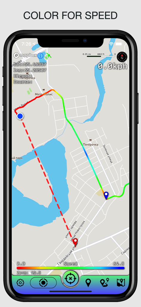
다양한 이동 속도를 나타내는 색상으로 구분된 그래디언트와 함께 지도에 GPX 트랙을 표시하는 모바일 앱 인터페이스.
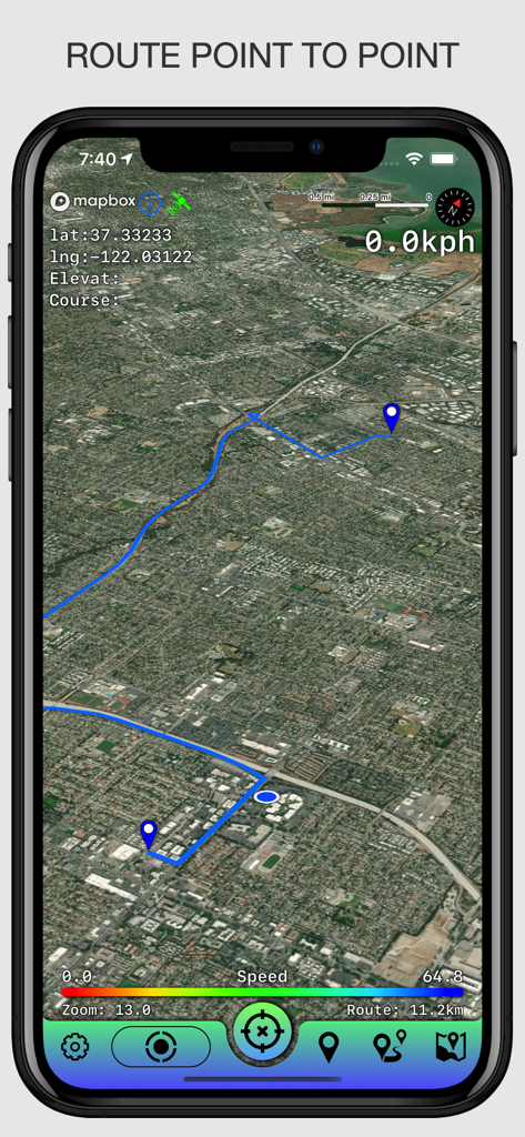
GPS 좌표 및 속도 데이터와 함께 두 지점 사이의 파란색 경로 선을 보여주는 위성 지도 보기.
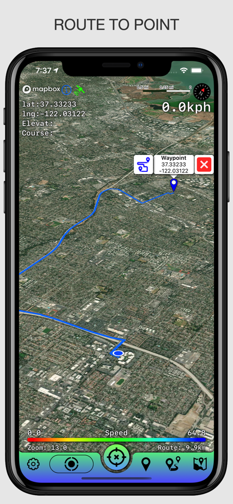
좌표가 있는 특정 웨이포인트로의 내비게이션 경로를 보여주는 위성 지도 보기.
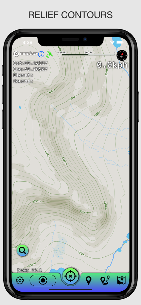
스마트폰에 지형 윤곽선과 GPS 좌표를 표시하는 지형 지도 디스플레이.
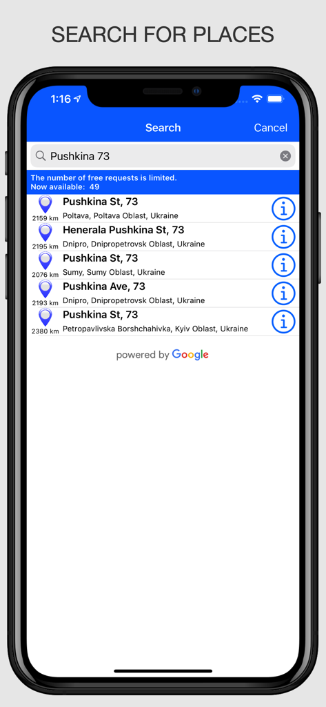
오프라인 지도 앱에서 장소 검색 기능을 보여주는 모바일 인터페이스
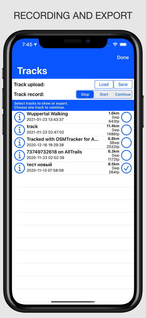
오프라인 지도 앱에서 GPX 파일을 시작, 중지 및 내보내는 옵션과 함께 기록된 GPX 트랙 목록을 보여주는 인터페이스
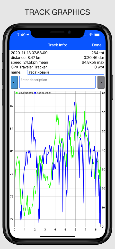
오프라인 지도 GPS 추적기 앱이 거리에 따른 속도 및 고도에 대한 트랙 그래픽을 표시하는 모습
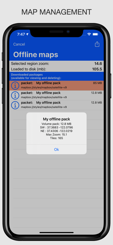
앱에서 다운로드한 오프라인 지도 패키지의 관리 및 기술 세부 정보를 보여주는 인터페이스
설명
Download
비슷한 앱
같은 카테고리의 상위 앱

Google Maps
Google LLC

Waze Navigation & Live Traffic
waze

AMap Global
AutoNavi Information Technology Co. Ltd.

百度地图-路线规划,出行必备
Beijing Baidu Netcom Science & Technology Co.,Ltd

Moovit: Bus & Transit Tracker
Moovit App Global LTD

Transit • Subway & Bus Times
9280-0366 Quebec inc.

ParkMobile: Park. Pay. Go.
Parkmobile USA, Inc

腾讯地图-路线规划,导航地铁打车出行
Shenzhen Tencent Computer Systems Company Limited

Île-de-France Mobilités
Ile de France Mobilites
이 페이지는 앱이나 개발자의 공식 페이지가 아니며, 정보 제공 및 논평을 목적으로 작성된 독립 편집 간행물입니다. 명시적으로 달리 언급되지 않는 한, 해당 앱이나 개발자는 MWM, Apple, Google Play, 앱 퍼블리셔 또는 앱 개발자와 제휴, 보증, 후원, 승인 또는 공식적으로 연결되어 있지 않으며, 이 페이지의 어떤 내용도 해당 앱이 MWM의 서비스를 사용하여 개발되었음을 의미하지 않습니다. 모든 상표, 로고, 스크린샷 및 기타 콘텐츠는 해당 소유자의 자산입니다.