이 페이지는 앱이나 개발자의 공식 페이지가 아니며, 정보 제공 및 논평을 목적으로 작성된 독립 편집 간행물입니다. 명시적으로 달리 언급되지 않는 한, 해당 앱이나 개발자는 MWM, Apple, Google Play, 앱 퍼블리셔 또는 앱 개발자와 제휴, 보증, 후원, 승인 또는 공식적으로 연결되어 있지 않으며, 이 페이지의 어떤 내용도 해당 앱이 MWM의 서비스를 사용하여 개발되었음을 의미하지 않습니다. 모든 상표, 로고, 스크린샷 및 기타 콘텐츠는 해당 소유자의 자산입니다.

OpenMaps - Topographic maps
정밀한 OpenStreetMap 데이터, 라이브 타일 매핑, 그리고 오지에서도 신뢰성을 요구하는 하이커, 산악 자전거 이용자 및 오지 애호가를 위해 설계된 특수 지형 레이어로 모든 지형을 정복하세요.
다운로드
227K+사용자 평점
총 평가 수
0개발사
카테고리
Navigation지원 언어
1최신 버전
6.16크기
16.2 MB출시일
2015년 9월 22일진지한 탐험가를 위한 정밀 매핑
OpenStreetMap과 특수 지형 레이어의 힘을 활용하여 가장 험난한 지형을 자신감 있고 기술적으로 정확하게 탐험하세요.
라이브 OSM 데이터 통합
일반 GPS 앱이 놓치는 최신 트레일 변경 사항과 숨겨진 경로를 포착하는 실시간 커뮤니티 소스 데이터로 앞서 나가세요.
기술적 지형 인사이트
등산가와 산악 자전거 이용자를 위해 맞춤 설계된 상세한 등고선과 6가지 특수 지도 스타일로 모든 오르막과 내리막을 완벽히 파악하세요.
다음 스크린샷과 설명은 앱의 공식 스토어 목록에서 직접 가져온 것이며 앱 개발자의 자산입니다.
앱 스토어
스크린샷
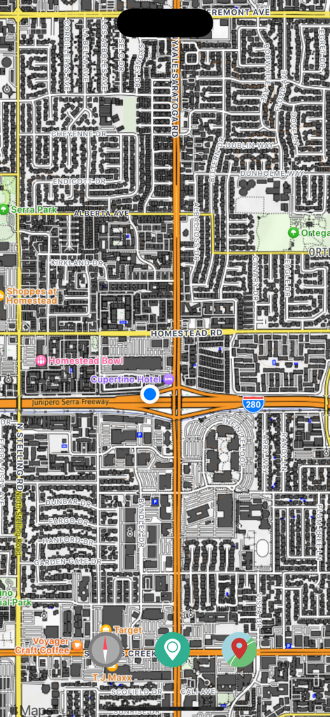
지역 랜드마크와 도로를 보여주는 상세한 도시 거리 지도 뷰
현재 위치를 나타내는 파란색 점과 상세한 도시 지도를 보여주는 OpenMaps 앱의 스크린샷.
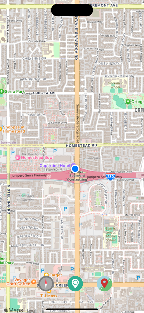
거리 이름과 관심 지점이 표시된 상세한 도시 지도를 보여주는 OpenMaps 앱 화면
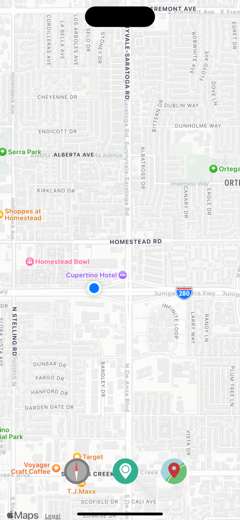
내비게이션 버튼과 현재 위치 마커가 있는 거리 지도 뷰를 보여주는 OpenMaps 앱의 스크린샷.
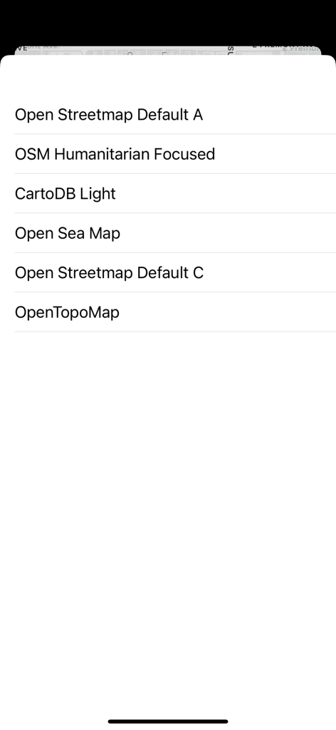
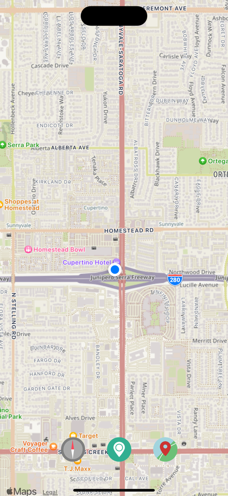
6가지 오픈 소스 지형 및 해상 지도 레이어 선택 항목을 보여주는 OpenMaps 앱의 메뉴
설명
Download
비슷한 앱
같은 카테고리의 상위 앱

Google Maps
Google LLC

Waze Navigation & Live Traffic
waze

AMap Global
AutoNavi Information Technology Co. Ltd.

百度地图-路线规划,出行必备
Beijing Baidu Netcom Science & Technology Co.,Ltd

Moovit: Bus & Transit Tracker
Moovit App Global LTD

Transit • Subway & Bus Times
9280-0366 Quebec inc.

ParkMobile: Park. Pay. Go.
Parkmobile USA, Inc

腾讯地图-路线规划,导航地铁打车出行
Shenzhen Tencent Computer Systems Company Limited

Île-de-France Mobilités
Ile de France Mobilites
이 페이지는 앱이나 개발자의 공식 페이지가 아니며, 정보 제공 및 논평을 목적으로 작성된 독립 편집 간행물입니다. 명시적으로 달리 언급되지 않는 한, 해당 앱이나 개발자는 MWM, Apple, Google Play, 앱 퍼블리셔 또는 앱 개발자와 제휴, 보증, 후원, 승인 또는 공식적으로 연결되어 있지 않으며, 이 페이지의 어떤 내용도 해당 앱이 MWM의 서비스를 사용하여 개발되었음을 의미하지 않습니다. 모든 상표, 로고, 스크린샷 및 기타 콘텐츠는 해당 소유자의 자산입니다.