이 페이지는 앱이나 개발자의 공식 페이지가 아니며, 정보 제공 및 논평을 목적으로 작성된 독립 편집 간행물입니다. 명시적으로 달리 언급되지 않는 한, 해당 앱이나 개발자는 MWM, Apple, Google Play, 앱 퍼블리셔 또는 앱 개발자와 제휴, 보증, 후원, 승인 또는 공식적으로 연결되어 있지 않으며, 이 페이지의 어떤 내용도 해당 앱이 MWM의 서비스를 사용하여 개발되었음을 의미하지 않습니다. 모든 상표, 로고, 스크린샷 및 기타 콘텐츠는 해당 소유자의 자산입니다.

Peakbagger
Peakbagger.com 및 ListsOfJohn.com와 등반 기록을 동기화하고, 오프라인 지형 지도를 사용하여 길을 찾고, 데이터 기반의 정확성으로 공식 봉우리 목록 진행 상황을 추적하세요.
다운로드
400사용자 평점
총 평가 수
0개발사
카테고리
Health & Fitness지원 언어
11최신 버전
1.63.2크기
140.6 MB출시일
2015년 10월 17일목록 정복 및 산악 마스터
실시간 GPS 추적부터 글로벌 봉우리 데이터베이스까지, 진지한 등반가 및 목록 완성자를 위해 제작된 전문가급 도구에 액세스하세요.
통합 봉우리 데이터베이스
Peakbagger.com 및 ListsOfJohn와 즉시 동기화하여 공식 봉우리 목록 진행 상황을 관리하고 모든 성공적인 등반을 추적하세요.
안정적인 오프라인 내비게이션
다운로드 가능한 지형 지도를 사용하여 자신감을 가지고 더 깊이 탐험하고, 고도 프로필 및 오프라인 GPS 추적은 외딴 백컨트리를 위해 설계되었습니다.
다음 스크린샷과 설명은 앱의 공식 스토어 목록에서 직접 가져온 것이며 앱 개발자의 자산입니다.
앱 스토어
스크린샷
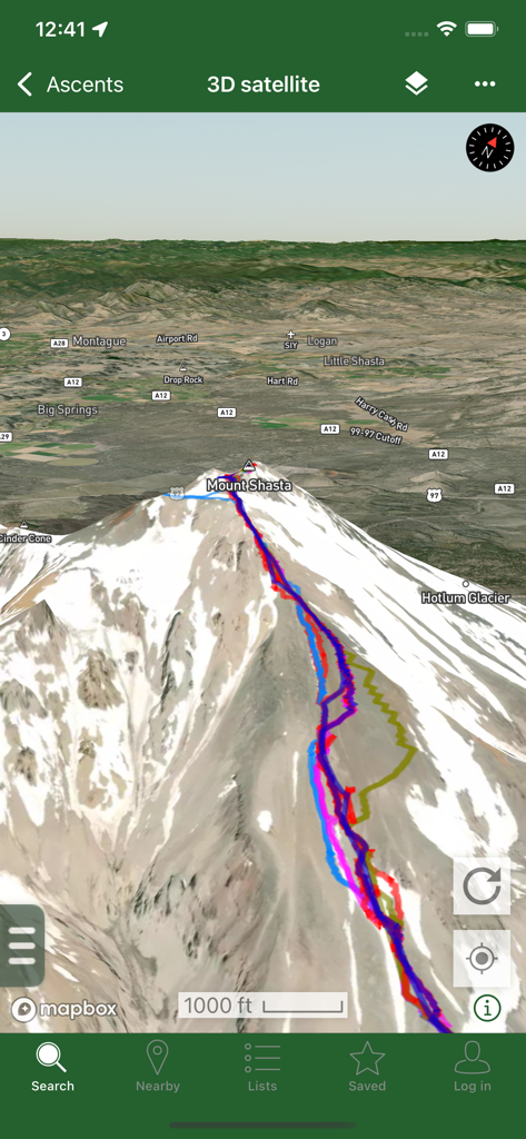
Peakbagger 앱의 샤스타 산 3D 위성 지도 보기, 여러 색상의 GPS 트랙을 산악 등반용으로 표시.
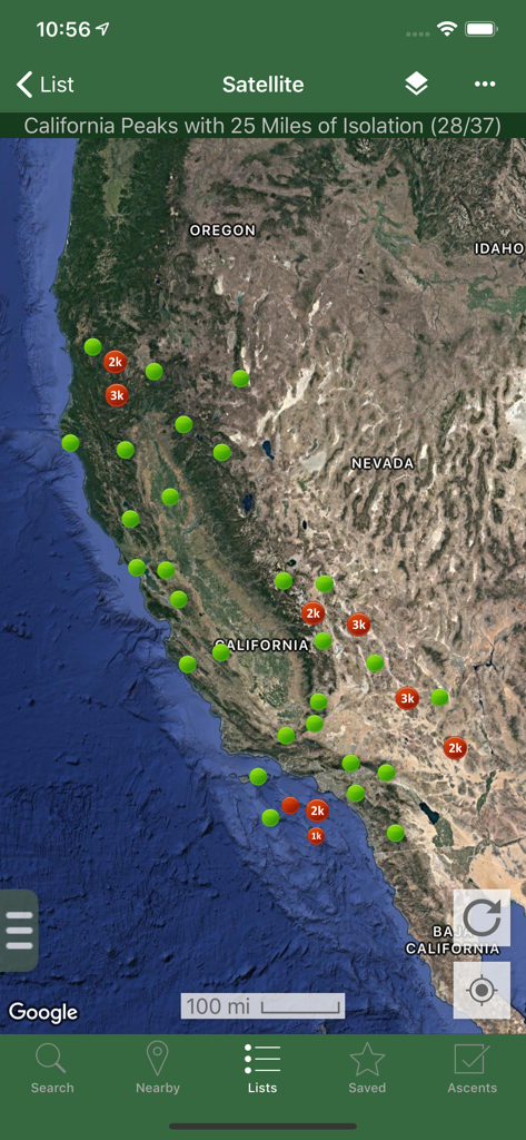
Peakbagger 앱의 고립 마커가 있는 캘리포니아 봉우리 위성 지도
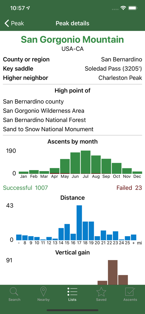
Peakbagger 앱의 샌 고르 고니오 산 기술 데이터 및 등반 통계
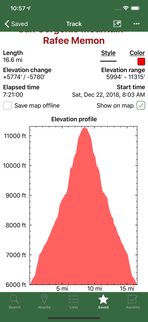
Peakbagger 앱 스크린샷, 상세한 고도 프로필 그래프와 녹화된 산악 트랙 하이킹 통계 표시
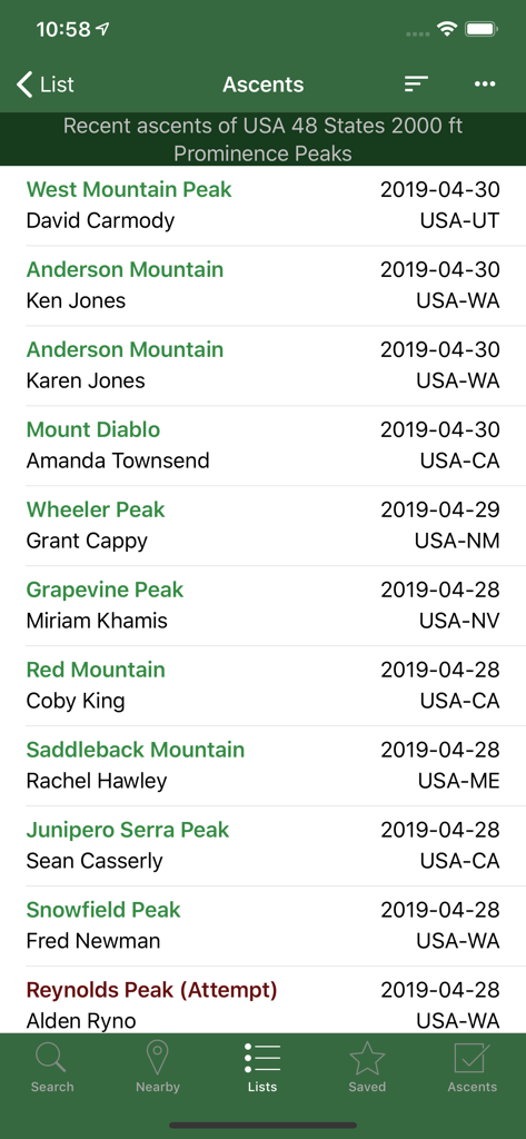
Peakbagger 앱 스크린샷, 등반가 이름과 위치가 포함된 최근 봉우리 등반 연대기 목록 표시
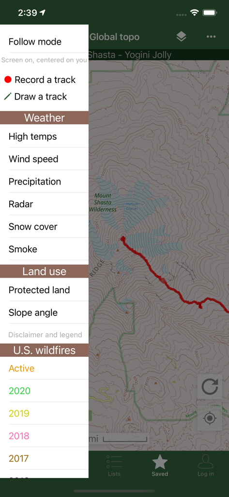
Peakbagger 앱 인터페이스, 지형도와 날씨 및 산불 데이터 오버레이용 사이드바 메뉴 표시
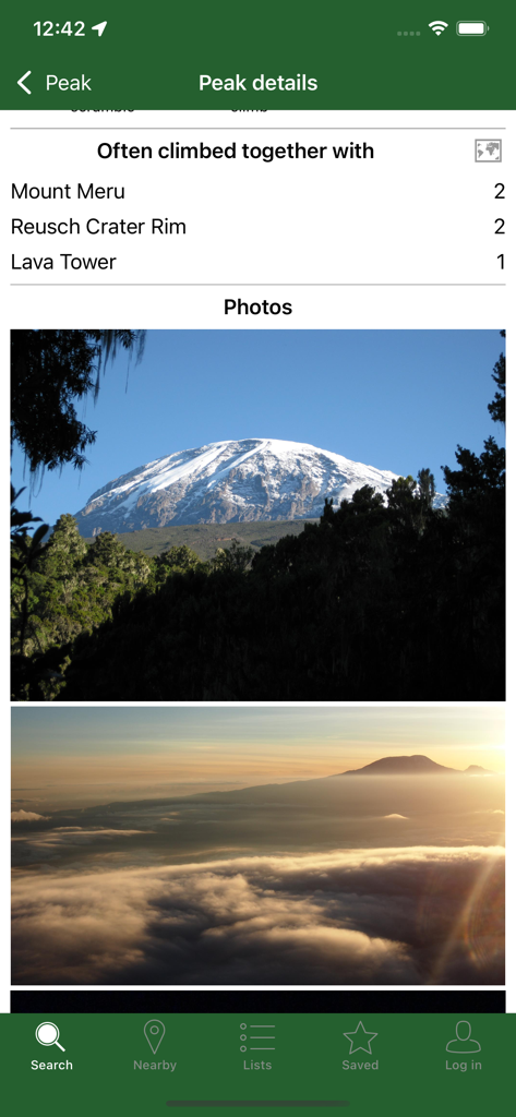
Peakbagger 앱, 봉우리 세부 정보 사진 및 함께 자주 등반하는 봉우리 목록 표시
설명
Download
비슷한 앱
같은 카테고리의 상위 앱

Strava: Run, Bike, Walk
Strava Inc.

Flo Cycle & Period Tracker
FLO HEALTH UK LIMITED

AI Calorie Tracker by Yazio
YAZIO GmbH

Mi Fitness (Xiaomi Wear Lite)
Beijing Xiaomi Co., Ltd

MyFitnessPal: Calorie Counter
MyFitnessPal, Inc.

Cal AI - Calorie Tracker
Viral Development LLC

美柚 - 经期·备孕·怀孕·育儿&亲友版
Xiamen Meet You Co., Ltd.

Yuka - Food & Cosmetic Scanner
Yuca

Period Tracker Period Calendar
ABISHKKING LIMITED.
이 페이지는 앱이나 개발자의 공식 페이지가 아니며, 정보 제공 및 논평을 목적으로 작성된 독립 편집 간행물입니다. 명시적으로 달리 언급되지 않는 한, 해당 앱이나 개발자는 MWM, Apple, Google Play, 앱 퍼블리셔 또는 앱 개발자와 제휴, 보증, 후원, 승인 또는 공식적으로 연결되어 있지 않으며, 이 페이지의 어떤 내용도 해당 앱이 MWM의 서비스를 사용하여 개발되었음을 의미하지 않습니다. 모든 상표, 로고, 스크린샷 및 기타 콘텐츠는 해당 소유자의 자산입니다.