이 페이지는 앱이나 개발자의 공식 페이지가 아니며, 정보 제공 및 논평을 목적으로 작성된 독립 편집 간행물입니다. 명시적으로 달리 언급되지 않는 한, 해당 앱이나 개발자는 MWM, Apple, Google Play, 앱 퍼블리셔 또는 앱 개발자와 제휴, 보증, 후원, 승인 또는 공식적으로 연결되어 있지 않으며, 이 페이지의 어떤 내용도 해당 앱이 MWM의 서비스를 사용하여 개발되었음을 의미하지 않습니다. 모든 상표, 로고, 스크린샷 및 기타 콘텐츠는 해당 소유자의 자산입니다.

Public transport map Vienna
모든 지하철, 트램, 버스 노선을 쉽게 마스터하세요. 여행을 계획하고, 근처 역을 찾고, 오프라인에서도 자신 있게 비엔나를 탐험하세요.
다운로드
64K+사용자 평점
총 평가 수
0개발사
카테고리
Navigation지원 언어
1최신 버전
4.3.6크기
85.2 MB출시일
2019년 4월 28일현지인처럼 비엔나 탐험하기
주머니 속에 비엔나 지하철, 트램, 버스에 대한 완벽한 가이드. 데이터 소모 없이 효율성을 원하는 탐험가를 위해 설계되었습니다.
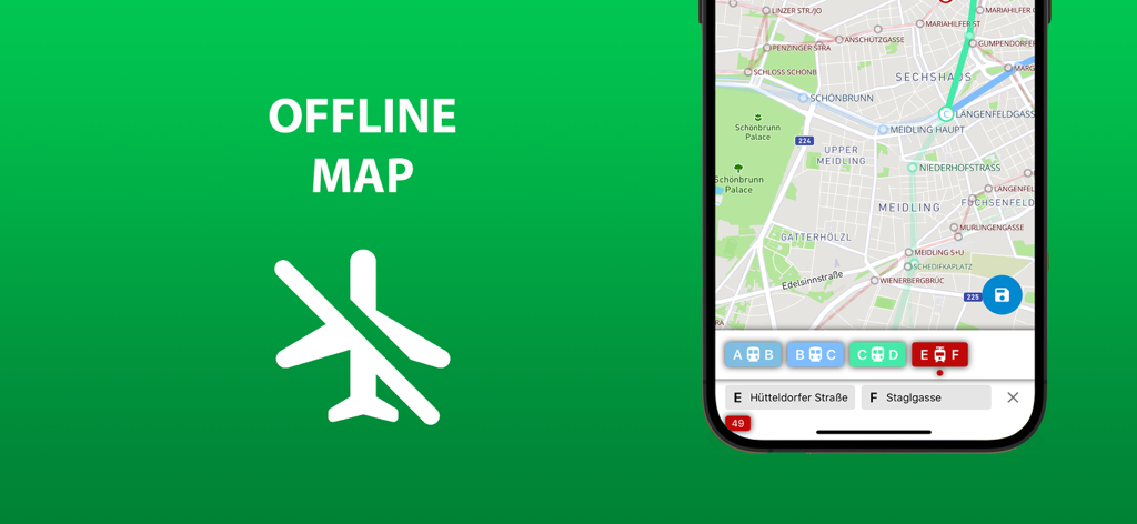
100% 오프라인 기능
SIM 카드나 Wi-Fi 없이 도시 전체를 탐색하세요. 전체 대중교통망을 손안에 두면서 비싼 로밍 요금을 절약하세요.
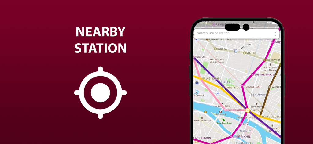
정밀 지리적 위치 파악
낯선 도시에서 길을 잃지 마세요. 지도에서 실시간 위치를 즉시 확인하고 가장 가까운 정류장을 찾아 원활하게 환승하세요.
다음 스크린샷과 설명은 앱의 공식 스토어 목록에서 직접 가져온 것이며 앱 개발자의 자산입니다.
앱 스토어
스크린샷
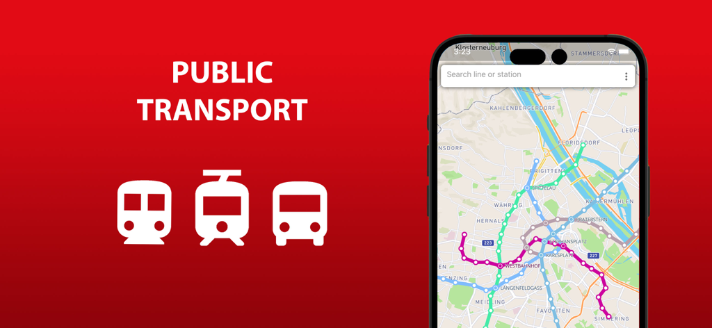
휴대폰 화면에 표시된 비엔나 대중교통 노선 지도
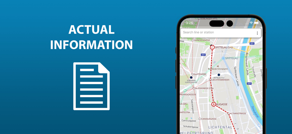
지하철, 트램, 버스 노선이 표시된 비엔나 대중교통 지도 앱 화면
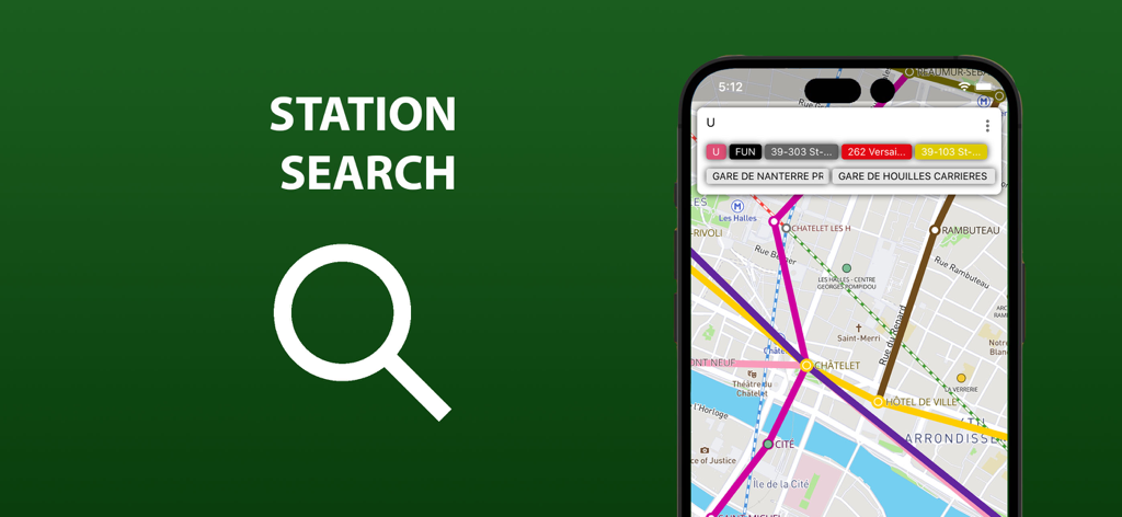
비엔나 대중교통 지도 앱의 역 검색 기능
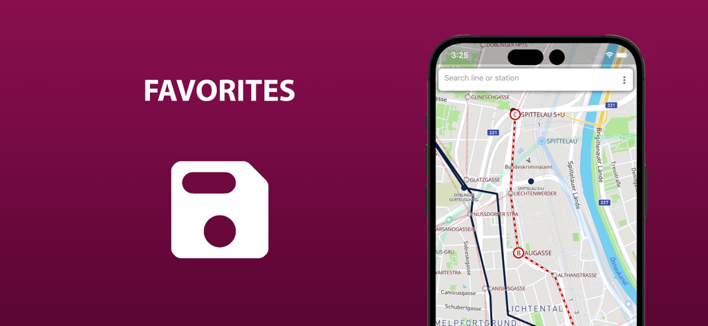
스마트폰 화면에 저장된 즐겨찾기 노선이 표시된 비엔나 대중교통 지도
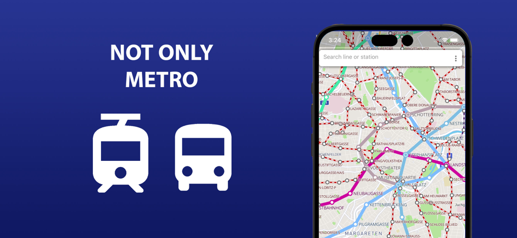
녹색 배경에 지하철 및 트램 노선이 표시된 오프라인 지도 기능을 보여주는 비엔나 대중교통 앱 스크린샷
근처 역 위치 기능을 보여주는 대중교통 지도 모바일 앱 인터페이스
하이라이트된 노선과 검색창이 표시된 비엔나 대중교통 지도를 표시하는 스마트폰 화면
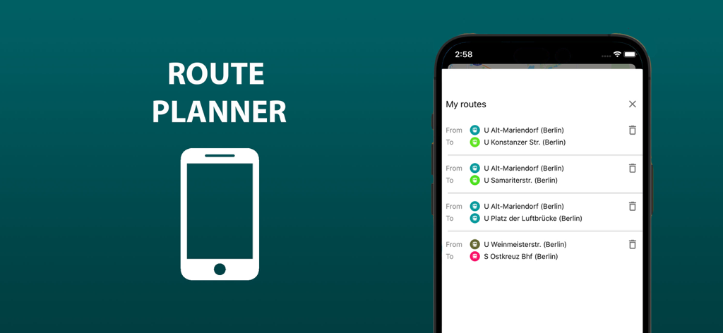
비엔나 대중교통 앱의 내 경로 목록을 표시하는 휴대폰 화면
설명
Download
비슷한 앱
같은 카테고리의 상위 앱

Google Maps
Google LLC

Waze Navigation & Live Traffic
waze

AMap Global
AutoNavi Information Technology Co. Ltd.

百度地图-路线规划,出行必备
Beijing Baidu Netcom Science & Technology Co.,Ltd

Moovit: Bus & Transit Tracker
Moovit App Global LTD

Transit • Subway & Bus Times
9280-0366 Quebec inc.

ParkMobile: Park. Pay. Go.
Parkmobile USA, Inc

腾讯地图-路线规划,导航地铁打车出行
Shenzhen Tencent Computer Systems Company Limited

Île-de-France Mobilités
Ile de France Mobilites
이 페이지는 앱이나 개발자의 공식 페이지가 아니며, 정보 제공 및 논평을 목적으로 작성된 독립 편집 간행물입니다. 명시적으로 달리 언급되지 않는 한, 해당 앱이나 개발자는 MWM, Apple, Google Play, 앱 퍼블리셔 또는 앱 개발자와 제휴, 보증, 후원, 승인 또는 공식적으로 연결되어 있지 않으며, 이 페이지의 어떤 내용도 해당 앱이 MWM의 서비스를 사용하여 개발되었음을 의미하지 않습니다. 모든 상표, 로고, 스크린샷 및 기타 콘텐츠는 해당 소유자의 자산입니다.