이 페이지는 앱이나 개발자의 공식 페이지가 아니며, 정보 제공 및 논평을 목적으로 작성된 독립 편집 간행물입니다. 명시적으로 달리 언급되지 않는 한, 해당 앱이나 개발자는 MWM, Apple, Google Play, 앱 퍼블리셔 또는 앱 개발자와 제휴, 보증, 후원, 승인 또는 공식적으로 연결되어 있지 않으며, 이 페이지의 어떤 내용도 해당 앱이 MWM의 서비스를 사용하여 개발되었음을 의미하지 않습니다. 모든 상표, 로고, 스크린샷 및 기타 콘텐츠는 해당 소유자의 자산입니다.

TrailWay: GPX Hiking Companion
하이커, 사이클리스트, 트레일 러너를 위해 제작된 전문 GPS 동반자로 원활하게 경로를 가져오고, 상세한 고도 프로필을 분석하며, 백컨트리를 마스터하세요.
다운로드
800사용자 평점
총 평가 수
0개발사
카테고리
Navigation지원 언어
1최신 버전
1.1.1크기
37.3 MB출시일
2024년 8월 30일기술적인 탐험가를 위해 설계됨
소셜 피드와 복잡한 인터페이스는 잊으세요. TrailWay는 백컨트리에서 완벽한 자신감으로 길을 찾기 위해 필요한 고정밀 도구와 데이터 기반 통찰력을 제공합니다.
고급 GPX 가져오기
URL, 클라우드 스토리지 또는 로컬 파일에서 직접 경로를 가져옵니다. 기술적인 트레일 데이터를 블로그와 포럼에서 지도 위로 마찰 없이 이동하세요.
정밀 고도 프로필
출발 전에 모든 오르막과 내리막을 분석하세요. 상세한 지형 난이도 통찰력으로 페이스와 에너지 관리를 마스터하세요.
다음 스크린샷과 설명은 앱의 공식 스토어 목록에서 직접 가져온 것이며 앱 개발자의 자산입니다.
앱 스토어
스크린샷
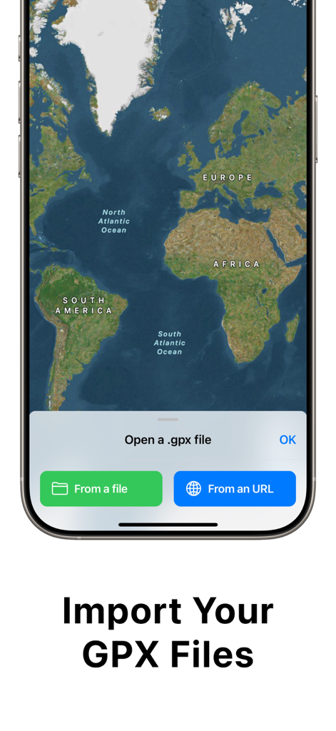
위성 지도 위에 로컬 파일 또는 URL에서 GPX 파일을 가져오는 옵션을 보여주는 TrailWay 앱 인터페이스.
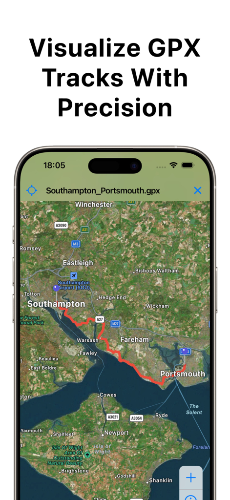
정밀한 GPX 트랙 시각화라는 텍스트와 함께 상세한 위성 지도 위에 빨간색 GPX 경로를 표시하는 스마트폰.
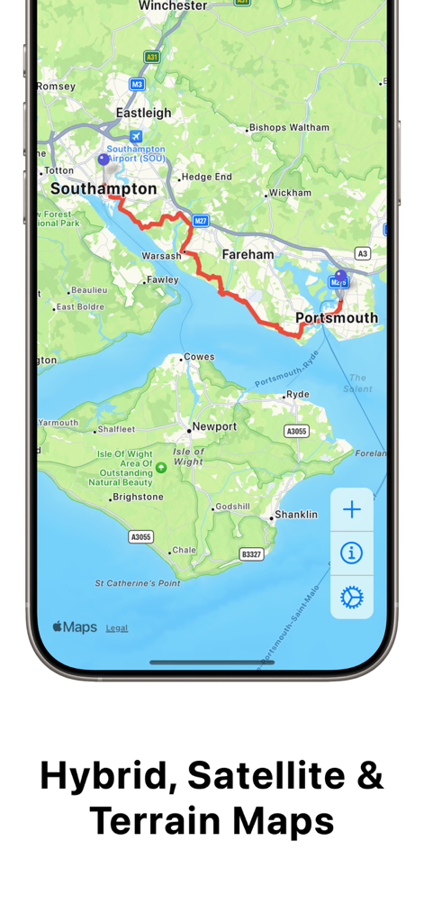
상세 지도 위에 빨간색 GPX 하이킹 경로를 보여주는 TrailWay 앱
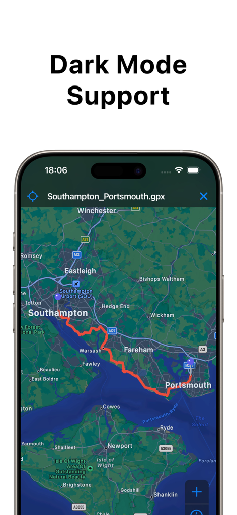
사우샘프턴에서 포츠머스까지 GPX 경로를 보여주는 어두운 모드의 TrailWay 앱 인터페이스
설명
Download
비슷한 앱
같은 카테고리의 상위 앱

Google Maps
Google LLC

Waze Navigation & Live Traffic
waze

AMap Global
AutoNavi Information Technology Co. Ltd.

百度地图-路线规划,出行必备
Beijing Baidu Netcom Science & Technology Co.,Ltd

Moovit: Bus & Transit Tracker
Moovit App Global LTD

Transit • Subway & Bus Times
9280-0366 Quebec inc.

ParkMobile: Park. Pay. Go.
Parkmobile USA, Inc

腾讯地图-路线规划,导航地铁打车出行
Shenzhen Tencent Computer Systems Company Limited

Île-de-France Mobilités
Ile de France Mobilites
이 페이지는 앱이나 개발자의 공식 페이지가 아니며, 정보 제공 및 논평을 목적으로 작성된 독립 편집 간행물입니다. 명시적으로 달리 언급되지 않는 한, 해당 앱이나 개발자는 MWM, Apple, Google Play, 앱 퍼블리셔 또는 앱 개발자와 제휴, 보증, 후원, 승인 또는 공식적으로 연결되어 있지 않으며, 이 페이지의 어떤 내용도 해당 앱이 MWM의 서비스를 사용하여 개발되었음을 의미하지 않습니다. 모든 상표, 로고, 스크린샷 및 기타 콘텐츠는 해당 소유자의 자산입니다.