이 페이지는 앱이나 개발자의 공식 페이지가 아니며, 정보 제공 및 논평을 목적으로 작성된 독립 편집 간행물입니다. 명시적으로 달리 언급되지 않는 한, 해당 앱이나 개발자는 MWM, Apple, Google Play, 앱 퍼블리셔 또는 앱 개발자와 제휴, 보증, 후원, 승인 또는 공식적으로 연결되어 있지 않으며, 이 페이지의 어떤 내용도 해당 앱이 MWM의 서비스를 사용하여 개발되었음을 의미하지 않습니다. 모든 상표, 로고, 스크린샷 및 기타 콘텐츠는 해당 소유자의 자산입니다.

TrueNorth: Compass, Altimeter
3중 소스 고도 정확도, 실시간 기압 모니터링 및 고정밀 나침반 도구를 사용하여 절대적인 자신감을 가지고 탐색하세요. 오프라인 안정성과 완전한 개인 정보 보호를 최악의 환경에서도 요구하는 전문가 및 아웃도어 애호가를 위해 제작되었습니다.
다운로드
600사용자 평점
총 평가 수
0개발사
카테고리
Navigation지원 언어
1최신 버전
1.0.4크기
17.9 MB출시일
2025년 5월 30일백컨트리를 위한 전문가 수준의 내비게이션
전혀 연결되지 않은 상태에서 최고의 성능을 발휘하도록 설계된 안정적인 현장 도구로 iPhone을 변환하세요.
3중 소스 고도 정밀도
GPS, 기압 센서 및 고도 데이터베이스를 결합하여 모든 지형에서 가장 정확한 고도 판독값을 얻으세요.
오프라인 안정성을 위한 제작
휴대폰 신호가 없다고요? 문제없습니다. 인터넷 연결 없이도 전문 나침반 및 GPS 좌표에 액세스할 수 있습니다.
다음 스크린샷과 설명은 앱의 공식 스토어 목록에서 직접 가져온 것이며 앱 개발자의 자산입니다.
앱 스토어
스크린샷
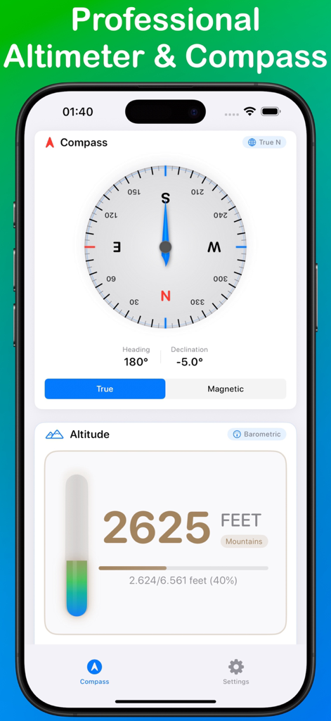
TrueNorth 앱 인터페이스가 180도 방향을 표시하는 전문 나침반 로즈와 2625피트를 표시하는 디지털 고도계를 표시합니다.
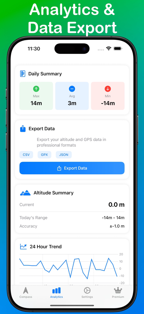
TrueNorth 앱 분석 대시보드가 고도 요약 및 데이터 내보내기 옵션을 표시합니다.
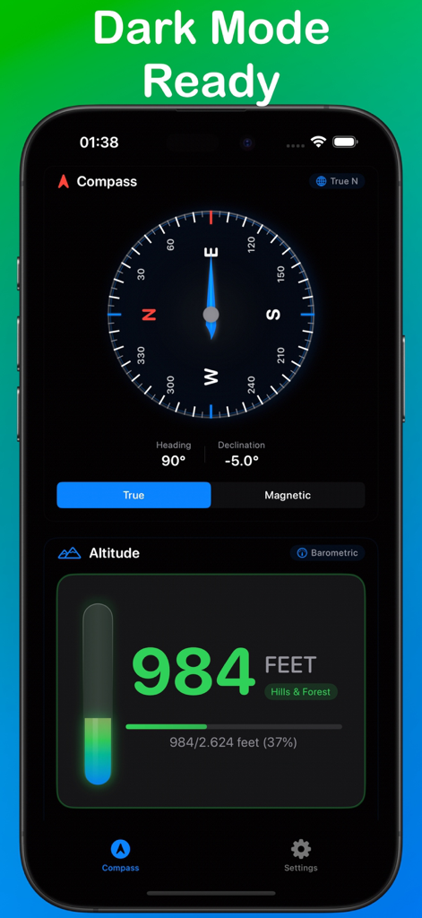
TrueNorth 앱 인터페이스가 어두운 모드에서 전문 나침반과 디지털 고도계를 표시합니다.
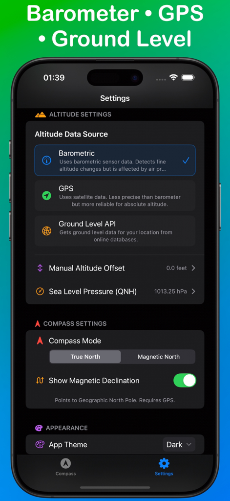
TrueNorth 앱 설정 화면이 고도 소스 옵션 및 나침반 내비게이션 모드를 표시합니다.
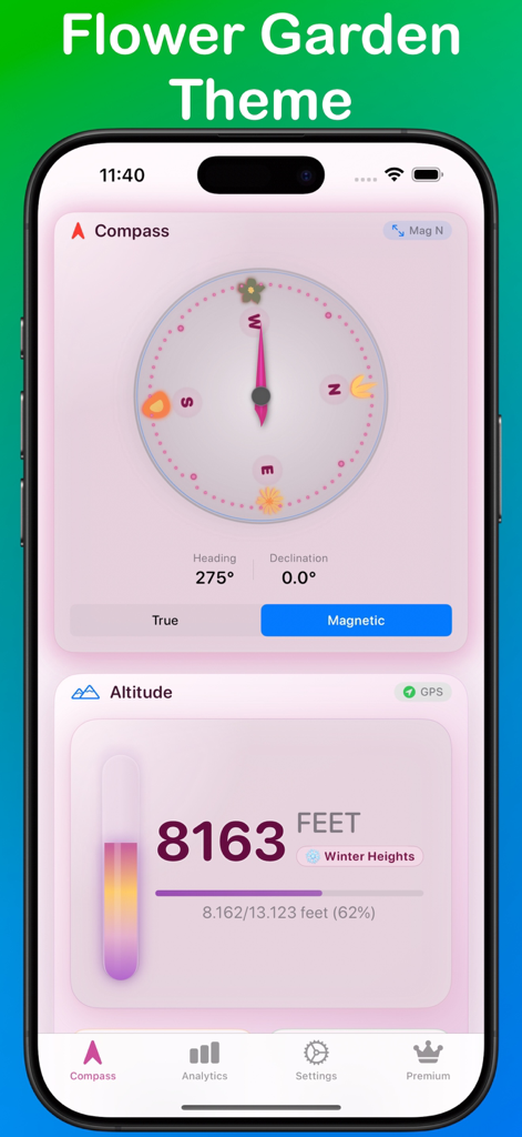
TrueNorth 내비게이션 앱이 분홍색 꽃 정원 테마의 나침반과 고도계를 표시합니다.
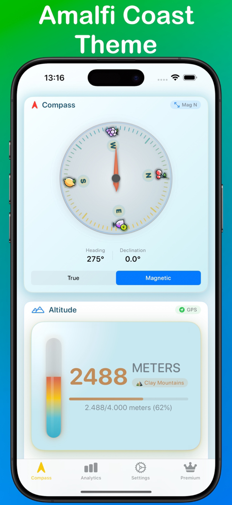
TrueNorth 앱 인터페이스가 나침반 및 고도 판독값과 함께 아말피 해안 테마를 표시합니다.
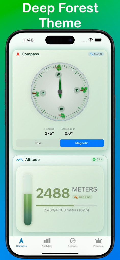
TrueNorth 내비게이션 앱이 짙은 숲 녹색 테마의 자기 나침반 및 고도계를 표시합니다.
설명
Download
비슷한 앱
같은 카테고리의 상위 앱

Google Maps
Google LLC

Waze Navigation & Live Traffic
waze

AMap Global
AutoNavi Information Technology Co. Ltd.

百度地图-路线规划,出行必备
Beijing Baidu Netcom Science & Technology Co.,Ltd

Moovit: Bus & Transit Tracker
Moovit App Global LTD

Transit • Subway & Bus Times
9280-0366 Quebec inc.

ParkMobile: Park. Pay. Go.
Parkmobile USA, Inc

腾讯地图-路线规划,导航地铁打车出行
Shenzhen Tencent Computer Systems Company Limited

Île-de-France Mobilités
Ile de France Mobilites
이 페이지는 앱이나 개발자의 공식 페이지가 아니며, 정보 제공 및 논평을 목적으로 작성된 독립 편집 간행물입니다. 명시적으로 달리 언급되지 않는 한, 해당 앱이나 개발자는 MWM, Apple, Google Play, 앱 퍼블리셔 또는 앱 개발자와 제휴, 보증, 후원, 승인 또는 공식적으로 연결되어 있지 않으며, 이 페이지의 어떤 내용도 해당 앱이 MWM의 서비스를 사용하여 개발되었음을 의미하지 않습니다. 모든 상표, 로고, 스크린샷 및 기타 콘텐츠는 해당 소유자의 자산입니다.