이 페이지는 앱이나 개발자의 공식 페이지가 아니며, 정보 제공 및 논평을 목적으로 작성된 독립 편집 간행물입니다. 명시적으로 달리 언급되지 않는 한, 해당 앱이나 개발자는 MWM, Apple, Google Play, 앱 퍼블리셔 또는 앱 개발자와 제휴, 보증, 후원, 승인 또는 공식적으로 연결되어 있지 않으며, 이 페이지의 어떤 내용도 해당 앱이 MWM의 서비스를 사용하여 개발되었음을 의미하지 않습니다. 모든 상표, 로고, 스크린샷 및 기타 콘텐츠는 해당 소유자의 자산입니다.

UoB Campus Map
에지배스턴과 셀리 오크를 쉽게 탐색하세요. 실시간 학습 공간 찾기, 실시간 대중교통 추적, 통합된 계단 없는 경로 안내까지, 버밍엄 커뮤니티를 위한 필수 앱 하나로 모두 이용 가능합니다.
다운로드
64K+사용자 평점
총 평가 수
0개발사
카테고리
Navigation지원 언어
1최신 버전
3.2크기
44.6 MB출시일
2019년 1월 22일캠퍼스 경험 마스터하기
에지배스턴과 셀리 오크를 전문가처럼 탐색하세요. 숨겨진 학습 공간 찾기부터 실시간 대중교통 추적까지, 버밍엄 대학교를 당신의 손안에 담았습니다.
스마트 캠퍼스 내비게이션
계단 없는 맞춤형 경로 안내로 모든 건물까지 길을 찾고, 통합적이고 스트레스 없는 이동을 경험하세요.
즉시 학습 공간 찾기
자리를 찾는 데 시간을 낭비하지 마세요. 캠퍼스 전역에서 최고의 학습 공간을 빠르게 찾아 생산성을 극대화하세요.
다음 스크린샷과 설명은 앱의 공식 스토어 목록에서 직접 가져온 것이며 앱 개발자의 자산입니다.
앱 스토어
스크린샷
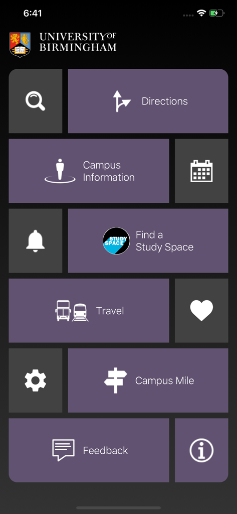
University of Birmingham 캠퍼스 지도 앱의 메인 메뉴로, 길찾기, 교통, 학습 공간 타일 표시
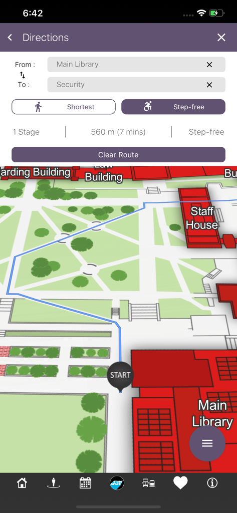
UoB 캠퍼스 지도 앱에서 메인 도서관에서 보안팀까지 계단 없는 도보 길찾기를 보여주는 스크린샷
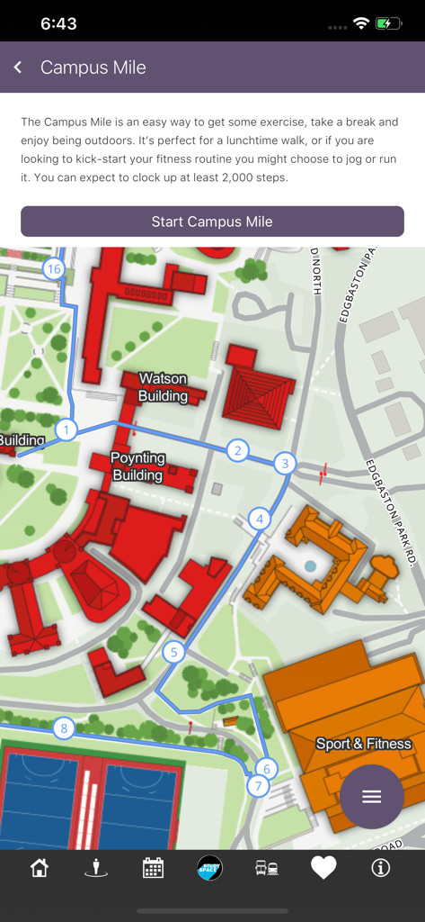
UoB 캠퍼스 지도 앱에서 대학 지도에 지정된 걷기 경로인 캠퍼스 마일을 보여줌
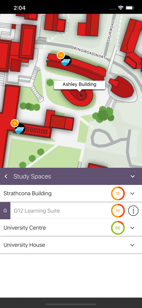
UoB 캠퍼스 지도 앱 인터페이스에서 버밍엄 대학교 캠퍼스 전역의 학습 공간 실시간 이용 가능 여부를 보여줌
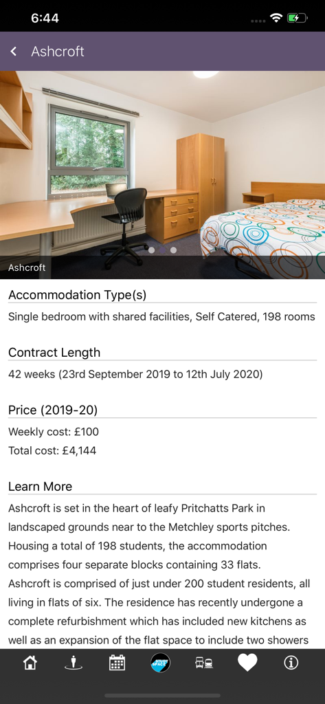
UoB 캠퍼스 지도 앱에서 Ashcroft 학생 숙소에 대한 객실 사진 및 가격 정보를 포함한 세부 정보를 표시하는 스크린샷
설명
Download
비슷한 앱
같은 카테고리의 상위 앱

Google Maps
Google LLC

AMap Global
AutoNavi Information Technology Co. Ltd.

Waze Navigation & Live Traffic
waze

百度地图-路线规划,出行必备
Beijing Baidu Netcom Science & Technology Co.,Ltd

Moovit: Bus & Transit Tracker
Moovit App Global LTD

Transit • Subway & Bus Times
9280-0366 Quebec inc.

ParkMobile: Park. Pay. Go.
Parkmobile USA, Inc

腾讯地图-路线规划,导航地铁打车出行
Shenzhen Tencent Computer Systems Company Limited

MapXplorer: Map Radar Navigate
GOLDLAB APPLICATIONS YAZILIM VE BILISIM ANONIM SIRKETI
이 페이지는 앱이나 개발자의 공식 페이지가 아니며, 정보 제공 및 논평을 목적으로 작성된 독립 편집 간행물입니다. 명시적으로 달리 언급되지 않는 한, 해당 앱이나 개발자는 MWM, Apple, Google Play, 앱 퍼블리셔 또는 앱 개발자와 제휴, 보증, 후원, 승인 또는 공식적으로 연결되어 있지 않으며, 이 페이지의 어떤 내용도 해당 앱이 MWM의 서비스를 사용하여 개발되었음을 의미하지 않습니다. 모든 상표, 로고, 스크린샷 및 기타 콘텐츠는 해당 소유자의 자산입니다.