이 페이지는 앱이나 개발자의 공식 페이지가 아니며, 정보 제공 및 논평을 목적으로 작성된 독립 편집 간행물입니다. 명시적으로 달리 언급되지 않는 한, 해당 앱이나 개발자는 MWM, Apple, Google Play, 앱 퍼블리셔 또는 앱 개발자와 제휴, 보증, 후원, 승인 또는 공식적으로 연결되어 있지 않으며, 이 페이지의 어떤 내용도 해당 앱이 MWM의 서비스를 사용하여 개발되었음을 의미하지 않습니다. 모든 상표, 로고, 스크린샷 및 기타 콘텐츠는 해당 소유자의 자산입니다.

Watch Wayfinder
손목 위에서 즐기는 정밀 내비게이션. 오프라인 NOAA 차트, 실시간 VMG 데이터, 사용자 지정 GPX 통합을 통해 수면과 트레일을 마스터하세요. 기술에 정통한 아웃도어 프로슈머를 위해 설계되었습니다.
다운로드
14K+사용자 평점
총 평가 수
0개발사
카테고리
Navigation지원 언어
1최신 버전
1.7.5크기
5.8 MB출시일
2023년 8월 10일손목 위에서 즐기는 전문가급 내비게이션
부피가 큰 차트 플로터를 세련되고 데이터 중심적인 도구로 교체하세요. 기술적 아웃도어 프로슈머를 위해 설계된 전문가용 해양 차트, 실시간 성능 지표, 오프라인 지도에 액세스하세요.
오프라인 해양 및 트레일 지도
NOAA 차트와 OpenStreetMap 데이터를 사용하여 안전하고 정확한 경로를 유지하세요. 셀룰러 서비스가 없는 외딴 지역에서도 신뢰성을 보장하기 위해 출발 전에 고화질 지도 영역을 수동으로 다운로드하세요.
실시간 성능 분석
기술 지표를 사용하여 라인을 최적화하세요. Velocity Made Good(VMG), 최대 속도, 정확한 헤딩을 한눈에 모니터링하세요. 윈드서핑, 카이트보딩, 경쟁 세일링에 완벽합니다.
다음 스크린샷과 설명은 앱의 공식 스토어 목록에서 직접 가져온 것이며 앱 개발자의 자산입니다.
앱 스토어
스크린샷
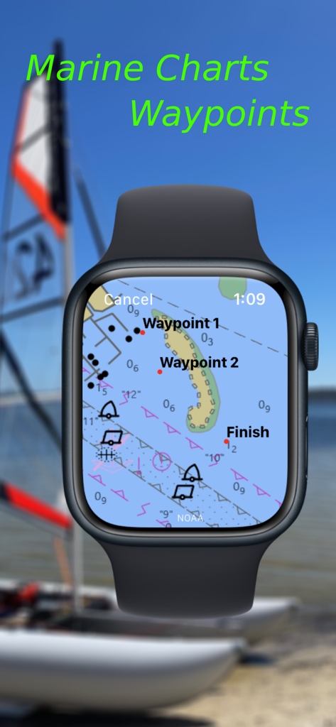
Apple Watch에서 상세한 해양 차트와 내비게이션 웨이포인트를 보여주는 Watch Wayfinder 앱
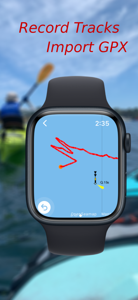
해양 지도에서 내비게이션 트랙을 기록하는 Watch Wayfinder 앱을 표시하는 Apple Watch
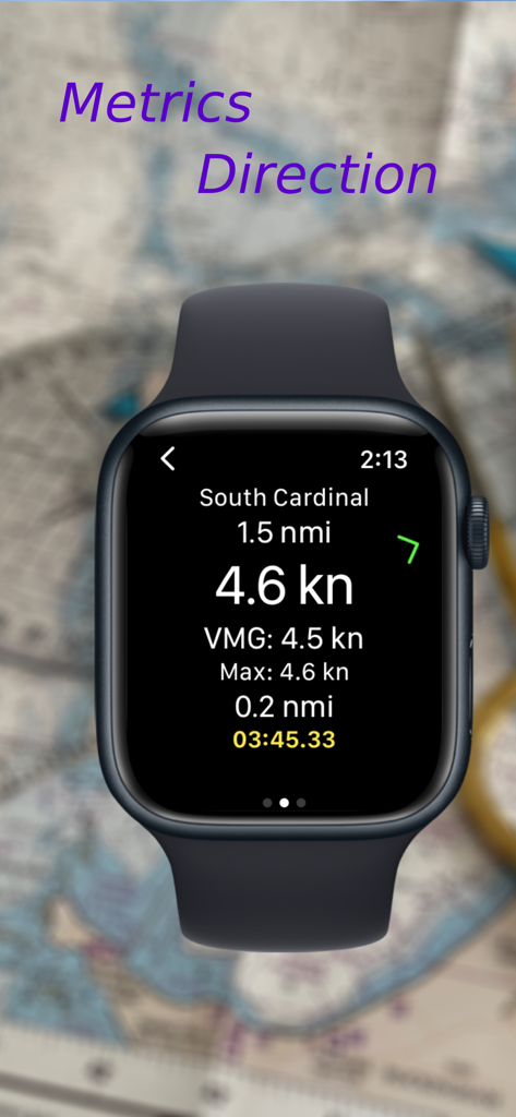
Apple Watch 화면에 속도, VMG, 남쪽 카디널 웨이포인트까지의 거리를 포함한 내비게이션 데이터 표시
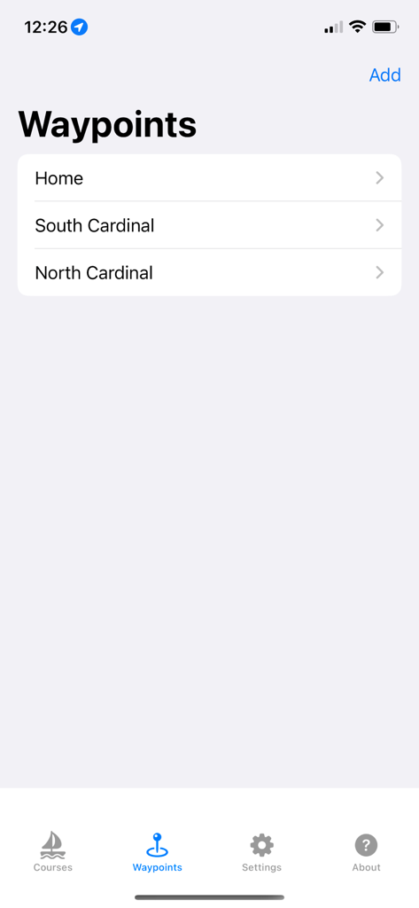
Watch Wayfinder iPhone 앱의 인터페이스에서 저장된 내비게이션 웨이포인트 목록 표시
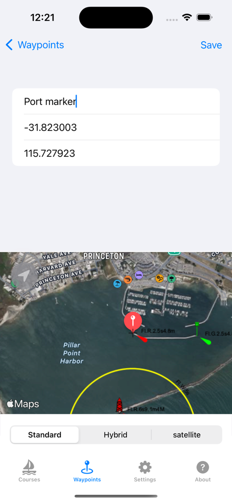
GPS 좌표 및 위성 지도를 사용하여 웨이포인트 생성을 보여주는 Watch Wayfinder 앱의 iPhone 인터페이스
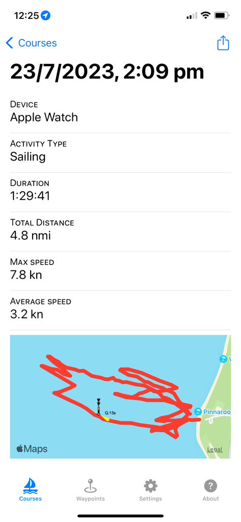
Apple Watch의 GPS 트랙 지도 및 해양 통계와 함께 세일링 활동 요약을 보여주는 iPhone 화면
설명
Download
비슷한 앱
같은 카테고리의 상위 앱

Google Maps
Google LLC

Waze Navigation & Live Traffic
waze

AMap Global
AutoNavi Information Technology Co. Ltd.

百度地图-路线规划,出行必备
Beijing Baidu Netcom Science & Technology Co.,Ltd

Moovit: Bus & Transit Tracker
Moovit App Global LTD

Transit • Subway & Bus Times
9280-0366 Quebec inc.

ParkMobile: Park. Pay. Go.
Parkmobile USA, Inc

腾讯地图-路线规划,导航地铁打车出行
Shenzhen Tencent Computer Systems Company Limited

Île-de-France Mobilités
Ile de France Mobilites
이 페이지는 앱이나 개발자의 공식 페이지가 아니며, 정보 제공 및 논평을 목적으로 작성된 독립 편집 간행물입니다. 명시적으로 달리 언급되지 않는 한, 해당 앱이나 개발자는 MWM, Apple, Google Play, 앱 퍼블리셔 또는 앱 개발자와 제휴, 보증, 후원, 승인 또는 공식적으로 연결되어 있지 않으며, 이 페이지의 어떤 내용도 해당 앱이 MWM의 서비스를 사용하여 개발되었음을 의미하지 않습니다. 모든 상표, 로고, 스크린샷 및 기타 콘텐츠는 해당 소유자의 자산입니다.