이 페이지는 앱이나 개발자의 공식 페이지가 아니며, 정보 제공 및 논평을 목적으로 작성된 독립 편집 간행물입니다. 명시적으로 달리 언급되지 않는 한, 해당 앱이나 개발자는 MWM, Apple, Google Play, 앱 퍼블리셔 또는 앱 개발자와 제휴, 보증, 후원, 승인 또는 공식적으로 연결되어 있지 않으며, 이 페이지의 어떤 내용도 해당 앱이 MWM의 서비스를 사용하여 개발되었음을 의미하지 않습니다. 모든 상표, 로고, 스크린샷 및 기타 콘텐츠는 해당 소유자의 자산입니다.

WinGPS Marine Plus
전문 경로 계획, 실시간 AIS 추적 및 진지한 선원, 연안 순항 선박, 그레이트 루프 모험가를 위한 맞춤형 상세 수로 데이터를 자신 있게 탐색하세요.
다운로드
12K+사용자 평점
총 평가 수
0개발사
카테고리
Navigation지원 언어
3최신 버전
1.39크기
59.6 MB출시일
2020년 12월 11일현대 선장을 위한 전문가 수준의 내비게이션
공해 항해부터 복잡한 내륙 수로까지, WinGPS Marine Plus는 전문적인 선박 관리에 필요한 정밀도, 안전 기능 및 실시간 데이터를 제공합니다.
실시간 AIS 인식
고화질 해도에 주변 AIS 객체를 직접 표시하여 바쁜 연안 채널 및 항로를 안전하게 탐색하세요.
선박별 경로 설정
교량 통과 높이, 갑문 일정 및 내륙 수로 데이터를 고려하여 선박 치수에 맞게 최적화된 항해 경로를 생성하세요.
다음 스크린샷과 설명은 앱의 공식 스토어 목록에서 직접 가져온 것이며 앱 개발자의 자산입니다.
앱 스토어
스크린샷
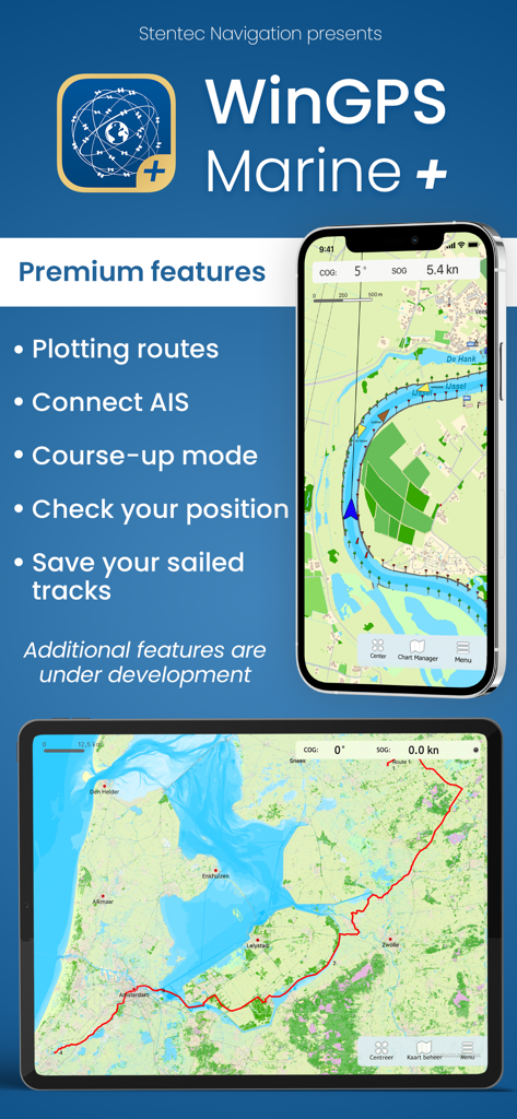
WinGPS Marine Plus 앱 인터페이스가 모바일 기기에서 해도 및 내비게이션 기능을 보여줍니다.
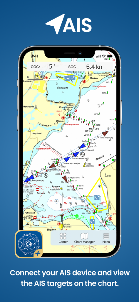
WinGPS Marine Plus 앱이 해도에서 AIS 선박 추적을 보여줍니다.
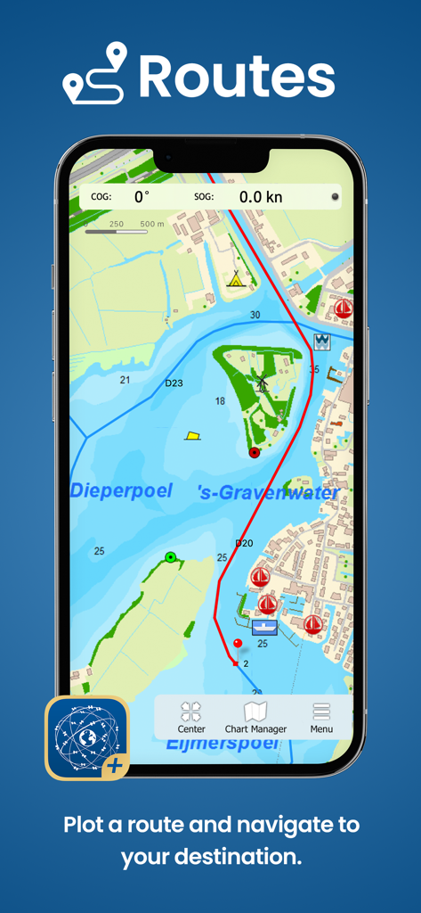
선박용 해도에 해상 경로를 표시하는 WinGPS Marine Plus 앱을 보여주는 스마트폰 화면.
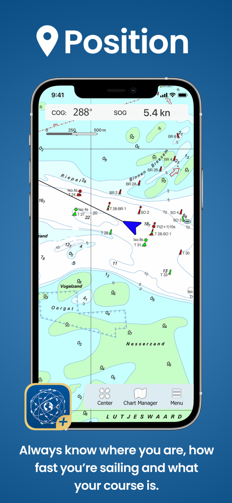
WinGPS Marine Plus 앱 인터페이스가 현재 선박 위치와 속도가 표시된 해도에 표시됩니다.
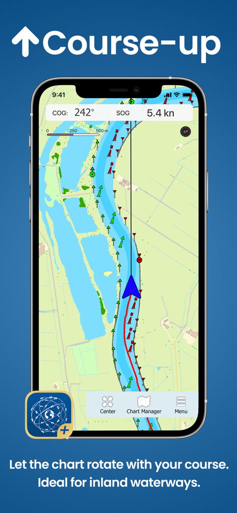
WinGPS Marine Plus 앱이 내륙 내비게이션을 위해 코스 상향 차트 회전을 표시합니다.
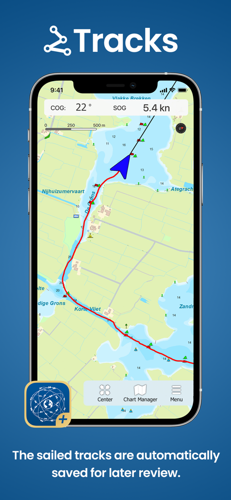
WinGPS Marine Plus 앱 인터페이스가 차트에 저장된 해상 트랙을 표시합니다.
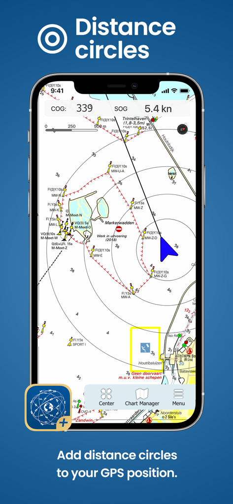
WinGPS Marine Plus 앱이 디지털 해도에서 선박 위치 주변의 거리 원을 보여줍니다.
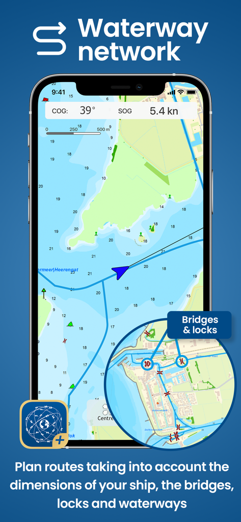
해도 및 수로 네트워크 세부 정보가 있는 WinGPS Marine Plus 앱을 보여주는 스마트폰.
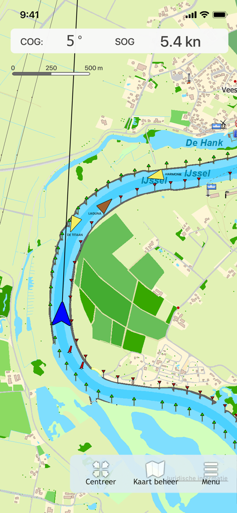
WinGPS Marine Plus 내비게이션 맵이 강에서 AIS 선박 추적 및 해도 표식을 보여줍니다.
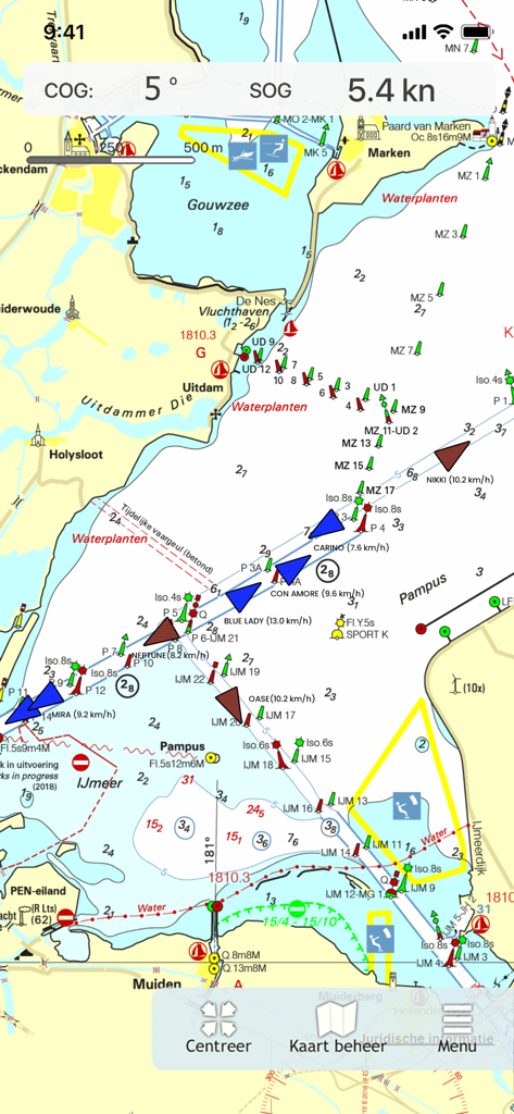
WinGPS Marine Plus 앱이 실시간 AIS 선박 추적 및 해도 데이터를 갖춘 해상 내비게이션 차트를 보여줍니다.
설명
Download
비슷한 앱
같은 카테고리의 상위 앱

Google Maps
Google LLC

Waze Navigation & Live Traffic
waze

AMap Global
AutoNavi Information Technology Co. Ltd.

百度地图-路线规划,出行必备
Beijing Baidu Netcom Science & Technology Co.,Ltd

Moovit: Bus & Transit Tracker
Moovit App Global LTD

Transit • Subway & Bus Times
9280-0366 Quebec inc.

ParkMobile: Park. Pay. Go.
Parkmobile USA, Inc

腾讯地图-路线规划,导航地铁打车出行
Shenzhen Tencent Computer Systems Company Limited

Île-de-France Mobilités
Ile de France Mobilites
이 페이지는 앱이나 개발자의 공식 페이지가 아니며, 정보 제공 및 논평을 목적으로 작성된 독립 편집 간행물입니다. 명시적으로 달리 언급되지 않는 한, 해당 앱이나 개발자는 MWM, Apple, Google Play, 앱 퍼블리셔 또는 앱 개발자와 제휴, 보증, 후원, 승인 또는 공식적으로 연결되어 있지 않으며, 이 페이지의 어떤 내용도 해당 앱이 MWM의 서비스를 사용하여 개발되었음을 의미하지 않습니다. 모든 상표, 로고, 스크린샷 및 기타 콘텐츠는 해당 소유자의 자산입니다.