This page is not an official page of the app or its developer, but an independent editorial publication created for informational and commentary purposes. Unless expressly stated otherwise, neither the app nor its developer is affiliated with, endorsed by, sponsored by, authorized by, or otherwise officially connected with MWM, Apple, Google Play, the app publisher, or the app's developer, and nothing on this page implies that the app was developed using MWM's services. Any trademarks, logos, screenshots, and other content remain the property of their respective owners.

Air Map Israel
Master Israel’s complex airspace with real-time tracking, integrated flight planning, and smart safety alerts—all in one professional-grade cockpit tool.
Downloads
4K+User Rating
Total Ratings
0Publisher
Category
NavigationLocales
1Latest Version
2.7.3Size
45.0 MBFirst Released
Aug 3, 2023Your Complete Electronic Flight Bag for Israel
Navigate the complex Israeli airspace with a comprehensive EFB designed for precision, safety, and regulatory compliance, ensuring you have every critical tool at your fingertips.
Precision Flight Planning
Build complex FPLs with snap-to-waypoint accuracy, real-time ETA/ETE calculations, and specialized CVFR, LSA, and IFR map layers specifically for Israel.
Real-Time Safety Alerts
Enhance situational awareness with voice-activated alerts for restricted zones, training area boundaries, and altitude deviations in tight airspace.
The following screenshots and description are sourced directly from the app's official store listing and are the property of the app developer.
App Store
Screenshots
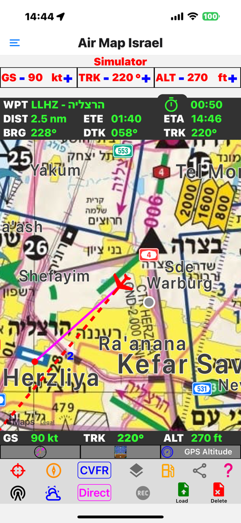
Air Map Israel mobile app interface showing flight navigation and simulator mode with real time pilot data
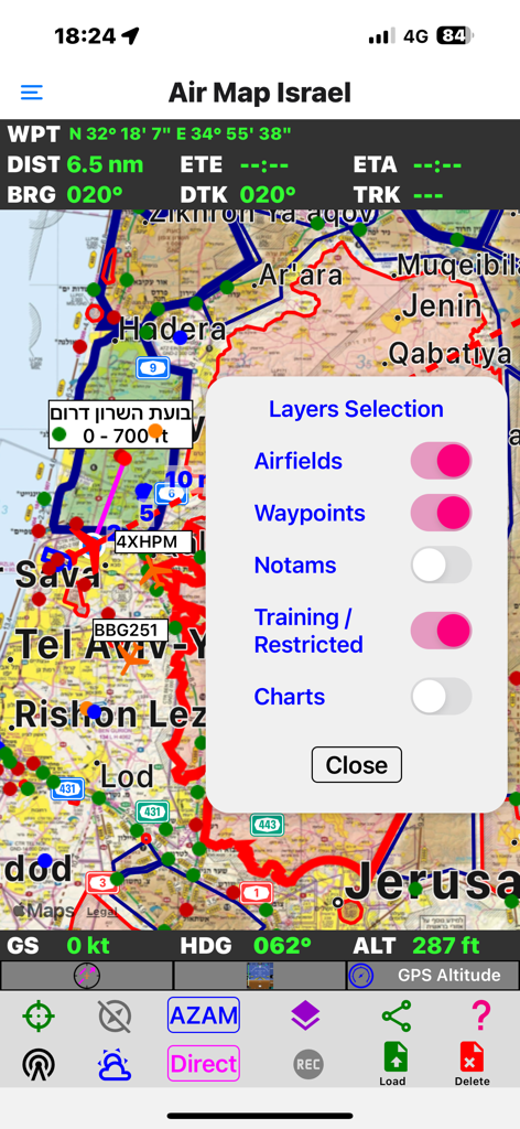
Air Map Israel navigation screen showing the layers selection menu with toggles for airfields and restricted areas over a flight map.
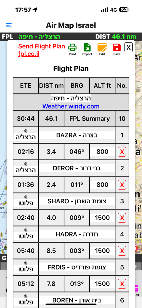
A detailed flight plan display within the Air Map Israel app featuring navigation waypoints altitude and distance data
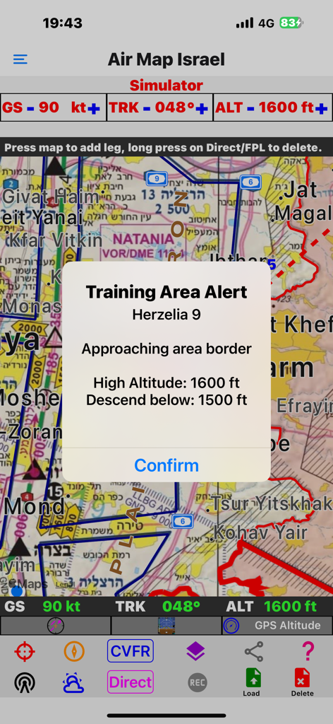
Air Map Israel app interface showing a training area alert popup with altitude warning on a flight navigation map.
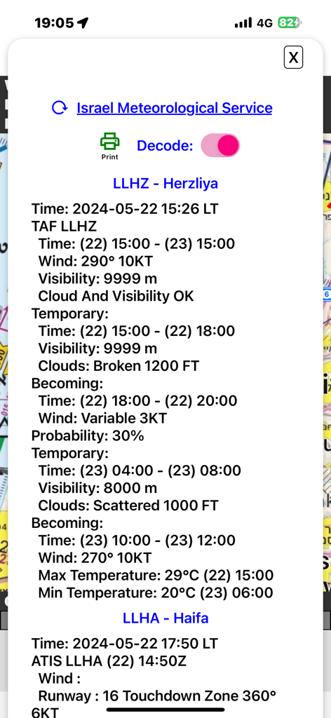
Aviation weather report screen for Herzliya and Haifa airports showing wind and visibility data
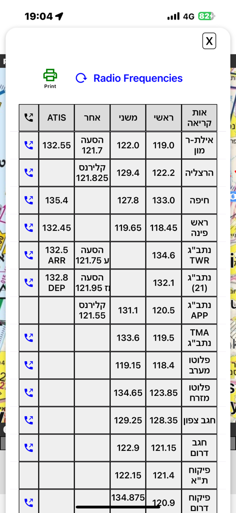
A comprehensive table of aviation radio frequencies for airports and airspaces throughout Israel
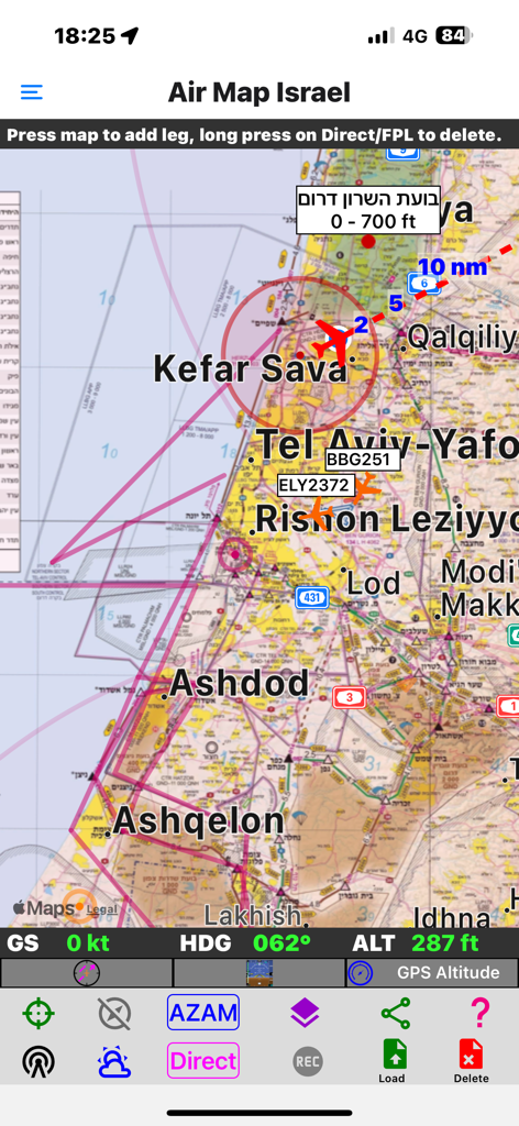
Air Map Israel mobile app interface showing real-time aircraft tracking on a VFR flight chart over Tel Aviv and surrounding areas.
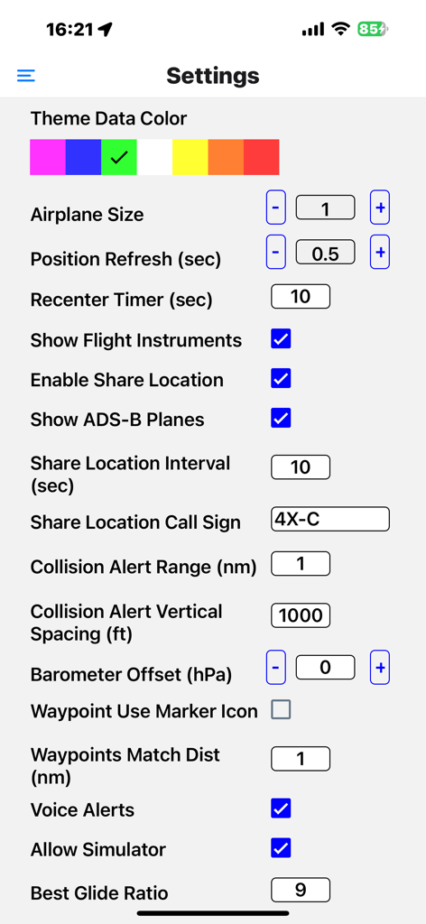
Settings menu of the Air Map Israel app showing flight instrument and safety alert configurations
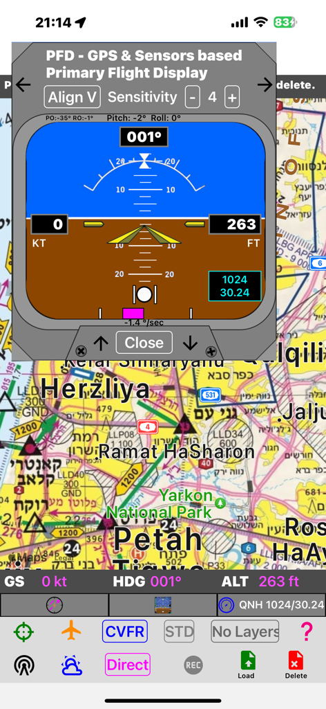
Air Map Israel app interface showing the Primary Flight Display overlay on a detailed aviation navigation map
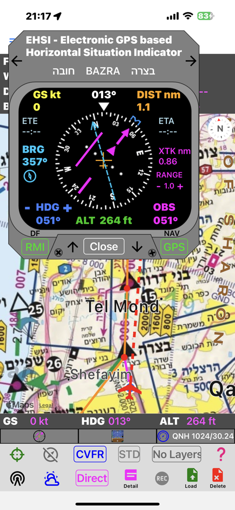
Air Map Israel application interface showing the electronic horizontal situation indicator overlay on a VFR aviation chart.
Description
Download
More Like This
Top-ranked apps in the same category

Google Maps
Google LLC

Waze Navigation & Live Traffic
waze

AMap Global
AutoNavi Information Technology Co. Ltd.

百度地图-路线规划,出行必备
Beijing Baidu Netcom Science & Technology Co.,Ltd

Moovit: Bus & Transit Tracker
Moovit App Global LTD

Transit • Subway & Bus Times
9280-0366 Quebec inc.

ParkMobile: Park. Pay. Go.
Parkmobile USA, Inc

腾讯地图-路线规划,导航地铁打车出行
Shenzhen Tencent Computer Systems Company Limited

Île-de-France Mobilités
Ile de France Mobilites
This page is not an official page of the app or its developer, but an independent editorial publication created for informational and commentary purposes. Unless expressly stated otherwise, neither the app nor its developer is affiliated with, endorsed by, sponsored by, authorized by, or otherwise officially connected with MWM, Apple, Google Play, the app publisher, or the app's developer, and nothing on this page implies that the app was developed using MWM's services. Any trademarks, logos, screenshots, and other content remain the property of their respective owners.