This page is not an official page of the app or its developer, but an independent editorial publication created for informational and commentary purposes. Unless expressly stated otherwise, neither the app nor its developer is affiliated with, endorsed by, sponsored by, authorized by, or otherwise officially connected with MWM, Apple, Google Play, the app publisher, or the app's developer, and nothing on this page implies that the app was developed using MWM's services. Any trademarks, logos, screenshots, and other content remain the property of their respective owners.

Airfield Watch - METAR & TAF
Master your pre-flight briefing with real-time METAR, TAF, and NOTAM alerts. Built with 40 years of aviation expertise to provide the critical data you need for a safe 'Go/No-Go' decision.
Downloads
9K+User Rating
Total Ratings
0Publisher
Category
WeatherLocales
1Latest Version
1.1.3Size
74.1 MBFirst Released
Aug 15, 2024Precision Tools for Every Pilot
Turn complex meteorological data into actionable intelligence with tools designed to streamline your pre-flight briefing and enhance safety.
Visual Quick Briefing
Map your flight path and instantly see weather symbols and NOTAMs along your route for total situational awareness.
Smart NOTAM Filtering
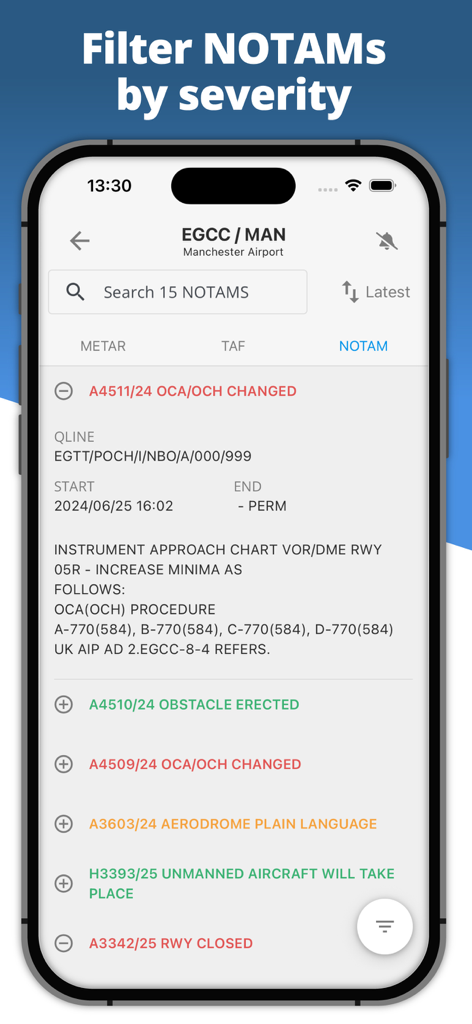
Filter notices by keyword or severity to find critical airfield updates fast, replacing hours of manual document review.
The following screenshots and description are sourced directly from the app's official store listing and are the property of the app developer.
App Store
Screenshots
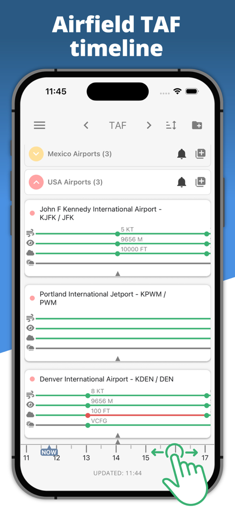
Airfield Watch app interface displaying a detailed TAF weather timeline for airports including JFK and Denver
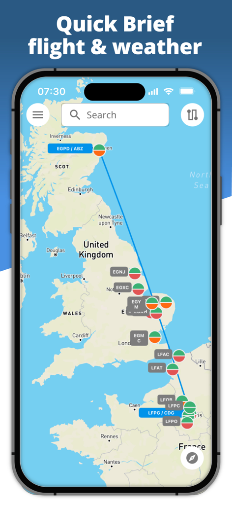
Airfield Watch app displaying the Quick Brief feature with a flight route from the UK to France and color coded aviation weather icons on a map
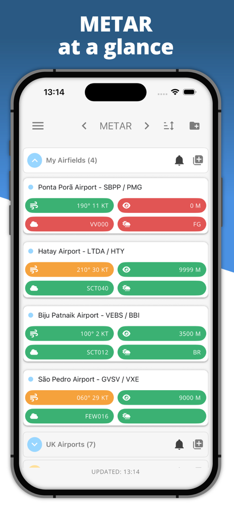
Airfield Watch app screen showing decoded METAR weather data for multiple international airports with color coded safety status
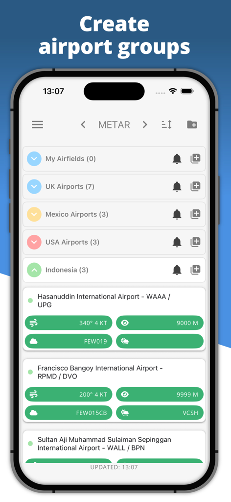
Airfield Watch app screen showing organized airport groups and METAR weather reports.
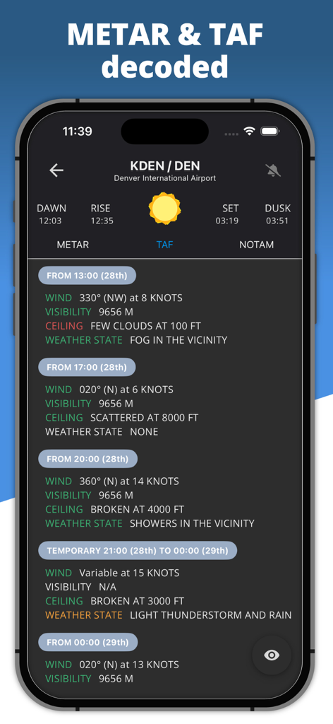
Decoded TAF aviation weather forecast for Denver International Airport on Airfield Watch app
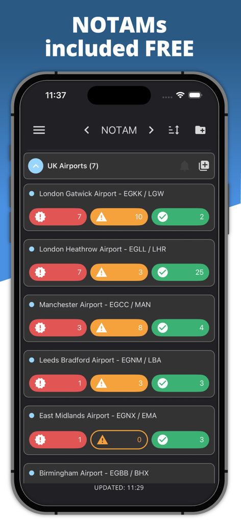
A mobile app screen showing a list of airports with categorized NOTAM alerts for pilots
Airfield Watch app interface displaying airport NOTAMs organized by severity level
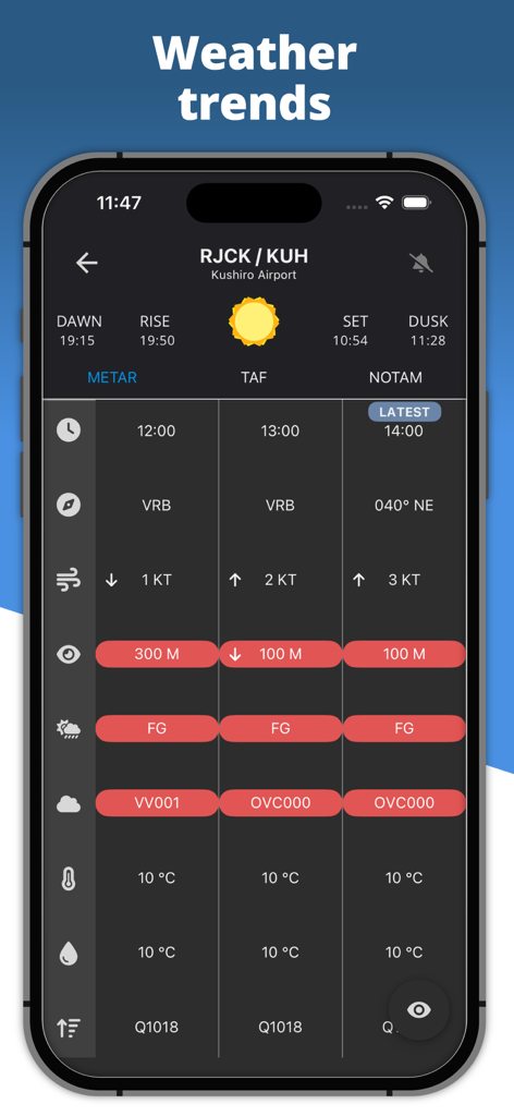
Airfield Watch app showing detailed METAR weather trends and airport meteorological data for pilots.
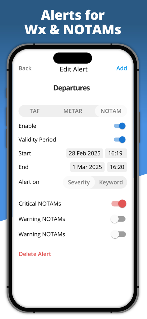
A smartphone interface showing the Edit Alert screen for configuring NOTAM alerts by severity and validity period
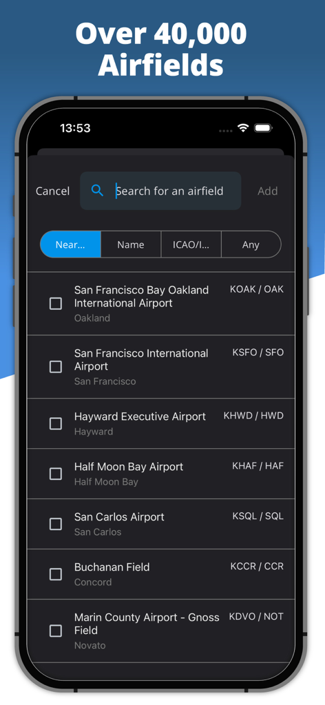
App screen showing search for over 40000 airfields with ICAO codes
Description
Download
More Like This
Top-ranked apps in the same category

墨迹天气-MojiWeather
Beijing MojiFengyun Technology Co.,Ltd.

The Weather Channel - Radar
The Weather Channel

Windy.com
Windyty, SE

天气预报-精准15日天气预报
Chongqing Caochen Technology Co., Ltd.

My Aurora Forecast & Alerts
JRustonApps B.V.

AccuWeather: Weather Forecast
AccuWeather International, Inc.

Weather & Radar - Storm radar
WetterOnline - Meteorologische Dienstleistungen GmbH

天气通
Weibo Internet Technology (China) Co.Ltd.

The Thermometer -Digital-
Vida Apps Incorporated
This page is not an official page of the app or its developer, but an independent editorial publication created for informational and commentary purposes. Unless expressly stated otherwise, neither the app nor its developer is affiliated with, endorsed by, sponsored by, authorized by, or otherwise officially connected with MWM, Apple, Google Play, the app publisher, or the app's developer, and nothing on this page implies that the app was developed using MWM's services. Any trademarks, logos, screenshots, and other content remain the property of their respective owners.