This page is not an official page of the app or its developer, but an independent editorial publication created for informational and commentary purposes. Unless expressly stated otherwise, neither the app nor its developer is affiliated with, endorsed by, sponsored by, authorized by, or otherwise officially connected with MWM, Apple, Google Play, the app publisher, or the app's developer, and nothing on this page implies that the app was developed using MWM's services. Any trademarks, logos, screenshots, and other content remain the property of their respective owners.

Airports Plus
Access detailed runway layouts, radio frequencies, and real-time METAR/TAF data for thousands of airports globally—optimized for iPad and fully functional without an internet connection.
Downloads
211K+User Rating
Total Ratings
100Publisher
Category
TravelLocales
26Latest Version
5.2Size
148.8 MBFirst Released
Jan 24, 2012Essential Intelligence for Every Flight
Access a comprehensive, offline database of global airport technical specifications, radio frequencies, and real-time weather data designed for pilots and aviation enthusiasts.
High-Speed Offline Database
Access thousands of detailed airport profiles instantly, even at 10,000 feet without a cellular connection for maximum cockpit redundancy.
Critical Radio & Runway Data
Get instant access to ATIS, Tower, and Ground frequencies alongside detailed runway dimensions, headings, surfaces, and lighting specs.
The following screenshots and description are sourced directly from the app's official store listing and are the property of the app developer.
App Store
Screenshots
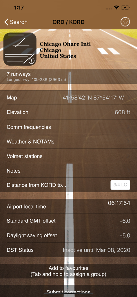
Detailed aviation data for Chicago Ohare International Airport including runways elevation and local time
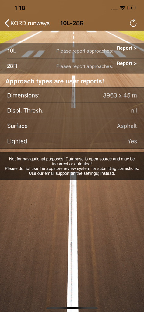
Technical runway specifications for Chicago OHare International Airport in the Airports Plus app
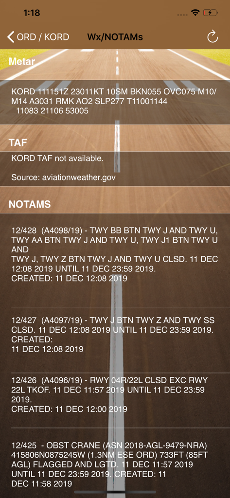
Airports Plus app displaying aviation weather METAR and NOTAM safety notices for KORD airport
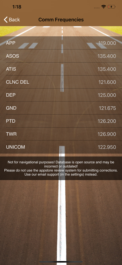
Airports Plus app screen displaying airport communication frequencies like Tower and Ground.
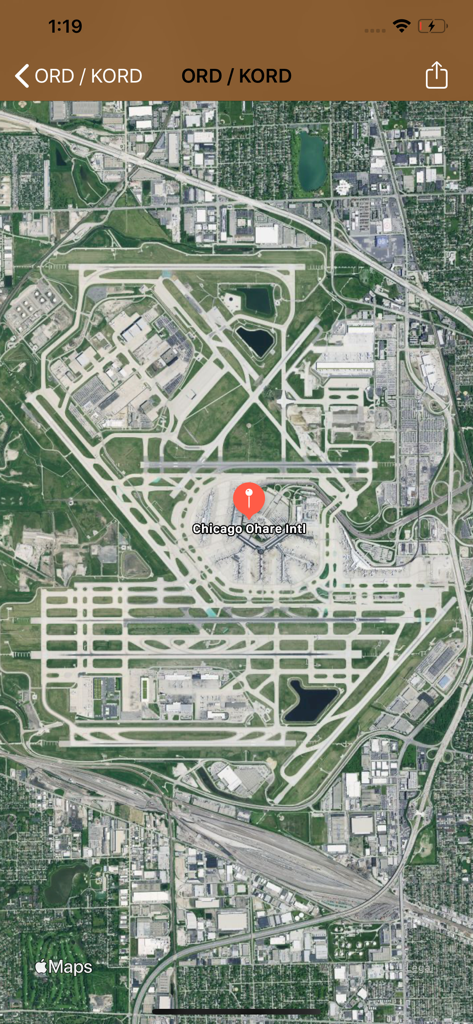
Satellite map view of Chicago Ohare International Airport in the Airports Plus app
Description
Download
More Like This
Top-ranked apps in the same category

Uber - Request a ride
Uber Technologies, Inc.

Airbnb
Airbnb, Inc.

铁路12306
ACADEMY OF RAILWAY SCIENCES CO., ltd.

Booking.com: Hotels & Travel
Booking.com B.V.

Grab: Taxi Ride, Food Delivery
GRABTAXI HOLDINGS PTE. LTD.

Trip.com: Book Flights, Hotels
Trip.com Travel Singapore Pte. Ltd.

DiDi China: Ride Hailing
Didi Chuxing (Beijing) Network Platform Technology Co., Ltd

去哪儿旅行-订酒店机票火车票
Beijing Qunar Information Technology Company Limit

Bolt: Request a Ride
BOLT TECHNOLOGY OU
This page is not an official page of the app or its developer, but an independent editorial publication created for informational and commentary purposes. Unless expressly stated otherwise, neither the app nor its developer is affiliated with, endorsed by, sponsored by, authorized by, or otherwise officially connected with MWM, Apple, Google Play, the app publisher, or the app's developer, and nothing on this page implies that the app was developed using MWM's services. Any trademarks, logos, screenshots, and other content remain the property of their respective owners.