This page is not an official page of the app or its developer, but an independent editorial publication created for informational and commentary purposes. Unless expressly stated otherwise, neither the app nor its developer is affiliated with, endorsed by, sponsored by, authorized by, or otherwise officially connected with MWM, Apple, Google Play, the app publisher, or the app's developer, and nothing on this page implies that the app was developed using MWM's services. Any trademarks, logos, screenshots, and other content remain the property of their respective owners.

Alaska Pocket Maps
Navigate the wilderness with confidence. Access 200+ official National Park maps, 800+ trails, and GPX tracking—no Wi-Fi or cell service required.
Downloads
0User Rating
Total Ratings
0Publisher
Category
TravelLocales
29Latest Version
7.7Size
92.7 MBFirst Released
Jun 23, 2018Navigate the Last Frontier with Confidence
The ultimate survival and planning toolkit for Alaska’s rugged terrain, designed to work perfectly where cell service ends.
Total Offline Independence
Download official NPS, BLM, and USFS maps to navigate safely without Wi-Fi or cellular signals.
800+ Trails at Your Fingertips
Explore the backcountry with detailed trailheads, GPX tracking, and localized weather for over 60 national and state parks.
The following screenshots and description are sourced directly from the app's official store listing and are the property of the app developer.
App Store
Screenshots
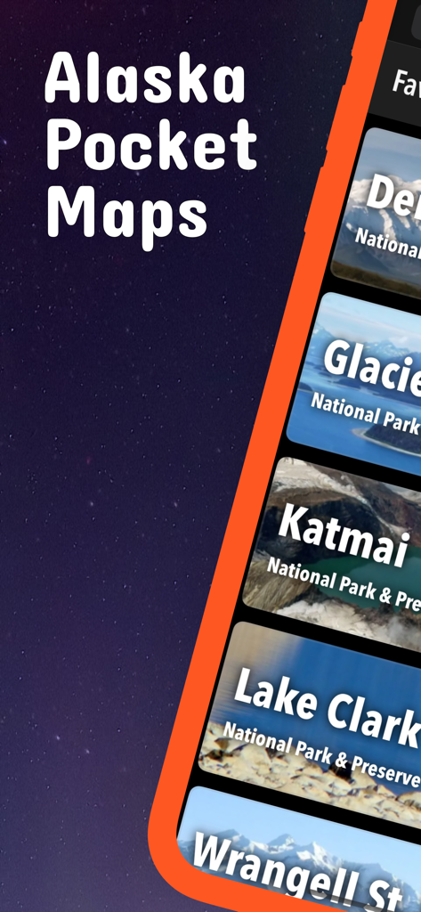
Screenshot of Alaska Pocket Maps app showcasing a selection of national parks including Denali and Katmai.
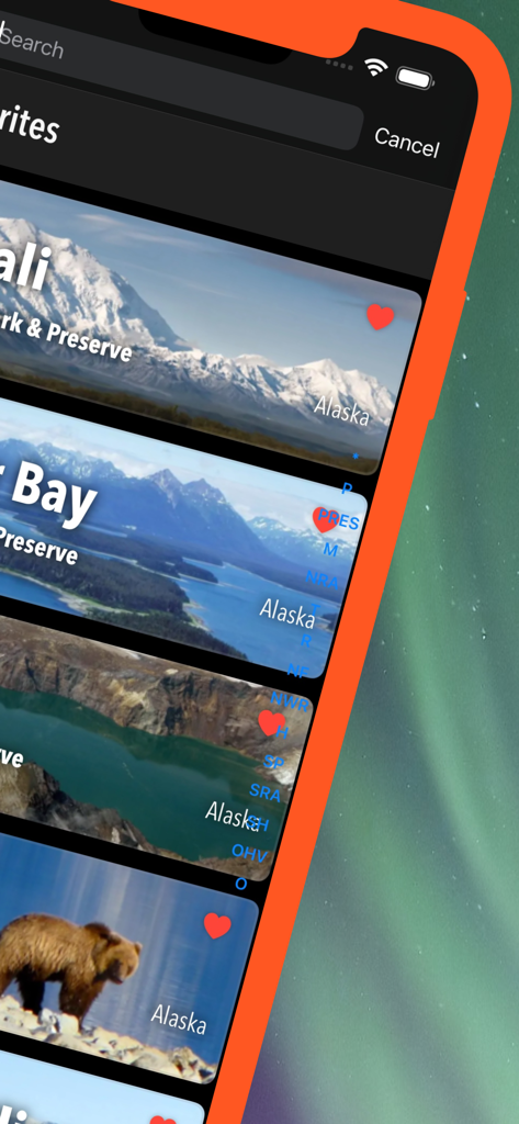
Favorites screen of the Alaska Pocket Maps app featuring saved national parks like Denali and Glacier Bay
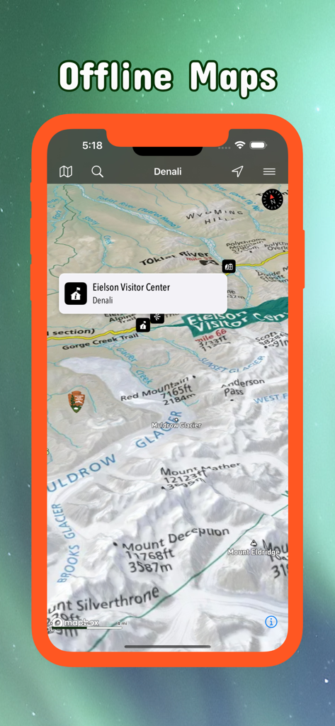
A screenshot of the Alaska Pocket Maps app displaying an offline 3D terrain map of Denali National Park with a pin on the Eielson Visitor Center.
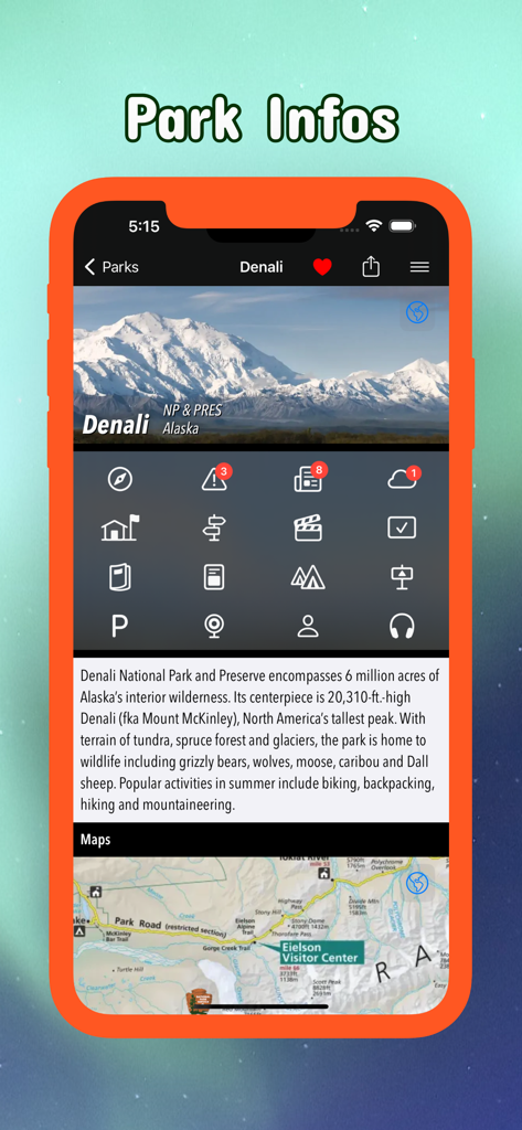
Alaska Pocket Maps mobile app screen showing Denali National Park details and maps
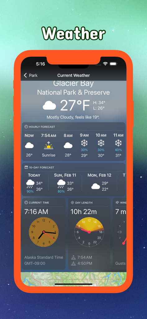
Current weather and day length details for Glacier Bay National Park in the Alaska Pocket Maps app
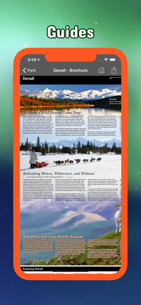
Smartphone screen showing a digital brochure for Denali National Park within the Alaska Pocket Maps app
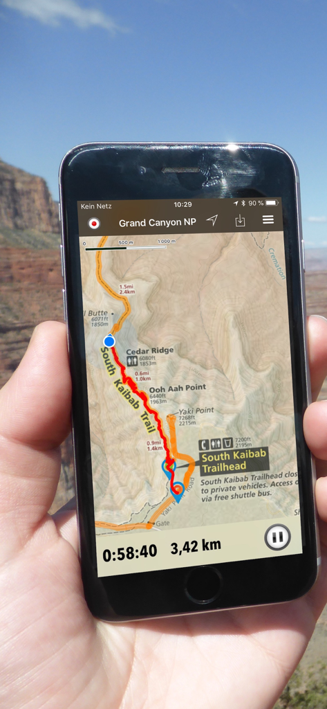
Alaska Pocket Maps app interface showing a tracked hiking route and offline GPS navigation on a smartphone
Description
Download
More Like This
Top-ranked apps in the same category

Uber - Request a ride
Uber Technologies, Inc.

铁路12306
ACADEMY OF RAILWAY SCIENCES CO., ltd.

Airbnb
Airbnb, Inc.

Booking.com: Hotels & Travel
Booking.com B.V.

Grab: Taxi Ride, Food Delivery
GRABTAXI HOLDINGS PTE. LTD.

Bolt: Request a Ride
BOLT TECHNOLOGY OU

DiDi China: Ride Hailing
Didi Chuxing (Beijing) Network Platform Technology Co., Ltd

携程旅行-订酒店机票火车票
Shanghai Ctrip Commerce Co.,Ltd

去哪儿旅行-订酒店机票火车票
Beijing Qunar Information Technology Company Limit
This page is not an official page of the app or its developer, but an independent editorial publication created for informational and commentary purposes. Unless expressly stated otherwise, neither the app nor its developer is affiliated with, endorsed by, sponsored by, authorized by, or otherwise officially connected with MWM, Apple, Google Play, the app publisher, or the app's developer, and nothing on this page implies that the app was developed using MWM's services. Any trademarks, logos, screenshots, and other content remain the property of their respective owners.