This page is not an official page of the app or its developer, but an independent editorial publication created for informational and commentary purposes. Unless expressly stated otherwise, neither the app nor its developer is affiliated with, endorsed by, sponsored by, authorized by, or otherwise officially connected with MWM, Apple, Google Play, the app publisher, or the app's developer, and nothing on this page implies that the app was developed using MWM's services. Any trademarks, logos, screenshots, and other content remain the property of their respective owners.

Alpine Quest PRO
Master the terrain with military-grade MGRS coordinates, 3D offline maps, and total data privacy. Built for tactical operators, backcountry hunters, and off-roaders who demand absolute reliability without ads or tracking.
Downloads
0User Rating
Total Ratings
0Publisher
Category
NavigationLocales
1Latest Version
5.0.1Size
21.8 MBFirst Released
Mar 23, 2026Professional Grade Field Navigation
Built for tactical operators and backcountry professionals who demand precision, privacy, and performance in the most remote environments.
Tactical Coordinate Systems
Full MGRS, UTM, and USNG support with real-time conversion for mission-critical accuracy in the field.
100% Offline Capability
Navigate with confidence in total dead zones with downloadable topographic maps and detailed 3D terrain views.
The following screenshots and description are sourced directly from the app's official store listing and are the property of the app developer.
App Store
Screenshots
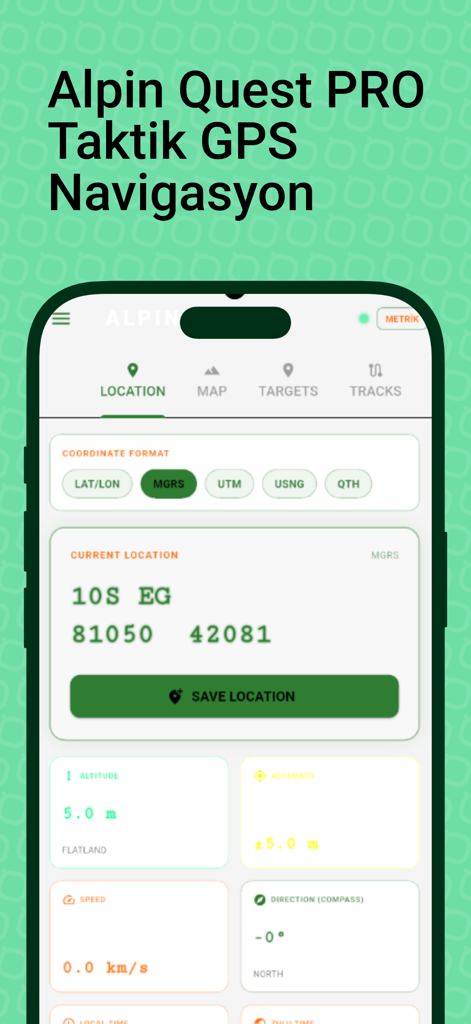
Alpine Quest PRO app interface showing tactical GPS navigation and MGRS coordinate tracking
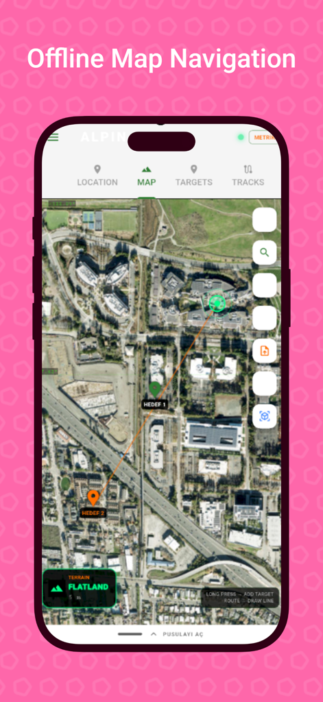
Alpine Quest PRO app interface showing offline satellite map navigation with target waypoints
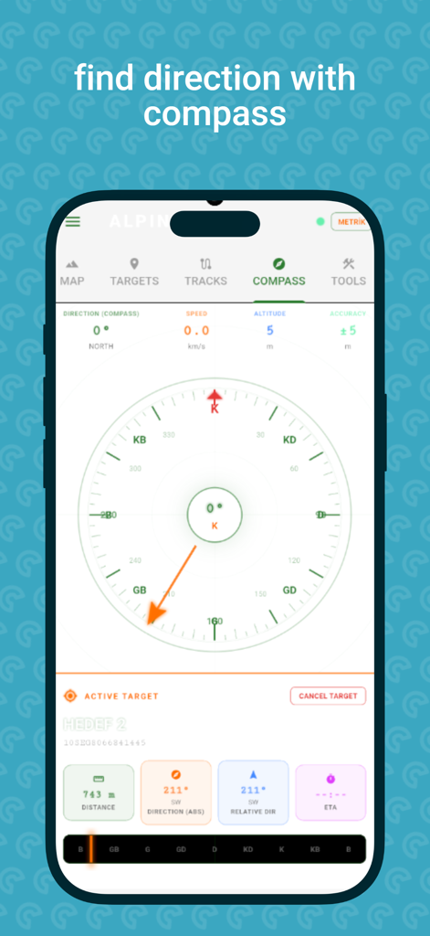
Alpine Quest PRO app interface displaying a tactical digital compass and navigation data including altitude and distance to target
Description
Download
More Like This
Top-ranked apps in the same category

Google Maps
Google LLC

AMap Global
AutoNavi Information Technology Co. Ltd.

Waze Navigation & Live Traffic
waze

百度地图-路线规划,出行必备
Beijing Baidu Netcom Science & Technology Co.,Ltd

Moovit: Bus & Transit Tracker
Moovit App Global LTD

腾讯地图-路线规划,导航地铁打车出行
Shenzhen Tencent Computer Systems Company Limited

ParkMobile: Park. Pay. Go.
Parkmobile USA, Inc

Transit • Subway & Bus Times
9280-0366 Quebec inc.

NAVER Maps, Navigation
NAVER Corp.
This page is not an official page of the app or its developer, but an independent editorial publication created for informational and commentary purposes. Unless expressly stated otherwise, neither the app nor its developer is affiliated with, endorsed by, sponsored by, authorized by, or otherwise officially connected with MWM, Apple, Google Play, the app publisher, or the app's developer, and nothing on this page implies that the app was developed using MWM's services. Any trademarks, logos, screenshots, and other content remain the property of their respective owners.