This page is not an official page of the app or its developer, but an independent editorial publication created for informational and commentary purposes. Unless expressly stated otherwise, neither the app nor its developer is affiliated with, endorsed by, sponsored by, authorized by, or otherwise officially connected with MWM, Apple, Google Play, the app publisher, or the app's developer, and nothing on this page implies that the app was developed using MWM's services. Any trademarks, logos, screenshots, and other content remain the property of their respective owners.

Alpinverlag Touren-App
Carry the expertise of Alpinverlag guidebooks in your pocket. Access high-resolution technical topos, offline GPS navigation, and expert-verified route data designed for the most demanding mountaineers and ski tourers.
Downloads
0User Rating
Total Ratings
0Publisher
Category
SportsLocales
-Latest Version
4.0Size
320.8 MBFirst Released
May 3, 2019Precision Tools for Every Ascent
The digital companion to your Alpinverlag guides, offering high-resolution topos, GPS navigation, and complete offline access for the serious mountaineer.
Pro-Grade Technical Topos
Zoom into high-resolution sketches and wall overviews to identify every pitch and rappel station with pinpoint accuracy.
Reliable Offline Navigation
Save detailed maps and GPS tracks locally to navigate confidently in remote wilderness areas without cellular coverage.
The following screenshots and description are sourced directly from the app's official store listing and are the property of the app developer.
App Store
Screenshots
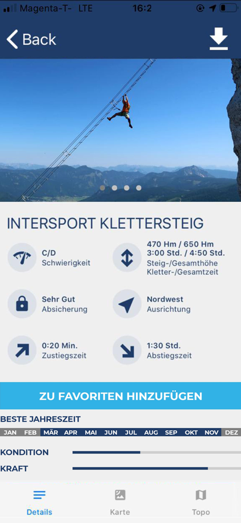
Detailed technical information and statistics for a via ferrata route in the Alpinverlag Touren-App
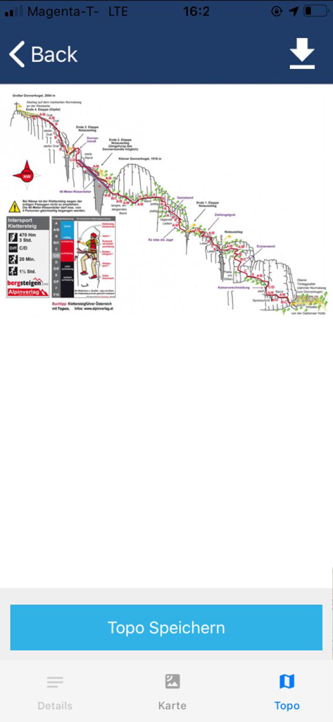
Technical climbing topo of Intersport Klettersteig showing route difficulty and elevation
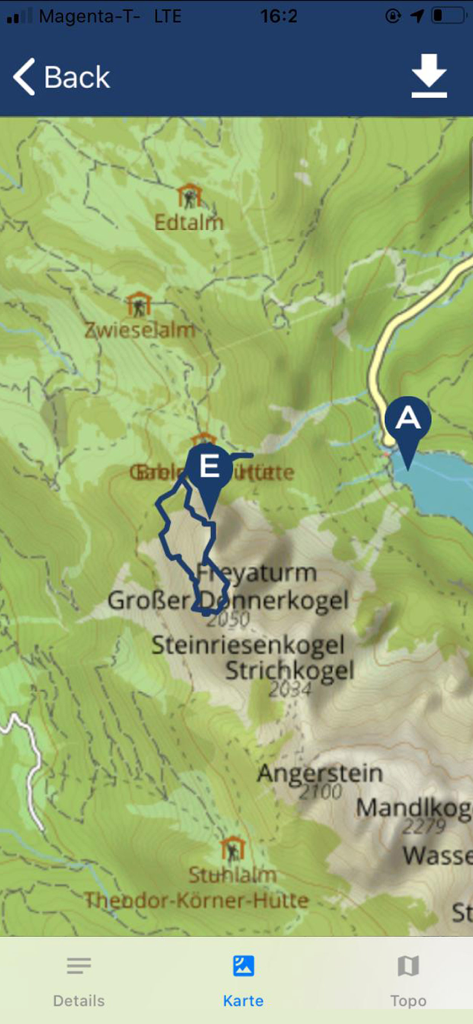
Topographical map showing a mountaineering GPS track and mountain peaks in the Alpinverlag Touren-App
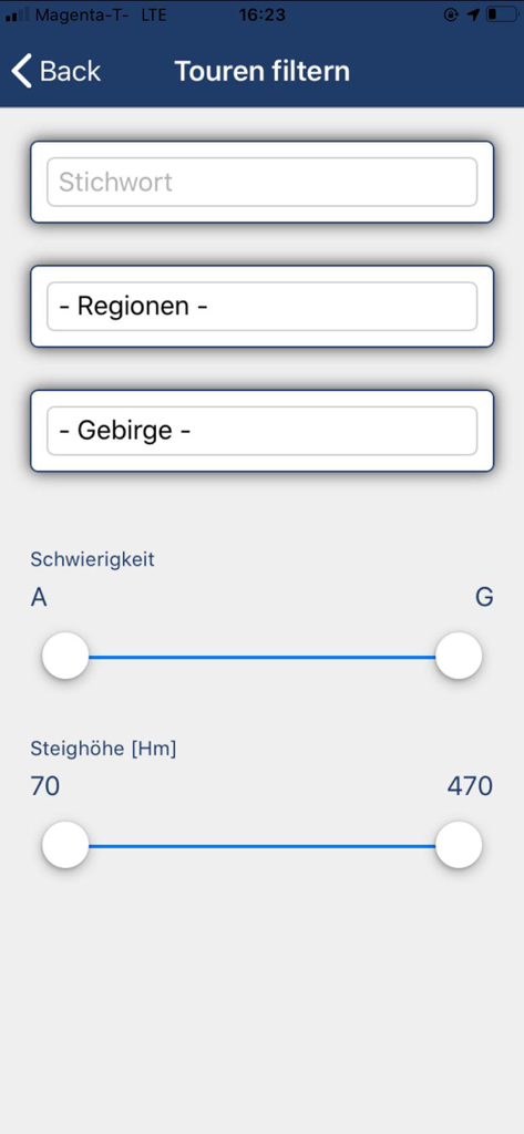
Filter interface in Alpinverlag app for mountain tours by difficulty and elevation
Description
Download
More Like This
Top-ranked apps in the same category

得物 - 得到美好事物
Shanghai Dewu Information Group Co., Ltd.

虎扑-评分篮球足球游戏影视
Shanghai Kuanghui Network Technology Co., LTD

运动世界校园版-大学生校园趣味运动
Zhejiang Wanhang Mdt InfoTech Co., Ltd.

NCAA March Madness Live
Turner Sports

CBS Sports App: Scores & News
CBS Mobile

GameChanger
GameChanger Media, Inc.

F1 TV
Formula One Digital Media Limited

Formula 1®
Formula One Digital Media Limited

腾讯体育
Tencent Technology (Beijing) Company Limited
This page is not an official page of the app or its developer, but an independent editorial publication created for informational and commentary purposes. Unless expressly stated otherwise, neither the app nor its developer is affiliated with, endorsed by, sponsored by, authorized by, or otherwise officially connected with MWM, Apple, Google Play, the app publisher, or the app's developer, and nothing on this page implies that the app was developed using MWM's services. Any trademarks, logos, screenshots, and other content remain the property of their respective owners.