This page is not an official page of the app or its developer, but an independent editorial publication created for informational and commentary purposes. Unless expressly stated otherwise, neither the app nor its developer is affiliated with, endorsed by, sponsored by, authorized by, or otherwise officially connected with MWM, Apple, Google Play, the app publisher, or the app's developer, and nothing on this page implies that the app was developed using MWM's services. Any trademarks, logos, screenshots, and other content remain the property of their respective owners.

Alps Peaks AR
Instantly identify 20,000+ summits and locate nearby shelters, lakes, and trails using advanced augmented reality—no internet connection required for your high-altitude adventures.
Downloads
79K+User Rating
Total Ratings
0Publisher
Category
TravelLocales
9Latest Version
1.4Size
41.7 MBFirst Released
Oct 12, 2014Master the Alpine Horizon
Navigate the European Alps with the confidence of a local. Our augmented reality technology bridges the knowledge gap for international explorers, turning every view into a data-rich experience.
Instant Peak Intelligence
Identify over 20,000 summits across seven countries instantly. Point your camera to see names, altitudes, and distances overlaid on the landscape in real-time.
100% Offline Reliability
Eliminate expensive international roaming fees and data dead zones. Every peak, map, and point of interest is stored locally for total independence on the trail.
The following screenshots and description are sourced directly from the app's official store listing and are the property of the app developer.
App Store
Screenshots
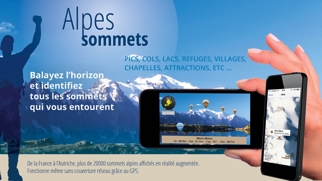
Alps Peaks AR app marketing image showing augmented reality mountain peak identification and offline 2D mapping on a smartphone
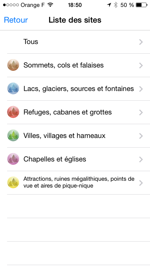
A menu screen listing mountain points of interest categories such as peaks lakes and refuges in the Alps Peaks AR app
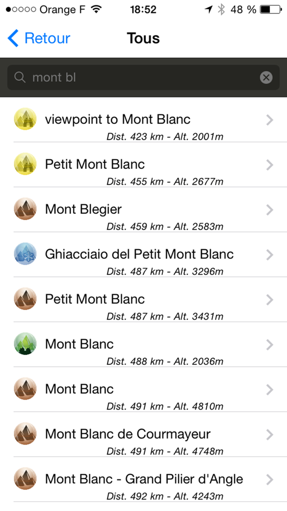
List of search results for Mont Blanc showing distance and altitude in the Alps Peaks AR app
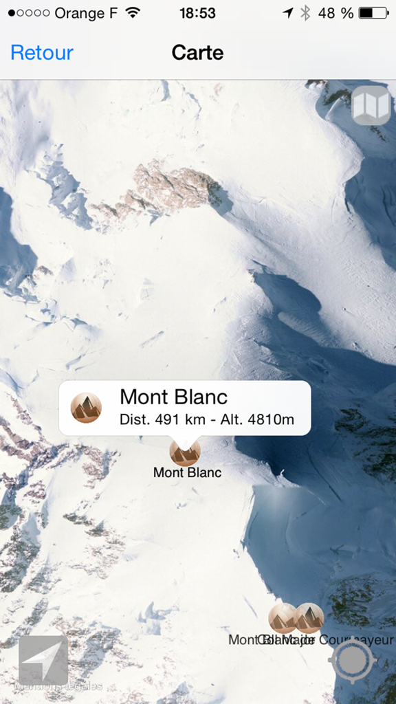
Satellite map view of Mont Blanc showing altitude and distance in the Alps Peaks AR app.
Description
Download
More Like This
Top-ranked apps in the same category

Uber - Request a ride
Uber Technologies, Inc.

Airbnb
Airbnb, Inc.

铁路12306
ACADEMY OF RAILWAY SCIENCES CO., ltd.

Booking.com: Hotels & Travel
Booking.com B.V.

Grab: Taxi Ride, Food Delivery
GRABTAXI HOLDINGS PTE. LTD.

Trip.com: Book Flights, Hotels
Trip.com Travel Singapore Pte. Ltd.

DiDi China: Ride Hailing
Didi Chuxing (Beijing) Network Platform Technology Co., Ltd

去哪儿旅行-订酒店机票火车票
Beijing Qunar Information Technology Company Limit

Bolt: Request a Ride
BOLT TECHNOLOGY OU
This page is not an official page of the app or its developer, but an independent editorial publication created for informational and commentary purposes. Unless expressly stated otherwise, neither the app nor its developer is affiliated with, endorsed by, sponsored by, authorized by, or otherwise officially connected with MWM, Apple, Google Play, the app publisher, or the app's developer, and nothing on this page implies that the app was developed using MWM's services. Any trademarks, logos, screenshots, and other content remain the property of their respective owners.