This page is not an official page of the app or its developer, but an independent editorial publication created for informational and commentary purposes. Unless expressly stated otherwise, neither the app nor its developer is affiliated with, endorsed by, sponsored by, authorized by, or otherwise officially connected with MWM, Apple, Google Play, the app publisher, or the app's developer, and nothing on this page implies that the app was developed using MWM's services. Any trademarks, logos, screenshots, and other content remain the property of their respective owners.

Altimeter Pro: Compass, GPS
The professional toolkit for hikers, climbers, and outdoor enthusiasts. Track elevation, monitor pressure, and share your summit success with data-rich photos directly from your pocket or Apple Watch.
Downloads
118K+User Rating
Total Ratings
500Publisher
Category
NavigationLocales
8Latest Version
2.1Size
89.7 MBFirst Released
May 29, 2017Master Every Terrain with Precision
Your ultimate all-in-one companion for mountaineering, hiking, and exploration, delivering real-time elevation and location data directly to your wrist and palm.
Real-Time Altitude & Pressure
Monitor your elevation gain and atmospheric pressure instantly to predict weather shifts and stay safe during high-altitude adventures.
Verified Achievement Sharing
Capture your summit moments with automatic overlays of your altitude, GPS coordinates, and compass direction to share your proof of achievement.
Frequently Asked Questions
Everything you need to know about Altimeter Pro: Compass, GPS
What is Altimeter Pro: Compass, GPS?
Altimeter Pro: Compass, GPS is an application that allows users to instantly discover their location, altitude, direction, geographic coordinates, address, and atmospheric pressure while traveling or hiking.
What information does Altimeter Pro provide in Normal Mode?
In Normal Mode, Altimeter Pro provides current altitude, atmospheric pressure, latitude and longitude coordinates, address, speed in motion, and direction with a detailed compass.
Can Altimeter Pro track my location and altitude while I am moving?
Yes, Altimeter Pro features a "Track Mode on the Map" that instantly tracks your location and changes in altitude, pressure, coordinates, address, speed, and direction while in motion.
How does Altimeter Pro measure altitude and location coordinates?
Altimeter Pro calculates altitude and location coordinates using the GPS signals of the device. The accuracy of these measurements may vary depending on the GPS signal quality.
Can Altimeter Pro save altitudes of specific locations?
Yes, Altimeter Pro's Marker Mode allows users to explore, mark, and save altitude and coordinate information for selected locations directly on the map.
Does Altimeter Pro allow sharing of photos with location data?
Yes, Altimeter Pro's Sharing Mode enables users to share photos embedded with altitude, pressure, coordinate, and address information. Compass direction is also included depending on the shooting angle.
Is Altimeter Pro compatible with Apple Watch?
Yes, users can access altitude and location information directly from their Apple Watch using Altimeter Pro.
Can I customize the measurement units in Altimeter Pro?
Yes, Altimeter Pro allows users to change altitude units to meters or feet, coordinate formats, velocity to km/h or mph, and barometer units to psi or kPA.
Does Altimeter Pro display atmospheric pressure?
Yes, Altimeter Pro displays the open-air (atmosphere) pressure in Normal Mode, Track Mode, and on the main interface as a barometer reading.
Can Altimeter Pro show my current speed?
Yes, Altimeter Pro displays your speed in motion, which is available in both Normal Mode and Track Mode on the map.
Does Altimeter Pro offer a dark mode interface?
Yes, Altimeter Pro provides a dark mode option for its interface, as depicted in the application's screenshots.
Can I view my location on a satellite map in Altimeter Pro?
Yes, Altimeter Pro supports displaying your location on a satellite map view, offering an alternative to the standard map interface.
The following screenshots and description are sourced directly from the app's official store listing and are the property of the app developer.
App Store
Screenshots
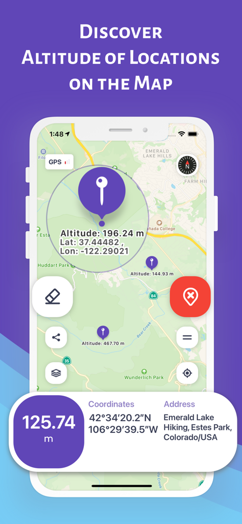
Altimeter Pro app interface showing a map with altitude and GPS coordinates for hiking locations in Colorado
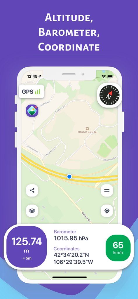
Altimeter Pro app interface showing altitude barometer and GPS coordinates on a detailed map
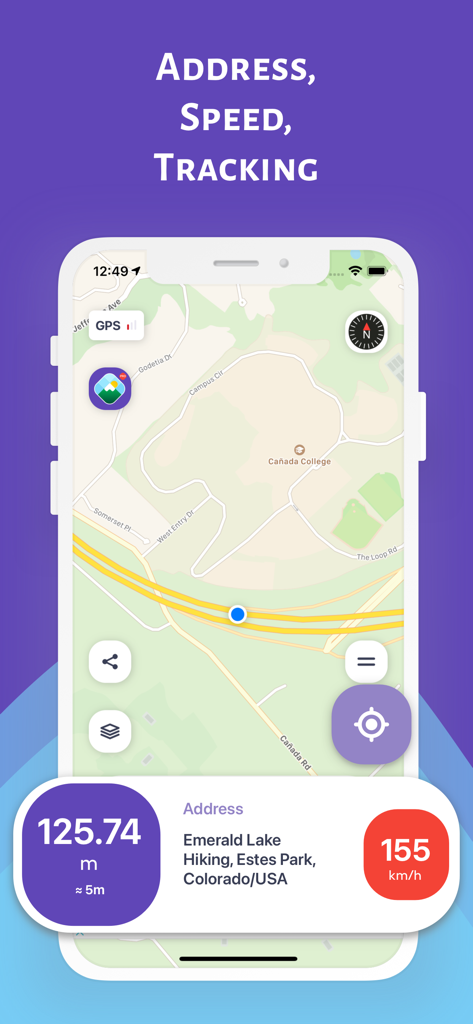
Altimeter Pro app interface showing map tracking with altitude speed and location address
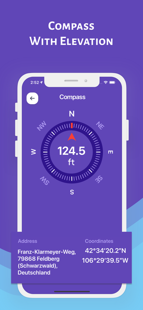
Altimeter Pro app interface displaying a digital compass with current elevation and GPS coordinates
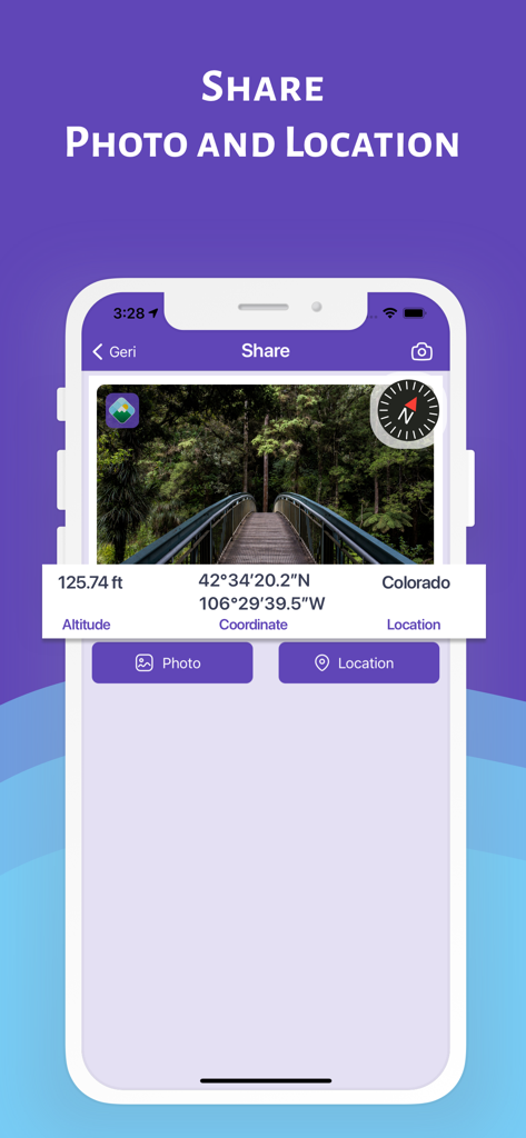
A forest bridge photo within the Altimeter Pro app displaying altitude, GPS coordinates, and compass data for social sharing.
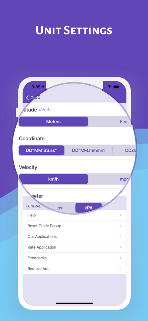
Unit settings screen in the Altimeter Pro app showing customization options for altitude, coordinates, velocity, and barometric pressure.
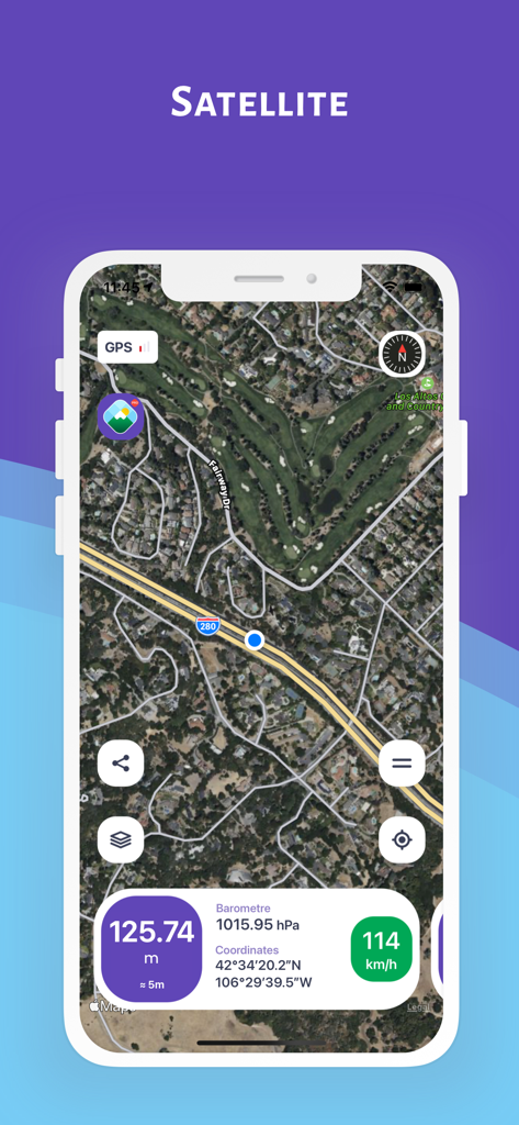
Altimeter Pro app screenshot showing satellite map with real time altitude and coordinates
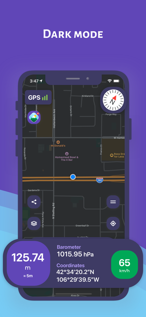
Screenshot of Altimeter Pro app in dark mode showing navigation map and real-time altitude data
Description
Download
More Like This
Top-ranked apps in the same category

Google Maps
Google LLC

Waze Navigation & Live Traffic
waze

AMap Global
AutoNavi Information Technology Co. Ltd.

百度地图-路线规划,出行必备
Beijing Baidu Netcom Science & Technology Co.,Ltd

Moovit: Bus & Transit Tracker
Moovit App Global LTD

Transit • Subway & Bus Times
9280-0366 Quebec inc.

ParkMobile: Park. Pay. Go.
Parkmobile USA, Inc

腾讯地图-路线规划,导航地铁打车出行
Shenzhen Tencent Computer Systems Company Limited

Île-de-France Mobilités
Ile de France Mobilites
This page is not an official page of the app or its developer, but an independent editorial publication created for informational and commentary purposes. Unless expressly stated otherwise, neither the app nor its developer is affiliated with, endorsed by, sponsored by, authorized by, or otherwise officially connected with MWM, Apple, Google Play, the app publisher, or the app's developer, and nothing on this page implies that the app was developed using MWM's services. Any trademarks, logos, screenshots, and other content remain the property of their respective owners.