This page is not an official page of the app or its developer, but an independent editorial publication created for informational and commentary purposes. Unless expressly stated otherwise, neither the app nor its developer is affiliated with, endorsed by, sponsored by, authorized by, or otherwise officially connected with MWM, Apple, Google Play, the app publisher, or the app's developer, and nothing on this page implies that the app was developed using MWM's services. Any trademarks, logos, screenshots, and other content remain the property of their respective owners.

Altitude Finder: GPS Altimeter
The ultimate companion for the data-driven explorer. Track elevation, speed, and routes with real-time barometric accuracy—designed to work flawlessly offline in the most remote mountain ranges.
Downloads
0User Rating
Total Ratings
0Publisher
Category
NavigationLocales
1Latest Version
1.1.8Size
49.4 MBFirst Released
Apr 24, 2025Master Every Ascent with Precision
Whether you are bagging 14ers in the Rockies or trail running in the Cascades, Altitude Finder provides the real-time vertical data and navigation tools you need to push your limits safely.
Pro-Grade Dual Accuracy
Combine high-precision GPS with barometric sensors for ultra-accurate elevation tracking, providing the reliability that professional explorers demand.
Built for the Backcountry
Navigate with confidence in 'Dead Zones'. Our offline-ready altimeter and built-in compass keep you oriented even when you are miles away from cell service.
The following screenshots and description are sourced directly from the app's official store listing and are the property of the app developer.
App Store
Screenshots
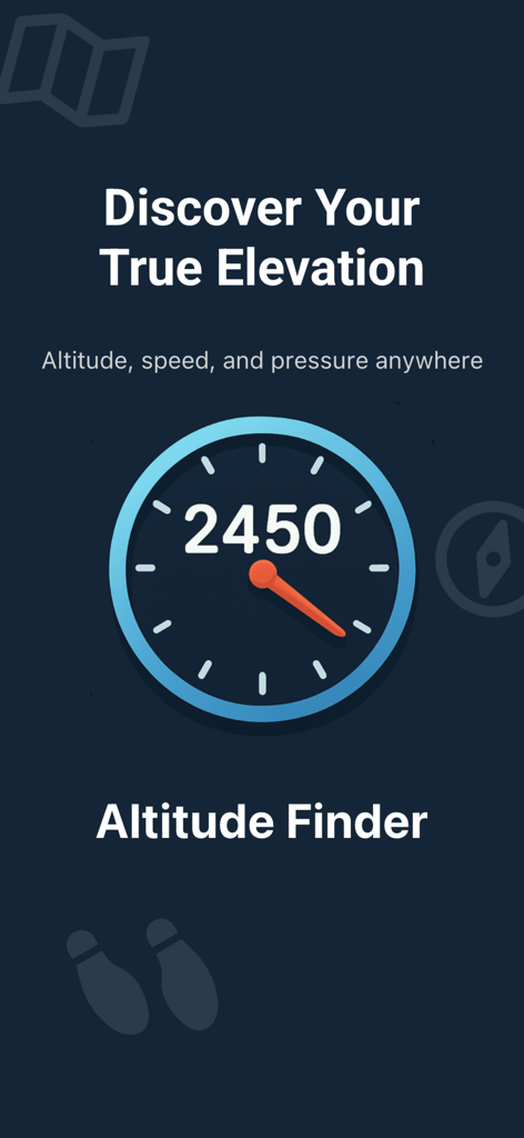
Altitude Finder app interface showing real time elevation data and tracking features

A mobile app interface displaying real-time altitude tracking with an elevation graph and a digital compass
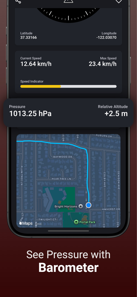
Altitude Finder app interface showing barometric pressure relative altitude and real-time map tracking
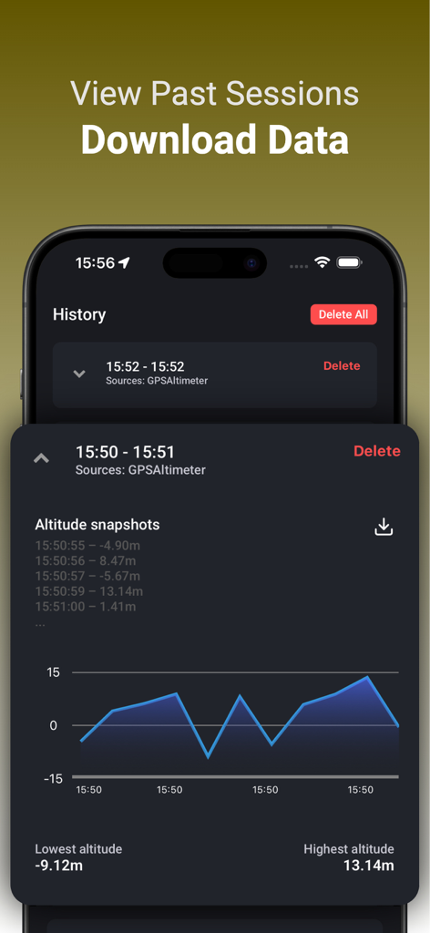
Altitude history screen showing an elevation graph and a list of past recorded hiking sessions with options to download data.
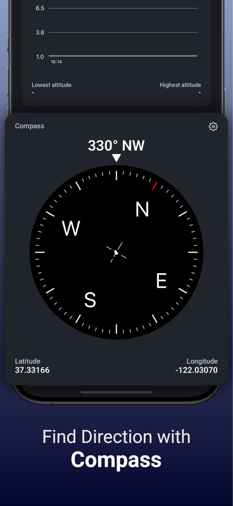
Altitude Finder app interface showing a digital compass with heading and GPS coordinates
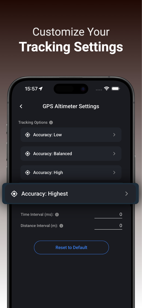
A screenshot of the GPS Altimeter settings page in Altitude Finder showing tracking accuracy options and interval customization
Description
Download
More Like This
Top-ranked apps in the same category

Google Maps
Google LLC

AMap Global
AutoNavi Information Technology Co. Ltd.

Waze Navigation & Live Traffic
waze

百度地图-路线规划,出行必备
Beijing Baidu Netcom Science & Technology Co.,Ltd

Moovit: Bus & Transit Tracker
Moovit App Global LTD

腾讯地图-路线规划,导航地铁打车出行
Shenzhen Tencent Computer Systems Company Limited

Transit • Subway & Bus Times
9280-0366 Quebec inc.

ParkMobile: Park. Pay. Go.
Parkmobile USA, Inc

MapXplorer: Map Radar Navigate
GOLDLAB APPLICATIONS YAZILIM VE BILISIM ANONIM SIRKETI
This page is not an official page of the app or its developer, but an independent editorial publication created for informational and commentary purposes. Unless expressly stated otherwise, neither the app nor its developer is affiliated with, endorsed by, sponsored by, authorized by, or otherwise officially connected with MWM, Apple, Google Play, the app publisher, or the app's developer, and nothing on this page implies that the app was developed using MWM's services. Any trademarks, logos, screenshots, and other content remain the property of their respective owners.