This page is not an official page of the app or its developer, but an independent editorial publication created for informational and commentary purposes. Unless expressly stated otherwise, neither the app nor its developer is affiliated with, endorsed by, sponsored by, authorized by, or otherwise officially connected with MWM, Apple, Google Play, the app publisher, or the app's developer, and nothing on this page implies that the app was developed using MWM's services. Any trademarks, logos, screenshots, and other content remain the property of their respective owners.

地籍AR街景看界線,使用分區查詢,國內開放圖層套疊
專為地主、開發商與房地產投資者打造。整合AR實境邊界、使用分區查詢與3D地圖,助您精準掌握每一吋土地資訊,遠端掌握投資動向。
Downloads
91K+User Rating
Total Ratings
1K+Publisher
Category
NavigationLocales
1Latest Version
3.0.3Size
107.9 MBFirst Released
Jun 5, 2021Master Your Property Due Diligence From Anywhere
Access precision cadastral data, AR boundary visualization, and detailed zoning information to make informed real estate decisions in Taiwan, no matter where you are.
AR Boundary Visualization
Overlay official land registry lines directly onto street views to verify property boundaries and prevent encroachment disputes in real-time.
Smart Zoning & Risk Analysis
Instantly check land use regulations and identify nearby facilities like power plants or cemeteries to protect your investment value.
The following screenshots and description are sourced directly from the app's official store listing and are the property of the app developer.
App Store
Screenshots
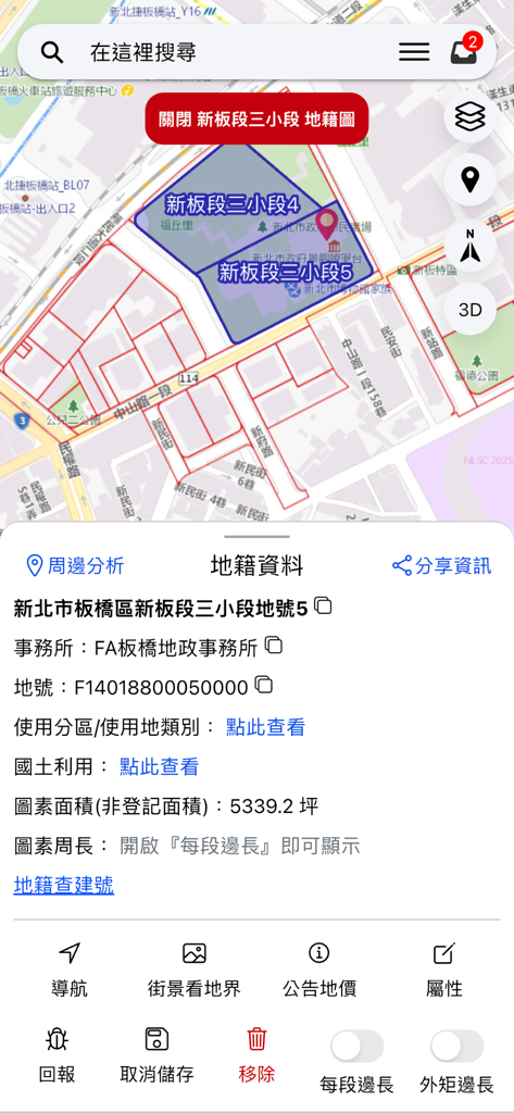
Map interface showing detailed land registry data and parcel boundaries in Banqiao District Taiwan
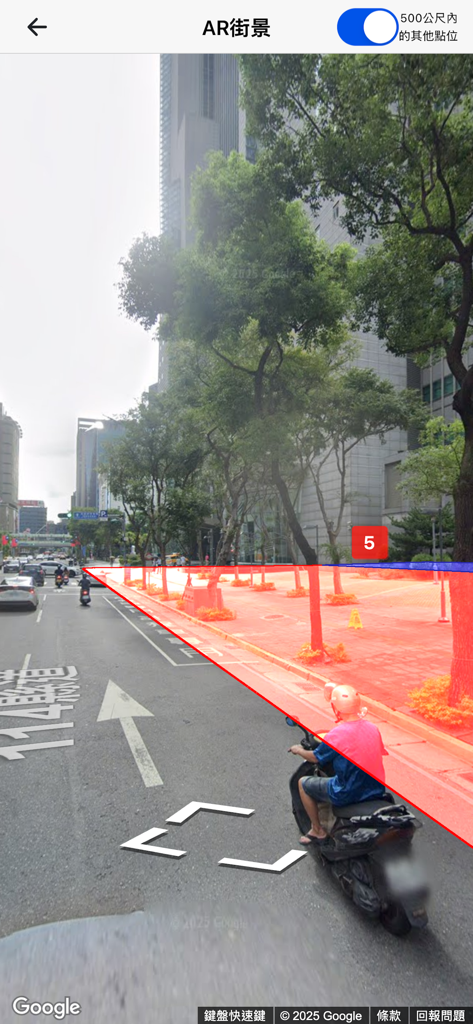
AR street view showing red land boundary lines overlaid on a city street in Taiwan.
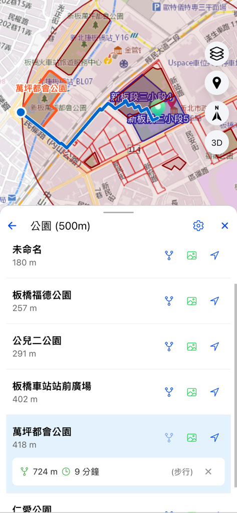
Mobile app interface displaying a map with land boundaries and a list of nearby parks within 500 meters including distance and navigation features.
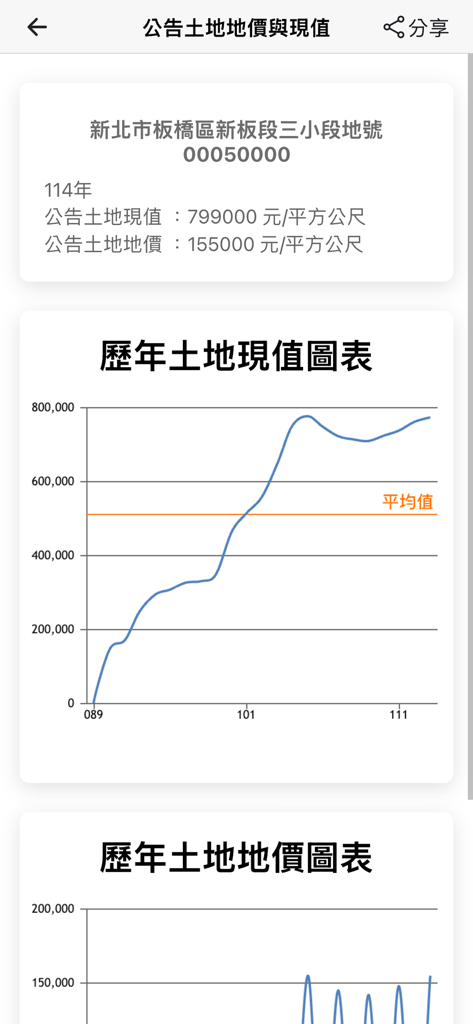
Historical land value chart and current price data for a property plot in Taiwan
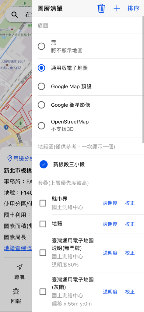
The layer list menu in the Cadastral AR app showing various base map choices and land registry overlay options.
Description
Download
More Like This
Top-ranked apps in the same category

Google Maps
Google LLC

Waze Navigation & Live Traffic
waze

AMap Global
AutoNavi Information Technology Co. Ltd.

百度地图-路线规划,出行必备
Beijing Baidu Netcom Science & Technology Co.,Ltd

Moovit: Bus & Transit Tracker
Moovit App Global LTD

Transit • Subway & Bus Times
9280-0366 Quebec inc.

ParkMobile: Park. Pay. Go.
Parkmobile USA, Inc

腾讯地图-路线规划,导航地铁打车出行
Shenzhen Tencent Computer Systems Company Limited

Île-de-France Mobilités
Ile de France Mobilites
This page is not an official page of the app or its developer, but an independent editorial publication created for informational and commentary purposes. Unless expressly stated otherwise, neither the app nor its developer is affiliated with, endorsed by, sponsored by, authorized by, or otherwise officially connected with MWM, Apple, Google Play, the app publisher, or the app's developer, and nothing on this page implies that the app was developed using MWM's services. Any trademarks, logos, screenshots, and other content remain the property of their respective owners.