This page is not an official page of the app or its developer, but an independent editorial publication created for informational and commentary purposes. Unless expressly stated otherwise, neither the app nor its developer is affiliated with, endorsed by, sponsored by, authorized by, or otherwise officially connected with MWM, Apple, Google Play, the app publisher, or the app's developer, and nothing on this page implies that the app was developed using MWM's services. Any trademarks, logos, screenshots, and other content remain the property of their respective owners.

ArcGIS Navigator
Empower your mobile team with reliable, voice-guided directions that work anywhere—even offline. Navigate on private roads, integrate your own GIS asset data, and ensure safety with vehicle-specific routing tailored to your industry's unique requirements.
Downloads
221K+User Rating
Total Ratings
0Publisher
Category
NavigationLocales
17Latest Version
24.1.0Size
133.8 MBFirst Released
Jul 24, 2015Built for the Field, Engineered for Precision
Empower your mobile workforce with professional-grade routing, offline reliability, and custom asset integration designed specifically for complex enterprise workflows.
Work Without Limits
Navigate completely offline with locally stored maps, ensuring your team stays productive even in the most remote dead zones.
Navigate Your Own Assets
Access private roads and search proprietary company infrastructure that consumer-grade GPS apps can't find.
The following screenshots and description are sourced directly from the app's official store listing and are the property of the app developer.
App Store
Screenshots
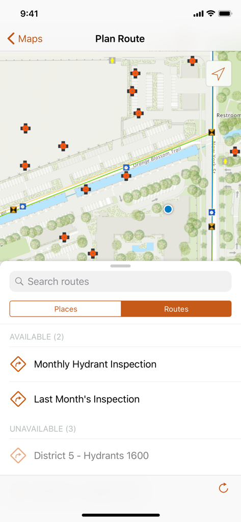
ArcGIS Navigator app interface showing a map with hydrant inspection routes and asset locations
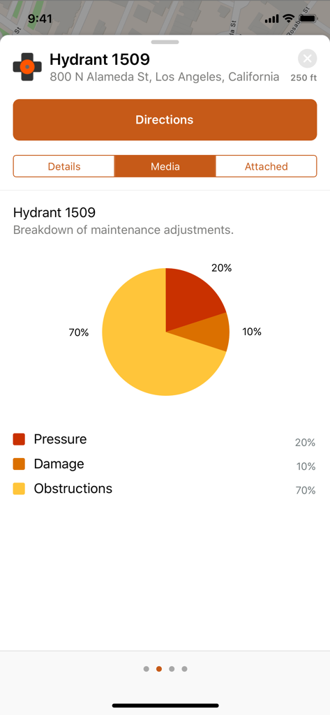
ArcGIS Navigator screen showing maintenance adjustment data for a hydrant asset with a descriptive pie chart.
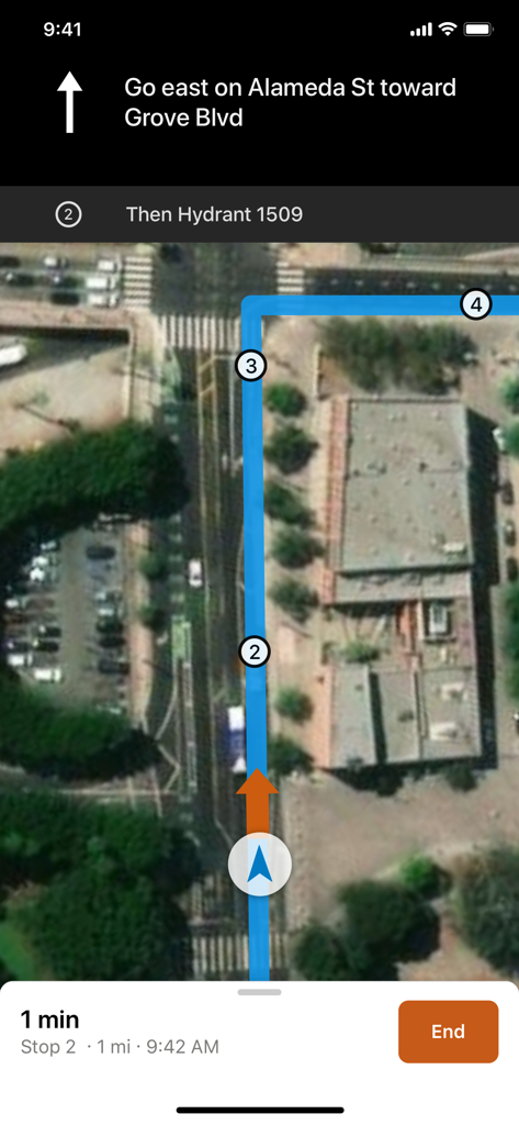
Satellite map view in ArcGIS Navigator showing turn by turn directions to a specific field asset
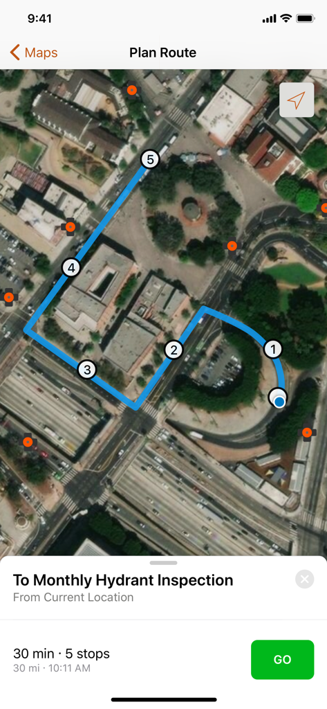
Satellite map in ArcGIS Navigator showing a planned route with five stops for a hydrant inspection.
Description
Download
More Like This
Top-ranked apps in the same category

Google Maps
Google LLC

Waze Navigation & Live Traffic
waze

AMap Global
AutoNavi Information Technology Co. Ltd.

百度地图-路线规划,出行必备
Beijing Baidu Netcom Science & Technology Co.,Ltd

Moovit: Bus & Transit Tracker
Moovit App Global LTD

Transit • Subway & Bus Times
9280-0366 Quebec inc.

ParkMobile: Park. Pay. Go.
Parkmobile USA, Inc

腾讯地图-路线规划,导航地铁打车出行
Shenzhen Tencent Computer Systems Company Limited

Île-de-France Mobilités
Ile de France Mobilites
This page is not an official page of the app or its developer, but an independent editorial publication created for informational and commentary purposes. Unless expressly stated otherwise, neither the app nor its developer is affiliated with, endorsed by, sponsored by, authorized by, or otherwise officially connected with MWM, Apple, Google Play, the app publisher, or the app's developer, and nothing on this page implies that the app was developed using MWM's services. Any trademarks, logos, screenshots, and other content remain the property of their respective owners.