This page is not an official page of the app or its developer, but an independent editorial publication created for informational and commentary purposes. Unless expressly stated otherwise, neither the app nor its developer is affiliated with, endorsed by, sponsored by, authorized by, or otherwise officially connected with MWM, Apple, Google Play, the app publisher, or the app's developer, and nothing on this page implies that the app was developed using MWM's services. Any trademarks, logos, screenshots, and other content remain the property of their respective owners.

Bristol Maps
Navigate shifting sandbars with seasonal low-tide satellite imagery, avoid costly boundary fines, and maximize your ROI with integrated digital logs and private group coordination.
Downloads
300User Rating
Total Ratings
0Publisher
Category
NavigationLocales
-Latest Version
3.13.1Size
413.0 MBFirst Released
May 7, 2023Built for the Wheelhouse, Not the Sidelines
Bristol Maps gives professional mariners the edge they need with high-resolution imagery and data-driven tools designed specifically for the rugged Bristol Bay and Copper River fisheries.
Low-Tide Satellite Overlays
Stop guessing where the sandbars have shifted. Access curated, high-resolution satellite imagery taken during extreme low tides to navigate changing channels with absolute confidence.
Secure Code Group Sharing
Protect your advantage. Use private groups to securely share waypoints, routes, and live locations with your fleet, plus integrated digital code tables to replace outdated paper maps.
The following screenshots and description are sourced directly from the app's official store listing and are the property of the app developer.
App Store
Screenshots
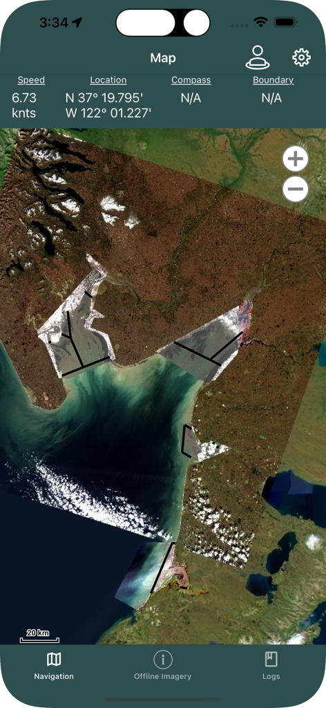
Bristol Maps app navigation interface showing high resolution satellite imagery of fishing zones and real time vessel coordinates
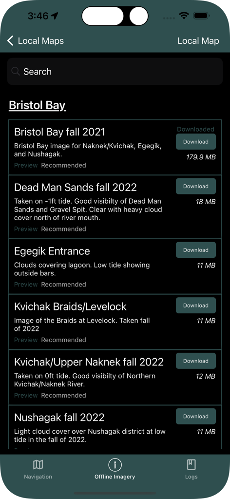
Bristol Maps app showing a list of downloadable satellite imagery for Alaska fishing areas
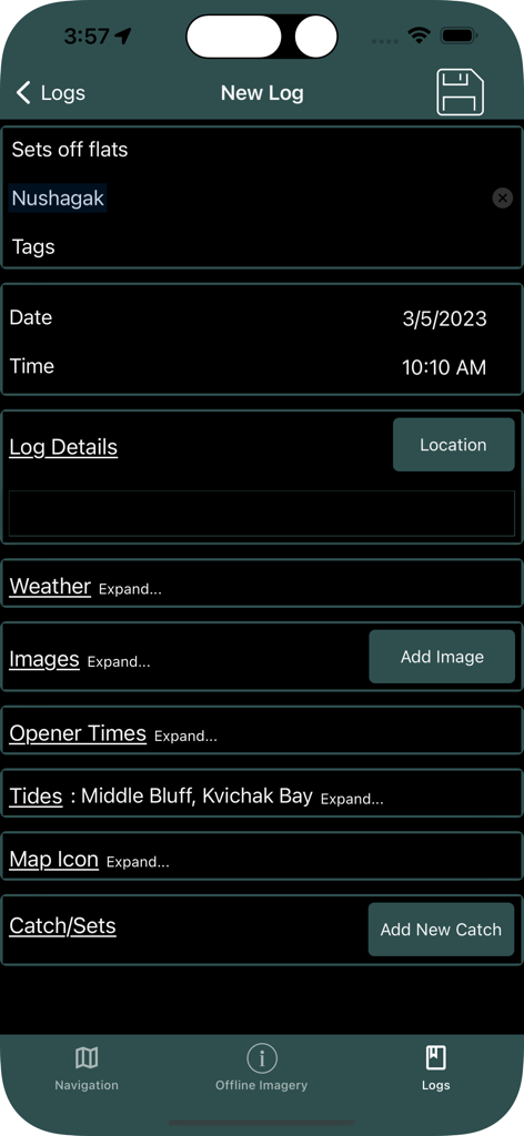
Interface of the Bristol Maps app showing a new log entry screen for recording fishing data such as location tides and catch details
Description
Download
More Like This
Top-ranked apps in the same category

Google Maps
Google LLC

AMap Global
AutoNavi Information Technology Co. Ltd.

Waze Navigation & Live Traffic
waze

百度地图-路线规划,出行必备
Beijing Baidu Netcom Science & Technology Co.,Ltd

Moovit: Bus & Transit Tracker
Moovit App Global LTD

Transit • Subway & Bus Times
9280-0366 Quebec inc.

ParkMobile: Park. Pay. Go.
Parkmobile USA, Inc

腾讯地图-路线规划,导航地铁打车出行
Shenzhen Tencent Computer Systems Company Limited

MapXplorer: Map Radar Navigate
GOLDLAB APPLICATIONS YAZILIM VE BILISIM ANONIM SIRKETI
This page is not an official page of the app or its developer, but an independent editorial publication created for informational and commentary purposes. Unless expressly stated otherwise, neither the app nor its developer is affiliated with, endorsed by, sponsored by, authorized by, or otherwise officially connected with MWM, Apple, Google Play, the app publisher, or the app's developer, and nothing on this page implies that the app was developed using MWM's services. Any trademarks, logos, screenshots, and other content remain the property of their respective owners.