This page is not an official page of the app or its developer, but an independent editorial publication created for informational and commentary purposes. Unless expressly stated otherwise, neither the app nor its developer is affiliated with, endorsed by, sponsored by, authorized by, or otherwise officially connected with MWM, Apple, Google Play, the app publisher, or the app's developer, and nothing on this page implies that the app was developed using MWM's services. Any trademarks, logos, screenshots, and other content remain the property of their respective owners.

Busan Subway Map
The essential English guide for independent travelers. Master the metro, plan airport transfers, and discover Busan with confidence—all without worrying about roaming data.
Downloads
0User Rating
Total Ratings
0Publisher
Category
NavigationLocales
1Latest Version
3.0Size
131.1 MBFirst Released
Feb 24, 2024Master Busan’s Transit with Ease
The all-in-one English guide for travelers to navigate the metro, plan routes offline, and explore the city without the stress of international data roaming.
100% Offline Navigation
Access high-resolution metro maps and build routes anywhere—even deep underground—without needing a local SIM card or Wi-Fi.
Smart Route Planner
Get clear, step-by-step directions between stations with estimated travel times, making it easy to hop from Seomyeon to Haeundae Beach.
The following screenshots and description are sourced directly from the app's official store listing and are the property of the app developer.
App Store
Screenshots
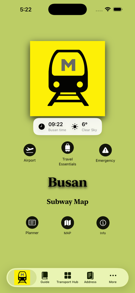
Home screen of the Busan Subway Map app showing navigation icons for airport, travel essentials, and a route planner.
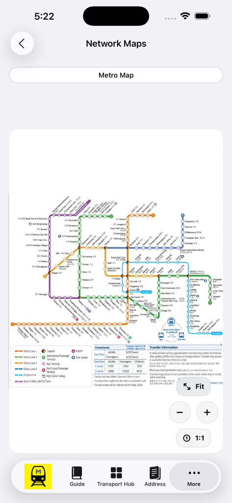
High resolution Busan metro map view with zoom controls and English station names for travelers
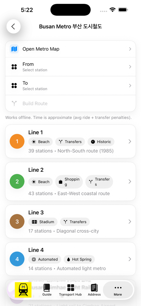
Busan Subway Map app interface displaying subway lines and route planner
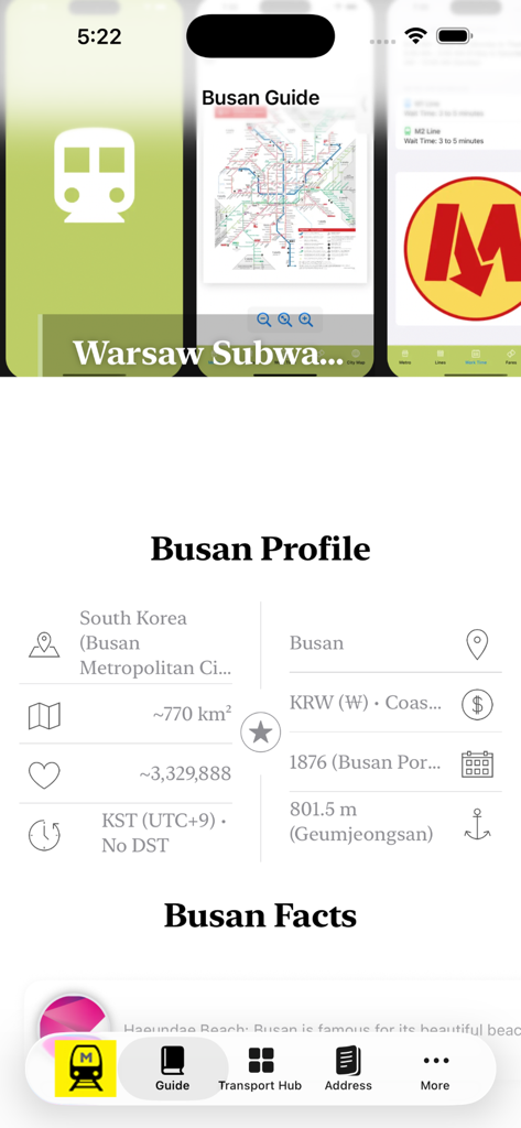
Interface of the Busan Subway Map app showing the city profile and general travel facts about Busan
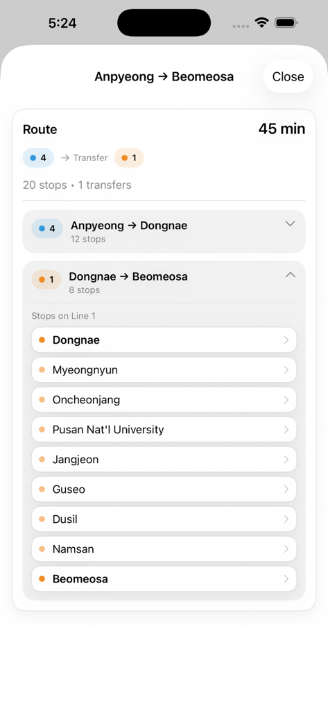
Busan subway route planner showing directions and station list in English
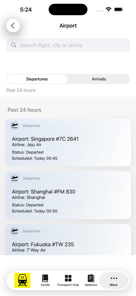
Busan subway map app showing airport flight departures and arrivals
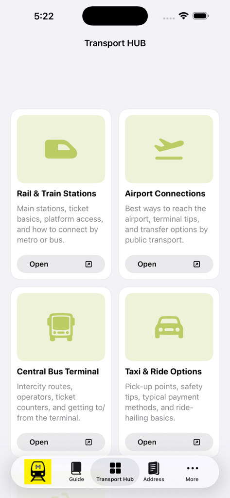
Transport Hub screen showing Busan travel options for rail, airport connections, bus terminal, and taxi services.
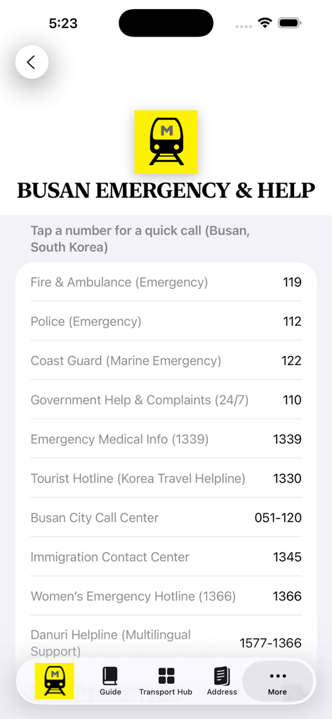
List of emergency contact numbers in Busan including police, ambulance, and tourist hotline.
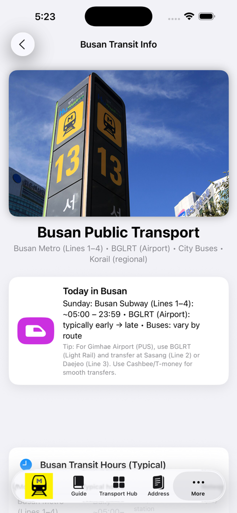
Busan Public Transport information screen showing metro hours and airport transfer tips.
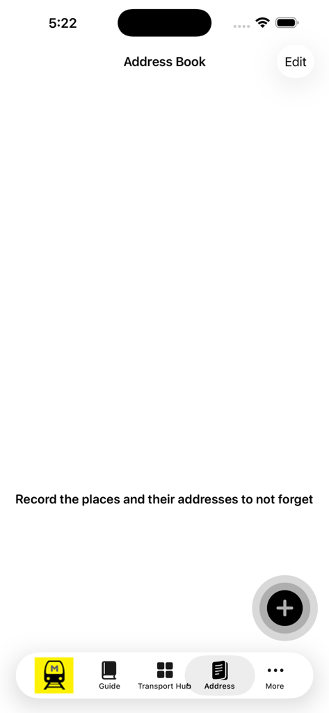
Address book feature in the Busan Subway Map app to save travel locations
Description
Download
More Like This
Top-ranked apps in the same category

Google Maps
Google LLC

AMap Global
AutoNavi Information Technology Co. Ltd.

Waze Navigation & Live Traffic
waze

百度地图-路线规划,出行必备
Beijing Baidu Netcom Science & Technology Co.,Ltd

Moovit: Bus & Transit Tracker
Moovit App Global LTD

Transit • Subway & Bus Times
9280-0366 Quebec inc.

MapXplorer: Map Radar Navigate
GOLDLAB APPLICATIONS YAZILIM VE BILISIM ANONIM SIRKETI

ParkMobile: Park. Pay. Go.
Parkmobile USA, Inc

腾讯地图-路线规划,导航地铁打车出行
Shenzhen Tencent Computer Systems Company Limited
This page is not an official page of the app or its developer, but an independent editorial publication created for informational and commentary purposes. Unless expressly stated otherwise, neither the app nor its developer is affiliated with, endorsed by, sponsored by, authorized by, or otherwise officially connected with MWM, Apple, Google Play, the app publisher, or the app's developer, and nothing on this page implies that the app was developed using MWM's services. Any trademarks, logos, screenshots, and other content remain the property of their respective owners.