This page is not an official page of the app or its developer, but an independent editorial publication created for informational and commentary purposes. Unless expressly stated otherwise, neither the app nor its developer is affiliated with, endorsed by, sponsored by, authorized by, or otherwise officially connected with MWM, Apple, Google Play, the app publisher, or the app's developer, and nothing on this page implies that the app was developed using MWM's services. Any trademarks, logos, screenshots, and other content remain the property of their respective owners.

City Transport Map Porto
The ultimate all-in-one transit guide for independent travelers. Explore Porto’s historic streets and modern lines with detailed interactive maps, smart route searches, and full offline access—no data plan required.
Downloads
700User Rating
Total Ratings
0Publisher
Category
NavigationLocales
1Latest Version
4.2.3Size
85.3 MBFirst Released
Jul 25, 2025Explore Porto Like a Local
The ultimate navigation companion for the independent traveler. Master Porto's Metro, historic trams, and bus networks with a single, intuitive interface designed for stress-free exploration.
100% Offline Reliability
Avoid expensive data roaming charges and dead zones. Access complete transit maps, routes, and schedules even without a cellular connection.
Seamless Multi-Modal Transfers
Stop juggling multiple apps. We integrate Metro, bus, and tram lines into one unified map, clearly marking transfer points for a smooth journey.
Frequently Asked Questions
Everything you need to know about City Transport Map Porto
What is the City Transport Map Porto app?
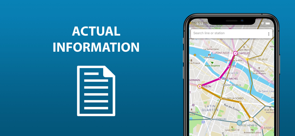
The City Transport Map Porto app provides comprehensive information on Porto's public transport, including metro lines, trams, and buses. It allows users to view routes and transfer stations for easy navigation.
Does City Transport Map Porto show all public transport types?
Yes, the City Transport Map Porto app displays the entire public transport infrastructure of Porto, including metro lines, tram routes, and bus routes. This helps users navigate comprehensively.
Can users search for stations or routes in City Transport Map Porto?
Yes, the City Transport Map Porto app enables users to search by station name to locate it on the map and by route number to determine its suitability quickly.
Does the City Transport Map Porto app offer an offline mode?
Yes, the extended version of the City Transport Map Porto app provides an offline mode. This allows users to access all its functionalities without requiring an active internet connection.
Can I save planned routes in City Transport Map Porto?
Yes, the City Transport Map Porto app allows users to save routes they have planned in advance. These saved routes can then be accessed and used again at any time.
Does City Transport Map Porto show nearby stations?
Yes, by enabling location access, the City Transport Map Porto app displays nearby stations on the map. This feature helps users to orient themselves and find transport easily.
What features are in the extended version of City Transport Map Porto?
The extended version of City Transport Map Porto includes offline mode, short public transport schedules, and detailed locations of all stops for routes passing through.
The following screenshots and description are sourced directly from the app's official store listing and are the property of the app developer.
App Store
Screenshots
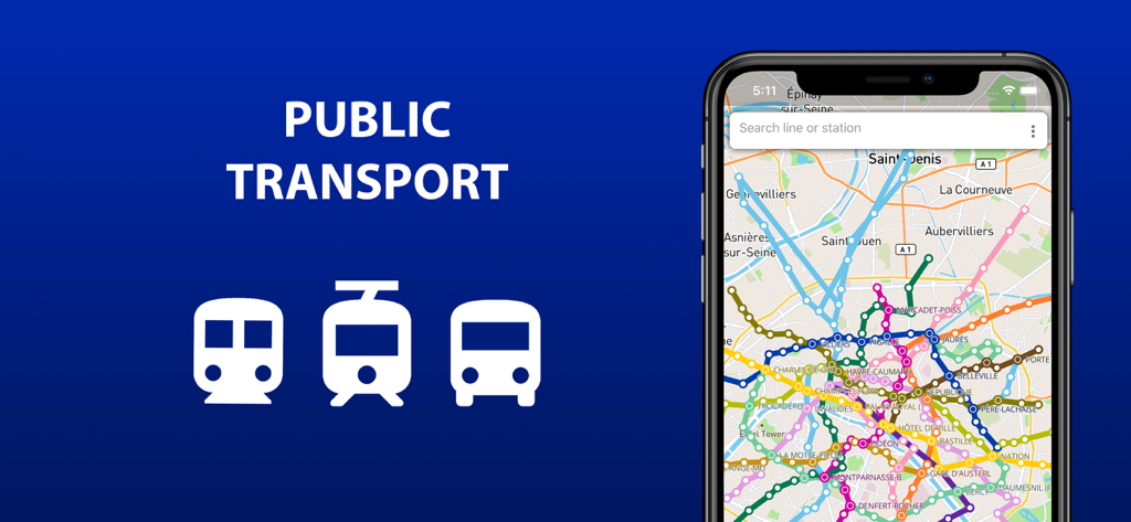
Mobile app interface showing Porto metro tram and bus routes on a digital map
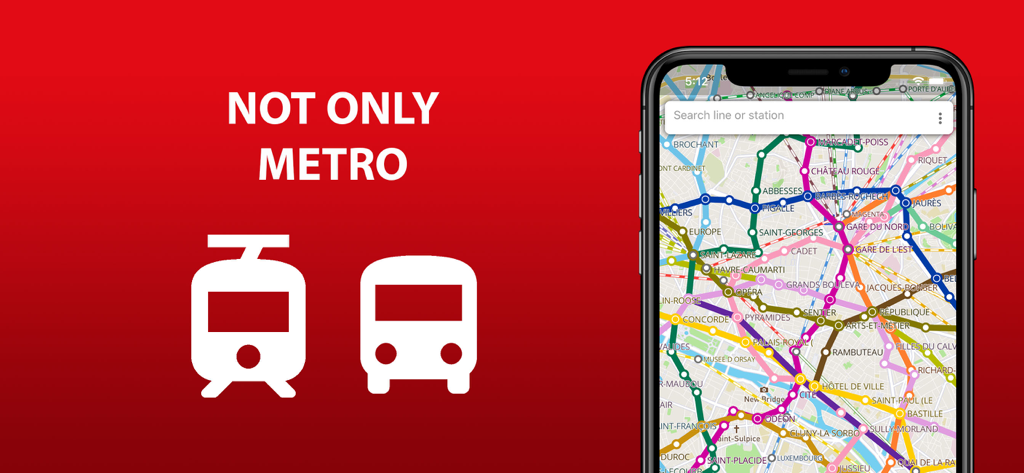
City transport map for Porto showing metro tram and bus lines on a phone screen
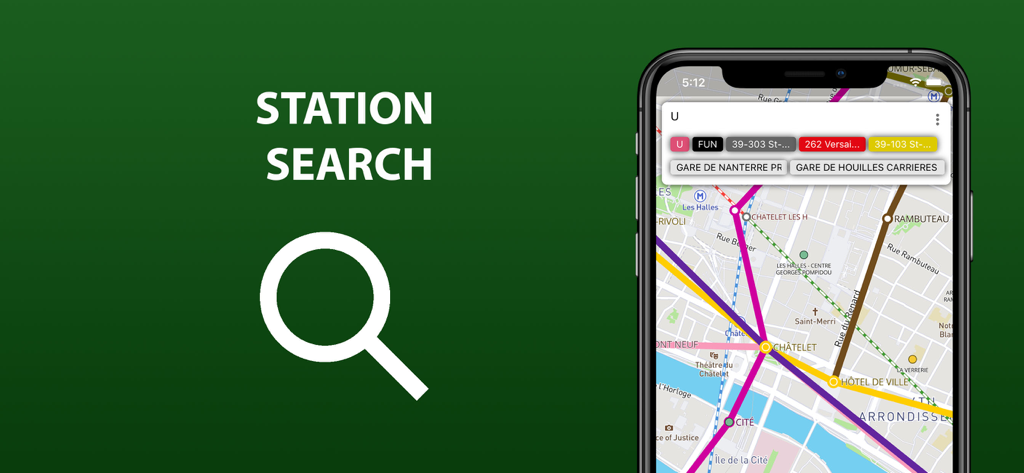
Mobile app interface showing the station search feature for Porto public transport
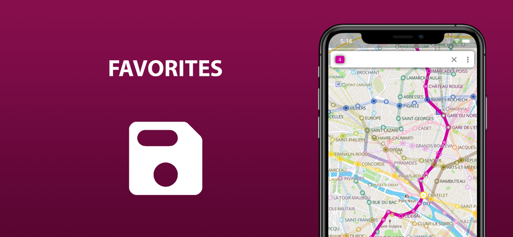
Smartphone screen showing the favorites feature for saving public transport routes in the Porto transit app.
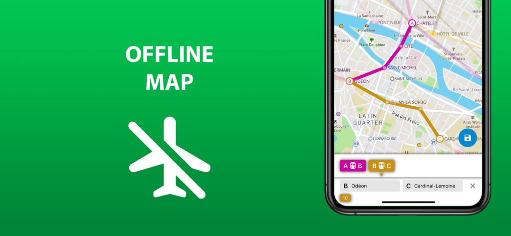
City Transport Map Porto app screenshot showing the offline map feature and public transit navigation interface
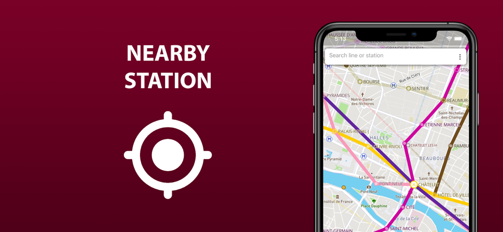
Mobile app interface showing nearby public transport stations and metro lines on a city map of Porto.
Porto transport map app showing metro and tram routes on a smartphone.
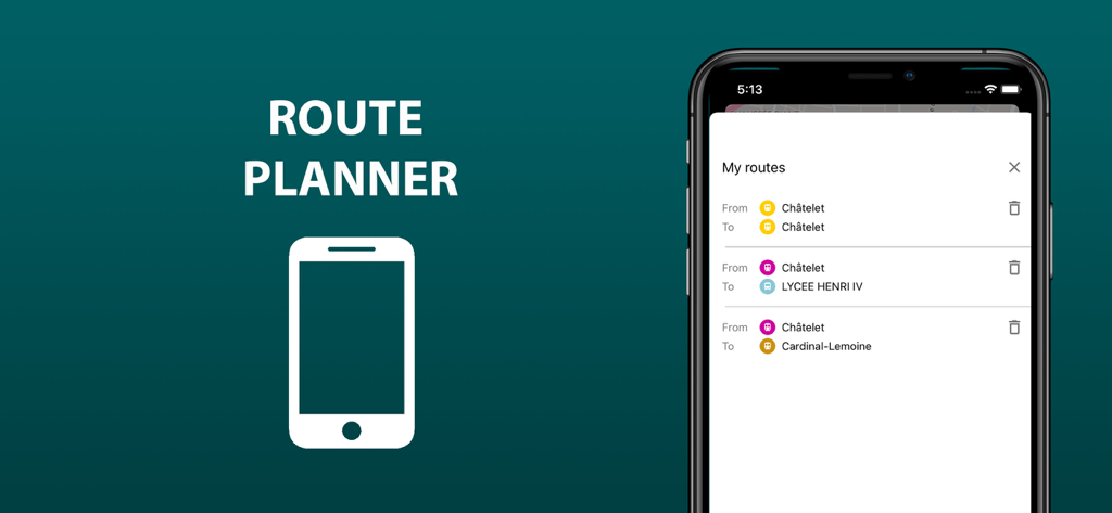
The route planner feature showing a list of saved trips in the Porto transit app
Description
Download
More Like This
Top-ranked apps in the same category

Google Maps
Google LLC

Waze Navigation & Live Traffic
waze

AMap Global
AutoNavi Information Technology Co. Ltd.

百度地图-路线规划,出行必备
Beijing Baidu Netcom Science & Technology Co.,Ltd

Moovit: Bus & Transit Tracker
Moovit App Global LTD

Transit • Subway & Bus Times
9280-0366 Quebec inc.

ParkMobile: Park. Pay. Go.
Parkmobile USA, Inc

腾讯地图-路线规划,导航地铁打车出行
Shenzhen Tencent Computer Systems Company Limited

Île-de-France Mobilités
Ile de France Mobilites
This page is not an official page of the app or its developer, but an independent editorial publication created for informational and commentary purposes. Unless expressly stated otherwise, neither the app nor its developer is affiliated with, endorsed by, sponsored by, authorized by, or otherwise officially connected with MWM, Apple, Google Play, the app publisher, or the app's developer, and nothing on this page implies that the app was developed using MWM's services. Any trademarks, logos, screenshots, and other content remain the property of their respective owners.