This page is not an official page of the app or its developer, but an independent editorial publication created for informational and commentary purposes. Unless expressly stated otherwise, neither the app nor its developer is affiliated with, endorsed by, sponsored by, authorized by, or otherwise officially connected with MWM, Apple, Google Play, the app publisher, or the app's developer, and nothing on this page implies that the app was developed using MWM's services. Any trademarks, logos, screenshots, and other content remain the property of their respective owners.

Drone Assist - Flight Planning
Join over 160,000 pilots using the industry's most trusted source for real-time situational awareness, No-Fly Zone alerts, and professional-grade flight reporting.
Downloads
163K+User Rating
Total Ratings
1K+Publisher
Category
NavigationLocales
4Latest Version
2.4.182332Size
28.7 MBFirst Released
Jul 26, 2017Fly Smarter, Safer, and Fully Compliant
Join over 160,000 pilots using the most trusted source for real-time airspace situational awareness and flight planning.
Instant Airspace Intelligence
Avoid costly FAA fines and physical hazards with real-time access to No-Fly Zones (NFZ), NOTAMs, and ground-level risks.
Professional Mission Planning
Create, manage, and submit flight plans to alert other airspace users, building a professional paper trail for every commercial or hobbyist mission.
The following screenshots and description are sourced directly from the app's official store listing and are the property of the app developer.
App Store
Screenshots
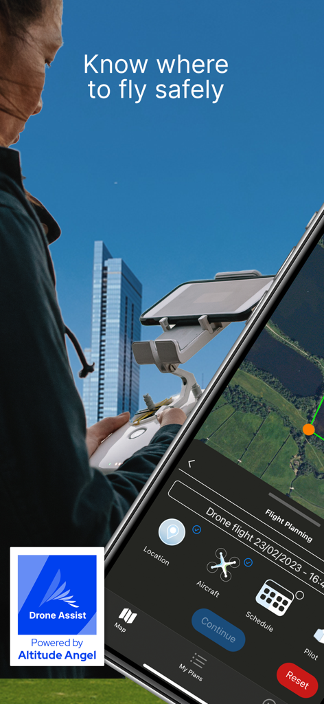
A drone pilot using the Drone Assist app for flight planning and airspace safety information on a smartphone attached to a controller.
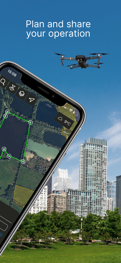
Smartphone displaying the Drone Assist app interface for planning drone flights in urban areas.
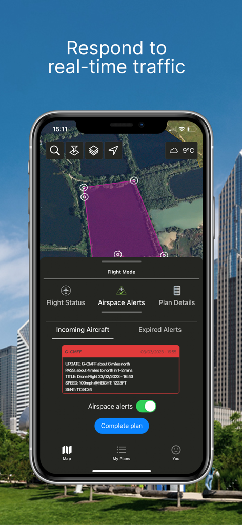
Drone Assist app interface showing real time aircraft traffic alerts and flight area map
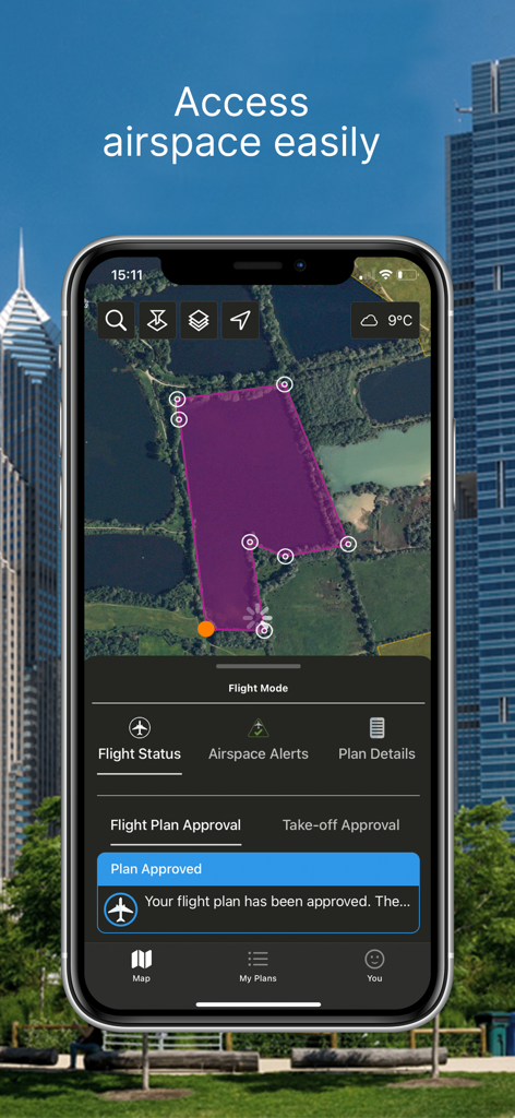
A smartphone showing the Drone Assist app interface with a purple-shaded flight area on a map and a notification that the flight plan has been approved.
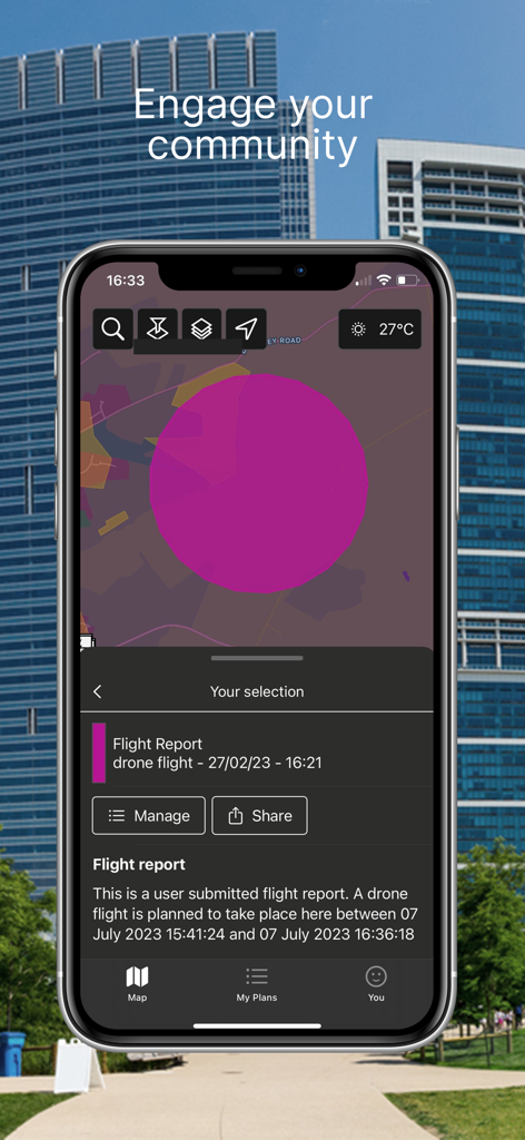
Drone Assist mobile app displaying a flight report and map sharing feature
Description
Download
More Like This
Top-ranked apps in the same category

Google Maps
Google LLC

Waze Navigation & Live Traffic
waze

AMap Global
AutoNavi Information Technology Co. Ltd.

百度地图-路线规划,出行必备
Beijing Baidu Netcom Science & Technology Co.,Ltd

Moovit: Bus & Transit Tracker
Moovit App Global LTD

Transit • Subway & Bus Times
9280-0366 Quebec inc.

ParkMobile: Park. Pay. Go.
Parkmobile USA, Inc

腾讯地图-路线规划,导航地铁打车出行
Shenzhen Tencent Computer Systems Company Limited

Île-de-France Mobilités
Ile de France Mobilites
This page is not an official page of the app or its developer, but an independent editorial publication created for informational and commentary purposes. Unless expressly stated otherwise, neither the app nor its developer is affiliated with, endorsed by, sponsored by, authorized by, or otherwise officially connected with MWM, Apple, Google Play, the app publisher, or the app's developer, and nothing on this page implies that the app was developed using MWM's services. Any trademarks, logos, screenshots, and other content remain the property of their respective owners.