This page is not an official page of the app or its developer, but an independent editorial publication created for informational and commentary purposes. Unless expressly stated otherwise, neither the app nor its developer is affiliated with, endorsed by, sponsored by, authorized by, or otherwise officially connected with MWM, Apple, Google Play, the app publisher, or the app's developer, and nothing on this page implies that the app was developed using MWM's services. Any trademarks, logos, screenshots, and other content remain the property of their respective owners.

Earthquake - alerts and map
Join 5 million users who trust the fastest worldwide alerts from USGS, EMSC, and NOAA. Stay informed with ad-free, high-precision mapping and critical notifications on your iPhone and Apple Watch.
Downloads
3M+User Rating
Total Ratings
175K+Publisher
Category
WeatherLocales
17Latest Version
7.3.1Size
45.1 MBFirst Released
May 9, 2013Professional Monitoring for Total Safety
Trusted by over 5 million users, our app delivers real-time seismic data and critical alerts to help you protect what matters most.
Instant Critical Alerts
Receive high-priority notifications that can bypass 'Do Not Disturb' mode, ensuring you get life-saving information the moment an event is detected.
Authoritative Global Data
Access live feeds from the USGS, EMSC, and NOAA with advanced map layers showing tectonic plates, volcano locations, and population density.
Frequently Asked Questions
Everything you need to know about Earthquake - alerts and map
What is the "Earthquake - alerts and map" app?
The "Earthquake - alerts and map" app is the leading earthquake application for iPhone and iPad, providing worldwide earthquake data, push notifications, and detailed maps with event information.
Does the "Earthquake - alerts and map" app offer push notifications for earthquakes?
Yes, the "Earthquake - alerts and map" app offers rich push notifications for earthquake events as soon as data is available from official sources. Users can set up to four alerts.
Can users filter earthquake notifications in the "Earthquake - alerts and map" app?
Yes, users can filter notifications in the "Earthquake - alerts and map" app by magnitude threshold and location. Custom filters allow setting minimum magnitude and a specific radius for alerts.
What data sources does the "Earthquake - alerts and map" app use?
The "Earthquake - alerts and map" app uses multiple official sources including USGS, EMSC, GeoScience Australia, GNS Science, Instituto Geográfico Nacional, Servicio Sismológico Nacional, British Geological Survey, GFZ GEOFON, Natural Resources Canada, and NOAA.
How can users search the earthquake catalog in the "Earthquake - alerts and map" app?
Users can search the "Earthquake - alerts and map" catalog by date, place, country/state/continent, data source, or by a specific region shown on the map. The catalog goes back to 1970.
What map layers are available in the "Earthquake - alerts and map" app?
The "Earthquake - alerts and map" app provides map layers for tectonic plate boundaries, orogens, volcanoes, nuclear power plants, and population density. These enhance the visual data representation.
Does the "Earthquake - alerts and map" app provide tsunami information?
Yes, the "Earthquake - alerts and map" app provides Tsunami bulletins and detailed information, utilizing data from NOAA to keep users informed about potential tsunami events.
Does the "Earthquake - alerts and map" app contain advertisements?
No, the "Earthquake - alerts and map" app does not contain any advertisements, ensuring an uninterrupted user experience for accessing earthquake data and alerts.
Does "Earthquake - alerts and map" support Critical Alerts?
Yes, the "Earthquake - alerts and map" app supports Critical Alerts. These alerts bypass silent mode and Do Not Disturb settings, ensuring important earthquake notifications are always heard.
Does the "Earthquake - alerts and map" app include user-reported earthquake data?
Yes, the "Earthquake - alerts and map" app supports notifications based on user reports. It also displays preliminary reports by app users, confirmed by seismic data, on the map.
The following screenshots and description are sourced directly from the app's official store listing and are the property of the app developer.
App Store
Screenshots
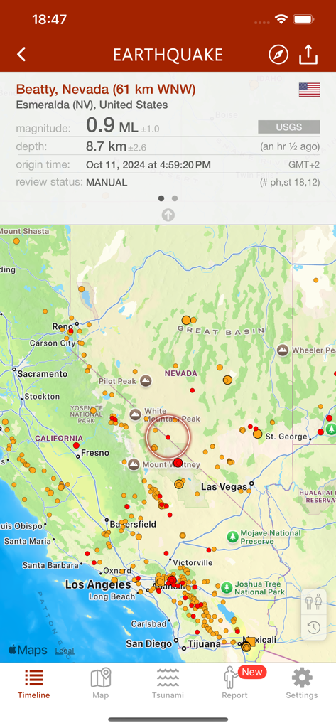
Earthquake app map showing seismic activity and event data for California and Nevada.
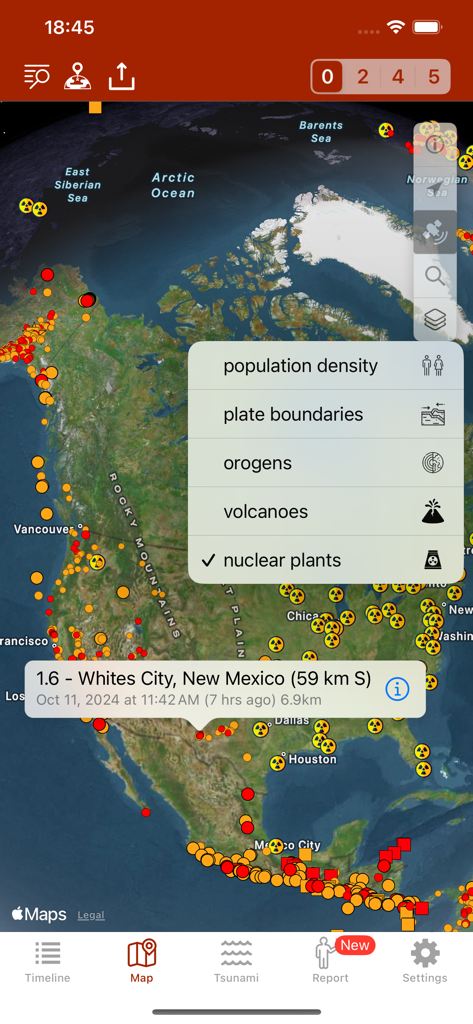
Earthquake app map view showing seismic activity and nuclear power plant locations across North America.
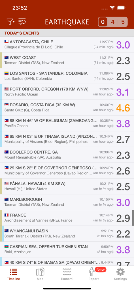
A smartphone screen showing a list of recent worldwide earthquake events with magnitudes and locations in the Earthquake app.
A world map in the Earthquake app displaying seismic activity alerts and tectonic plate boundaries.
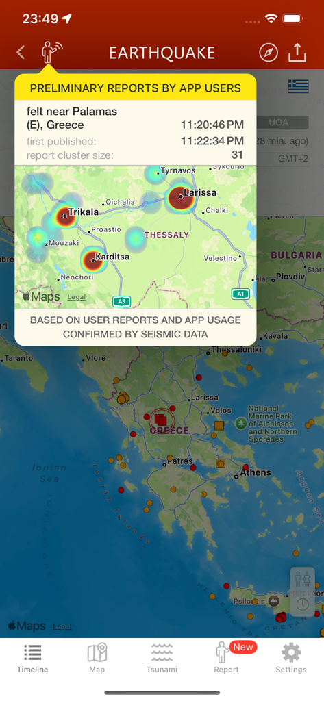
Interface of the Earthquake app displaying preliminary user reports and a heatmap of seismic activity in Greece
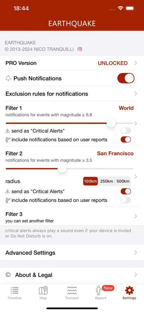
Settings screen showing earthquake notification filters for magnitude and location like San Francisco
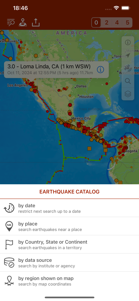
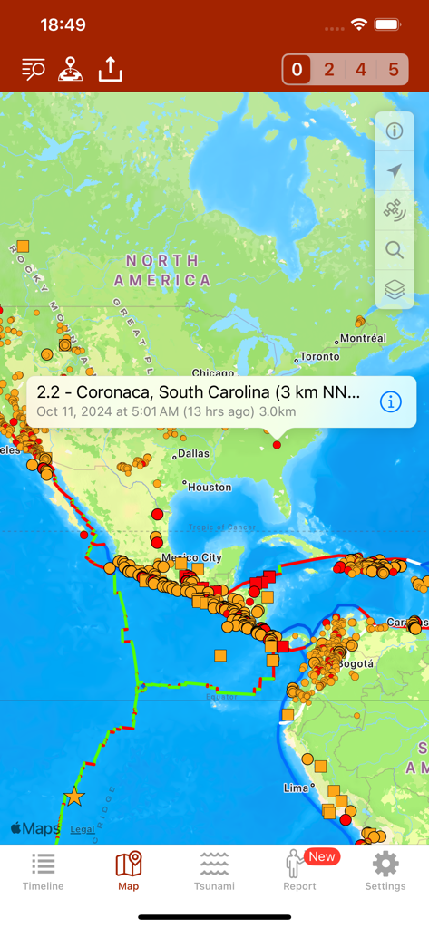
Seismic activity map of the Americas and earthquake catalog search options with filters for date and location
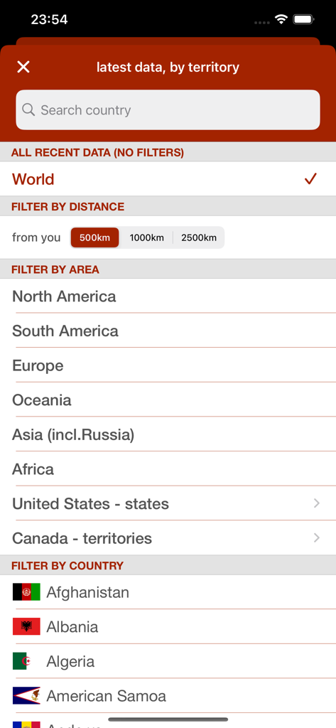
Earthquake app interface for filtering seismic events by country and region
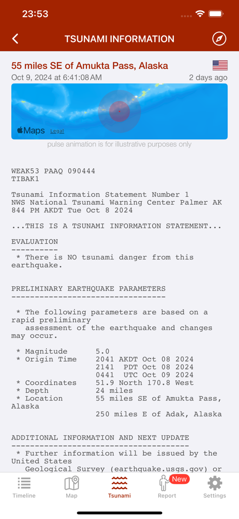
Tsunami information screen in the Earthquake app showing a magnitude 5.0 event near Alaska with a status of no tsunami danger.
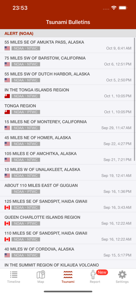
A list of tsunami alerts and bulletins from NOAA shown in the Earthquake app
Description
Download
More Like This
Apps with similar features and user experience

Alerta Sísmica México - SASSLA
Diego Ramirez

QuakeFeed Earthquake Alerts
Artisan Global LLC

My Earthquake Alerts Pro
JRustonApps B.V.

My Earthquake Alerts & Feed
JRustonApps B.V.

Earthquake+ Alerts, Map & Info
Slava Barouline

LastQuake
Ctre Sismologique Euro Mediterraneen

Earthquake Alert - Seismic
婷 张

Volcanoes: Map, Alerts & Ash
Slava Barouline

EarthQuake+
Avni Sagiroglu
This page is not an official page of the app or its developer, but an independent editorial publication created for informational and commentary purposes. Unless expressly stated otherwise, neither the app nor its developer is affiliated with, endorsed by, sponsored by, authorized by, or otherwise officially connected with MWM, Apple, Google Play, the app publisher, or the app's developer, and nothing on this page implies that the app was developed using MWM's services. Any trademarks, logos, screenshots, and other content remain the property of their respective owners.