This page is not an official page of the app or its developer, but an independent editorial publication created for informational and commentary purposes. Unless expressly stated otherwise, neither the app nor its developer is affiliated with, endorsed by, sponsored by, authorized by, or otherwise officially connected with MWM, Apple, Google Play, the app publisher, or the app's developer, and nothing on this page implies that the app was developed using MWM's services. Any trademarks, logos, screenshots, and other content remain the property of their respective owners.

Earthquake Map Tracker
Stay informed and protect your family with instant seismic alerts and integrated weather data. Get precise situational awareness with interactive mapping designed for the safety-conscious homeowner.
Downloads
0User Rating
Total Ratings
0Publisher
Category
WeatherLocales
1Latest Version
2Size
26.9 MBFirst Released
May 26, 2022Safety Through Real-Time Awareness
Monitor seismic activity worldwide and stay ahead of local weather conditions with professional-grade data visualization designed for your peace of mind.
Interactive Seismic Mapping
Visualize the exact epicenter and proximity of recent tremors relative to your home, children's school, or current location.
Live Activity Updates
Access the latest earthquake data the moment it occurs, providing the instant clarity needed during seismic events.
The following screenshots and description are sourced directly from the app's official store listing and are the property of the app developer.
App Store
Screenshots
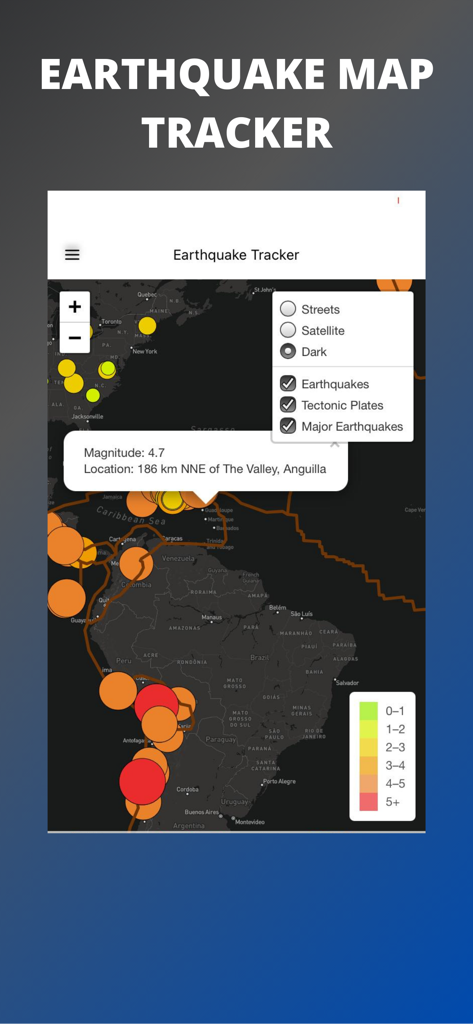
An interactive global earthquake map showing seismic activity magnitude and locations in dark mode
Earthquake Map Tracker app interface displaying real-time seismic activity and tectonic plate layers on a global map.
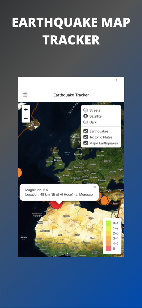
Real time earthquake tracker app interface showing seismic activity and magnitude details on a satellite map
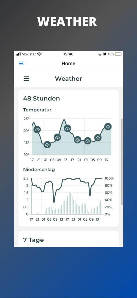
Weather forecast charts with temperature and precipitation data
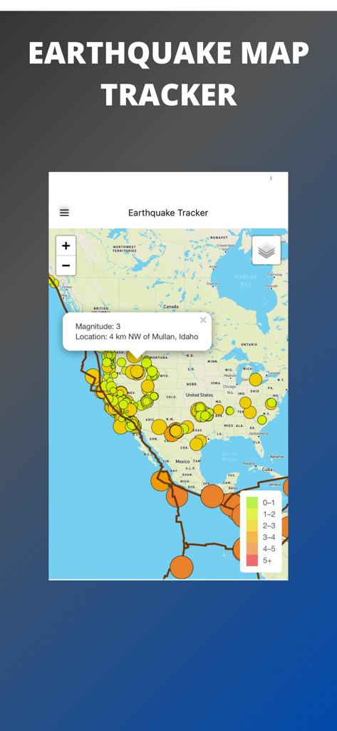
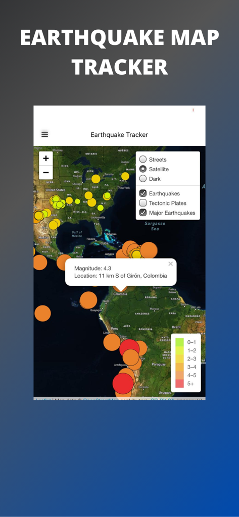
Interface of the Earthquake Map Tracker app showing seismic activity and earthquake magnitudes on a map of North America
Description
Download
More Like This
Top-ranked apps in the same category

墨迹天气-MojiWeather
Beijing MojiFengyun Technology Co.,Ltd.

Windy.com
Windyty, SE

The Weather Channel - Radar
The Weather Channel

天气预报-精准15日天气预报
Chongqing Caochen Technology Co., Ltd.

AccuWeather: Weather Forecast
AccuWeather International, Inc.

My Aurora Forecast & Alerts
JRustonApps B.V.

Weather & Radar USA
WetterOnline - Meteorologische Dienstleistungen GmbH

天气通
Weibo Internet Technology (China) Co.Ltd.

Stargazing Hub - Sky Live
长榕 许
This page is not an official page of the app or its developer, but an independent editorial publication created for informational and commentary purposes. Unless expressly stated otherwise, neither the app nor its developer is affiliated with, endorsed by, sponsored by, authorized by, or otherwise officially connected with MWM, Apple, Google Play, the app publisher, or the app's developer, and nothing on this page implies that the app was developed using MWM's services. Any trademarks, logos, screenshots, and other content remain the property of their respective owners.