This page is not an official page of the app or its developer, but an independent editorial publication created for informational and commentary purposes. Unless expressly stated otherwise, neither the app nor its developer is affiliated with, endorsed by, sponsored by, authorized by, or otherwise officially connected with MWM, Apple, Google Play, the app publisher, or the app's developer, and nothing on this page implies that the app was developed using MWM's services. Any trademarks, logos, screenshots, and other content remain the property of their respective owners.

防災リスマ - 災害リスク・ハザードマップ
Protect your family and property from afar. Get instant access to official flood, landslide, and sediment risk data for every municipality in Japan, providing peace of mind for expats and investors.
Downloads
72K+User Rating
Total Ratings
300Publisher
Category
WeatherLocales
1Latest Version
3.10Size
71.8 MBFirst Released
Nov 28, 2018Comprehensive Disaster Intelligence at Your Fingertips
Protect your property and loved ones in Japan with high-precision hazard maps and official government data, accessible from anywhere in the world.
Precision Hazard Overlays
Visualize street-level risks for floods, landslides, and debris flows using high-definition geospatial layers.
Verified Official Data
Make informed decisions with reliable data sourced directly from the Geospatial Information Authority of Japan and local municipalities.
The following screenshots and description are sourced directly from the app's official store listing and are the property of the app developer.
App Store
Screenshots
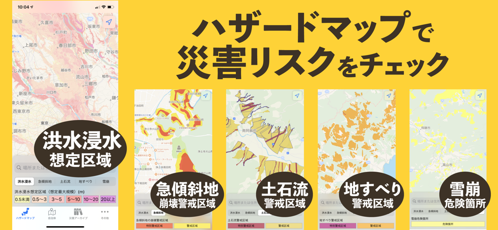
Bosai Lisma app screenshot showing various disaster hazard maps for flood and landslide risks in Japan
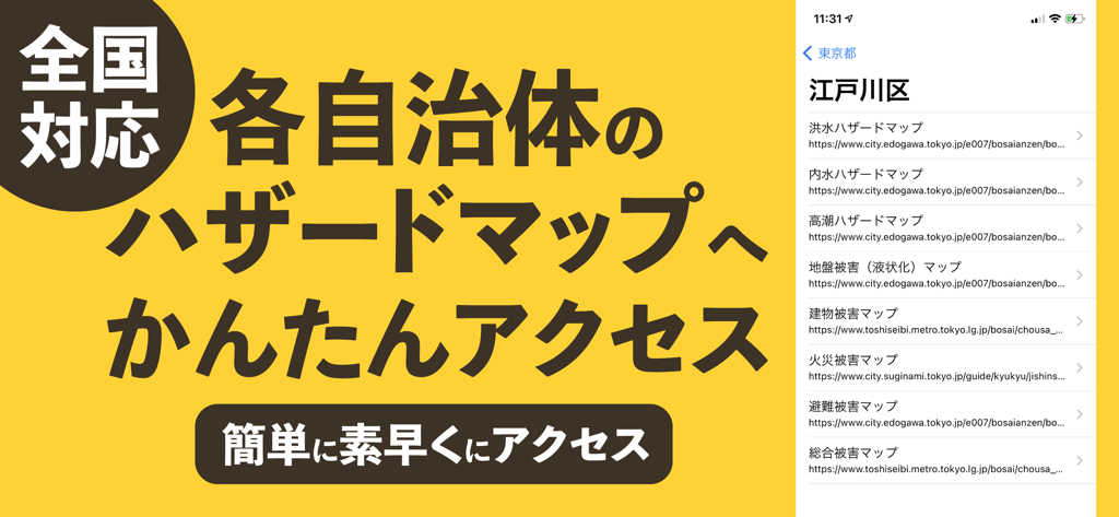
The Bosai Lisma app screen showing links to various disaster hazard maps for Japanese municipalities
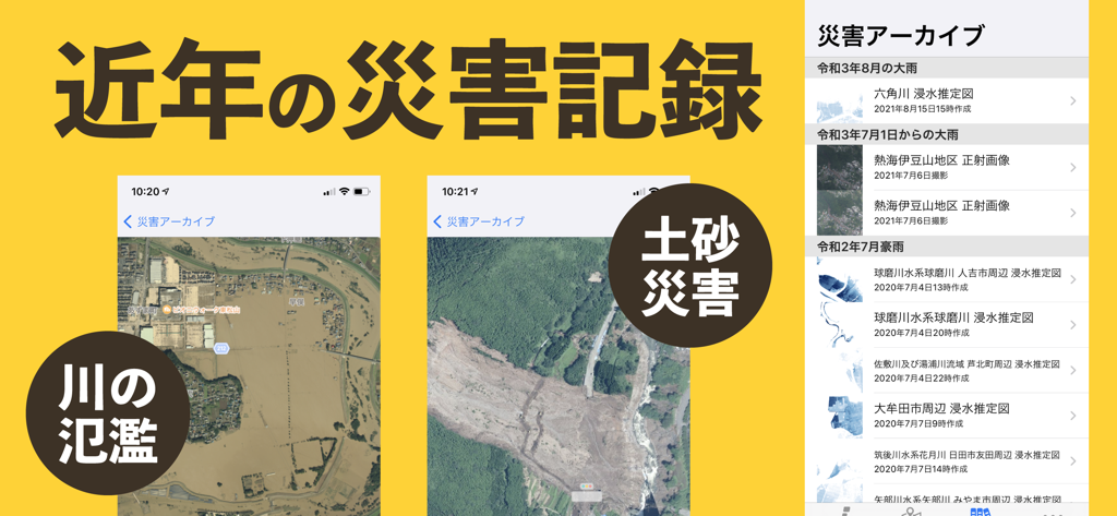
Bosai Lisma app disaster archive showing satellite imagery of historical flooding and landslides in Japan
Description
Download
More Like This
Top-ranked apps in the same category

墨迹天气-MojiWeather
Beijing MojiFengyun Technology Co.,Ltd.

The Weather Channel - Radar
The Weather Channel

Windy.com
Windyty, SE

天气预报-精准15日天气预报
Chongqing Caochen Technology Co., Ltd.

My Aurora Forecast & Alerts
JRustonApps B.V.

AccuWeather: Weather Forecast
AccuWeather International, Inc.

Weather & Radar - Storm radar
WetterOnline - Meteorologische Dienstleistungen GmbH

天气通
Weibo Internet Technology (China) Co.Ltd.

The Thermometer -Digital-
Vida Apps Incorporated
This page is not an official page of the app or its developer, but an independent editorial publication created for informational and commentary purposes. Unless expressly stated otherwise, neither the app nor its developer is affiliated with, endorsed by, sponsored by, authorized by, or otherwise officially connected with MWM, Apple, Google Play, the app publisher, or the app's developer, and nothing on this page implies that the app was developed using MWM's services. Any trademarks, logos, screenshots, and other content remain the property of their respective owners.