This page is not an official page of the app or its developer, but an independent editorial publication created for informational and commentary purposes. Unless expressly stated otherwise, neither the app nor its developer is affiliated with, endorsed by, sponsored by, authorized by, or otherwise officially connected with MWM, Apple, Google Play, the app publisher, or the app's developer, and nothing on this page implies that the app was developed using MWM's services. Any trademarks, logos, screenshots, and other content remain the property of their respective owners.

Feodal FMS
Maximize your ROI with real-time equipment monitoring, fuel control, and advanced satellite analytics. Transform your field data into actionable insights to optimize every acre and streamline your operation from the palm of your hand.
Downloads
0User Rating
Total Ratings
0Publisher
Category
BusinessLocales
1Latest Version
2.1.1Size
65.0 MBFirst Released
Sep 25, 2023Precision Control for the Modern Farm Operation
Feodal FMS consolidates telematics, satellite imagery, and team management into one mobile dashboard, helping you cut costs and boost ROI through data-driven decisions.
Real-Time Fleet & Fuel Tracking
Monitor machinery location, work hours, and fuel consumption to eliminate waste, prevent unauthorized land use, and protect against fuel theft.
High-Resolution Satellite Insights
Access NDVI, moisture, and vegetation indices updated every 3 days. Identify weak zones early and save thousands by applying inputs only where they are needed.
The following screenshots and description are sourced directly from the app's official store listing and are the property of the app developer.
App Store
Screenshots
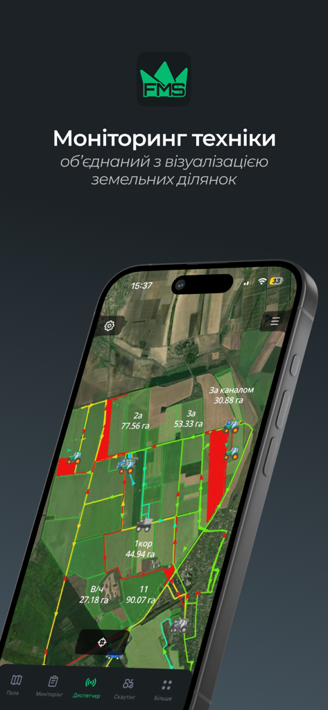
Smartphone screen of Feodal FMS app showing live equipment tracking on a detailed farm field map
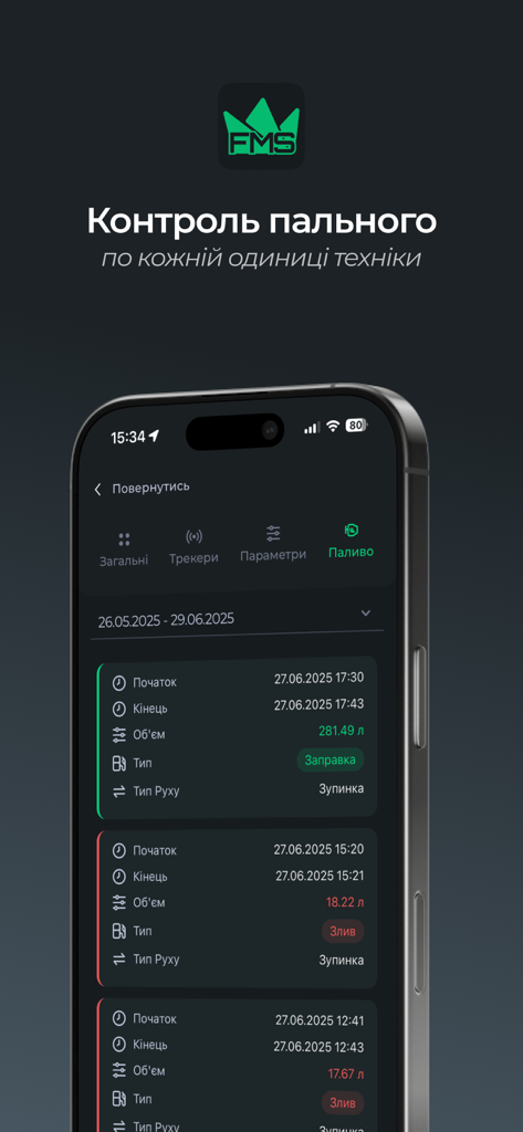
Feodal FMS mobile interface showing machinery fuel monitoring logs with refueling and drainage data
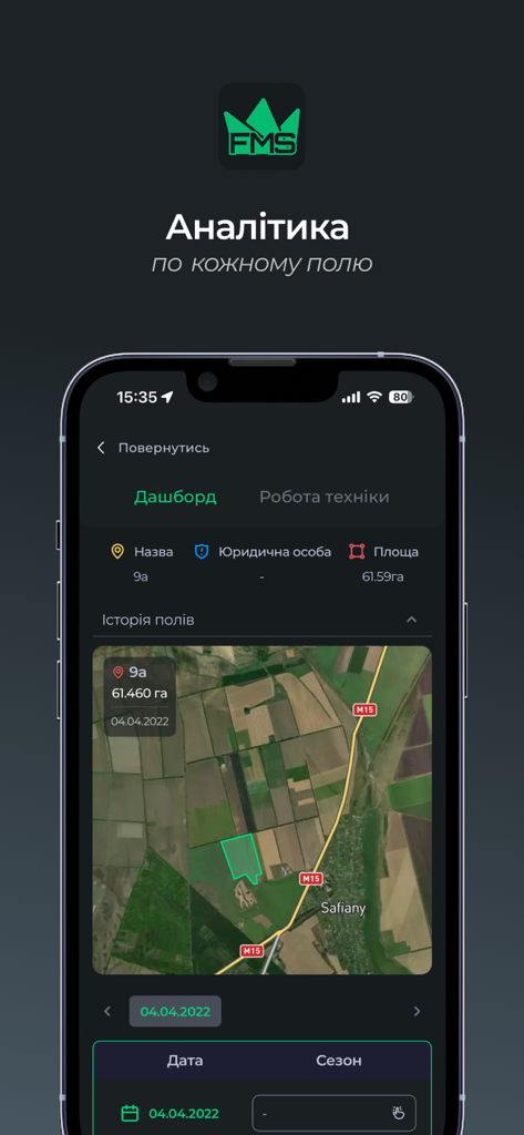
Feodal FMS mobile app interface showing a satellite map of agricultural fields with area data and analytics dashboard
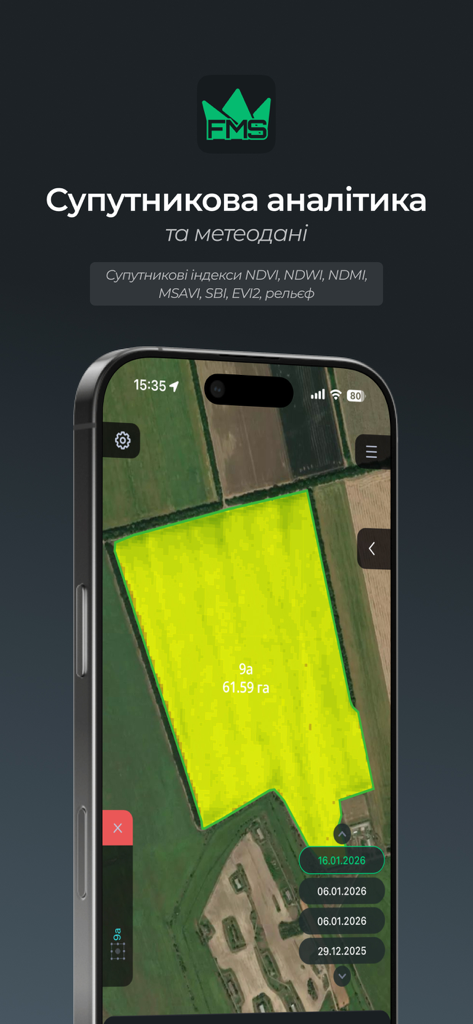
Feodal FMS mobile app interface displaying satellite analytics and NDVI crop monitoring on a farm field map.
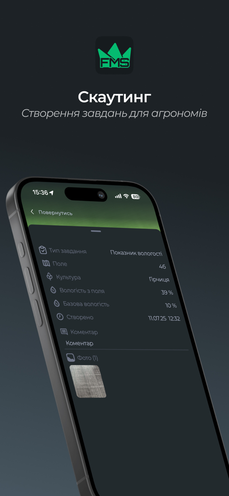
Feodal FMS mobile interface for managing agricultural scouting tasks and field reports
Description
Download
More Like This
Top-ranked apps in the same category

Microsoft Teams
Microsoft Corporation

WhatsApp Business
WhatsApp Inc.

BOSS直聘-招聘求职找工作神器
Beijing China Product Bo Farce Network Technology Co., Ltd.

Zoom Workplace
Zoom Communications, Inc.

Indeed Job Search
Indeed Inc.

LinkedIn: Community & Network
LinkedIn Corporation

WeCom-Work Communication&Tools
Tencent Technology (Shenzhen) Company Limited

DingDing - Redefine Work in AI
DingTalk Technology Co., Ltd.

Adobe Acrobat Reader: Sign PDF
Adobe Inc.
This page is not an official page of the app or its developer, but an independent editorial publication created for informational and commentary purposes. Unless expressly stated otherwise, neither the app nor its developer is affiliated with, endorsed by, sponsored by, authorized by, or otherwise officially connected with MWM, Apple, Google Play, the app publisher, or the app's developer, and nothing on this page implies that the app was developed using MWM's services. Any trademarks, logos, screenshots, and other content remain the property of their respective owners.