This page is not an official page of the app or its developer, but an independent editorial publication created for informational and commentary purposes. Unless expressly stated otherwise, neither the app nor its developer is affiliated with, endorsed by, sponsored by, authorized by, or otherwise officially connected with MWM, Apple, Google Play, the app publisher, or the app's developer, and nothing on this page implies that the app was developed using MWM's services. Any trademarks, logos, screenshots, and other content remain the property of their respective owners.

Field maps - Distance Measure
Transform your device into a powerful surveying tool for measuring field acreage, property perimeters, and land distance. Built for farmers, real estate professionals, and contractors who need reliable data and instant reports in the field.
Downloads
1K+User Rating
Total Ratings
0Publisher
Category
NavigationLocales
11Latest Version
1.2Size
63.4 MBFirst Released
Mar 13, 2025Professional Land Mapping Made Simple
Transform your iPhone or iPad into a high-precision surveying tool. Calculate acreage, perimeters, and distances instantly to make faster, data-driven decisions in the field.
Precision Area Calculation
Accurately measure acreage and square footage by walking the perimeter or dropping pins on the map for instant land valuations.
Live Boundary Tracking
Map complex fields and rugged terrain in real-time as you move, ensuring perfect accuracy for farming, fencing, or land development.
Frequently Asked Questions
Everything you need to know about Field maps - Distance Measure
What is Field maps - Distance Measure?
Field maps - Distance Measure is a powerful and easy-to-use app for measuring land area, distance, and perimeter using GPS technology. It provides accurate field area calculations.
How does Field maps - Distance Measure measure land area?
Field maps - Distance Measure accurately measures land area using your device’s GPS technology. It offers both manual and GPS-based measurement options.
Can Field maps - Distance Measure calculate distances and perimeters?
Yes, Field maps - Distance Measure can easily measure distances and perimeters. The app includes specific features for both distance and perimeter calculations.
What measurement units does Field maps - Distance Measure support for area?
Field maps - Distance Measure supports various area units including Sq Miles, Sq Yard, Sq Feet, Sq Inches, and Hectare. Users can select their preferred unit.
Is live tracking available in Field maps - Distance Measure?
Yes, Field maps - Distance Measure provides live tracking and mapping features. This enables real-time tracking for accurate land surveying purposes.
Can I save and share reports from Field maps - Distance Measure?
Yes, Field maps - Distance Measure allows users to save and share their measurement reports. You can export measurements in various formats for future reference.
Who can use the Field maps - Distance Measure app?
Field maps - Distance Measure is suitable for farmers, land surveyors, real estate professionals, and outdoor enthusiasts. It is perfect for agriculture, construction, and property assessment.
Where can I find the Privacy Policy for Field maps - Distance Measure?
The Privacy Policy for Field maps - Distance Measure is available at https://privacypolicy590.wordpress.com. This link provides details on data handling.
Does Field maps - Distance Measure show measured area on a map?
Yes, Field maps - Distance Measure displays the measured area directly on a map. For example, Screenshot #1 shows an area of 2789565.55 Sq Feet pinpointed on a map.
The following screenshots and description are sourced directly from the app's official store listing and are the property of the app developer.
App Store
Screenshots
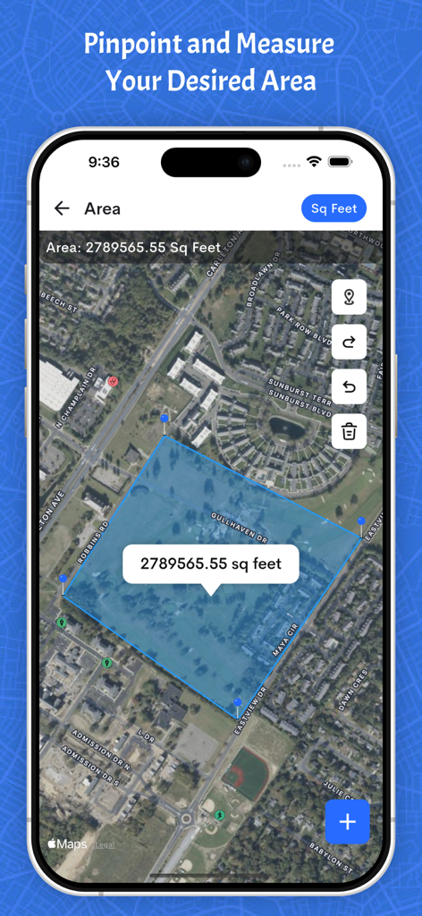
Satellite map view showing a blue highlighted polygon area measured in square feet on a mobile interface.
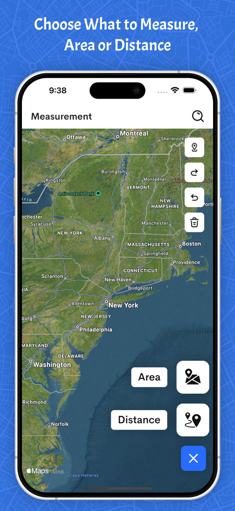
Smartphone screen displaying a satellite map of the Northeastern United States with buttons to select between area and distance measurement modes.
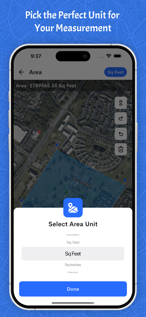
Area unit selection screen in the Field maps app showing square feet measurement over a land survey map.
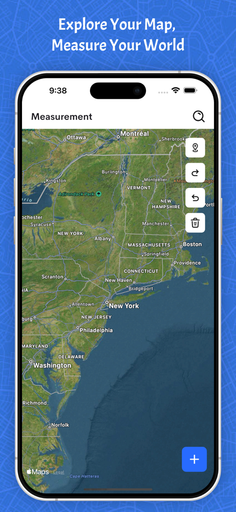
Satellite map view in the Field maps app for measuring land distance and area.
Description
Download
More Like This
Top-ranked apps in the same category

Google Maps
Google LLC

Waze Navigation & Live Traffic
waze

AMap Global
AutoNavi Information Technology Co. Ltd.

百度地图-路线规划,出行必备
Beijing Baidu Netcom Science & Technology Co.,Ltd

Moovit: Bus & Transit Tracker
Moovit App Global LTD

Transit • Subway & Bus Times
9280-0366 Quebec inc.

ParkMobile: Park. Pay. Go.
Parkmobile USA, Inc

腾讯地图-路线规划,导航地铁打车出行
Shenzhen Tencent Computer Systems Company Limited

Île-de-France Mobilités
Ile de France Mobilites
This page is not an official page of the app or its developer, but an independent editorial publication created for informational and commentary purposes. Unless expressly stated otherwise, neither the app nor its developer is affiliated with, endorsed by, sponsored by, authorized by, or otherwise officially connected with MWM, Apple, Google Play, the app publisher, or the app's developer, and nothing on this page implies that the app was developed using MWM's services. Any trademarks, logos, screenshots, and other content remain the property of their respective owners.