This page is not an official page of the app or its developer, but an independent editorial publication created for informational and commentary purposes. Unless expressly stated otherwise, neither the app nor its developer is affiliated with, endorsed by, sponsored by, authorized by, or otherwise officially connected with MWM, Apple, Google Play, the app publisher, or the app's developer, and nothing on this page implies that the app was developed using MWM's services. Any trademarks, logos, screenshots, and other content remain the property of their respective owners.

Fireguard Wildfire Tracker
Monitor wildfire progression, satellite hotspots, and live fire cameras on one comprehensive map. Stay ahead of the smoke and flames with zero subscriptions or logins required.
Downloads
30K+User Rating
Total Ratings
0Publisher
Category
WeatherLocales
1Latest Version
2.1.4Size
17.7 MBFirst Released
Mar 30, 2022Critical Wildfire Intelligence at Your Fingertips
Protect your home and family with real-time satellite hotspots, live fire cameras, and official incident reports on one integrated map.
Real-Time Satellite Tracking
Detect hotspots and fire progression instantly with advanced satellite sensors updated throughout the day for maximum situational awareness.
Immediate, No-Login Access
In an emergency, every second counts. Get full access to all maps and data without accounts, passwords, or monthly subscriptions.
The following screenshots and description are sourced directly from the app's official store listing and are the property of the app developer.
App Store
Screenshots
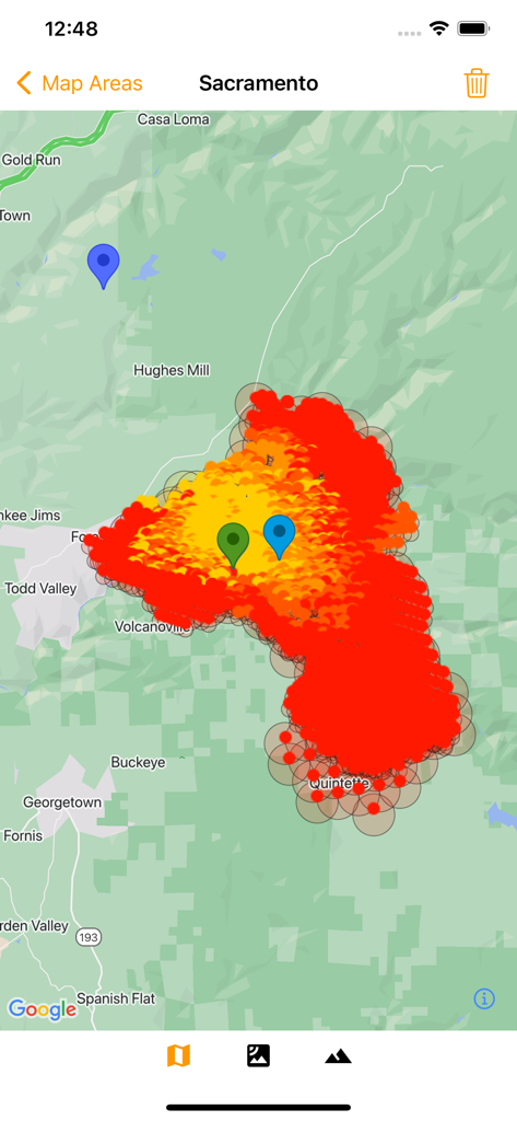
Map view of the Fireguard Wildfire Tracker app showing a large active wildfire hotspot and location markers near Sacramento
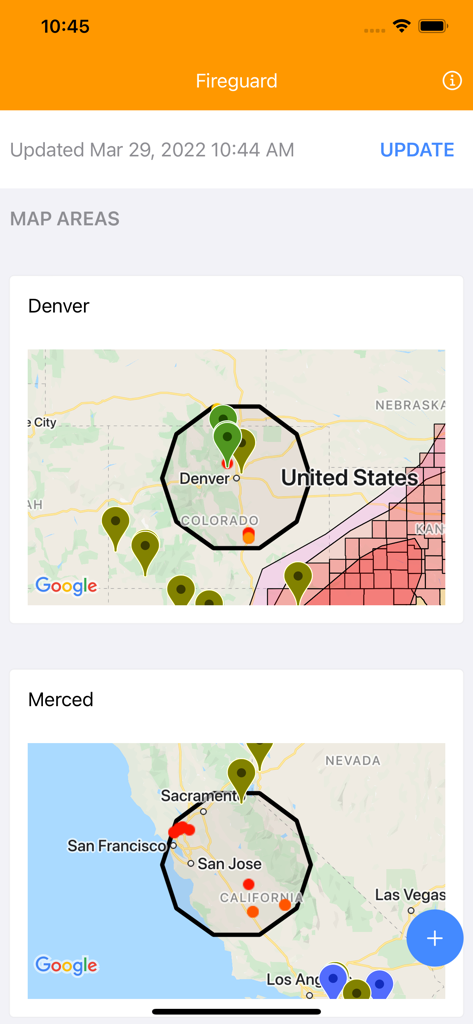
Fireguard app interface displaying wildfire monitoring map areas for Denver and Merced

A wildfire tracker map showing the Denver Colorado area with fire incident markers and hazard zones.
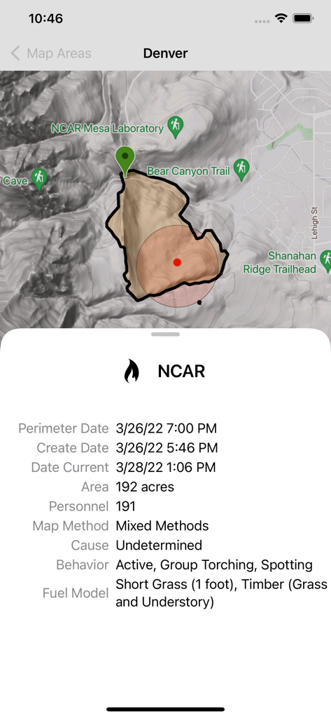
Fireguard Wildfire Tracker app displaying a map of the NCAR fire perimeter in Denver with detailed incident data like area size and fire behavior.
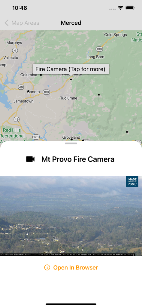
A live wildfire camera feed from Mt Provo shown on the Fireguard app map
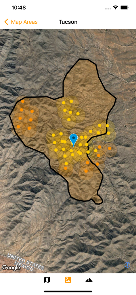
Satellite map of Tucson in the Fireguard app showing wildfire hotspots and incident markers
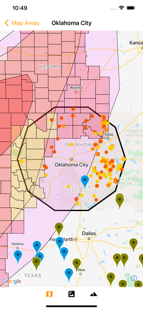
Fireguard Wildfire Tracker app displaying a map with hotspots and risk zones around Oklahoma City
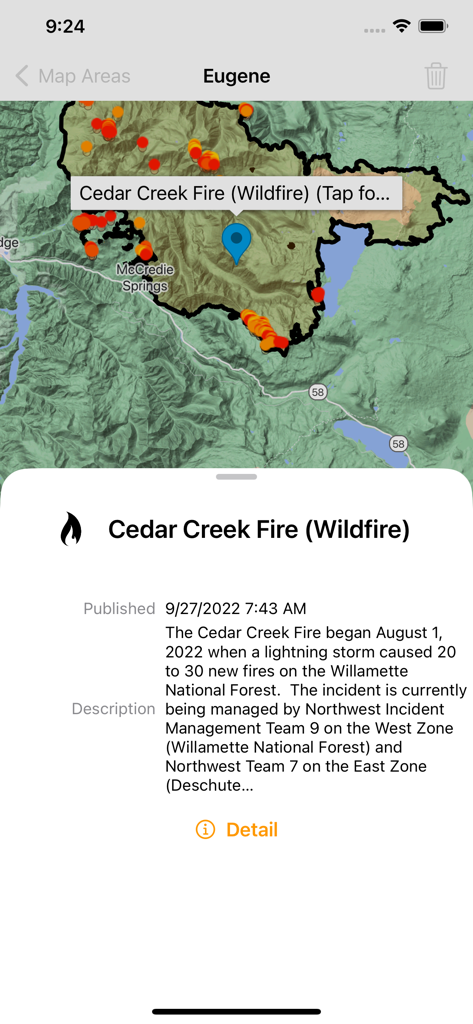
A wildfire map showing the Cedar Creek Fire boundaries and satellite hotspots near Eugene on the Fireguard app.
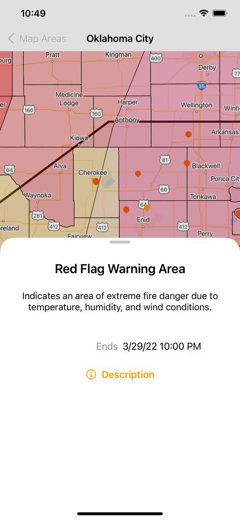
Fireguard app displaying a wildfire tracking map with highlighted Red Flag Warning areas and fire danger alerts near Oklahoma City.
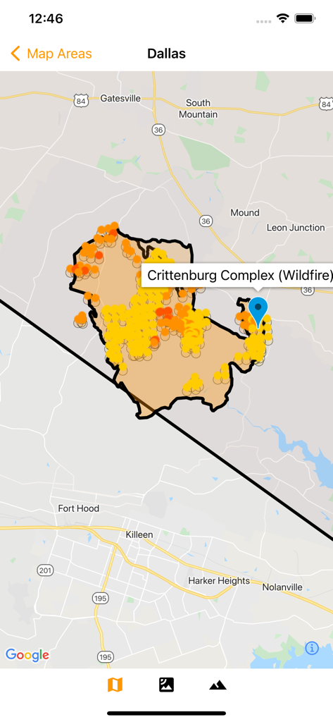
Map view of Fireguard Wildfire Tracker showing active wildfire hotspots and boundaries
Description
Download
More Like This
Top-ranked apps in the same category

墨迹天气-MojiWeather
Beijing MojiFengyun Technology Co.,Ltd.

The Weather Channel - Radar
The Weather Channel

Windy.com
Windyty, SE

天气预报-精准15日天气预报
Chongqing Caochen Technology Co., Ltd.

My Aurora Forecast & Alerts
JRustonApps B.V.

AccuWeather: Weather Forecast
AccuWeather International, Inc.

Weather & Radar - Storm radar
WetterOnline - Meteorologische Dienstleistungen GmbH

天气通
Weibo Internet Technology (China) Co.Ltd.

The Thermometer -Digital-
Vida Apps Incorporated
This page is not an official page of the app or its developer, but an independent editorial publication created for informational and commentary purposes. Unless expressly stated otherwise, neither the app nor its developer is affiliated with, endorsed by, sponsored by, authorized by, or otherwise officially connected with MWM, Apple, Google Play, the app publisher, or the app's developer, and nothing on this page implies that the app was developed using MWM's services. Any trademarks, logos, screenshots, and other content remain the property of their respective owners.