This page is not an official page of the app or its developer, but an independent editorial publication created for informational and commentary purposes. Unless expressly stated otherwise, neither the app nor its developer is affiliated with, endorsed by, sponsored by, authorized by, or otherwise officially connected with MWM, Apple, Google Play, the app publisher, or the app's developer, and nothing on this page implies that the app was developed using MWM's services. Any trademarks, logos, screenshots, and other content remain the property of their respective owners.

FlewAbove
Turn your window seat into a high-tech cockpit. Track your altitude, speed, and flight path with a privacy-first map that requires no Wi-Fi and never shares your data.
Downloads
100+User Rating
Total Ratings
0Publisher
Category
TravelLocales
10Latest Version
1.1.0Size
195.9 MBFirst Released
Feb 9, 2026Your Personal Window to the World
Turn every flight into a discovery mission. Track your journey with high-precision aviation data and detailed geography, even in Airplane Mode.
100% Offline Intelligence
Identify mountains, lakes, and cities without paying for over-priced in-flight Wi-Fi. Our maps run entirely on your device.
Live Dashboard & Metrics
View your altitude, speed, and heading in real-time. Stay updated via the Dynamic Island and Lock Screen Live Activities.
The following screenshots and description are sourced directly from the app's official store listing and are the property of the app developer.
App Store
Screenshots
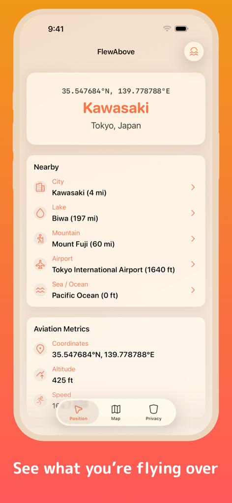
FlewAbove app interface showing live location over Kawasaki and aviation metrics
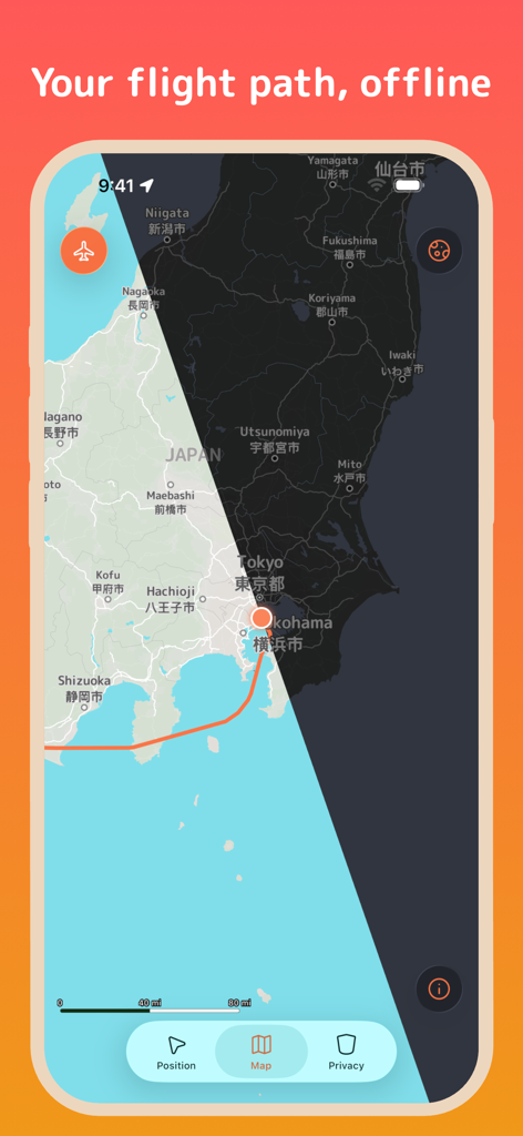
FlewAbove app screenshot showing an offline flight path map over Japan
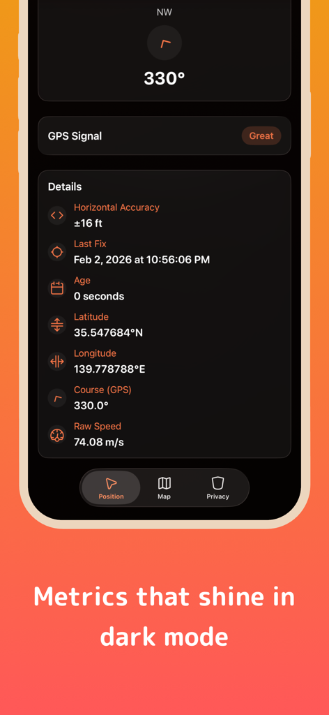
FlewAbove app screen displaying detailed flight metrics and GPS coordinates in dark mode.
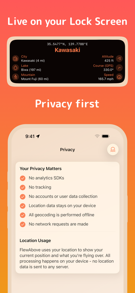
FlewAbove app screenshot showing a flight status widget for the lock screen and a list of privacy features
Description
Download
More Like This
Top-ranked apps in the same category

Uber - Request a ride
Uber Technologies, Inc.

铁路12306
ACADEMY OF RAILWAY SCIENCES CO., ltd.

Airbnb
Airbnb, Inc.

Grab: Taxi Ride, Food Delivery
GRABTAXI HOLDINGS PTE. LTD.

Booking.com: Hotels & Travel
Booking.com B.V.

DiDi China: Ride Hailing
Didi Chuxing (Beijing) Network Platform Technology Co., Ltd

Trip.com: Book Flights, Hotels
Trip.com Travel Singapore Pte. Ltd.

去哪儿旅行-订酒店机票火车票
Beijing Qunar Information Technology Company Limit

携程旅行-订酒店机票火车票
Shanghai Ctrip Commerce Co.,Ltd
This page is not an official page of the app or its developer, but an independent editorial publication created for informational and commentary purposes. Unless expressly stated otherwise, neither the app nor its developer is affiliated with, endorsed by, sponsored by, authorized by, or otherwise officially connected with MWM, Apple, Google Play, the app publisher, or the app's developer, and nothing on this page implies that the app was developed using MWM's services. Any trademarks, logos, screenshots, and other content remain the property of their respective owners.