This page is not an official page of the app or its developer, but an independent editorial publication created for informational and commentary purposes. Unless expressly stated otherwise, neither the app nor its developer is affiliated with, endorsed by, sponsored by, authorized by, or otherwise officially connected with MWM, Apple, Google Play, the app publisher, or the app's developer, and nothing on this page implies that the app was developed using MWM's services. Any trademarks, logos, screenshots, and other content remain the property of their respective owners.

Forest Watcher
The essential offline-first tool for conservation professionals to navigate to deforestation alerts, document field evidence, and manage land protection efforts without cellular service.
Downloads
31K+User Rating
Total Ratings
0Publisher
Category
NavigationLocales
5Latest Version
3.3.1Size
56.7 MBFirst Released
Sep 18, 2017Empower Your Field Conservation with Real-Time Data
Forest Watcher bridges the gap between satellite monitoring and field investigations. Navigate to alerts, document changes, and manage your conservation area—even without an internet connection.
Dynamic Change Alerts
Access near-real-time deforestation and fire data to prioritize patrols and respond to environmental threats as they happen.
Reliable Offline Navigation
Pre-load your monitoring areas and navigate to exact GPS coordinates in remote 'dead zones' where cellular service is unavailable.
The following screenshots and description are sourced directly from the app's official store listing and are the property of the app developer.
App Store
Screenshots
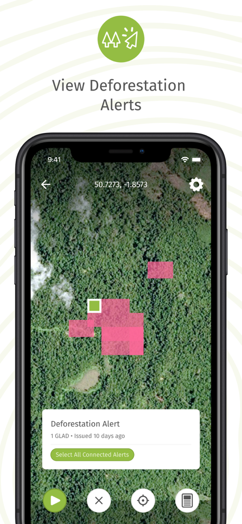
Forest Watcher app displaying a satellite map with pink areas indicating deforestation alerts
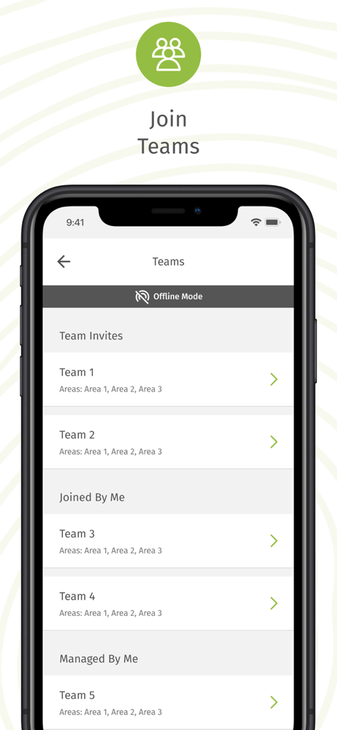
Smartphone screen of the Forest Watcher app showing the teams management interface in offline mode with a list of active conservation teams.
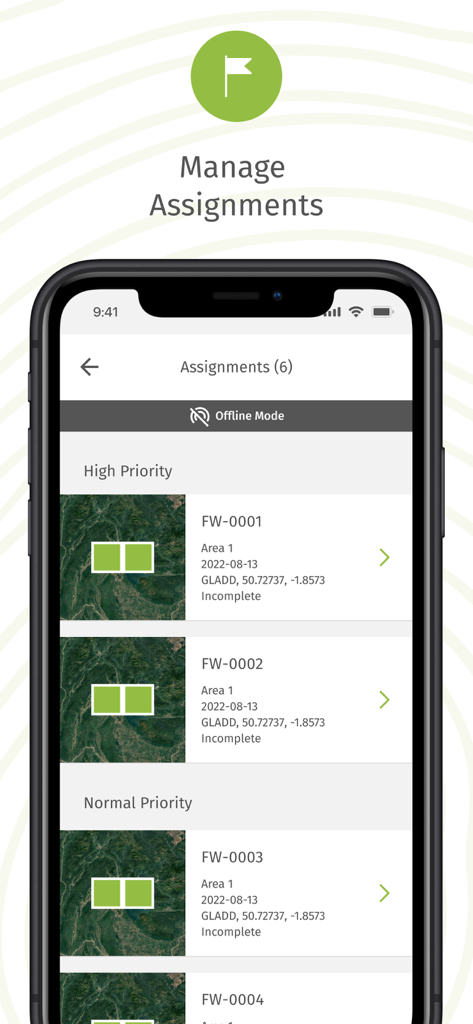
Mobile screen of the Forest Watcher app showing a list of prioritized forest monitoring assignments in offline mode
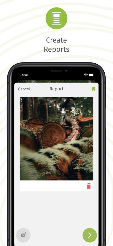
Smartphone screen showing the Forest Watcher app interface for creating a field report with a photo of cut tree logs
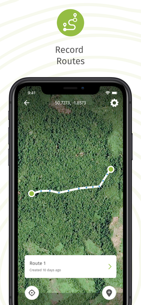
Forest Watcher mobile app interface showing recorded field routes on a satellite map
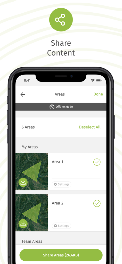
Forest Watcher app interface for sharing selected forest areas while in offline mode
Description
Download
More Like This
Top-ranked apps in the same category

Google Maps
Google LLC

Waze Navigation & Live Traffic
waze

AMap Global
AutoNavi Information Technology Co. Ltd.

百度地图-路线规划,出行必备
Beijing Baidu Netcom Science & Technology Co.,Ltd

Moovit: Bus & Transit Tracker
Moovit App Global LTD

Transit • Subway & Bus Times
9280-0366 Quebec inc.

ParkMobile: Park. Pay. Go.
Parkmobile USA, Inc

腾讯地图-路线规划,导航地铁打车出行
Shenzhen Tencent Computer Systems Company Limited

Île-de-France Mobilités
Ile de France Mobilites
This page is not an official page of the app or its developer, but an independent editorial publication created for informational and commentary purposes. Unless expressly stated otherwise, neither the app nor its developer is affiliated with, endorsed by, sponsored by, authorized by, or otherwise officially connected with MWM, Apple, Google Play, the app publisher, or the app's developer, and nothing on this page implies that the app was developed using MWM's services. Any trademarks, logos, screenshots, and other content remain the property of their respective owners.