This page is not an official page of the app or its developer, but an independent editorial publication created for informational and commentary purposes. Unless expressly stated otherwise, neither the app nor its developer is affiliated with, endorsed by, sponsored by, authorized by, or otherwise officially connected with MWM, Apple, Google Play, the app publisher, or the app's developer, and nothing on this page implies that the app was developed using MWM's services. Any trademarks, logos, screenshots, and other content remain the property of their respective owners.

GPS Altitude&Height tracker
The essential offline toolkit for hikers and mountaineers. Track altitude, air pressure, and your exact location anywhere—then share your summit glory with our stats-stamped watermark camera.
Downloads
80K+User Rating
Total Ratings
1K+Publisher
Category
TravelLocales
2Latest Version
2.0.1Size
16.8 MBFirst Released
Dec 10, 2024Master Every Mountain
Essential precision tools for hikers and explorers to track altitude, stay safe, and share their summit achievements.
Offline Altitude Tracking
Get real-time elevation and GPS data anywhere, even in remote areas without cellular service.
Summit Watermark Camera
Capture your peak moments with automatic altitude and location stamps for instant social proof.
The following screenshots and description are sourced directly from the app's official store listing and are the property of the app developer.
App Store
Screenshots
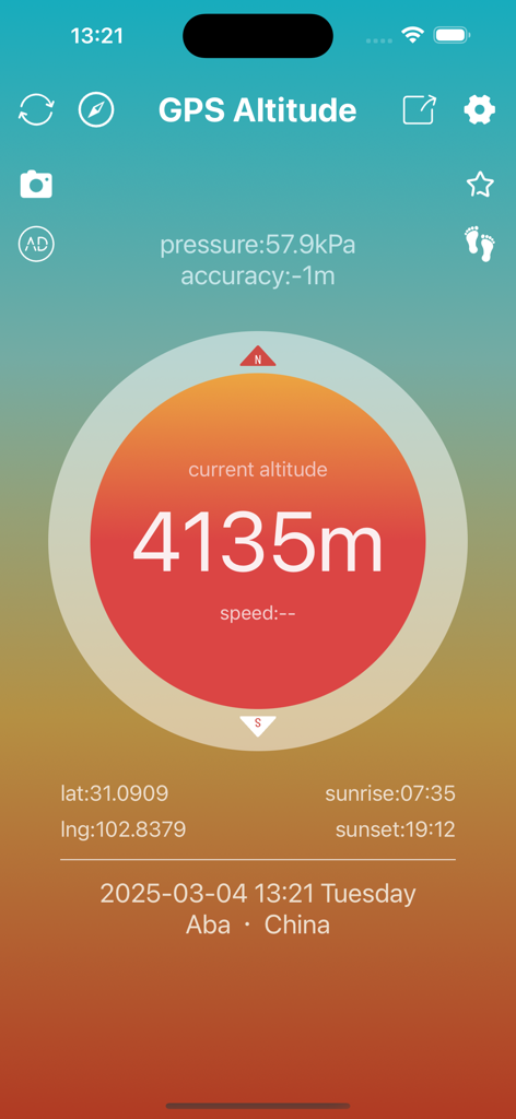
Interface of the GPS Altitude app displaying a current elevation of 4135 meters with pressure and location data
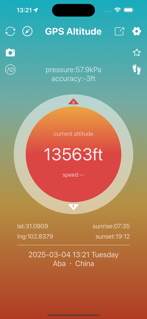
GPS Altitude app interface showing a current elevation of 13563 feet with air pressure and coordinates

Mobile interface of the GPS Altitude tracker app displaying a current height of 4135 meters and location on a topographic map.
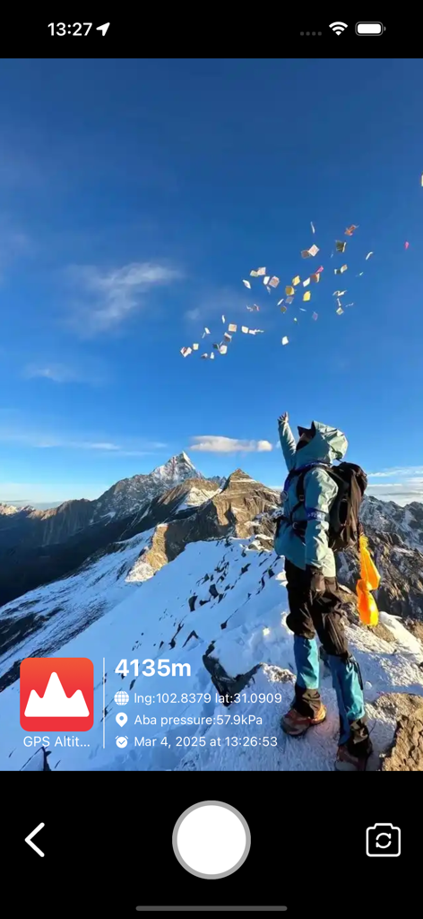
A hiker at a snowy mountain summit with a GPS watermark showing an altitude of 4135 meters and location coordinates.
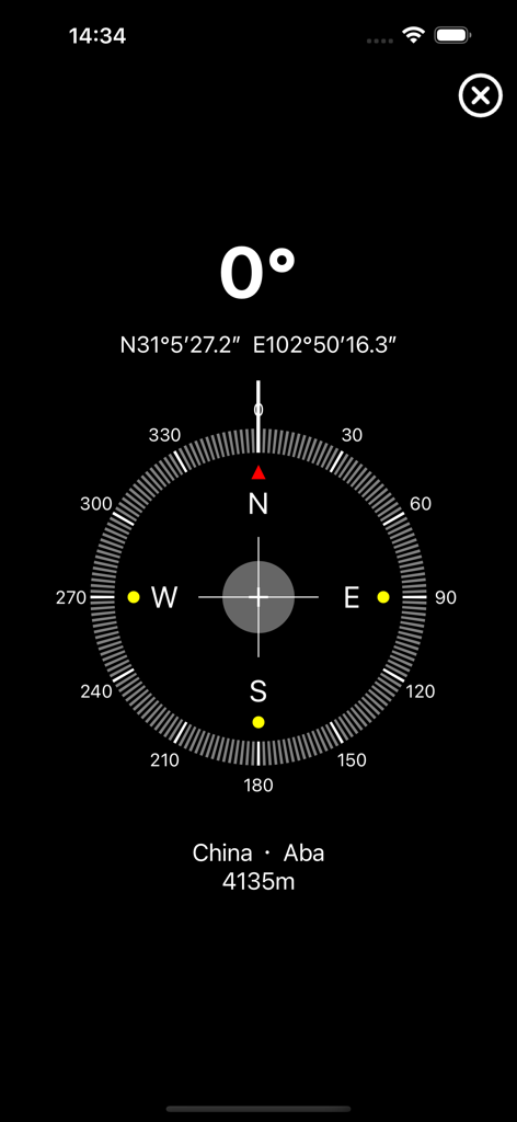
Digital compass interface showing 0 degrees North with GPS coordinates and altitude of 4135 meters
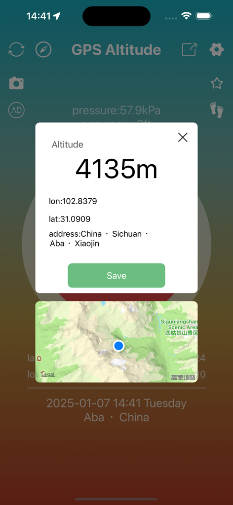
GPS Altitude app interface showing 4135 meters altitude with latitude longitude coordinates and a map location
Description
Download
More Like This
Top-ranked apps in the same category

Uber - Request a ride
Uber Technologies, Inc.

Airbnb
Airbnb, Inc.

铁路12306
ACADEMY OF RAILWAY SCIENCES CO., ltd.

Booking.com: Hotels & Travel
Booking.com B.V.

Grab: Taxi Ride, Food Delivery
GRABTAXI HOLDINGS PTE. LTD.

Trip.com: Book Flights, Hotels
Trip.com Travel Singapore Pte. Ltd.

DiDi China: Ride Hailing
Didi Chuxing (Beijing) Network Platform Technology Co., Ltd

去哪儿旅行-订酒店机票火车票
Beijing Qunar Information Technology Company Limit

Bolt: Request a Ride
BOLT TECHNOLOGY OU
This page is not an official page of the app or its developer, but an independent editorial publication created for informational and commentary purposes. Unless expressly stated otherwise, neither the app nor its developer is affiliated with, endorsed by, sponsored by, authorized by, or otherwise officially connected with MWM, Apple, Google Play, the app publisher, or the app's developer, and nothing on this page implies that the app was developed using MWM's services. Any trademarks, logos, screenshots, and other content remain the property of their respective owners.