This page is not an official page of the app or its developer, but an independent editorial publication created for informational and commentary purposes. Unless expressly stated otherwise, neither the app nor its developer is affiliated with, endorsed by, sponsored by, authorized by, or otherwise officially connected with MWM, Apple, Google Play, the app publisher, or the app's developer, and nothing on this page implies that the app was developed using MWM's services. Any trademarks, logos, screenshots, and other content remain the property of their respective owners.

GPS Coordinates Locator Map
Access instant, high-precision UTM, MGRS, and DMS data. From professional fieldwork to backcountry adventures, measure distances and mark locations with the ultimate geo-positioning tool.
Downloads
64K+User Rating
Total Ratings
200Publisher
Category
NavigationLocales
24Latest Version
1.5.6Size
64.9 MBFirst Released
Nov 4, 2024Precision Tools for Every Mission
From professional fieldwork to off-grid adventures, access high-precision coordinates, measurement tools, and advanced mapping in one powerful interface.
Universal Coordinate Support
Switch instantly between DMS, UTM, and MGRS formats to match your professional mapping or military-grade requirements.
Advanced Mapping Suite
Measure exact distances, calculate areas, and draw custom paths with interactive tools built for surveyors and planners.
Frequently Asked Questions
Everything you need to know about GPS Coordinates Locator Map
What is the GPS Coordinates Locator Map app?
GPS Coordinates Locator Map is an app designed to provide accurate GPS coordinates and latitude longitude instantly, supporting popular formats like DMS, UTM, and MGRS for hikers, travelers, and professionals.
What coordinate formats does GPS Coordinates Locator Map support?
The GPS Coordinates Locator Map app supports Latitude and Longitude, Degrees Minutes Seconds (DMS), Decimal Degrees (DD), DDM, UTM, MGRS, Plus Codes, Geohash, and GEOREF formats. Some advanced formats require a premium subscription.
Can I measure distances and areas with GPS Coordinates Locator Map?
Yes, GPS Coordinates Locator Map features interactive drawing tools and powerful measurement tools. Users can create paths, measure distances, and precisely calculate areas directly on maps.
Does GPS Coordinates Locator Map offer different map views?
Yes, GPS Coordinates Locator Map offers multiple map views, including Standard, Satellite, and Hybrid, to provide better context. Enhanced map types are available with a premium subscription.
How does GPS Coordinates Locator Map help with location sharing?
GPS Coordinates Locator Map includes an 'Easy Location Sharing' feature. Users can instantly share their coordinates in any supported format directly from the app.
Does GPS Coordinates Locator Map have a compass feature?
Yes, GPS Coordinates Locator Map includes a digital compass. This tool allows users to check their current direction and orientation within the app.
How do I convert an address to GPS coordinates using GPS Coordinates Locator Map?
GPS Coordinates Locator Map provides an Address Lookup feature. This functionality converts any given street address into precise GPS points and displays them on the map.
What premium features are available in GPS Coordinates Locator Map?
Premium benefits in GPS Coordinates Locator Map unlock professional formats (MGRS, UTM, Geohash, GEOREF), country flags, enhanced map types, unlimited saves, and an ad-free experience.
How do I manage my subscription for GPS Coordinates Locator Map?
Your GPS Coordinates Locator Map subscription automatically renews. You can manage your subscription preferences and turn off auto-renewal anytime through your account settings.
Where can I find the privacy policy for GPS Coordinates Locator Map?
The privacy policy for GPS Coordinates Locator Map is available at the provided URL: https://www.ankagis.com/gpscoordinates/privacy/.
Can GPS Coordinates Locator Map be used for outdoor activities?
Yes, GPS Coordinates Locator Map is suitable for outdoor activities and adventures. It provides precise positioning and accurate tracking for marking locations on maps, ideal for fieldwork.
Does the GPS Coordinates Locator Map app show location accuracy?
Yes, the GPS Coordinates Locator Map app displays the current Location Accuracy. This information provides a metric of the precision of the GPS data, such as '±50.0 m'.
The following screenshots and description are sourced directly from the app's official store listing and are the property of the app developer.
App Store
Screenshots
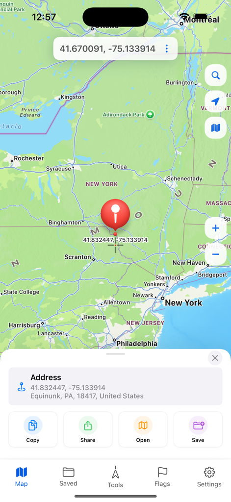
Interface of the GPS Coordinates Locator Map app showing a red location pin with latitude and longitude data on a map of Pennsylvania.
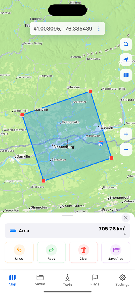
GPS app interface showing area measurement of 705.76 square kilometers on a map
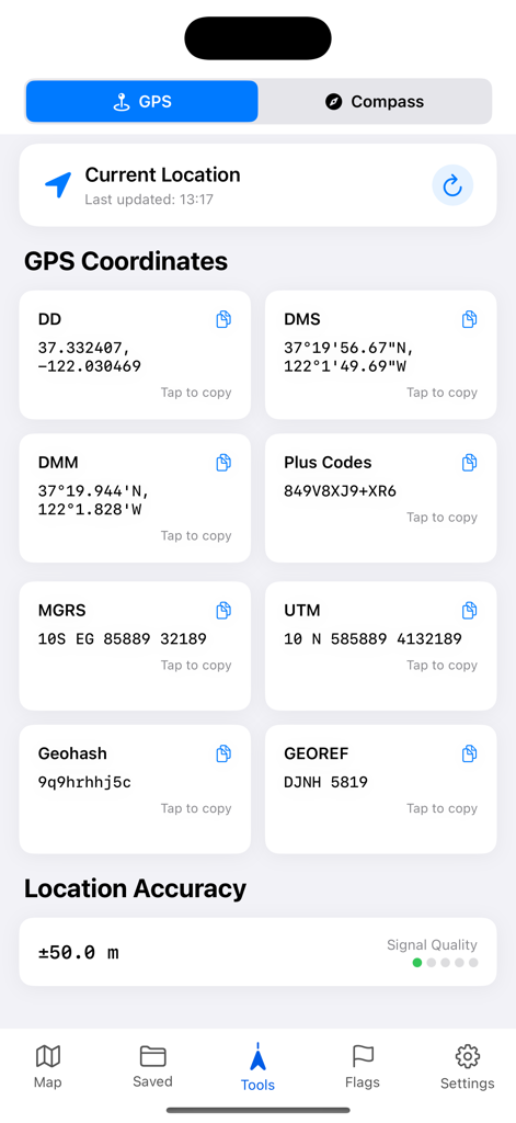
Dashboard showing various GPS coordinate formats including MGRS, UTM, and DMS for precise positioning.
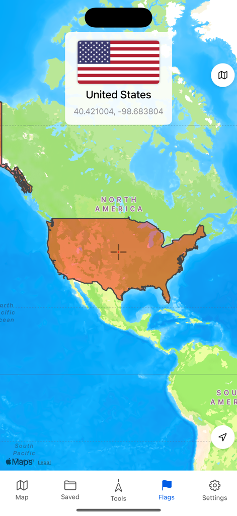
A mobile app interface displaying a map of North America with the United States highlighted and a popup showing the US flag with its central GPS coordinates.
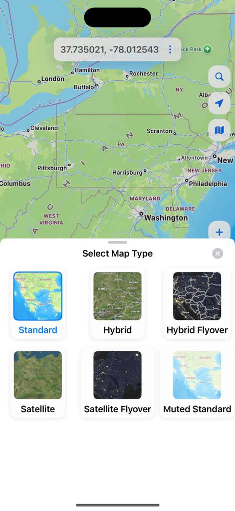
The map type selection interface in the GPS Coordinates Locator app showing standard hybrid and satellite view options
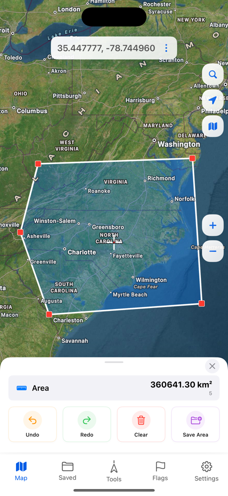
Mobile app interface showing a satellite map with a polygon tool calculating the total area of a region across North Carolina and Virginia
Description
Download
More Like This
Apps with similar features and user experience

what3words: Navigation & Maps
What3Words Limited

Location Changer: Loc Saver
Yassir Hrout

My GPS Coordinates °
MYSTIC MOBILE APPS LLC

Mapstr – Save & Follow Places
Hulab

Save Location GPS
RAYO INNOVATIONS PRIVATE LIMITED

Find My Car
Alexandre Morcos

Punkt AI
ROOOM APP

corner: curate & share places
Corner International, Inc.

Go Terrain
XPLORER
This page is not an official page of the app or its developer, but an independent editorial publication created for informational and commentary purposes. Unless expressly stated otherwise, neither the app nor its developer is affiliated with, endorsed by, sponsored by, authorized by, or otherwise officially connected with MWM, Apple, Google Play, the app publisher, or the app's developer, and nothing on this page implies that the app was developed using MWM's services. Any trademarks, logos, screenshots, and other content remain the property of their respective owners.