This page is not an official page of the app or its developer, but an independent editorial publication created for informational and commentary purposes. Unless expressly stated otherwise, neither the app nor its developer is affiliated with, endorsed by, sponsored by, authorized by, or otherwise officially connected with MWM, Apple, Google Play, the app publisher, or the app's developer, and nothing on this page implies that the app was developed using MWM's services. Any trademarks, logos, screenshots, and other content remain the property of their respective owners.

GPS Land Area Measure Live
The essential GPS tool for farmers and real estate professionals. Measure boundaries, calculate acreage, and convert units instantly with professional-grade accuracy right from your iPhone.
Downloads
25K+User Rating
Total Ratings
0Publisher
Category
NavigationLocales
1Latest Version
1.0.3Size
51.0 MBFirst Released
Jan 9, 2025Master Your Land with Professional Precision
The ultimate GPS toolkit for farmers, real estate agents, and property owners to measure boundaries and calculate acreage instantly.
Live Boundary Tracking
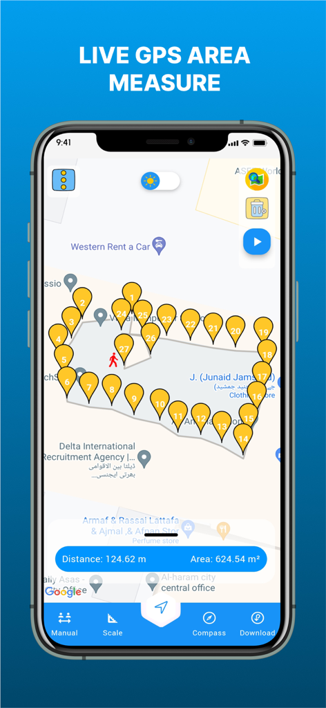
Walk your property lines to map areas in real-time with high-accuracy GPS tracking, perfect for fencing and field mapping.
Smart Manual Mapping
Drop precise pins on interactive maps to calculate land size for listings or development projects directly from your device.
The following screenshots and description are sourced directly from the app's official store listing and are the property of the app developer.
App Store
Screenshots
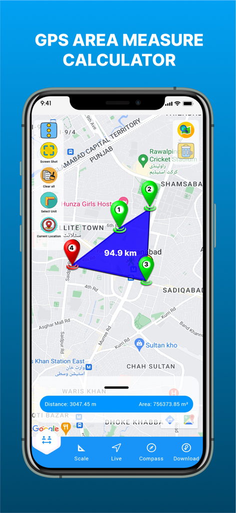
Interface of the GPS Land Area Measure Live app showing a measured polygonal area on a map with distance and square meter results.
GPS Land Area Measure Live app screenshot showing a map with pins calculating land area and distance
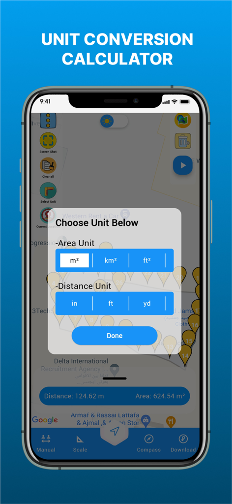
GPS Land Area Measure app showing area and distance unit conversion options on a map
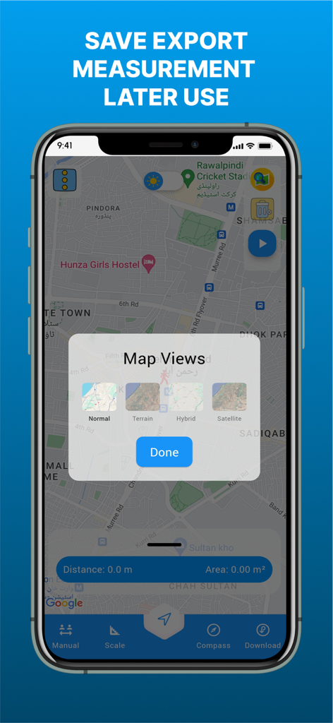
Interface of the GPS Land Area Measure Live app showing different map view settings like satellite and terrain
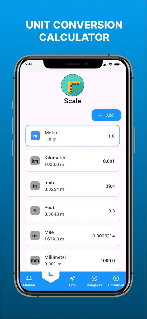
Unit conversion tool within the GPS Land Area Measure app showing length measurements in meters kilometers inches feet and miles
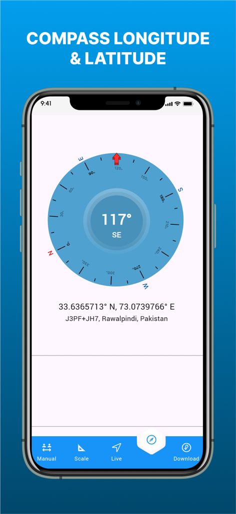
Digital compass showing longitude and latitude coordinates in the GPS Land Area Measure app
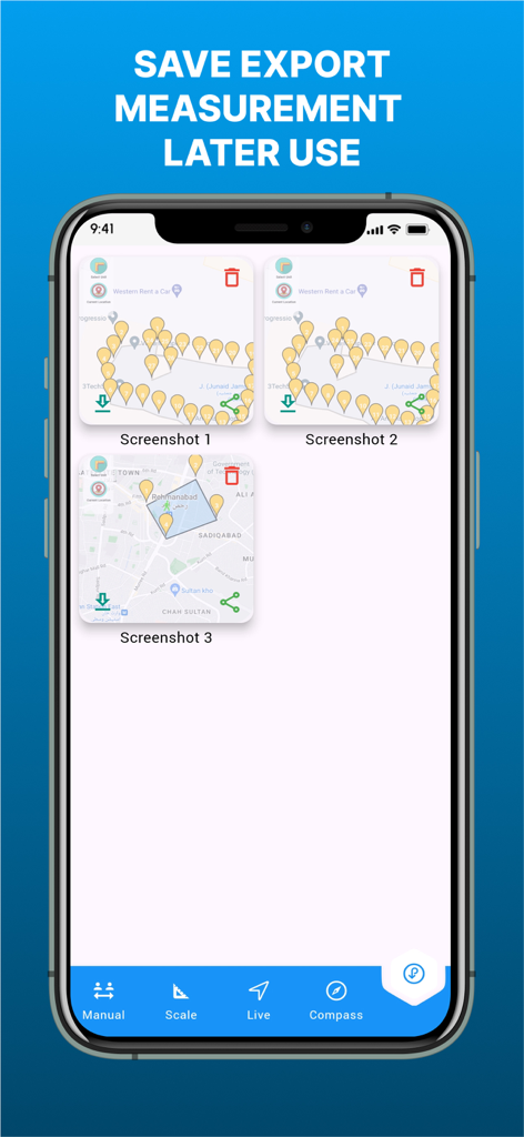
Saved map measurements and export interface in the GPS Land Area Measure app
Description
Download
More Like This
Top-ranked apps in the same category

Google Maps
Google LLC

AMap Global
AutoNavi Information Technology Co. Ltd.

Waze Navigation & Live Traffic
waze

百度地图-路线规划,出行必备
Beijing Baidu Netcom Science & Technology Co.,Ltd

Moovit: Bus & Transit Tracker
Moovit App Global LTD

Transit • Subway & Bus Times
9280-0366 Quebec inc.

ParkMobile: Park. Pay. Go.
Parkmobile USA, Inc

腾讯地图-路线规划,导航地铁打车出行
Shenzhen Tencent Computer Systems Company Limited

MapXplorer: Map Radar Navigate
GOLDLAB APPLICATIONS YAZILIM VE BILISIM ANONIM SIRKETI
This page is not an official page of the app or its developer, but an independent editorial publication created for informational and commentary purposes. Unless expressly stated otherwise, neither the app nor its developer is affiliated with, endorsed by, sponsored by, authorized by, or otherwise officially connected with MWM, Apple, Google Play, the app publisher, or the app's developer, and nothing on this page implies that the app was developed using MWM's services. Any trademarks, logos, screenshots, and other content remain the property of their respective owners.