This page is not an official page of the app or its developer, but an independent editorial publication created for informational and commentary purposes. Unless expressly stated otherwise, neither the app nor its developer is affiliated with, endorsed by, sponsored by, authorized by, or otherwise officially connected with MWM, Apple, Google Play, the app publisher, or the app's developer, and nothing on this page implies that the app was developed using MWM's services. Any trademarks, logos, screenshots, and other content remain the property of their respective owners.

GPS Map Camera – Time Stamp
Automatically embed live GPS coordinates, addresses, and timestamps into your photos. Whether for site documentation or trail tracking, capture every detail with professional-grade accuracy.
Downloads
0User Rating
Total Ratings
0Publisher
Category
NavigationLocales
11Latest Version
1.0.10Size
32.5 MBFirst Released
Feb 6, 2025Precision Documentation for Every Mission
Whether you are securing a job site or conquering a peak, our GPS-integrated camera turns every photo into a detailed, data-driven record that proves exactly where and when you were there.
Business-Grade Proof
Generate instant accountability with automatic address, GPS coordinates, and timestamps for professional construction, insurance, and real estate reports.
Explorer’s Dashboard
Capture the full context of your journey with live altitude, compass direction, and real-time weather data layered directly onto every shot.
The following screenshots and description are sourced directly from the app's official store listing and are the property of the app developer.
App Store
Screenshots
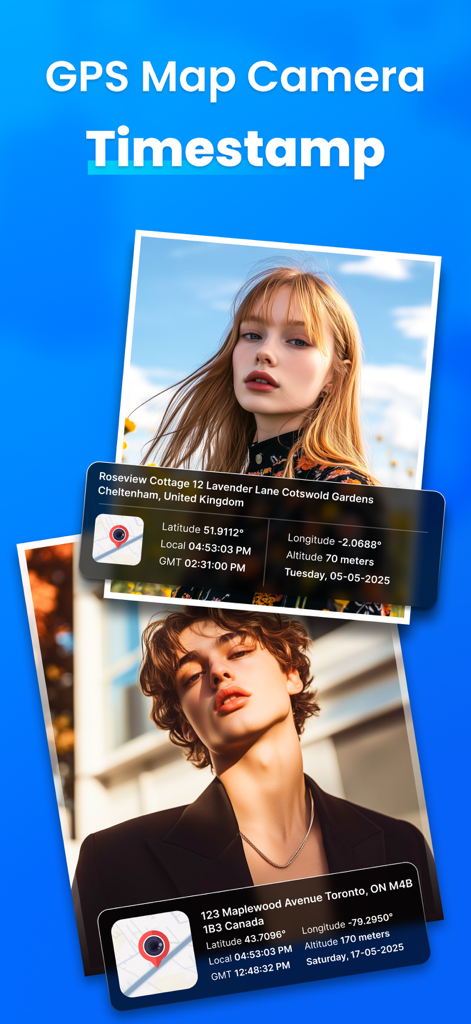
Screenshot of GPS Map Camera app showing photos with integrated location data timestamp and map overlays
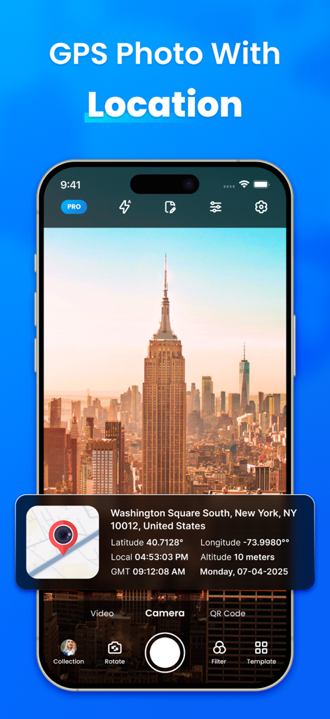
A screenshot of the GPS Map Camera app displaying a photo of the New York City skyline with an overlay showing the exact address, GPS coordinates, and timestamp.
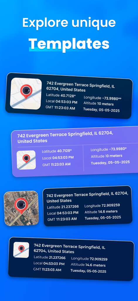
A variety of customizable GPS location and timestamp templates for photo documentation including map coordinates and street addresses.
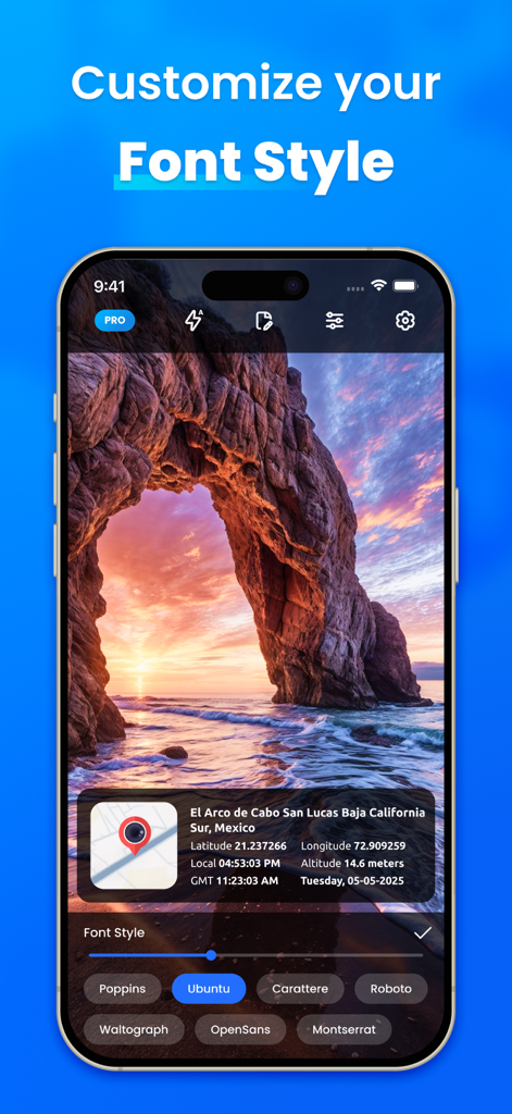
Mobile app interface showing font style customization options for GPS location and time stamp overlays on a photo
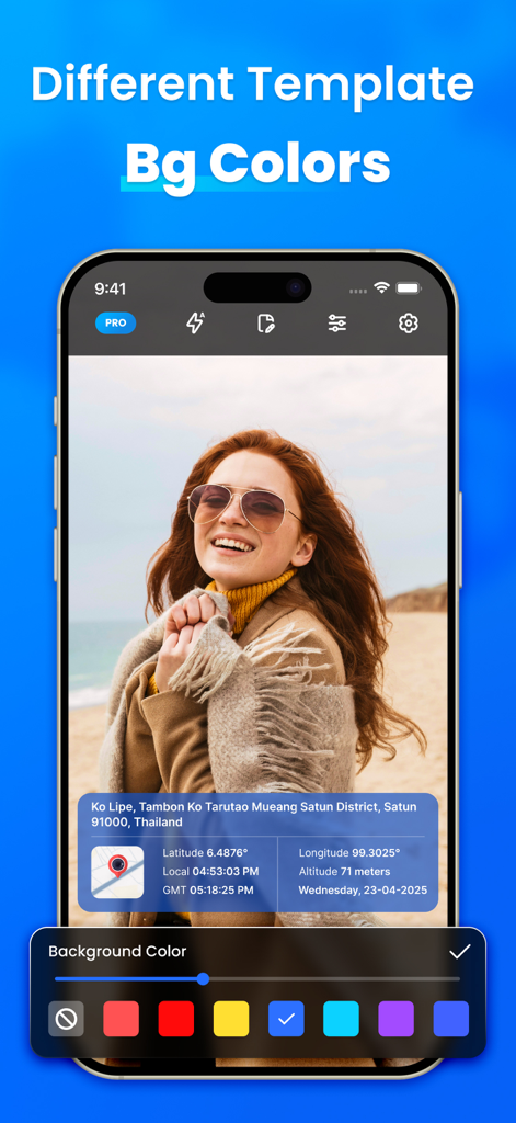
A screenshot of the GPS Map Camera app interface showing options to change the background color of the location data template overlay on a photo.
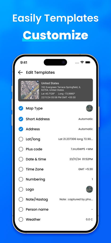
A mobile interface for customizing photo templates with GPS data including address coordinates and timestamps
Description
Download
More Like This
Top-ranked apps in the same category

Google Maps
Google LLC

AMap Global
AutoNavi Information Technology Co. Ltd.

Waze Navigation & Live Traffic
waze

百度地图-路线规划,出行必备
Beijing Baidu Netcom Science & Technology Co.,Ltd

Moovit: Bus & Transit Tracker
Moovit App Global LTD

Transit • Subway & Bus Times
9280-0366 Quebec inc.

MapXplorer: Map Radar Navigate
GOLDLAB APPLICATIONS YAZILIM VE BILISIM ANONIM SIRKETI

腾讯地图-路线规划,导航地铁打车出行
Shenzhen Tencent Computer Systems Company Limited

ParkMobile: Park. Pay. Go.
Parkmobile USA, Inc
This page is not an official page of the app or its developer, but an independent editorial publication created for informational and commentary purposes. Unless expressly stated otherwise, neither the app nor its developer is affiliated with, endorsed by, sponsored by, authorized by, or otherwise officially connected with MWM, Apple, Google Play, the app publisher, or the app's developer, and nothing on this page implies that the app was developed using MWM's services. Any trademarks, logos, screenshots, and other content remain the property of their respective owners.