This page is not an official page of the app or its developer, but an independent editorial publication created for informational and commentary purposes. Unless expressly stated otherwise, neither the app nor its developer is affiliated with, endorsed by, sponsored by, authorized by, or otherwise officially connected with MWM, Apple, Google Play, the app publisher, or the app's developer, and nothing on this page implies that the app was developed using MWM's services. Any trademarks, logos, screenshots, and other content remain the property of their respective owners.

GPS海拔高度-海拔高度表,元地球海拔-户外打卡-海拔测量仪
Conquer every peak with precision tracking for altitude, oxygen levels, and barometric pressure. Designed for hikers and overlanders, it works anywhere—no cellular signal required.
Downloads
1M+User Rating
Total Ratings
63K+Publisher
Category
TravelLocales
1Latest Version
1.2.7Size
46.7 MBFirst Released
Oct 13, 2020Master Every Elevation
Professional-grade altitude tracking, safety alerts, and environmental data for your most ambitious off-grid adventures.
Precision Offline Altimeter
Get accurate elevation, coordinates, and barometric pressure data even when you are miles away from cell service.
Real-Time Safety Metrics
Monitor oxygen levels and atmospheric pressure to stay ahead of altitude sickness during steep Western mountain ascents.
The following screenshots and description are sourced directly from the app's official store listing and are the property of the app developer.
App Store
Screenshots
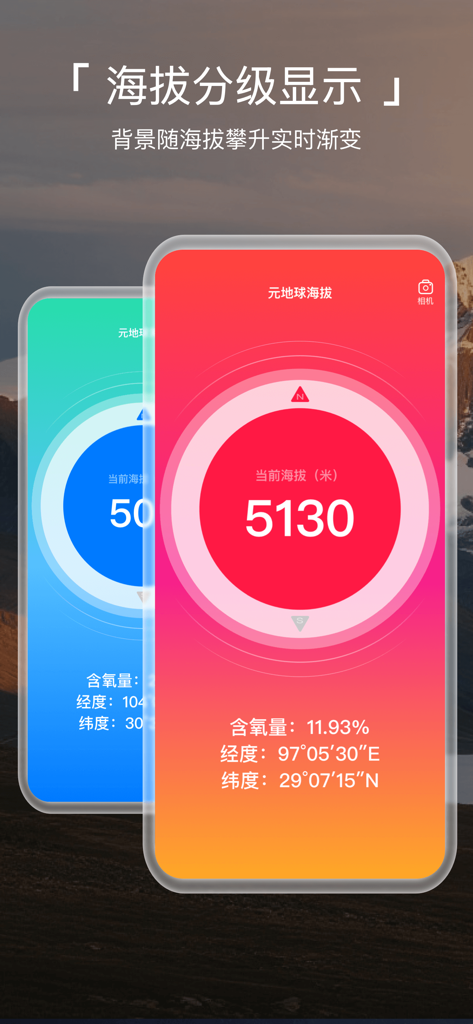
Meta Earth Altimeter app showing high altitude measurement with oxygen levels and GPS coordinates
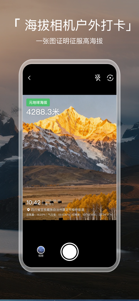
Meta Earth Altimeter app watermark camera displaying a mountain peak with altitude and coordinate overlays
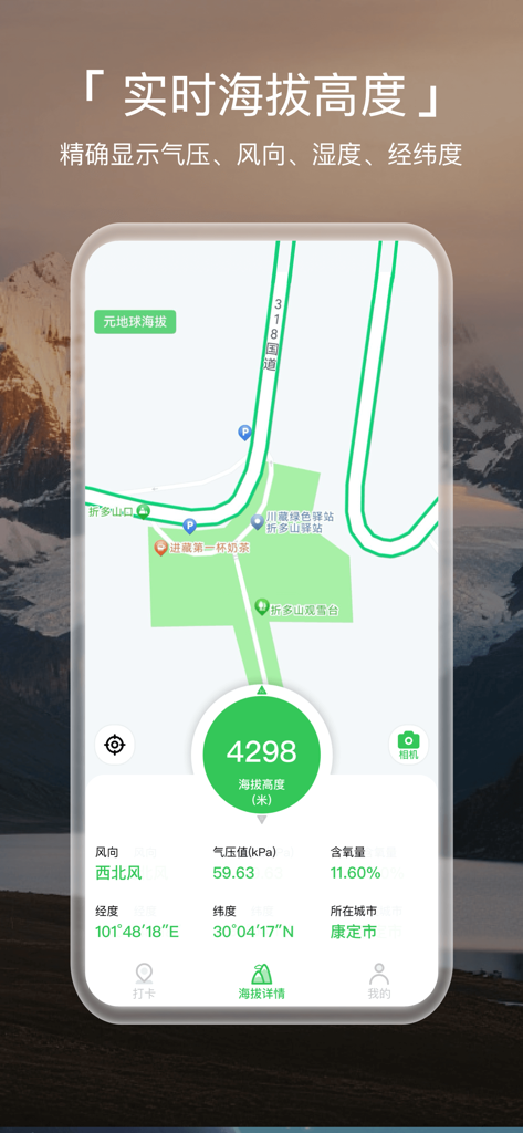
Mobile app interface showing real-time altitude, oxygen levels, and geographic coordinates.
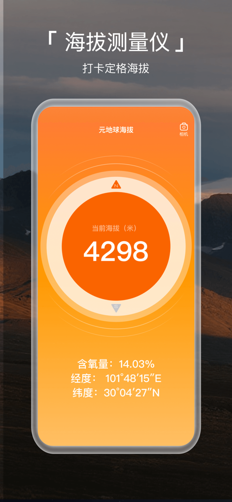
Mobile app interface displaying an altitude of 4298 meters with oxygen level and GPS coordinates against a mountain background
Description
Download
More Like This
Apps with similar features and user experience

This page is not an official page of the app or its developer, but an independent editorial publication created for informational and commentary purposes. Unless expressly stated otherwise, neither the app nor its developer is affiliated with, endorsed by, sponsored by, authorized by, or otherwise officially connected with MWM, Apple, Google Play, the app publisher, or the app's developer, and nothing on this page implies that the app was developed using MWM's services. Any trademarks, logos, screenshots, and other content remain the property of their respective owners.