This page is not an official page of the app or its developer, but an independent editorial publication created for informational and commentary purposes. Unless expressly stated otherwise, neither the app nor its developer is affiliated with, endorsed by, sponsored by, authorized by, or otherwise officially connected with MWM, Apple, Google Play, the app publisher, or the app's developer, and nothing on this page implies that the app was developed using MWM's services. Any trademarks, logos, screenshots, and other content remain the property of their respective owners.

HemsWX
Gain the visual ground truth with real-time weather cameras and localized sensor data. Built for HEMS, SAR, and emergency services to ensure safe flight decisions in the most volatile environments.
Downloads
32K+User Rating
Total Ratings
0Publisher
Category
WeatherLocales
4Latest Version
7.1.3Size
140.4 MBFirst Released
Jul 7, 2016Elevate Mission Safety with Ground Truth
HemsWX provides professional pilots and emergency teams with real-time visual and meteorological data for high-stakes aviation planning and critical decision-making.
Live Weather Camera Network
Eliminate uncertainty by accessing a dedicated network of webcams to verify ceiling height and visibility at remote landing sites.
Hyper-Local Sensor Data
Get precise, ground-level pressure and temperature measurements essential for calculating density altitude and helicopter performance.
The following screenshots and description are sourced directly from the app's official store listing and are the property of the app developer.
App Store
Screenshots
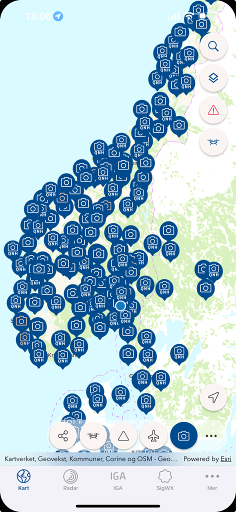
Interactive map in the HemsWX app showing a dense network of aviation weather cameras and QNH pressure stations
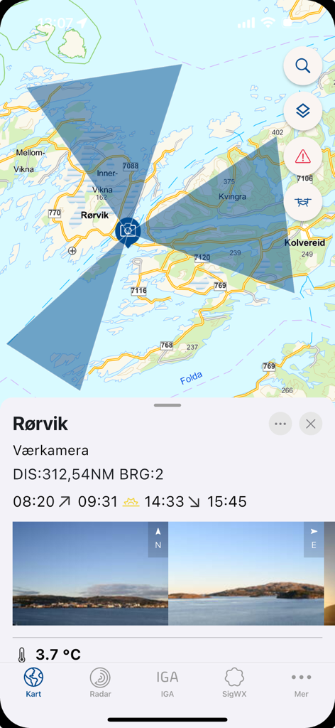
HemsWX mobile app displaying a map with weather camera coverage and live images.
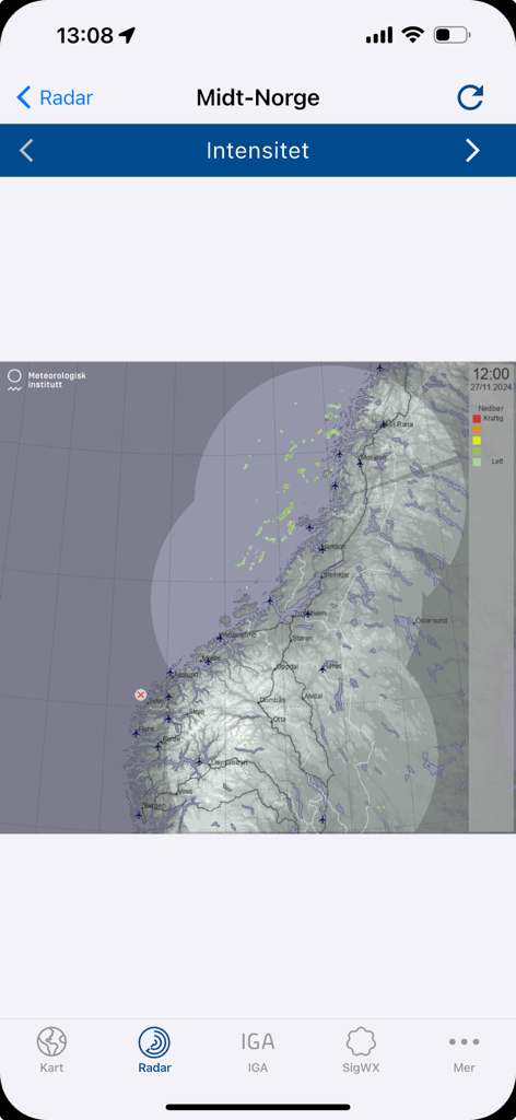
HemsWX app interface showing a weather radar map for Central Norway with precipitation intensity data for pilots

Professional meteorological analysis map with isobars and weather fronts for aviation planning
Description
Download
More Like This
Top-ranked apps in the same category

墨迹天气-MojiWeather
Beijing MojiFengyun Technology Co.,Ltd.

The Weather Channel - Radar
The Weather Channel

Windy.com
Windyty, SE

天气预报-精准15日天气预报
Chongqing Caochen Technology Co., Ltd.

My Aurora Forecast & Alerts
JRustonApps B.V.

AccuWeather: Weather Forecast
AccuWeather International, Inc.

Weather & Radar - Storm radar
WetterOnline - Meteorologische Dienstleistungen GmbH

天气通
Weibo Internet Technology (China) Co.Ltd.

The Thermometer -Digital-
Vida Apps Incorporated
This page is not an official page of the app or its developer, but an independent editorial publication created for informational and commentary purposes. Unless expressly stated otherwise, neither the app nor its developer is affiliated with, endorsed by, sponsored by, authorized by, or otherwise officially connected with MWM, Apple, Google Play, the app publisher, or the app's developer, and nothing on this page implies that the app was developed using MWM's services. Any trademarks, logos, screenshots, and other content remain the property of their respective owners.