This page is not an official page of the app or its developer, but an independent editorial publication created for informational and commentary purposes. Unless expressly stated otherwise, neither the app nor its developer is affiliated with, endorsed by, sponsored by, authorized by, or otherwise officially connected with MWM, Apple, Google Play, the app publisher, or the app's developer, and nothing on this page implies that the app was developed using MWM's services. Any trademarks, logos, screenshots, and other content remain the property of their respective owners.

Highpointer
The ultimate companion to research, plan, and track your progress across America’s highest elevations. From scenic drives to back-country climbs, start your quest to 50/50 today.
Downloads
0User Rating
Total Ratings
0Publisher
Category
TravelLocales
1Latest Version
1.10Size
130.6 MBFirst Released
Oct 5, 2022Master the 50 State Highpoints
From casual drive-ups to extreme alpine summits, Highpointer provides the essential data and tracking tools to help you complete America's most iconic peak-bagging challenge.
Research and Plan Every Trip
Get vital details for all 50 states, from easy roadside hills to technical mountain peaks, so you always know what to expect before you hit the trail.
Track Your Path to 50/50
Satisfy your inner completionist by tagging summits and monitoring your progress as you work your way through every highpoint in the USA.
The following screenshots and description are sourced directly from the app's official store listing and are the property of the app developer.
App Store
Screenshots
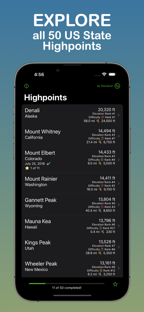
A mobile app interface showing a ranked list of US state highpoints like Denali and Mount Whitney with elevation details and completion progress
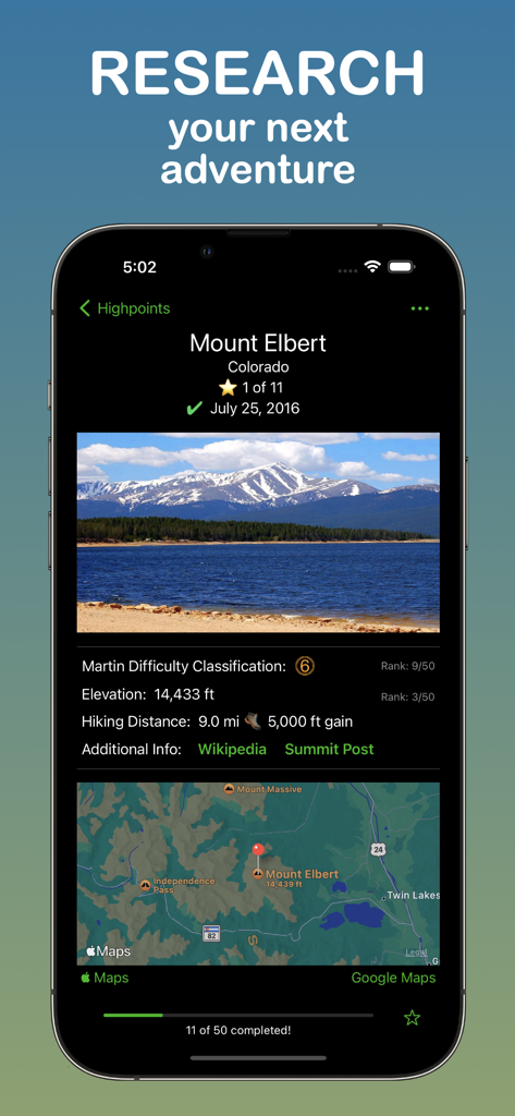
Research page for Mount Elbert in Colorado on the Highpointer app showing elevation and hiking details
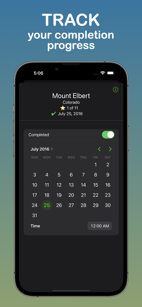
Highpointer app interface showing a completion progress tracker and calendar for marking the date a state highpoint was reached
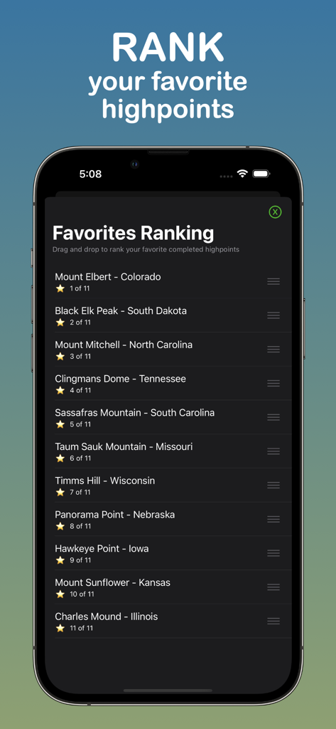
Favorites Ranking screen in the Highpointer app showing a personalized list of completed US state highpoints.
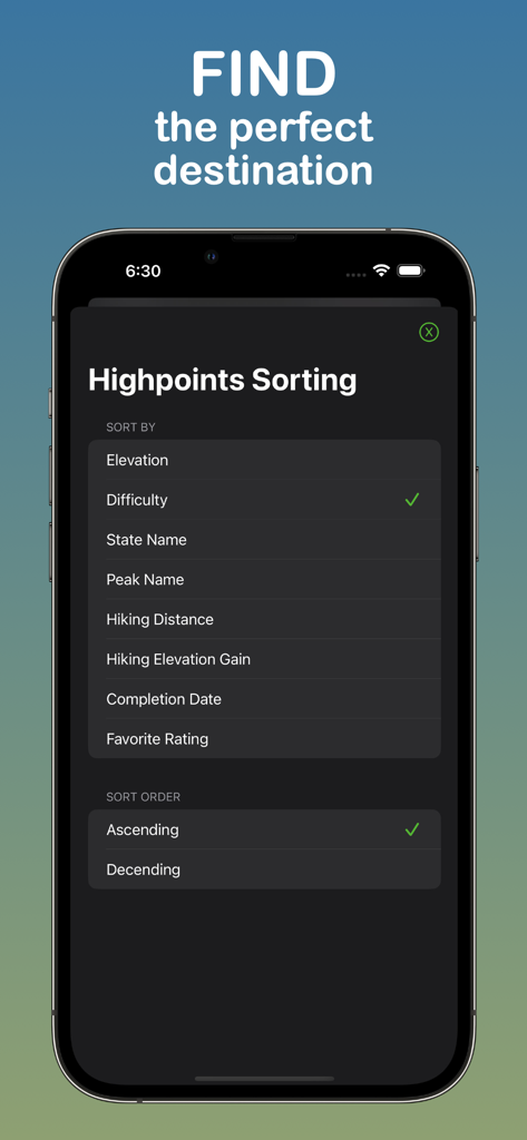
Highpointer app interface showing sorting options for state highpoints including difficulty elevation and hiking distance
Description
Download
More Like This
Top-ranked apps in the same category

Uber - Request a ride
Uber Technologies, Inc.

铁路12306
ACADEMY OF RAILWAY SCIENCES CO., ltd.

Airbnb
Airbnb, Inc.

Booking.com: Hotels & Travel
Booking.com B.V.

Grab: Taxi Ride, Food Delivery
GRABTAXI HOLDINGS PTE. LTD.

DiDi China: Ride Hailing
Didi Chuxing (Beijing) Network Platform Technology Co., Ltd

Bolt: Request a Ride
BOLT TECHNOLOGY OU

Trip.com: Book Flights, Hotels
Trip.com Travel Singapore Pte. Ltd.

去哪儿旅行-订酒店机票火车票
Beijing Qunar Information Technology Company Limit
This page is not an official page of the app or its developer, but an independent editorial publication created for informational and commentary purposes. Unless expressly stated otherwise, neither the app nor its developer is affiliated with, endorsed by, sponsored by, authorized by, or otherwise officially connected with MWM, Apple, Google Play, the app publisher, or the app's developer, and nothing on this page implies that the app was developed using MWM's services. Any trademarks, logos, screenshots, and other content remain the property of their respective owners.