This page is not an official page of the app or its developer, but an independent editorial publication created for informational and commentary purposes. Unless expressly stated otherwise, neither the app nor its developer is affiliated with, endorsed by, sponsored by, authorized by, or otherwise officially connected with MWM, Apple, Google Play, the app publisher, or the app's developer, and nothing on this page implies that the app was developed using MWM's services. Any trademarks, logos, screenshots, and other content remain the property of their respective owners.

HKF Outdoor
Experience the legendary precision of Kümmerly+Frey cartography. Navigate with confidence using offline maps, slope overlays, and expert tour planning designed for those who demand accuracy where the pavement ends.
Downloads
6K+User Rating
Total Ratings
100Publisher
Category
NavigationLocales
2Latest Version
6.3.2Size
118.0 MBFirst Released
Jan 22, 2020Master Every Trail with Swiss Precision
Bring the legendary detail of Hallwag Kümmerly+Frey cartography to your digital device. Designed for meticulous planners who demand professional-grade reliability over crowdsourced data.
Professional Map Quality
Experience the clarity of genuine Kümmerly+Frey hiking maps. Our high-resolution interface mirrors the trusted legibility of traditional paper maps for effortless orientation.
Absolute Offline Reliability
Navigate with confidence in remote wilderness or deep alpine valleys. Download high-detail maps and recorded tours to ensure you never lose your way, even without a cell signal.
The following screenshots and description are sourced directly from the app's official store listing and are the property of the app developer.
App Store
Screenshots
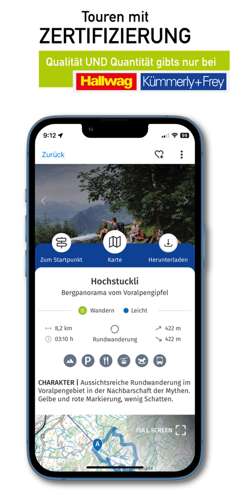
HKF Outdoor app interface showing a certified hiking tour for Hochstuckli with route statistics and professional topographic map
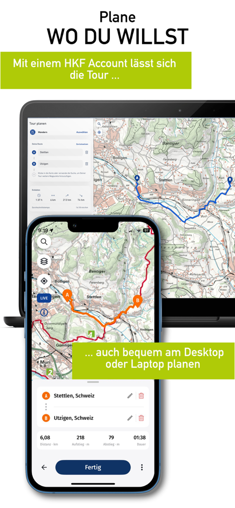
HKF Outdoor route planning synchronized between laptop and smartphone.
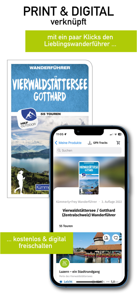
HKF Outdoor mobile app interface showing digital activation of a physical Swiss hiking guide.
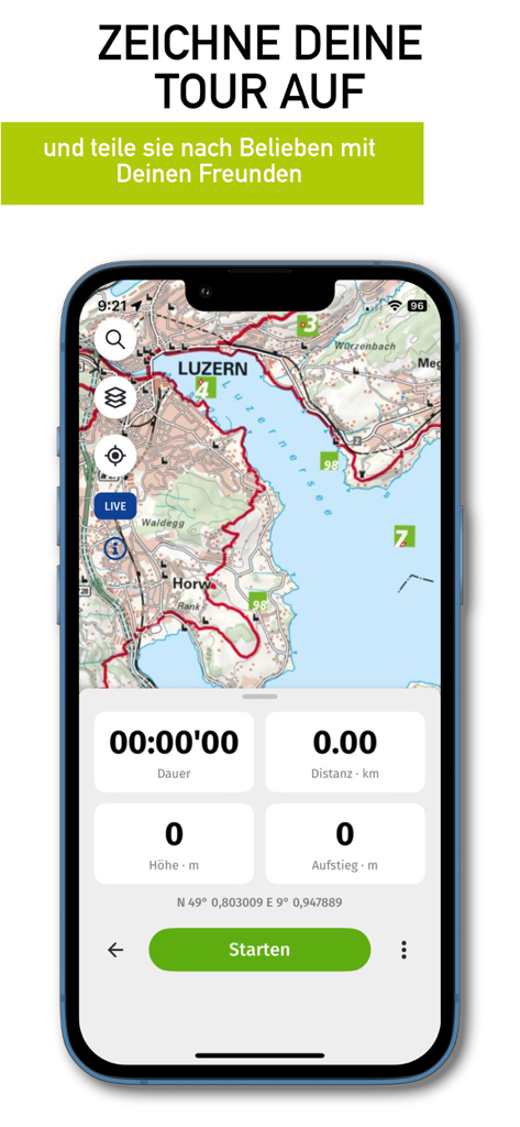
HKF Outdoor app screenshot showing a detailed hiking map of Luzern with a tour tracking dashboard and start button
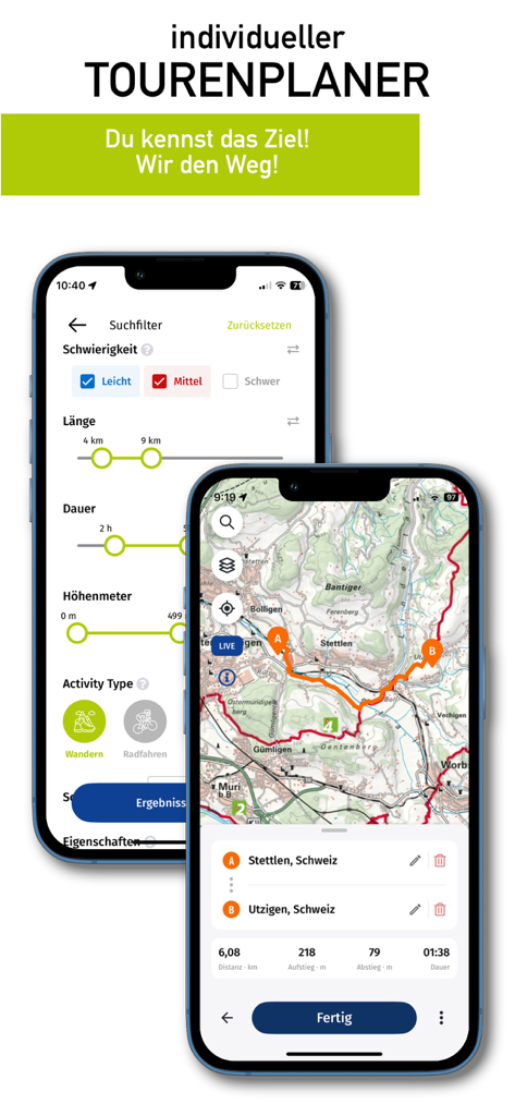
HKF Outdoor app interface showing search filters for hiking and a topographic map route in Switzerland
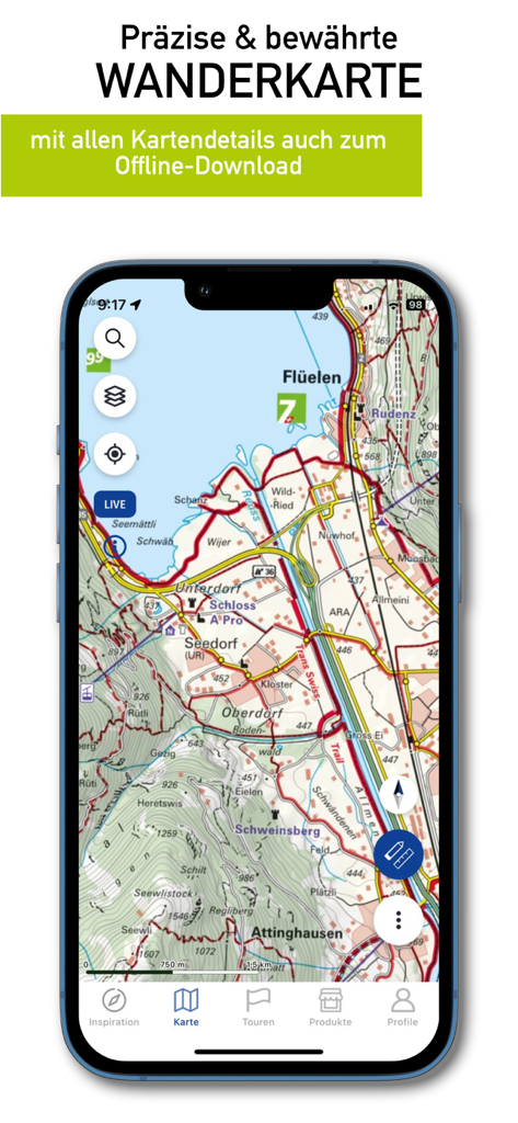
HKF Outdoor app displaying a detailed professional hiking map of Switzerland with offline download options
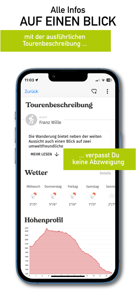
HKF Outdoor mobile app screen with tour description weather icons and elevation profile chart
Description
Download
More Like This
Top-ranked apps in the same category

Google Maps
Google LLC

Waze Navigation & Live Traffic
waze

AMap Global
AutoNavi Information Technology Co. Ltd.

百度地图-路线规划,出行必备
Beijing Baidu Netcom Science & Technology Co.,Ltd

Moovit: Bus & Transit Tracker
Moovit App Global LTD

Transit • Subway & Bus Times
9280-0366 Quebec inc.

ParkMobile: Park. Pay. Go.
Parkmobile USA, Inc

腾讯地图-路线规划,导航地铁打车出行
Shenzhen Tencent Computer Systems Company Limited

Île-de-France Mobilités
Ile de France Mobilites
This page is not an official page of the app or its developer, but an independent editorial publication created for informational and commentary purposes. Unless expressly stated otherwise, neither the app nor its developer is affiliated with, endorsed by, sponsored by, authorized by, or otherwise officially connected with MWM, Apple, Google Play, the app publisher, or the app's developer, and nothing on this page implies that the app was developed using MWM's services. Any trademarks, logos, screenshots, and other content remain the property of their respective owners.