This page is not an official page of the app or its developer, but an independent editorial publication created for informational and commentary purposes. Unless expressly stated otherwise, neither the app nor its developer is affiliated with, endorsed by, sponsored by, authorized by, or otherwise officially connected with MWM, Apple, Google Play, the app publisher, or the app's developer, and nothing on this page implies that the app was developed using MWM's services. Any trademarks, logos, screenshots, and other content remain the property of their respective owners.

户外高度表-指南针经纬度测量
The ultimate toolkit for the modern explorer. Track your exact altitude, monitor atmospheric pressure for safety, and capture your achievements with data-watermarked photos of every summit.
Downloads
3K+User Rating
Total Ratings
100Publisher
Category
NavigationLocales
2Latest Version
1.0.1Size
38.8 MBFirst Released
Sep 11, 2024Elevate Your Adventure
The all-in-one digital dashboard for modern explorers. From precision altitude tracking to social-ready summit photos, we provide the data you need to explore with confidence.
High-Precision Altimeter
Access real-time elevation and GPS coordinates using advanced satellite technology, perfect for peak bagging and backcountry navigation.
Adventure Watermark Camera
Turn your photos into trophies. Automatically overlay altitude and location data on your shots to share your achievements with the world.
The following screenshots and description are sourced directly from the app's official store listing and are the property of the app developer.
App Store
Screenshots
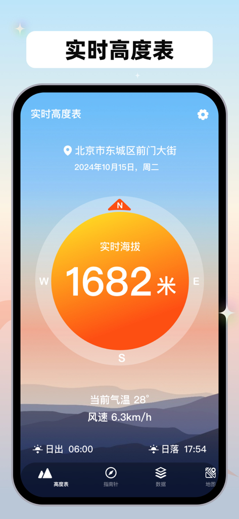
A mobile app interface of the Outdoor Altimeter app showing a real time elevation of 1682 meters with weather and location details
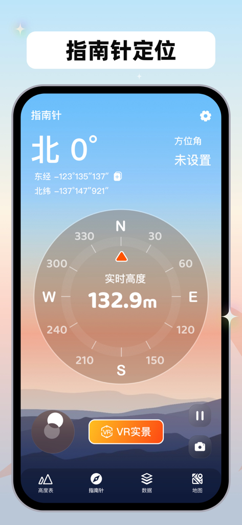
Compass interface of the Outdoor Altimeter app displaying 0 degrees North, GPS coordinates, and a real-time altitude of 132.9 meters over a mountain landscape background.
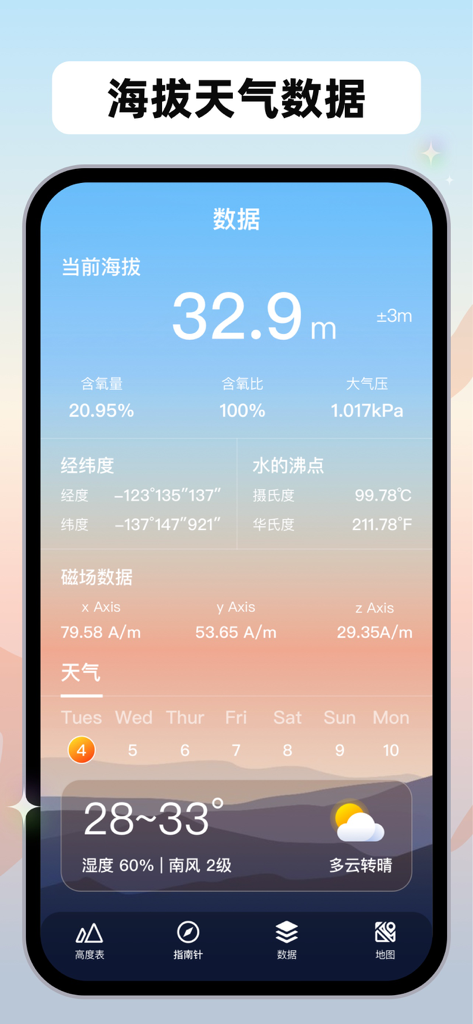
Outdoor altimeter app screen displaying altitude, air pressure, coordinates, and weather forecast.
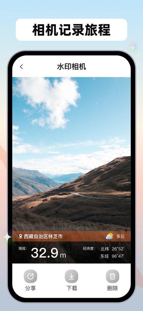
Outdoor altimeter app watermark camera interface displaying a scenic mountain view with altitude and GPS data
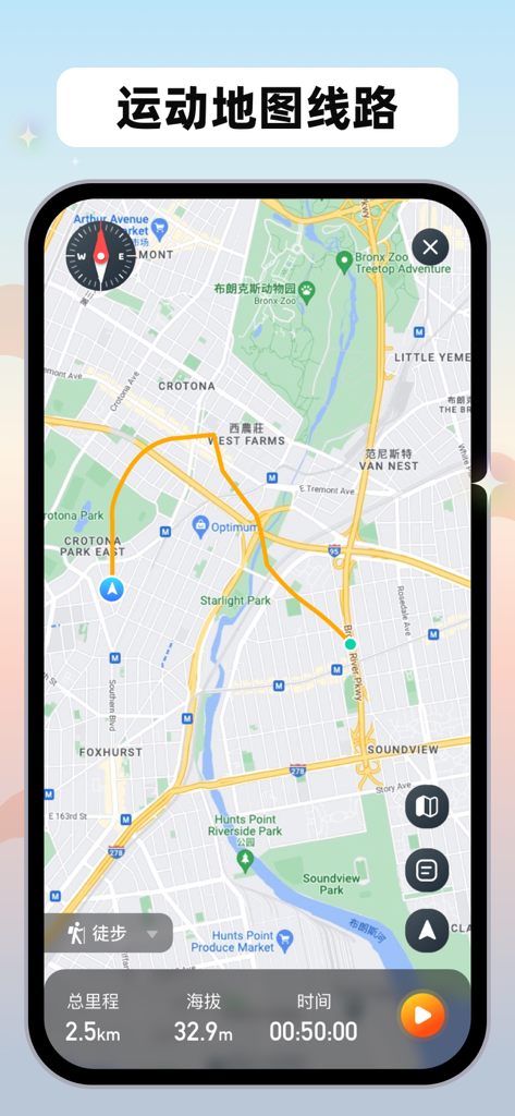
A mobile app screen displaying a tracked hiking route on a map with altitude and distance metrics
Description
Download
More Like This
Top-ranked apps in the same category

Google Maps
Google LLC

AMap Global
AutoNavi Information Technology Co. Ltd.

Waze Navigation & Live Traffic
waze

百度地图-路线规划,出行必备
Beijing Baidu Netcom Science & Technology Co.,Ltd

Moovit: Bus & Transit Tracker
Moovit App Global LTD

Transit • Subway & Bus Times
9280-0366 Quebec inc.

ParkMobile: Park. Pay. Go.
Parkmobile USA, Inc

腾讯地图-路线规划,导航地铁打车出行
Shenzhen Tencent Computer Systems Company Limited

MapXplorer: Map Radar Navigate
GOLDLAB APPLICATIONS YAZILIM VE BILISIM ANONIM SIRKETI
This page is not an official page of the app or its developer, but an independent editorial publication created for informational and commentary purposes. Unless expressly stated otherwise, neither the app nor its developer is affiliated with, endorsed by, sponsored by, authorized by, or otherwise officially connected with MWM, Apple, Google Play, the app publisher, or the app's developer, and nothing on this page implies that the app was developed using MWM's services. Any trademarks, logos, screenshots, and other content remain the property of their respective owners.