This page is not an official page of the app or its developer, but an independent editorial publication created for informational and commentary purposes. Unless expressly stated otherwise, neither the app nor its developer is affiliated with, endorsed by, sponsored by, authorized by, or otherwise officially connected with MWM, Apple, Google Play, the app publisher, or the app's developer, and nothing on this page implies that the app was developed using MWM's services. Any trademarks, logos, screenshots, and other content remain the property of their respective owners.

iGlide Pro
The ultimate digital cockpit for glider pilots. Optimize your OLC scores, master FAI triangles, and navigate with the mathematical certainty of real-time thermal and final glide analytics.
Downloads
60K+User Rating
Total Ratings
0Publisher
Category
NavigationLocales
4Latest Version
2.9.65Size
59.6 MBFirst Released
Aug 9, 2012Master Every Flight with Precision
iGlide Pro transforms your iPad into a professional digital cockpit, offering the data-driven tools you need for competitive racing and safe cross-country exploration.
Competitive Task Optimization
Maximize your OLC scores and master FAI triangles with real-time optimization and automated competition rule implementation.
Terrain-Aware Final Glide
Fly with absolute mathematical certainty using advanced final glide calculations that account for terrain elevation and aircraft polar data.
The following screenshots and description are sourced directly from the app's official store listing and are the property of the app developer.
App Store
Screenshots
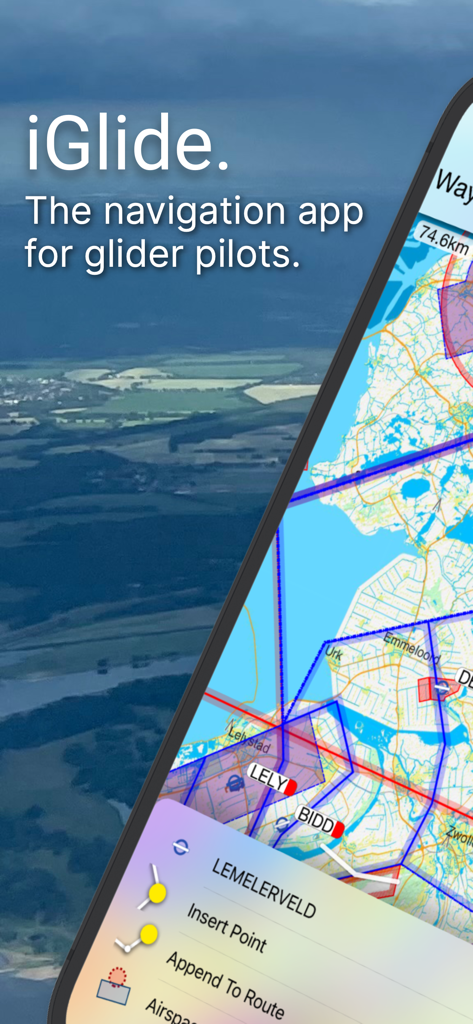
iGlide Pro navigation app interface for glider pilots showing a detailed aviation map and route planning menu
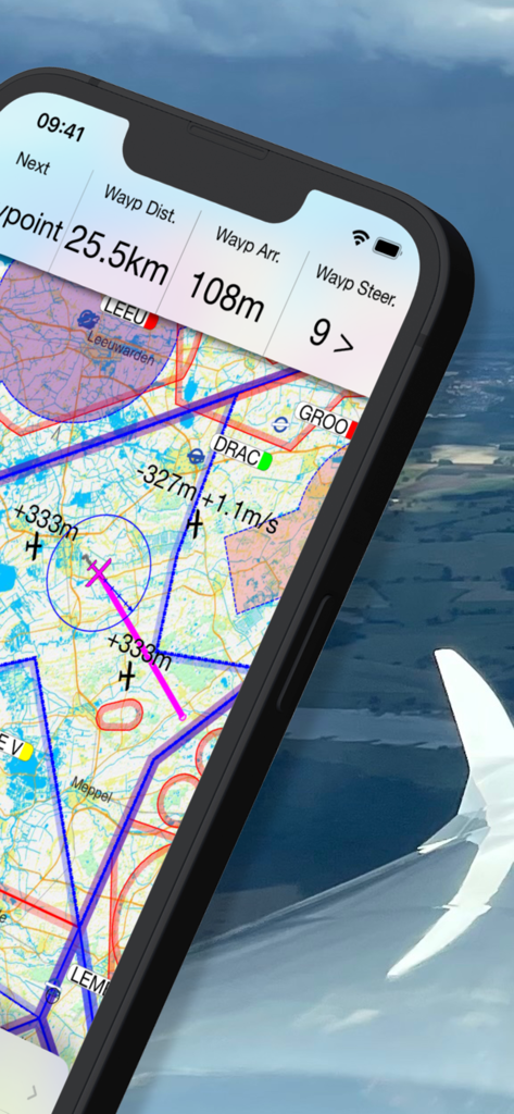
iGlide Pro soaring navigation map with flight data and topographic map displayed on a smartphone screen
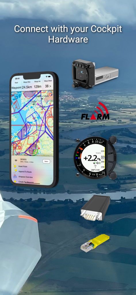
iGlide Pro app interface showing integration with glider cockpit hardware and FLARM systems
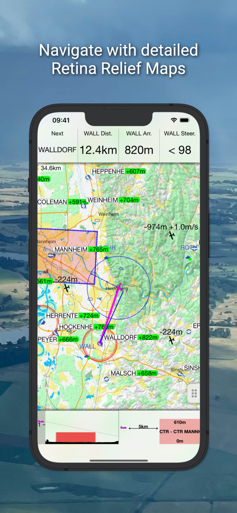
iGlide Pro app interface displaying a detailed topographical relief map with soaring navigation data
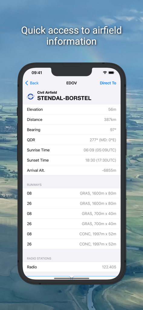
iGlide Pro app interface showing detailed airfield data for Stendal Borstel
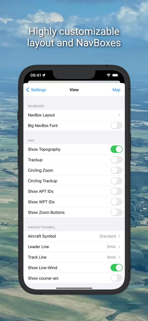
View settings menu in the iGlide Pro app showing customizable navigation layout and map options.
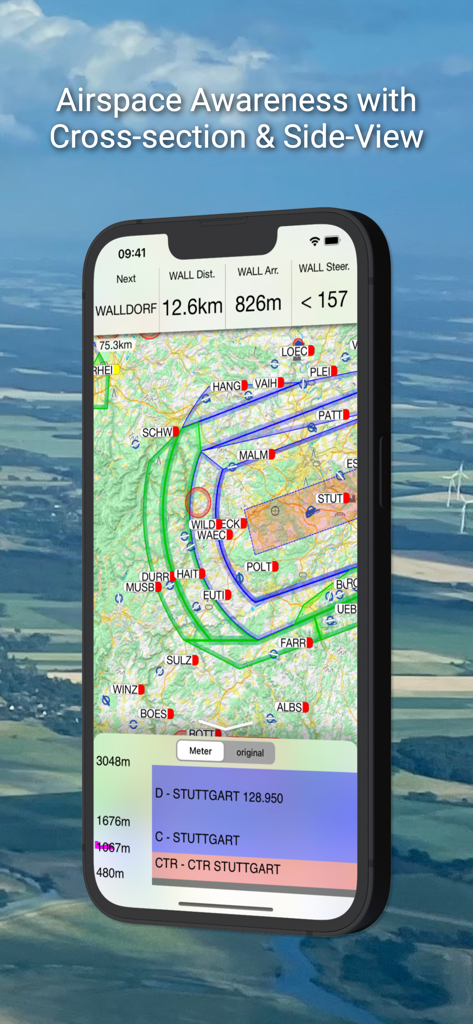
iGlide Pro soaring navigation app showing airspace awareness with map and side-view cross-section
Description
Download
More Like This
Top-ranked apps in the same category

Google Maps
Google LLC

Waze Navigation & Live Traffic
waze

AMap Global
AutoNavi Information Technology Co. Ltd.

百度地图-路线规划,出行必备
Beijing Baidu Netcom Science & Technology Co.,Ltd

Moovit: Bus & Transit Tracker
Moovit App Global LTD

Transit • Subway & Bus Times
9280-0366 Quebec inc.

ParkMobile: Park. Pay. Go.
Parkmobile USA, Inc

腾讯地图-路线规划,导航地铁打车出行
Shenzhen Tencent Computer Systems Company Limited

Île-de-France Mobilités
Ile de France Mobilites
This page is not an official page of the app or its developer, but an independent editorial publication created for informational and commentary purposes. Unless expressly stated otherwise, neither the app nor its developer is affiliated with, endorsed by, sponsored by, authorized by, or otherwise officially connected with MWM, Apple, Google Play, the app publisher, or the app's developer, and nothing on this page implies that the app was developed using MWM's services. Any trademarks, logos, screenshots, and other content remain the property of their respective owners.