This page is not an official page of the app or its developer, but an independent editorial publication created for informational and commentary purposes. Unless expressly stated otherwise, neither the app nor its developer is affiliated with, endorsed by, sponsored by, authorized by, or otherwise officially connected with MWM, Apple, Google Play, the app publisher, or the app's developer, and nothing on this page implies that the app was developed using MWM's services. Any trademarks, logos, screenshots, and other content remain the property of their respective owners.

静岡県防災
Stay safe while exploring Japan. Access offline hazard maps, AR-powered evacuation routes, and real-time emergency alerts in English—official government data for your total peace of mind.
Downloads
84K+User Rating
Total Ratings
100Publisher
Category
WeatherLocales
12Latest Version
1.1.40Size
103.2 MBFirst Released
Jun 1, 2019Explore Shizuoka and Mt. Fuji with Confidence
The official disaster prevention toolkit for English-speaking travelers. Stay safe, stay informed, and navigate with ease—even without a data connection.
Offline Maps & Navigation
Avoid expensive roaming fees and stay safe in remote hiking areas. Access critical hazard maps and shelter locations without an active internet connection.
Visual AR Evacuation
No need to read complex Japanese street signs. Use your camera and the AR compass to see exactly which direction to go to reach the nearest safe zone.
The following screenshots and description are sourced directly from the app's official store listing and are the property of the app developer.
App Store
Screenshots
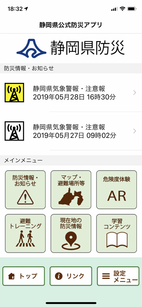
Main interface of the Shizuoka official disaster prevention app showing icons for maps and AR features
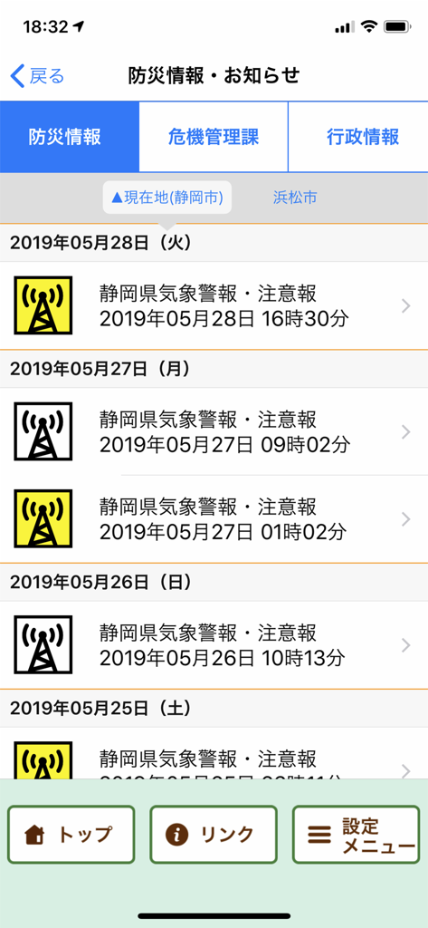
A list of weather warnings and disaster prevention alerts within the Shizuoka Prefecture emergency app interface
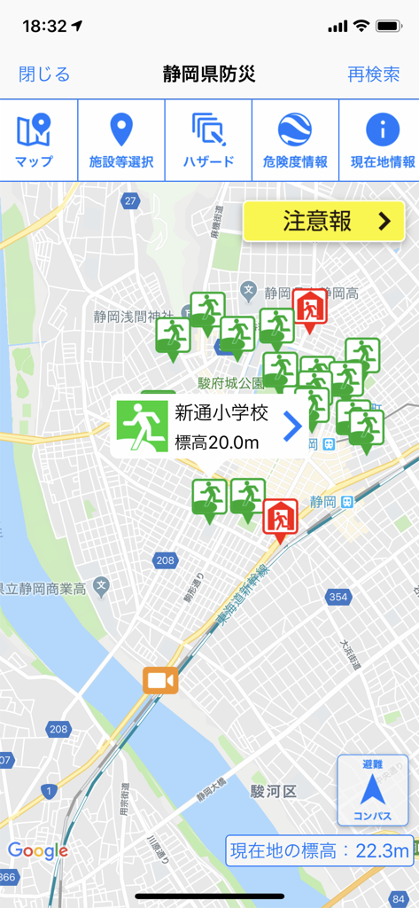
Map screen of the Shizuoka disaster prevention app showing evacuation sites and altitude
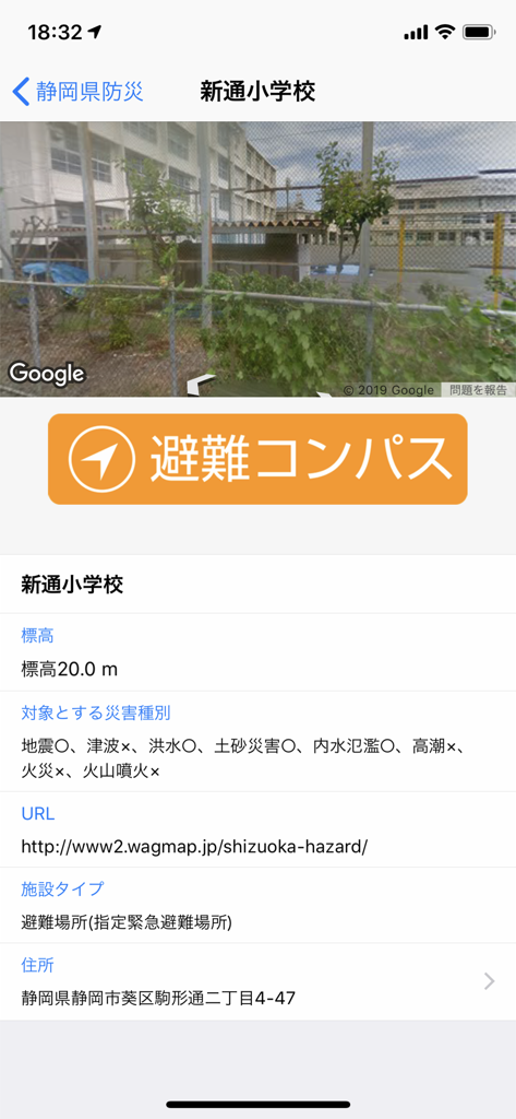
Screenshot of the Shizuoka Prefecture Disaster Prevention app showing an evacuation compass and shelter information for a local elementary school.
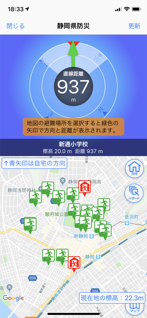
Evacuation navigation compass and shelter map in the Shizuoka Prefecture Disaster Prevention app.
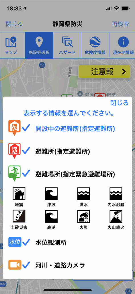
Selection menu for hazard maps and evacuation shelters on the Shizuoka disaster prevention app
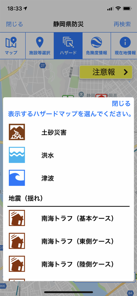
Menu in the Shizuoka disaster prevention app for selecting hazard maps like tsunami and earthquake risks
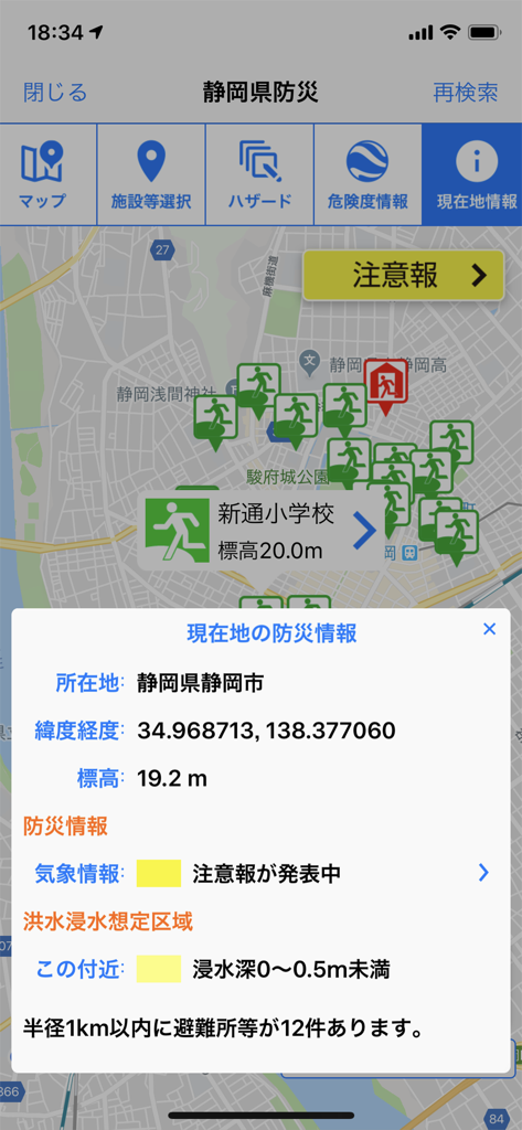
Mobile app interface showing a map with evacuation shelters and a disaster risk information popup for Shizuoka City
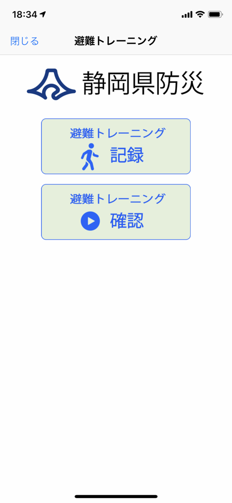
Shizuoka Prefecture disaster prevention app evacuation training menu screen
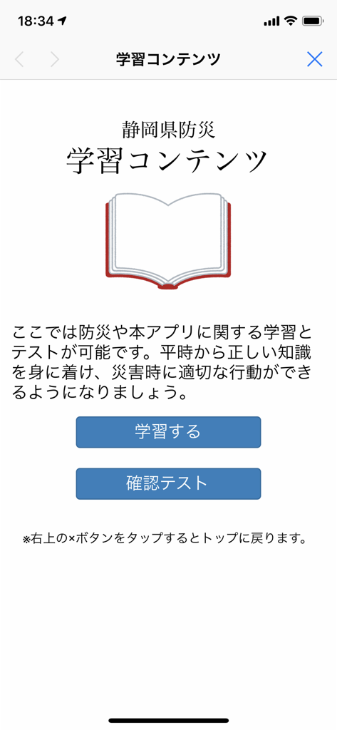
Learning content screen in the Shizuoka Disaster Prevention app showing study and test options.
Description
Download
More Like This
Top-ranked apps in the same category

墨迹天气-MojiWeather
Beijing MojiFengyun Technology Co.,Ltd.

The Weather Channel - Radar
The Weather Channel

Windy.com
Windyty, SE

天气预报-精准15日天气预报
Chongqing Caochen Technology Co., Ltd.

My Aurora Forecast & Alerts
JRustonApps B.V.

AccuWeather: Weather Forecast
AccuWeather International, Inc.

Weather & Radar - Storm radar
WetterOnline - Meteorologische Dienstleistungen GmbH

天气通
Weibo Internet Technology (China) Co.Ltd.

The Thermometer -Digital-
Vida Apps Incorporated
This page is not an official page of the app or its developer, but an independent editorial publication created for informational and commentary purposes. Unless expressly stated otherwise, neither the app nor its developer is affiliated with, endorsed by, sponsored by, authorized by, or otherwise officially connected with MWM, Apple, Google Play, the app publisher, or the app's developer, and nothing on this page implies that the app was developed using MWM's services. Any trademarks, logos, screenshots, and other content remain the property of their respective owners.