This page is not an official page of the app or its developer, but an independent editorial publication created for informational and commentary purposes. Unless expressly stated otherwise, neither the app nor its developer is affiliated with, endorsed by, sponsored by, authorized by, or otherwise officially connected with MWM, Apple, Google Play, the app publisher, or the app's developer, and nothing on this page implies that the app was developed using MWM's services. Any trademarks, logos, screenshots, and other content remain the property of their respective owners.

Land Field Area Measure GPS
Instantly calculate field areas, track perimeters, and map property boundaries with satellite precision. The all-in-one GPS tool trusted by farmers, real estate agents, and land surveyors.
Downloads
100+User Rating
Total Ratings
0Publisher
Category
NavigationLocales
8Latest Version
1.5Size
91.3 MBFirst Released
Sep 11, 2025Precision Tools for Every Acre
From planning harvests to closing real estate deals, LandLens provides the professional-grade GPS tools you need to measure, map, and manage your land with confidence.
Instant Acreage Calculation
Calculate the exact size and boundary of any plot with satellite precision. Switch between acres, hectares, and square meters instantly to eliminate guesswork.
Smart Infrastructure Mapping
Drop markers to locate gates, water sources, or irrigation lines. Organize your property layout directly on high-resolution maps for better resource management.
The following screenshots and description are sourced directly from the app's official store listing and are the property of the app developer.
App Store
Screenshots
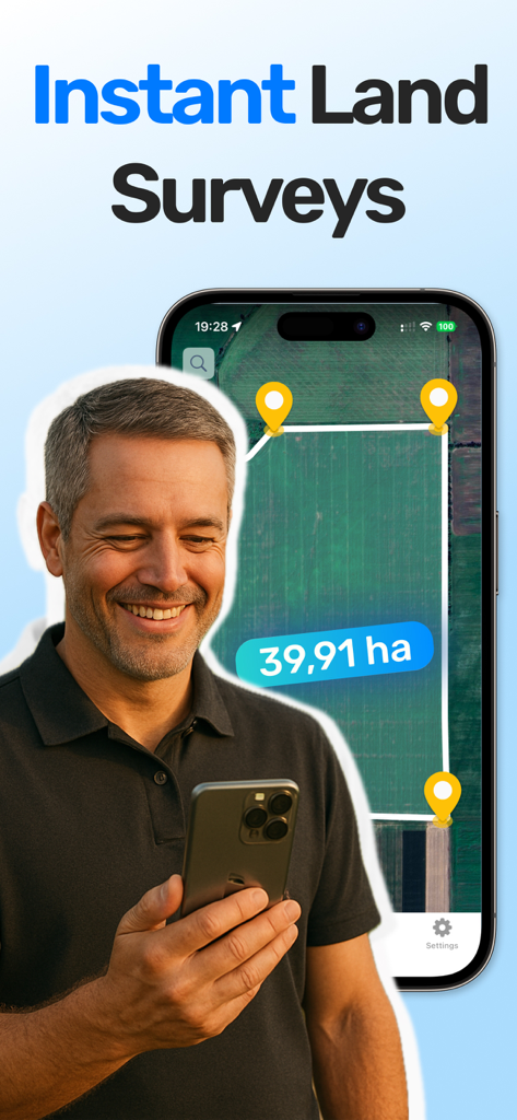
A man using the LandLens app on a smartphone for instant land surveying and area measurement.
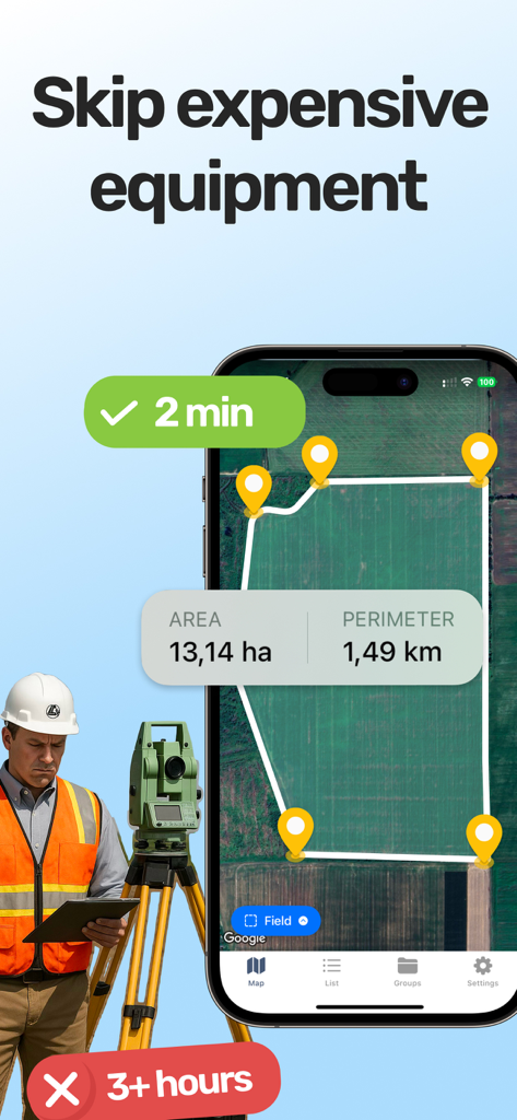
A comparison showing the LandLens app measuring a field in 2 minutes versus traditional manual surveying taking over 3 hours.
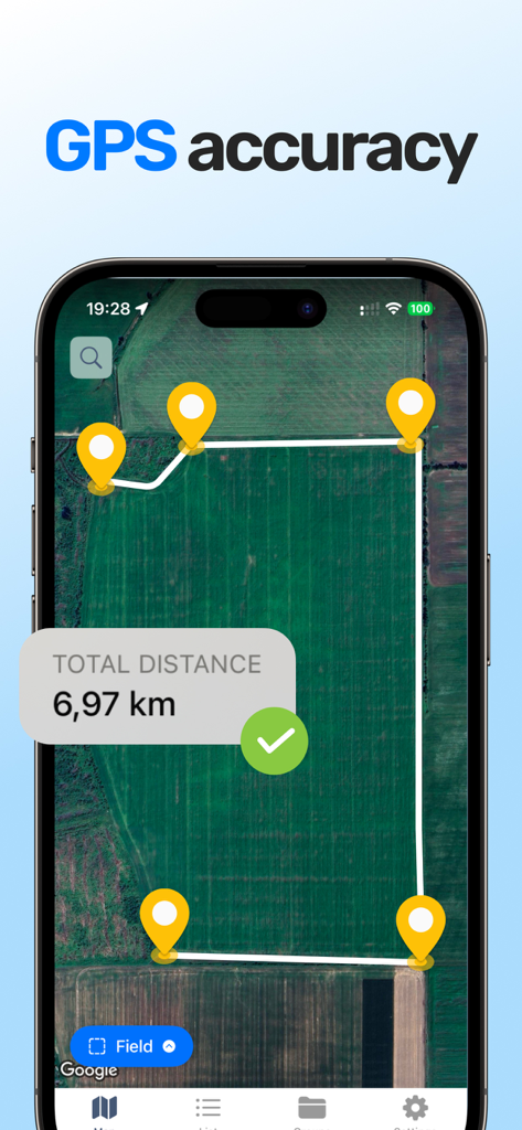
Smartphone displaying LandLens app measuring field distance using GPS markers on a satellite map.
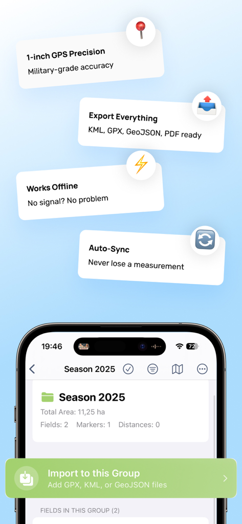
Features of LandLens app including high precision GPS and data export options
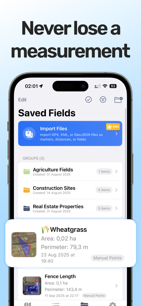
The saved fields screen of the LandLens app showing organized land measurements in folders

Testimonials from over 10,000 professionals who trust LandLens for land and field measurement.
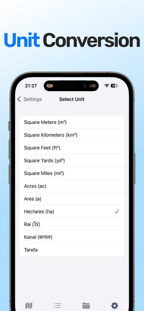
LandLens app interface for selecting land measurement units such as acres and hectares
Description
Download
More Like This
Top-ranked apps in the same category

Google Maps
Google LLC

AMap Global
AutoNavi Information Technology Co. Ltd.

Waze Navigation & Live Traffic
waze

百度地图-路线规划,出行必备
Beijing Baidu Netcom Science & Technology Co.,Ltd

Moovit: Bus & Transit Tracker
Moovit App Global LTD

腾讯地图-路线规划,导航地铁打车出行
Shenzhen Tencent Computer Systems Company Limited

Transit • Subway & Bus Times
9280-0366 Quebec inc.

ParkMobile: Park. Pay. Go.
Parkmobile USA, Inc

MapXplorer: Map Radar Navigate
GOLDLAB APPLICATIONS YAZILIM VE BILISIM ANONIM SIRKETI
This page is not an official page of the app or its developer, but an independent editorial publication created for informational and commentary purposes. Unless expressly stated otherwise, neither the app nor its developer is affiliated with, endorsed by, sponsored by, authorized by, or otherwise officially connected with MWM, Apple, Google Play, the app publisher, or the app's developer, and nothing on this page implies that the app was developed using MWM's services. Any trademarks, logos, screenshots, and other content remain the property of their respective owners.