This page is not an official page of the app or its developer, but an independent editorial publication created for informational and commentary purposes. Unless expressly stated otherwise, neither the app nor its developer is affiliated with, endorsed by, sponsored by, authorized by, or otherwise officially connected with MWM, Apple, Google Play, the app publisher, or the app's developer, and nothing on this page implies that the app was developed using MWM's services. Any trademarks, logos, screenshots, and other content remain the property of their respective owners.

Link-H
Monitor altitude, speed, and METAR/TAF weather with ease. Securely share your position using private channels—no accounts or logins required, just pure performance.
Downloads
0User Rating
Total Ratings
0Publisher
Category
NavigationLocales
1Latest Version
6.1Size
569.4 MBFirst Released
Aug 4, 2022Precision Tracking & Aviation Intelligence
Link-H provides real-time VFR flight telemetry, aviation weather alerts, and private fleet coordination without the friction of complex account setups.
Real-Time Flight Telemetry
Track altitude, speed, and course with updates every 30 seconds, ensuring precise location monitoring for VFR flights.
Critical Aviation Weather
Stay informed with METAR/TAF reports, meteorological radar, and custom widgets for cloud base and visibility minimums.
The following screenshots and description are sourced directly from the app's official store listing and are the property of the app developer.
App Store
Screenshots
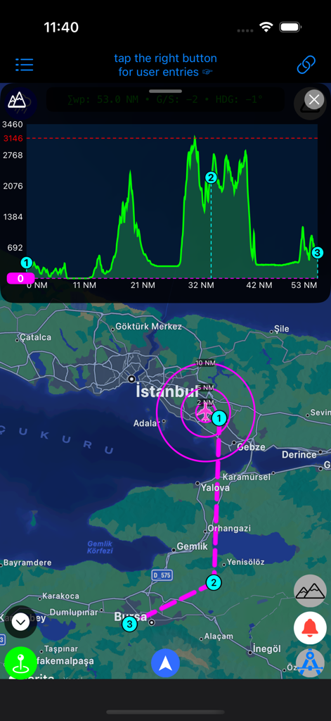
Link-H flight tracking app interface showing a map and terrain elevation profile
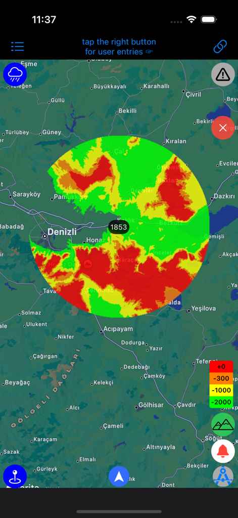
Link-H app interface showing a topographic map with aircraft proximity rings and elevation data.
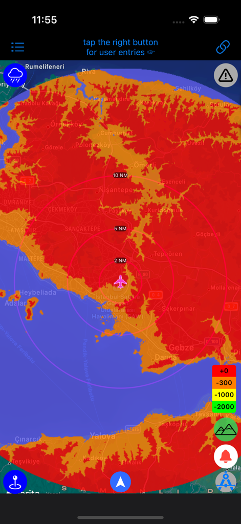
Link-H app interface showing a meteorological radar overlay on a topographic map
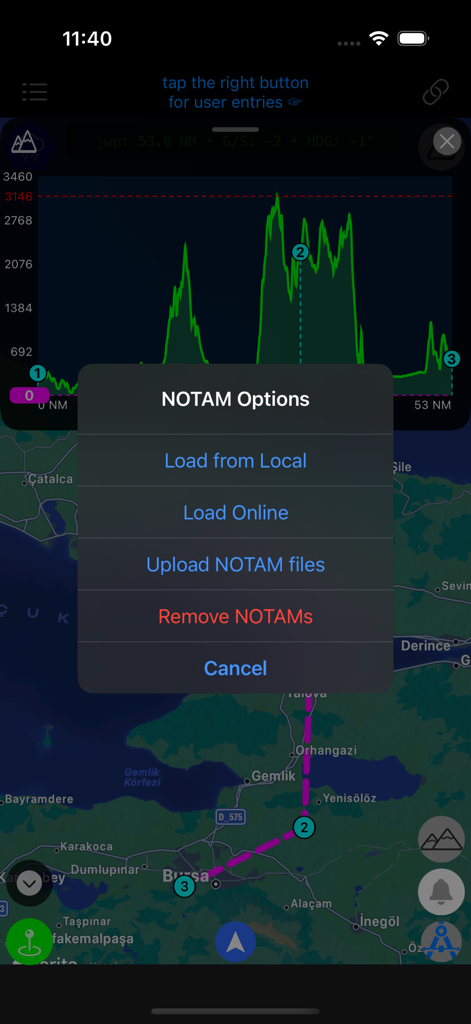
Link-H app interface displaying an elevation profile graph and a NOTAM options menu over a flight map.
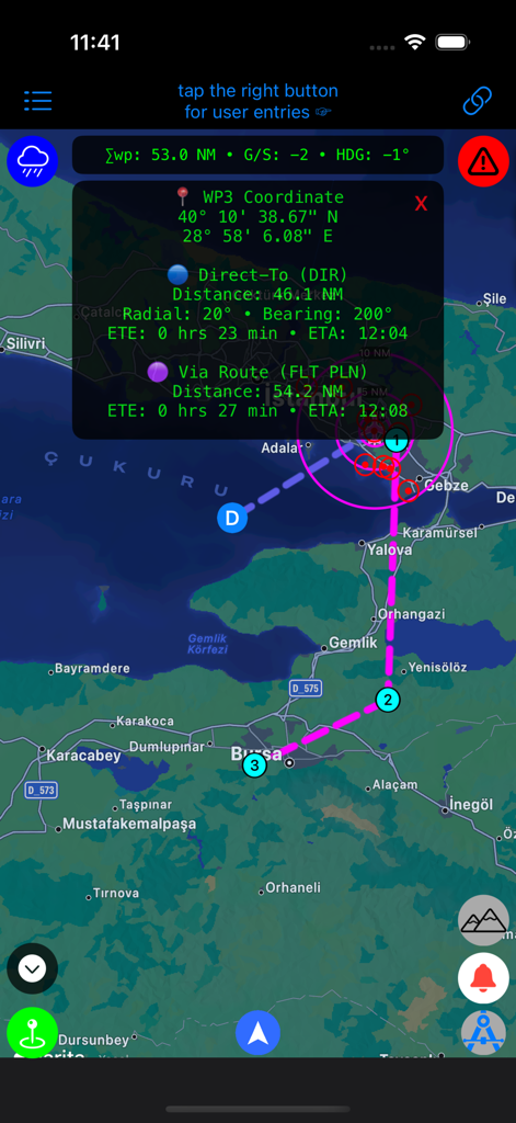
Interface of the Link-H app showing a flight route on a map with detailed waypoint coordinates and estimated time of arrival data.
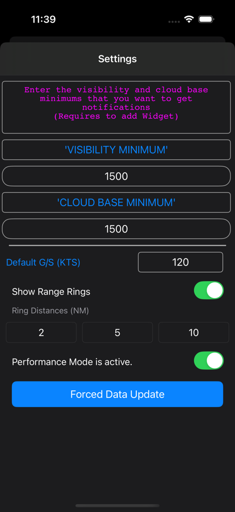
Link-H app settings screen showing flight parameters such as visibility minimums and cloud base notifications
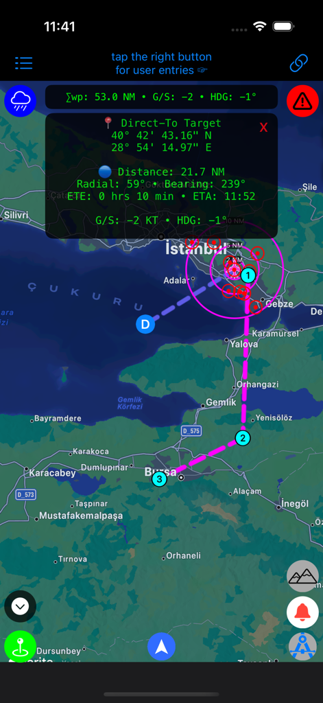
Aviation navigation interface of the Link-H app displaying a flight path and real-time telemetry over a map
Description
Download
More Like This
Top-ranked apps in the same category

Google Maps
Google LLC

AMap Global
AutoNavi Information Technology Co. Ltd.

Waze Navigation & Live Traffic
waze

百度地图-路线规划,出行必备
Beijing Baidu Netcom Science & Technology Co.,Ltd

Moovit: Bus & Transit Tracker
Moovit App Global LTD

腾讯地图-路线规划,导航地铁打车出行
Shenzhen Tencent Computer Systems Company Limited

ParkMobile: Park. Pay. Go.
Parkmobile USA, Inc

Transit • Subway & Bus Times
9280-0366 Quebec inc.

NAVER Maps, Navigation
NAVER Corp.
This page is not an official page of the app or its developer, but an independent editorial publication created for informational and commentary purposes. Unless expressly stated otherwise, neither the app nor its developer is affiliated with, endorsed by, sponsored by, authorized by, or otherwise officially connected with MWM, Apple, Google Play, the app publisher, or the app's developer, and nothing on this page implies that the app was developed using MWM's services. Any trademarks, logos, screenshots, and other content remain the property of their respective owners.