This page is not an official page of the app or its developer, but an independent editorial publication created for informational and commentary purposes. Unless expressly stated otherwise, neither the app nor its developer is affiliated with, endorsed by, sponsored by, authorized by, or otherwise officially connected with MWM, Apple, Google Play, the app publisher, or the app's developer, and nothing on this page implies that the app was developed using MWM's services. Any trademarks, logos, screenshots, and other content remain the property of their respective owners.

Live Aerial 3d View
From city streets to mountain peaks, explore high-definition satellite imagery and immersive 3D terrain. Plan your next adventure or scout your neighborhood with the ultimate visual navigation tool.
Downloads
400User Rating
Total Ratings
0Publisher
Category
NavigationLocales
1Latest Version
1.0.0Size
54.7 MBFirst Released
May 22, 2025Experience the World in High-Definition 3D
From planning your next mountain hike to scouting real estate, navigate with immersive satellite imagery and realistic terrain mapping tailored for the modern explorer.
Immersive 3D Terrain Mapping
Visualize elevation and topography with realistic depth, perfect for scouting hiking trails or checking property lines before you arrive.
Real-Time Satellite Clarity
Access high-definition aerial imagery from anywhere on Earth to explore remote destinations or verify the neighborhood vibe of your next vacation rental.
The following screenshots and description are sourced directly from the app's official store listing and are the property of the app developer.
App Store
Screenshots
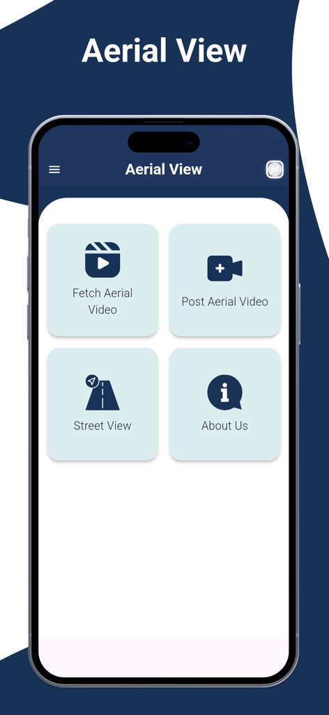
Main menu screen of the Live Aerial 3D View app showing navigation options for street view and aerial videos
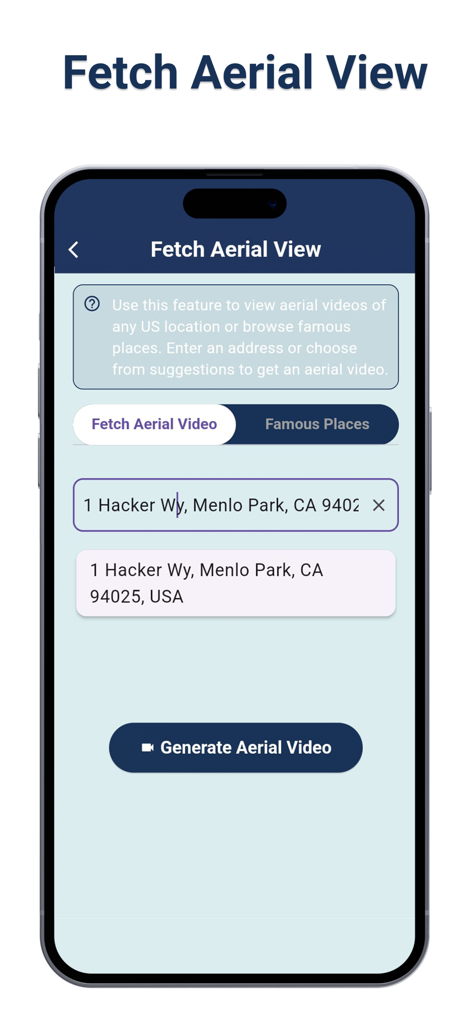
Interface for searching an address to generate an aerial video
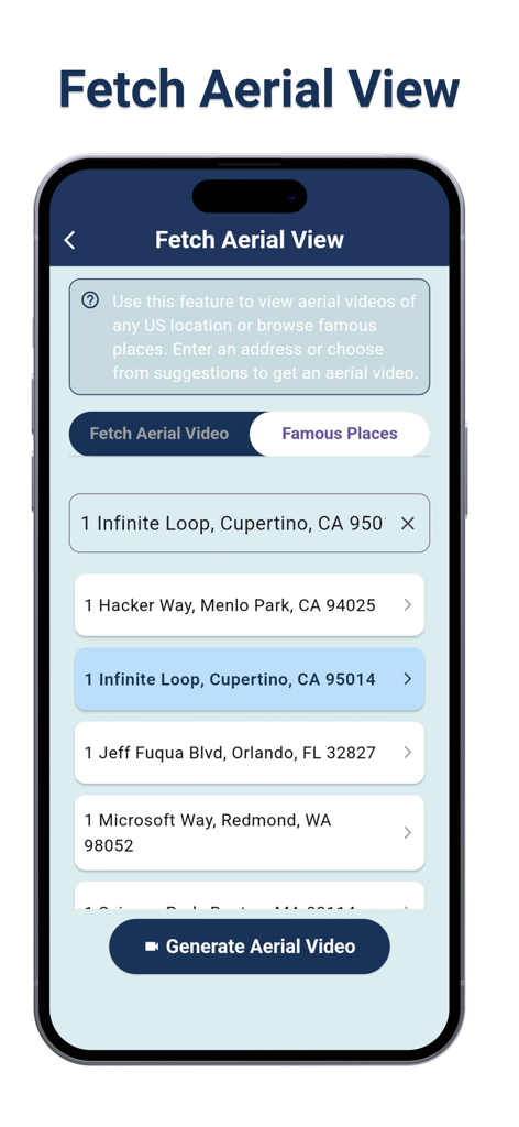
iPhone screen displaying the Fetch Aerial View search feature with address suggestions like Infinite Loop and Hacker Way to generate 3D videos
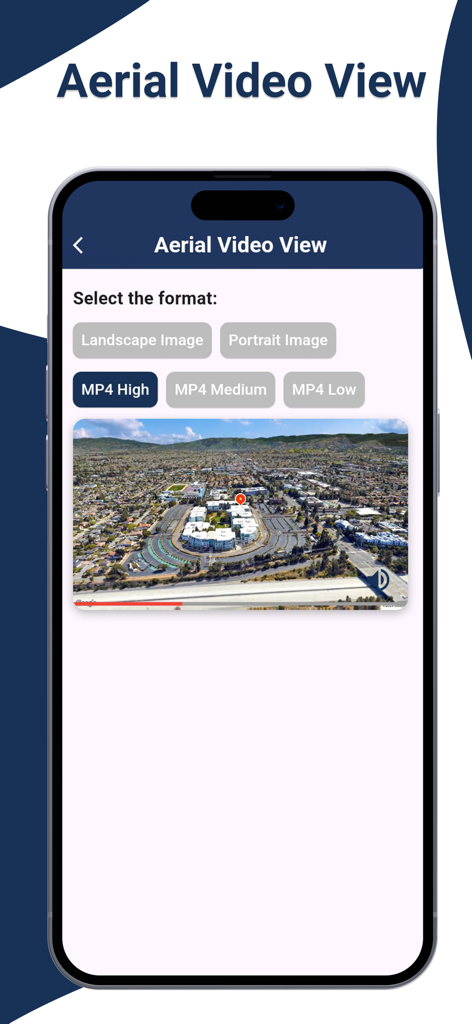
A mobile app interface displaying aerial video view options including format selection for high quality MP4 and images of a city landscape
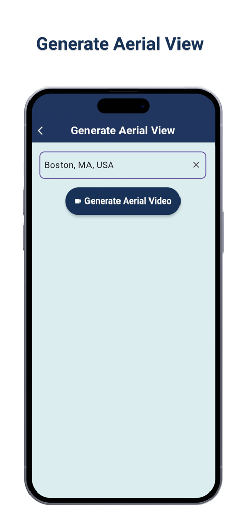
Interface to generate an aerial video for a specific location in the app
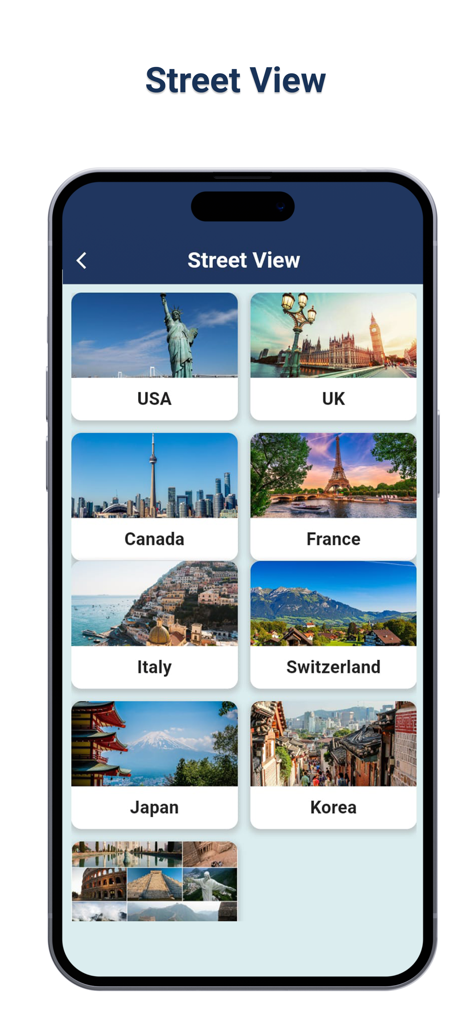
A smartphone screen displaying a list of countries for street view exploration within the Live Aerial 3d View app.
Description
Download
More Like This
Top-ranked apps in the same category

Google Maps
Google LLC

Waze Navigation & Live Traffic
waze

AMap Global
AutoNavi Information Technology Co. Ltd.

百度地图-路线规划,出行必备
Beijing Baidu Netcom Science & Technology Co.,Ltd

Moovit: Bus & Transit Tracker
Moovit App Global LTD

Transit • Subway & Bus Times
9280-0366 Quebec inc.

ParkMobile: Park. Pay. Go.
Parkmobile USA, Inc

腾讯地图-路线规划,导航地铁打车出行
Shenzhen Tencent Computer Systems Company Limited

Île-de-France Mobilités
Ile de France Mobilites
This page is not an official page of the app or its developer, but an independent editorial publication created for informational and commentary purposes. Unless expressly stated otherwise, neither the app nor its developer is affiliated with, endorsed by, sponsored by, authorized by, or otherwise officially connected with MWM, Apple, Google Play, the app publisher, or the app's developer, and nothing on this page implies that the app was developed using MWM's services. Any trademarks, logos, screenshots, and other content remain the property of their respective owners.