This page is not an official page of the app or its developer, but an independent editorial publication created for informational and commentary purposes. Unless expressly stated otherwise, neither the app nor its developer is affiliated with, endorsed by, sponsored by, authorized by, or otherwise officially connected with MWM, Apple, Google Play, the app publisher, or the app's developer, and nothing on this page implies that the app was developed using MWM's services. Any trademarks, logos, screenshots, and other content remain the property of their respective owners.

MapCam - GPS Map Camera
Instantly overlay GPS coordinates, timestamps, and professional metadata onto your photos. The all-in-one documentation tool for field professionals and outdoor explorers—built with 100% privacy in mind.
Downloads
2K+User Rating
Total Ratings
0Publisher
Category
NavigationLocales
12Latest Version
1.5Size
37.4 MBFirst Released
Jun 15, 2025Professional Precision in Every Frame
The ultimate geotagging tool for field workers and adventurers. Capture photos with automatic GPS, timestamps, and environmental data to document your work and world with absolute accuracy.
Instant Geotagging & Proof
Automatically stamp photos with latitude, longitude, and timestamps to provide ironclad proof of area for inspections, real estate, or travel logs.
Rich Metadata Overlays
Go beyond location with altitude, weather conditions, humidity, and compass direction baked directly into your high-resolution images for full context.
The following screenshots and description are sourced directly from the app's official store listing and are the property of the app developer.
App Store
Screenshots
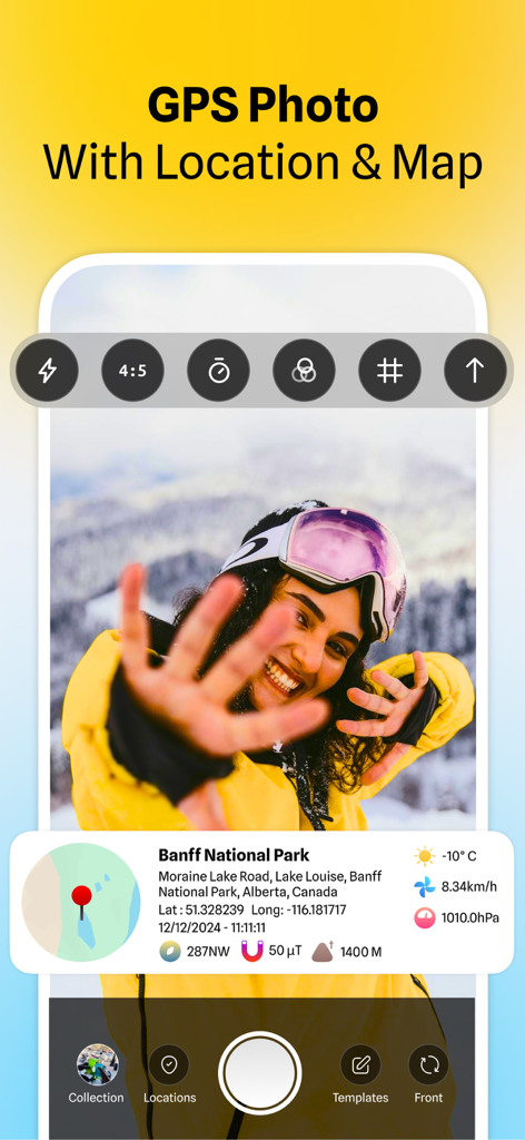
MapCam interface displaying a photo with GPS coordinates map and weather data
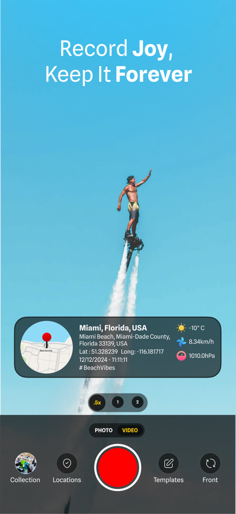
MapCam app interface showing a flyboarder with GPS location and weather stamps
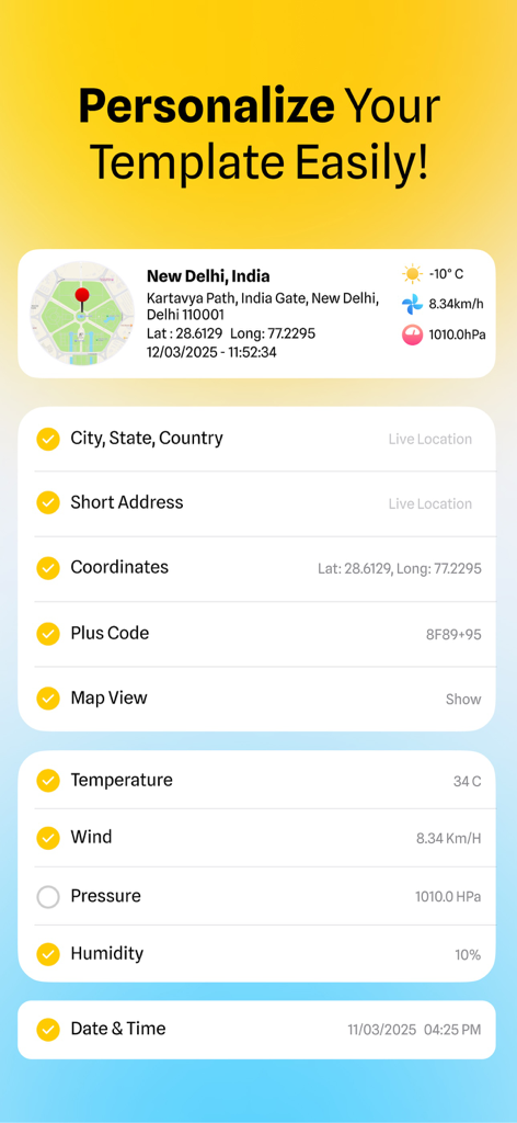
Interface of MapCam app showing options to customize photo stamps with GPS coordinates, address, and weather data
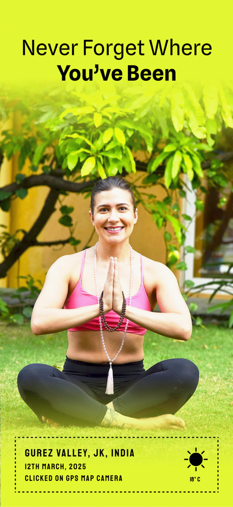
Woman practicing yoga with a GPS location and date stamp overlay
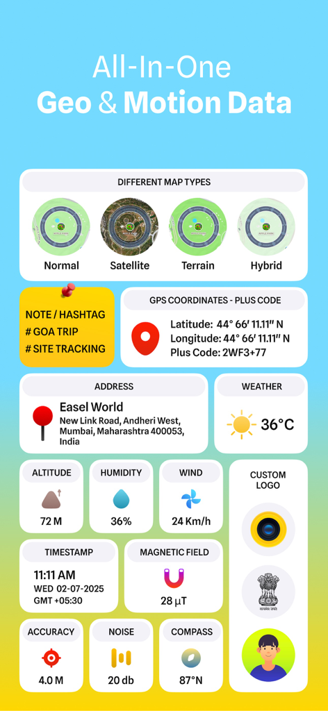
Interface showing GPS coordinates weather altitude and map types for photos and videos.
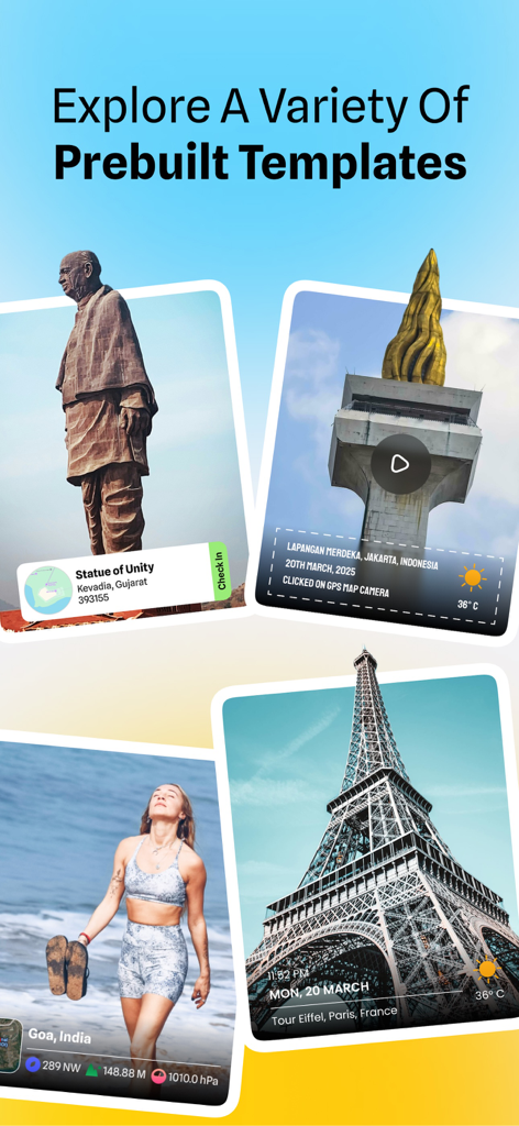
Showcase of various prebuilt templates for geotagging photos with GPS location and timestamps
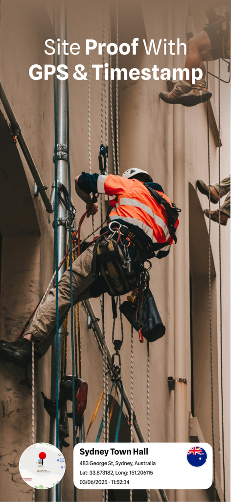
Construction worker documenting site progress with GPS coordinates and timestamp overlay
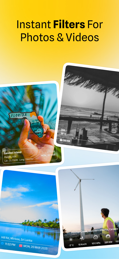
Examples of photos with GPS location stamps and visual filters from MapCam app
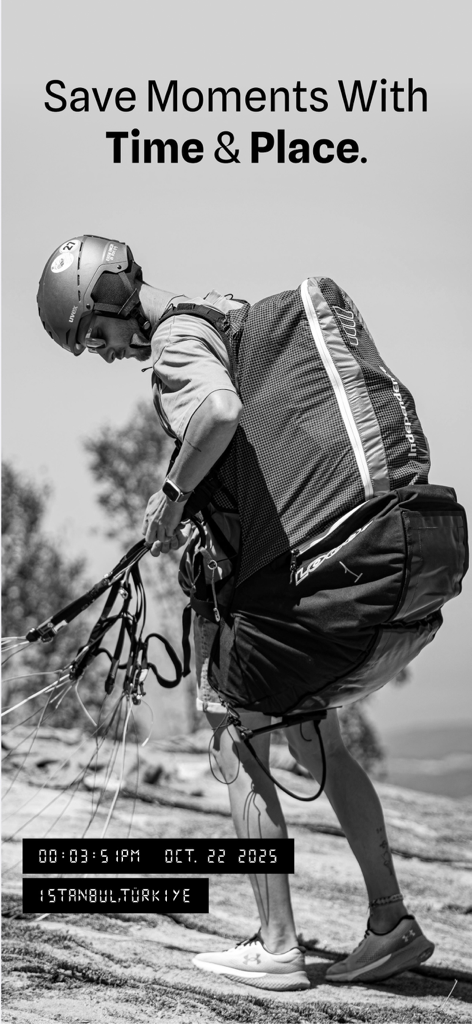
MapCam app showing a photo of a paraglider with GPS and timestamp tags
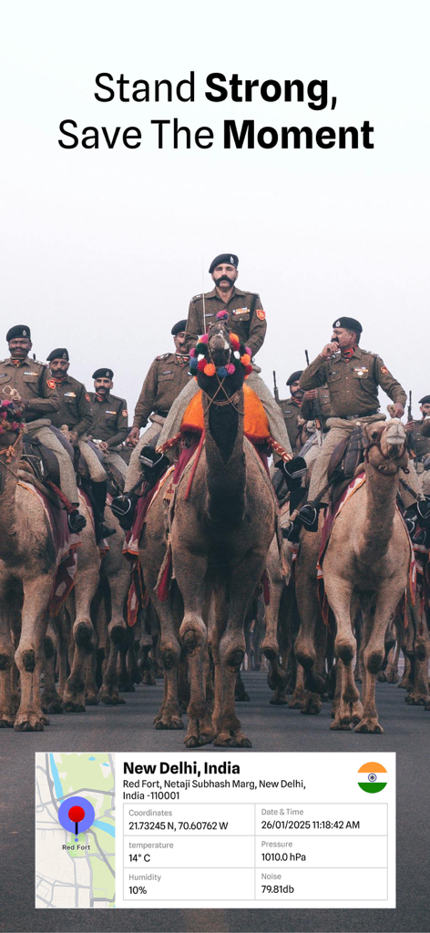
Geotagged photo of a camel parade in New Delhi with GPS location and environmental data
Description
Download
More Like This
Top-ranked apps in the same category

Google Maps
Google LLC

Waze Navigation & Live Traffic
waze

AMap Global
AutoNavi Information Technology Co. Ltd.

百度地图-路线规划,出行必备
Beijing Baidu Netcom Science & Technology Co.,Ltd

Moovit: Bus & Transit Tracker
Moovit App Global LTD

Transit • Subway & Bus Times
9280-0366 Quebec inc.

ParkMobile: Park. Pay. Go.
Parkmobile USA, Inc

腾讯地图-路线规划,导航地铁打车出行
Shenzhen Tencent Computer Systems Company Limited

Île-de-France Mobilités
Ile de France Mobilites
This page is not an official page of the app or its developer, but an independent editorial publication created for informational and commentary purposes. Unless expressly stated otherwise, neither the app nor its developer is affiliated with, endorsed by, sponsored by, authorized by, or otherwise officially connected with MWM, Apple, Google Play, the app publisher, or the app's developer, and nothing on this page implies that the app was developed using MWM's services. Any trademarks, logos, screenshots, and other content remain the property of their respective owners.