This page is not an official page of the app or its developer, but an independent editorial publication created for informational and commentary purposes. Unless expressly stated otherwise, neither the app nor its developer is affiliated with, endorsed by, sponsored by, authorized by, or otherwise officially connected with MWM, Apple, Google Play, the app publisher, or the app's developer, and nothing on this page implies that the app was developed using MWM's services. Any trademarks, logos, screenshots, and other content remain the property of their respective owners.

MapPath Pro
Track every journey with real-time stats and calculate surface areas with professional accuracy. From property management to backcountry trails, master your terrain with advanced maps and seamless iCloud sync.
Downloads
241K+User Rating
Total Ratings
100Publisher
Category
NavigationLocales
2Latest Version
9.3Size
6.7 MBFirst Released
Mar 27, 2012Professional Mapping and Measurement Made Simple
An all-in-one GPS toolkit designed for property management, outdoor exploration, and technical navigation without the social media clutter.
Precision Property Measurement
Easily calculate surface areas and perimeters by dragging pins or walking boundaries. Perfect for land management, fencing, and landscaping projects.
Real-Time Tracking & Live Data
Monitor altitude, speed, and pace with Dynamic Island and Live Activities support. Keep your critical trip data visible at a glance without unlocking your iPhone.
The following screenshots and description are sourced directly from the app's official store listing and are the property of the app developer.
App Store
Screenshots
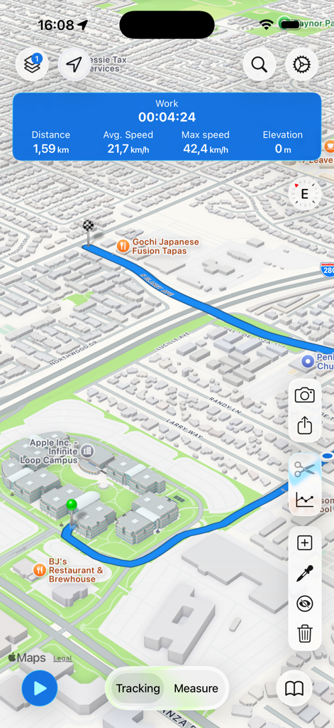
MapPath Pro interface displaying a blue GPS track on a 3D map with live distance and speed statistics.
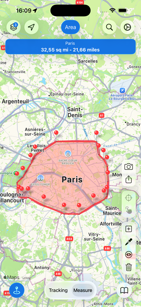
MapPath Pro app interface showing a red surface area and perimeter measurement around Paris on a map
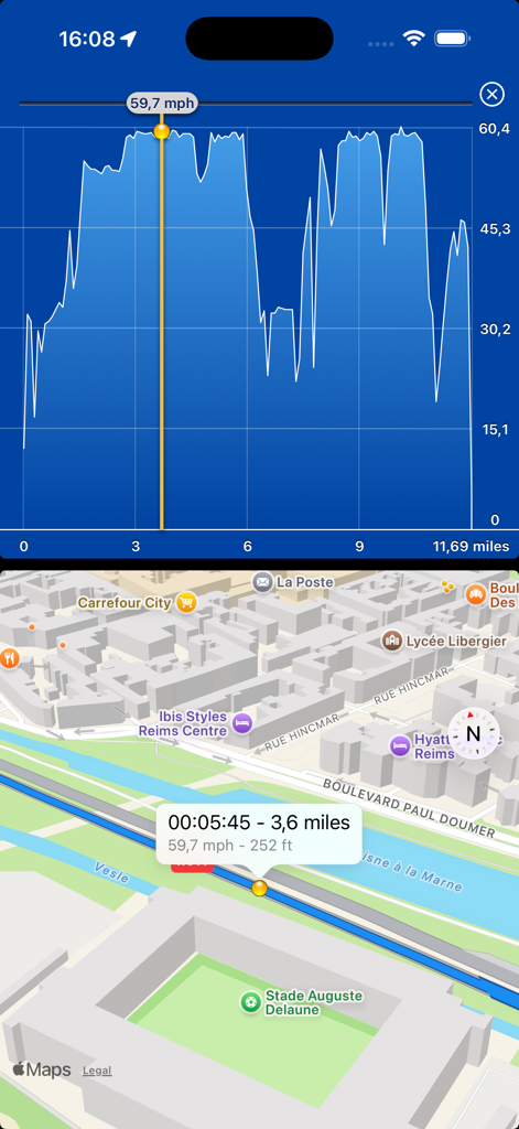
Split screen view of MapPath Pro showing a detailed speed chart on top and a corresponding 3D GPS track on a city map below.
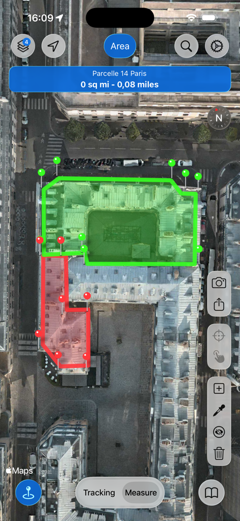
MapPath Pro app interface showing area and perimeter measurements on a satellite map
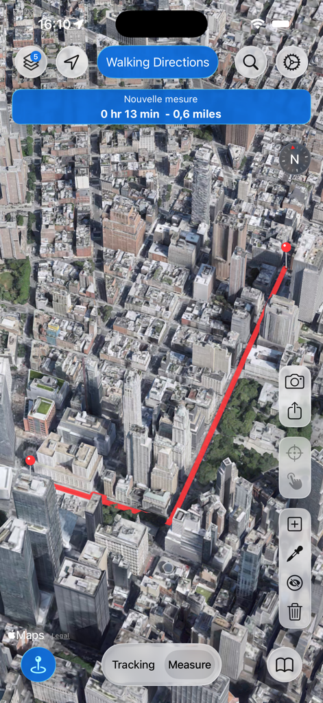
MapPath Pro interface showing a walking route and distance measurement on a 3D satellite city map.
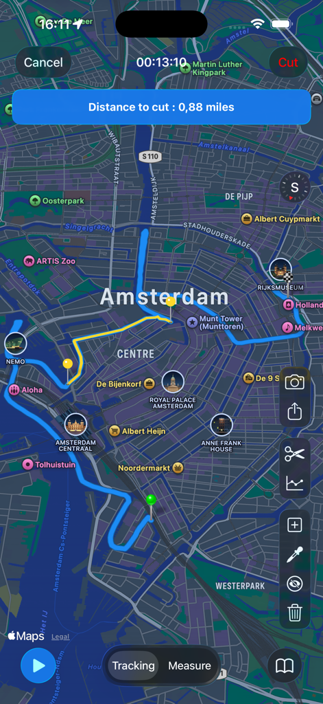
MapPath Pro app interface showing a blue GPS track on a map of Amsterdam with the track cutting tool enabled
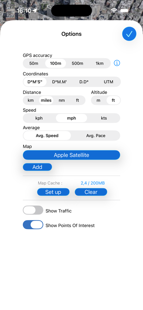
MapPath Pro app options screen showing settings for GPS accuracy coordinates measurement units and map layers.
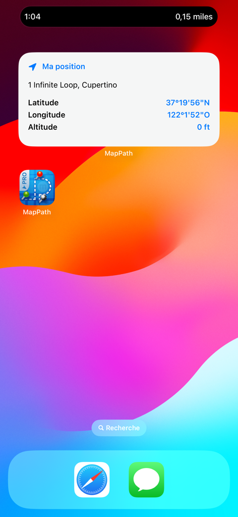
MapPath Pro iOS widget showing current location coordinates and altitude on an iPhone home screen
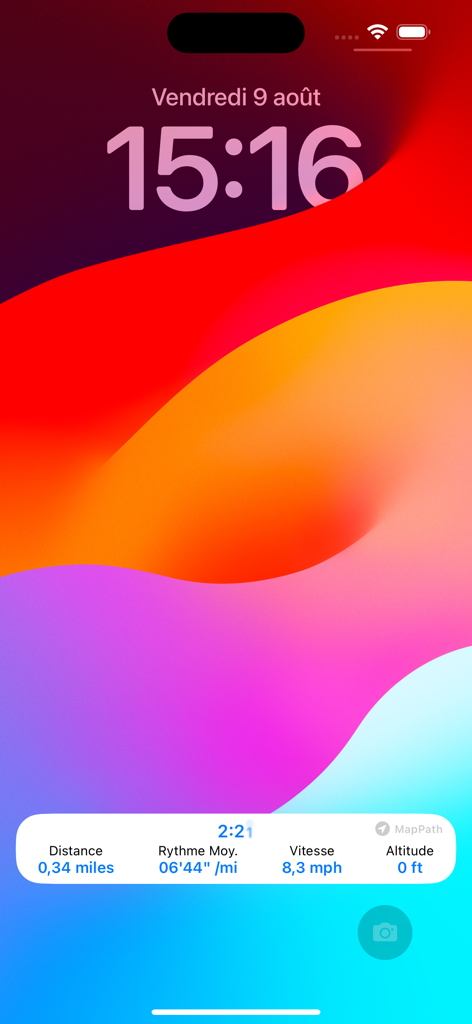
MapPath Pro Live Activity on iPhone lock screen displaying real-time tracking metrics like distance and speed
Description
Download
More Like This
Top-ranked apps in the same category

Google Maps
Google LLC

Waze Navigation & Live Traffic
waze

AMap Global
AutoNavi Information Technology Co. Ltd.

百度地图-路线规划,出行必备
Beijing Baidu Netcom Science & Technology Co.,Ltd

Moovit: Bus & Transit Tracker
Moovit App Global LTD

Transit • Subway & Bus Times
9280-0366 Quebec inc.

ParkMobile: Park. Pay. Go.
Parkmobile USA, Inc

腾讯地图-路线规划,导航地铁打车出行
Shenzhen Tencent Computer Systems Company Limited

Île-de-France Mobilités
Ile de France Mobilites
This page is not an official page of the app or its developer, but an independent editorial publication created for informational and commentary purposes. Unless expressly stated otherwise, neither the app nor its developer is affiliated with, endorsed by, sponsored by, authorized by, or otherwise officially connected with MWM, Apple, Google Play, the app publisher, or the app's developer, and nothing on this page implies that the app was developed using MWM's services. Any trademarks, logos, screenshots, and other content remain the property of their respective owners.